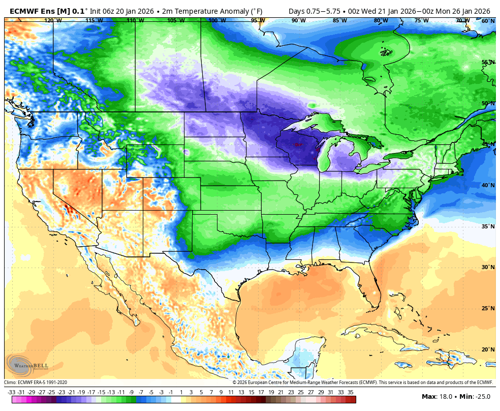
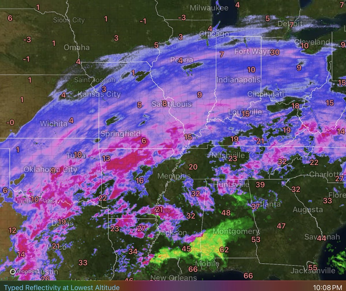
What's impressive with this overall set up is the abundant transport of moisture into a very cold, arctic air mass. Up to 1-inch of QPF is something this is not common across the Ohio Valley with arctic air!
Long way to go with this one! Snow goes all the way back to Texas and will stream across the Ohio Valley through Sunday. Expect to see some rippin snowfall rates overnight with bands of heavy snow with 1 in/hr.
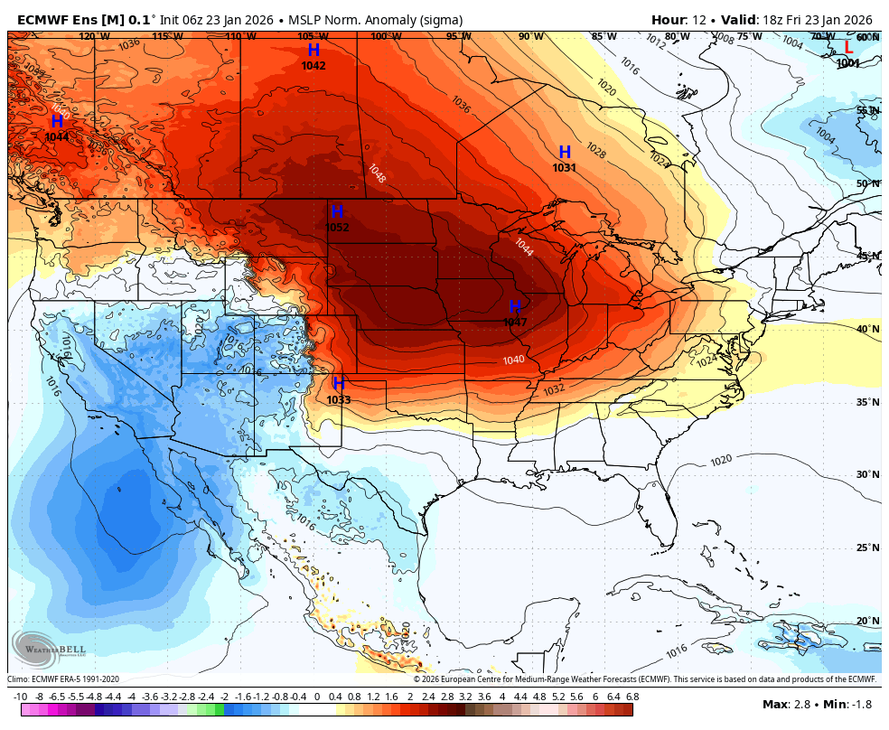
What makes this set up impressive is the massive 3 sigma arctic high pressure that presses the arctic air south. This is key to creating a widespread overrunning precipitation event, which is being enhanced by more phasing of the SW disturbance.
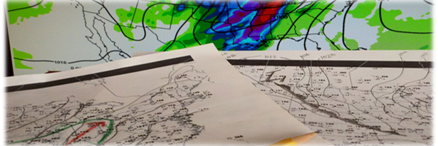
Incredible! Very impressive winter storm develops across the S. Plains and heads across the Ohio Valley and Northeast with far reaching impacts of heavy snow and icy conditions. #winterstorm
This is a very impressive set up for an overrunning precipitation event. Significant snow and ice could be quite expansive with arctic air surging south.
Pretty strong signal of a heavy snow band from the Euro with its' Extreme Forecast Index. Values of 2 or more are very significant and a strong indicator of a highly anomalous event. #kywx
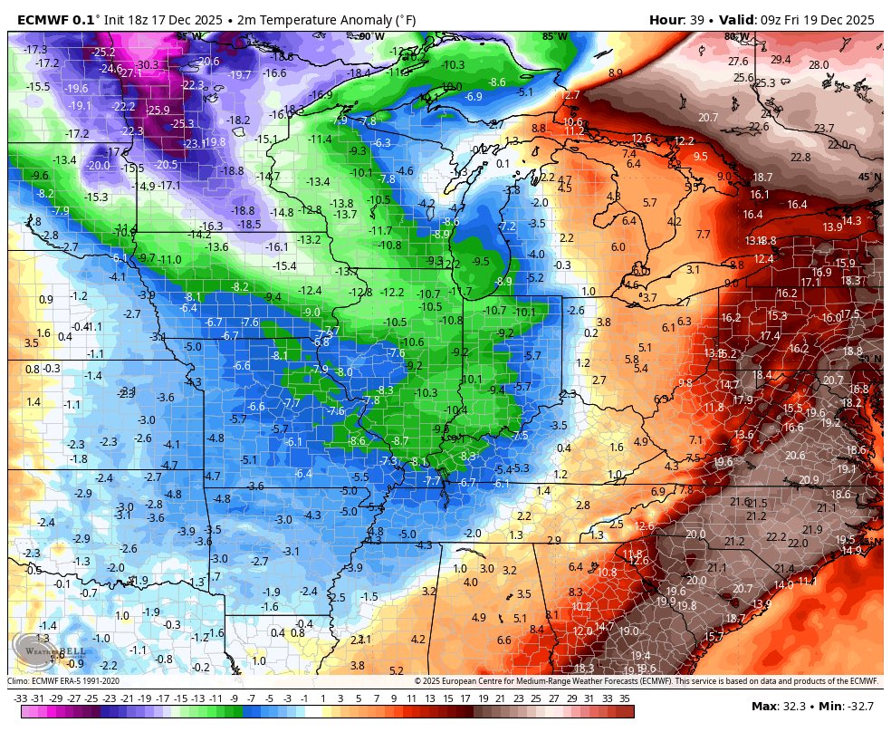
A significant winter weather event is increasingly possible later this week/weekend as arctic air presses south and sets up a strong temperature gradient. Potential for widespread, significant snow and ice from the S. Plains --> Eastern US. #energy#natgas#agwx
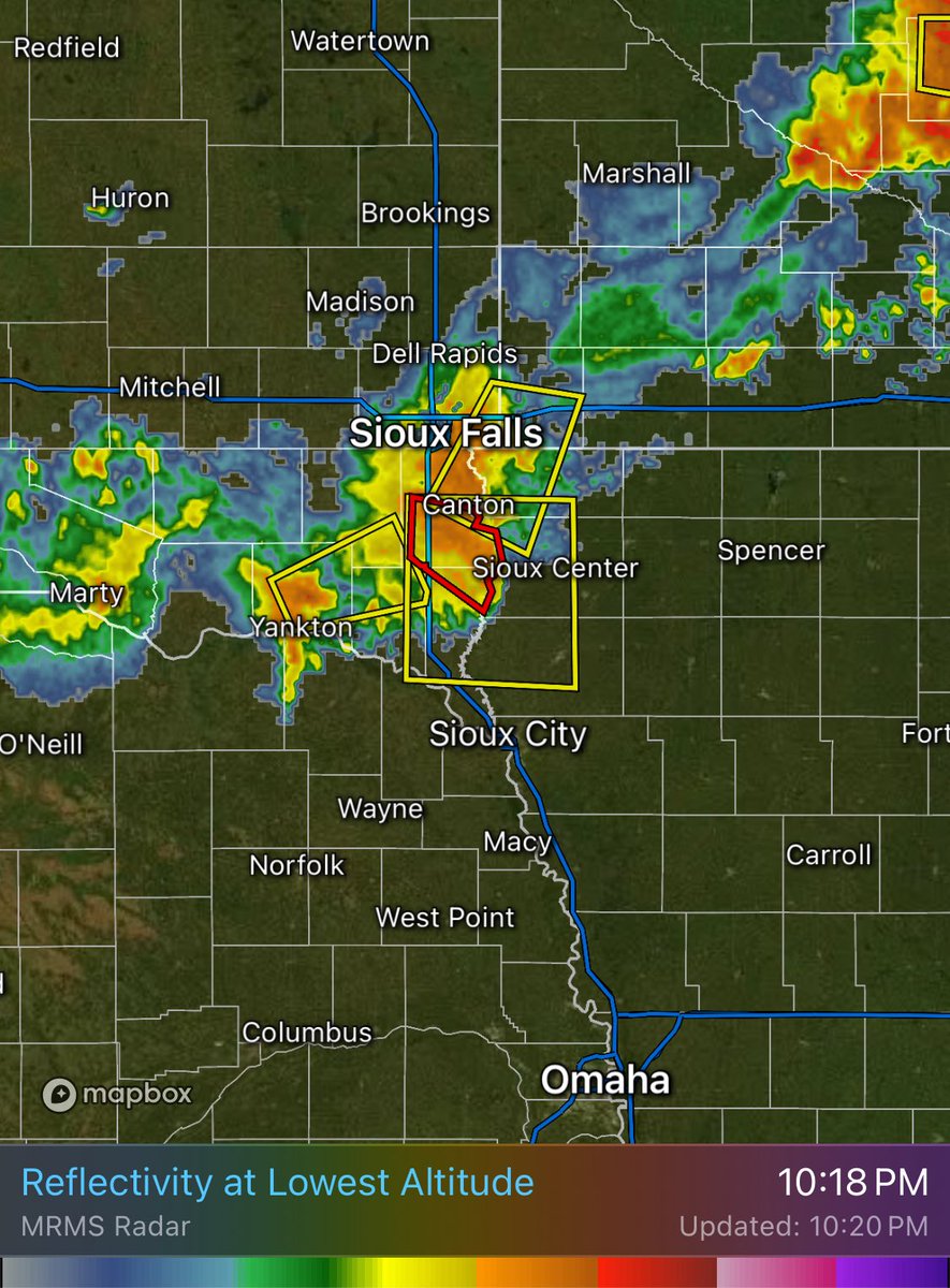
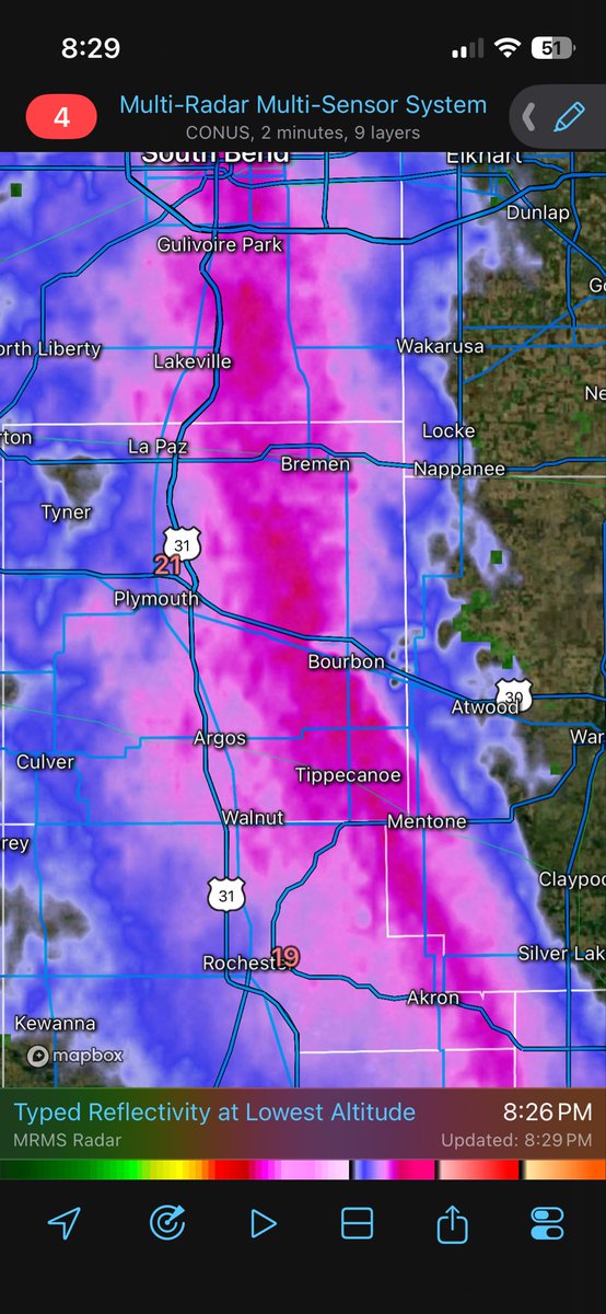
Significant band of lake-effect snow occurring across northern Indiana tonight. Godspeed to the plow driver driving through it! 🫡#inwx#lakeeffectsnow#heavysnow
A strong cold front plows through Thursday night with a big swing in temperatures. However, I’m puzzled by the hype over a “flash freeze” in the Ohio Valley. There is several hours of windy, lower dew point air prior to deep cold 🤷♂️
Last night, the 53rd Weather Reconnaissance Squadron flew into the eye of Hurricane Erin—and captured imagery of the breathtaking stadium effect.
These missions provide critical data to the NHC to improve forecasts, helping keep communities safe before the storm makes landfall.#readynow #weatherready
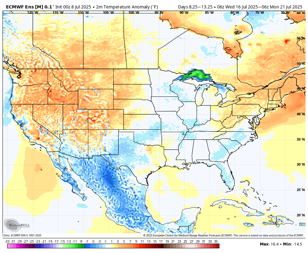
Ridge builds across the S. Plains next 10 days with a hot and dry pattern across Plains. Active/stormy pattern continues across the Midwest. Full details in today's reports! #agwx#corn#heat
Forecast models continue to highlight relatively favorable temperatures across the core of the AG Belt through mid-July with no support for a heatwave over the next 10 days. #agwx#corn#soybeans
While there is still significance to this line of thunderstorms (not downplaying it at all), models didn’t do so hot with the convection. Afternoon supercells/discrete cells did not materialize. It’s easy to lose sight of the fact that models are still tools.