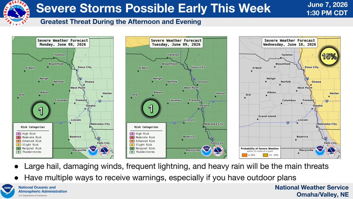
Another active weather pattern returns this week. Monday through Wednesday has the potential for severe weather, mainly during the afternoon and evening. Keep an eye on the forecast as more details are shared in the coming days.
We'll be moving into a hot and humid pattern beginning tomorrow. While much of the focus will be on the afternoon heat, morning temperatures will be oppressive as well.
This is especially true on Thursday, where it looks very possible that we will see some lows in the 80s!
Heavy rain and localized flooding may develop across parts of Iowa this afternoon. Some areas could see 2-3+ inches of rain, with flash flooding possible where storms repeatedly move over the same locations.