Elevated threat of tornadoes detected for Wednesday, June 10th, 2026.
See attached map for details.
This forecast initialized on Saturday morning. Follow for future forecast updates.
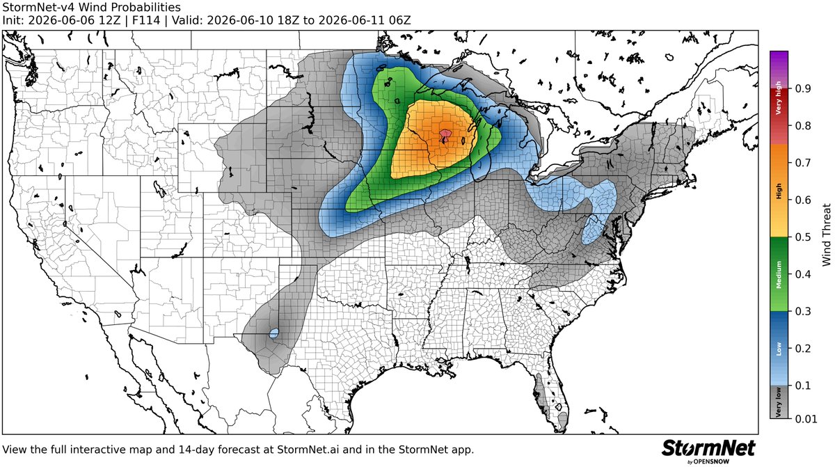
Elevated threat of *DAMAGING WINDS* detected for Wednesday, June 10th, 2026.
See attached map for details.
This forecast initialized on Saturday morning. Follow for future forecast updates.
A robust severe weather event may take place on Wed, June 10, across parts of the Northern Plains and Upper Midwest.
All severe hazards are possible, with some significant severe weather not being ruled out.
An elongated, and potent upper trough will progress over the region, favoring robust surface and low-level cyclogenesis, and a strong low-level response, producing a setup favorable for scattered-widespread severe weather.
The SPC has mentioned a potential upgrade to 30% severe probabilities in future outlooks.
Elevated threat of tornadoes detected for Wednesday, June 10th, 2026.
See attached map for details.
This forecast initialized on Friday night. Follow for future forecast updates.
Elevated threat of *DAMAGING WINDS* detected for Wednesday, June 10th, 2026.
See attached map for details.
This forecast initialized on Friday night. Follow for future forecast updates.
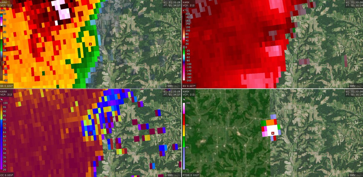
🌩️ Ever wonder what's happening inside a thunderstorm?
WeatherWise Pro's Cross Section tool lets you slice through a storm and view its structure from the side.
Tonight, we drew a cross section through the storm's strongest radar returns, near/in Wisconsin. Notice the deep purple and pink reflectivity values extending thousands of feet into the storm. That's a strong indication of a hail-producing core.
The cross section also reveals a possible updraft region and storm tops extending above 30,000 feet—details that aren't obvious from a traditional radar view alone.
Cross sections help meteorologists and weather enthusiasts better understand hail potential, storm organization, and what's happening beneath the cloud tops.
* Open Radar → Select Cross Section (by the inspector tool)→ Explore the storm from the inside out.
WeatherWise Pro helps you see what standard radar can't.
Over the next few days, hundred of thunderstorms will sweep across the United States. If you capture any photos/videos be sure to tag us and use the hashtag #WWStorm so that we can see it! Stay safe.