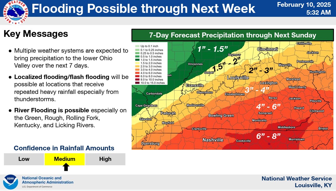
Recent model runs have trended the heavy rainfall axis noticeably northward. This now puts the heavy rainfall axis just south of the Ohio River across western and northern Kentucky.
From our perspective, the severe weather threat remains low, but not zero.
Severe thunderstorms are possible later tonight into Thursday morning, with the highest risk occurring from pre-dawn to mid-morning. Damaging winds and isolated tornadoes are possible. While some strong storms could develop earlier in the evening, the main concern is overnight.
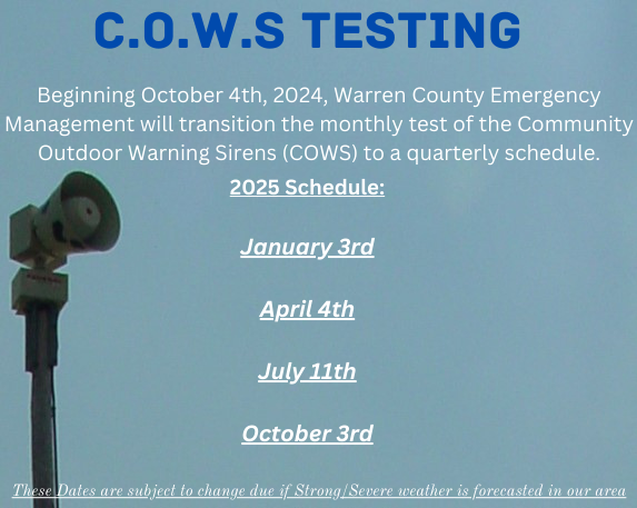
To help alleviate the anxiety of our Bowling Green/Warren County residents, our office will be shifting our monthly COWS testing to a quarterly schedule. As a reminder, our system undergoes testing twice daily, and our staff is ready to respond and address any issues promptly.
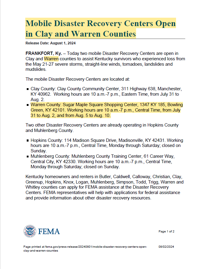
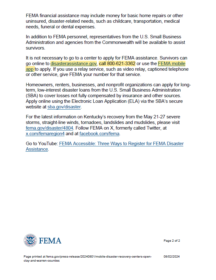
FEMA's Disaster Recovery Center is now open at Sugar Maple Square Shopping Center to assist those who experienced loss during the Memorial Day Severe Storms May 21st-27th. Here's FEMA's press release and instructions on how to apply.
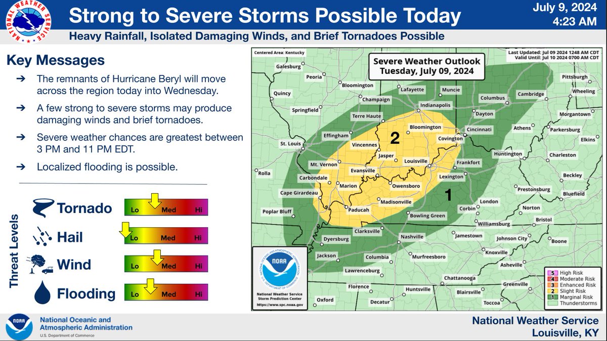
The remnants of Hurricane Beryl will move across the Ohio Valley today into tonight. This afternoon and evening, strong to severe thunderstorms will develop over western Kentucky, moving toward the I-65 corridor during the early-to-mid evening hours.
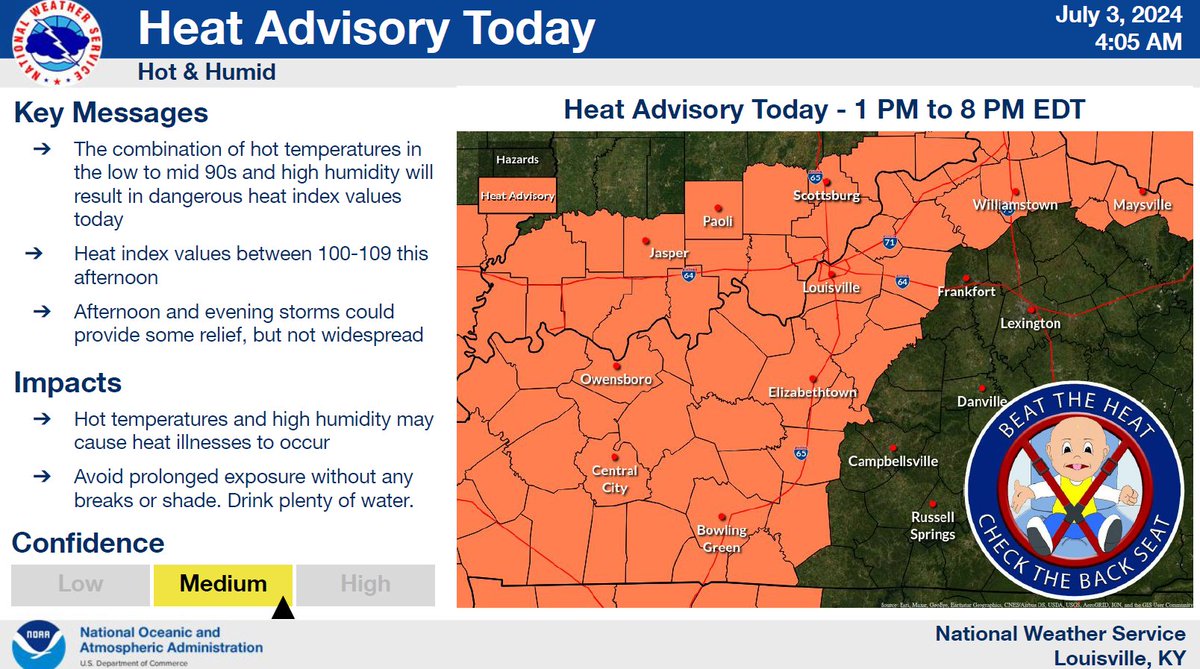
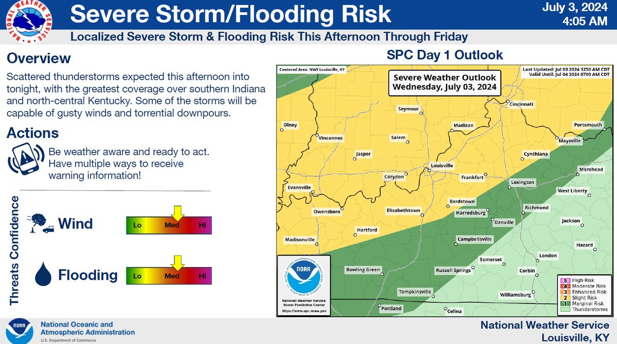
We'll start off with hot and humid conditions this afternoon and evening, which will push peak heat indices over 105 degrees for many. Rounds of showers and thunderstorms, some strong to severe, are expected this afternoon through Friday.
If you are in need of a cooling station while power is being restored. You can go to the Plano Fire Dept across from the Plano store or to Phil Moore Park on Scottsville Rd
EMA Personnel are working on damage assessments through Warren County.
Personnel will be taking pictures and logging information. All personnel will have identification with them.
@WarrenCountyGov@CityofBGKY
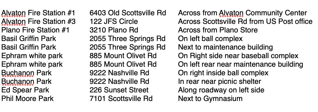
@WarrenCoEMA has asked media outlets to share the locations of tornado safe rooms, should someone want to utilize them with the possibility of severe weather this afternoon, tonight and tomorrow.
Alvaton Fire Station #1
Alvaton Fire Station #3
Plano Fire Station #1
Basil Griffin Park (2)
Ephram White park (2)
Buchanon Park (2)
Ed Spear Park
Phil Moore Park
⚠️Strong to severe storms are expected tonight (Monday night) through Tuesday.
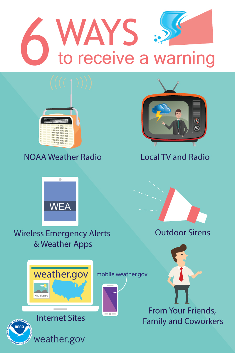
📌Have multiple ways to receive a warning:
📻NOAA Weather Radio
📱Emergency Alerts on your smart device
📺Local TV
#kywx#inwx
The @NWSLouisville is predicting possible severe weather Tuesday. The entire District 3 area is currently listed under the "Enhanced Risk" threat. Please plan ahead for the weather and stay updated on the forecast. #kywx
From NWS Louisville, KY:
Showers and storms will continue across the area today and tomorrow, with the main window for strong to severe storms expected late tonight through Tuesday evening. Damaging winds, large hail, and isolated tornadoes will all be possible.
Today @ 9:07 AM, we will activate the COWS and test AlertSense. The NWS will activate weather radios as well. As severe season approaches, now is a great time to ensure you know where to shelter, have your kit ready with all the necessary items, and have ways to receive alerts.
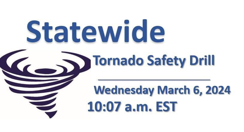
In conjunction with the NWS, WCEMA will be participating in the Statewide Tornado Drill on 3/6 @ 9:07 AM CST.
In lieu of the previously scheduled COWS test for this Friday, we will activate the COWS on March 6th @ 9:07 AM. We will NOT be testing the COWS on Friday.
In conjunction with the NWS, WCEMA will be participating in the Statewide Tornado Drill on 3/6 @ 9:07 AM CST.
In lieu of the previously scheduled COWS test for this Friday, we will activate the COWS on March 6th @ 9:07 AM. We will NOT be testing the COWS on Friday.
In conjunction with the NWS, WCEMA will be participating in the Statewide Tornado Drill on 3/6 @ 9:07 AM CST.
In lieu of the previously scheduled COWS test for this Friday, we will activate the COWS on March 6th @ 9:07 AM. We will NOT be testing the COWS on Friday.
A tornado WATCH has been issued for Warren County, KY, until 8:00 AM CST.
Have ways to receive alerts, know where to go, and DO NOT rely on tornado sirens as a primary warning.