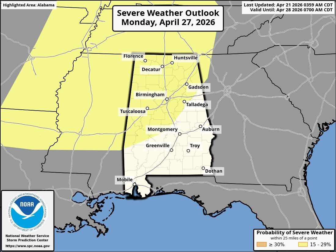
SPC has defined a risk of severe thunderstorms across much of North and West Alabama Monday of next week (April 27).
This involves the pattern change we have discussed that opens the door for more frequent rain/storm producing systems across the Deep South over the next few weeks. On the positive side, this will bring a good chance of much-needed rain. But from time to time, we will have the risk of strong to severe storms. 
It is way too early to discuss the magnitude of the threat on Monday, and the timing. You see a good bit of fear mongering from the social media content engagement farms.  I promise you’ll get the facts here without unnecessary hyperbole.  I know how to use strong language leading up to a weather event, but I use it only when it is needed.
Stay tuned for updates through the week… 
The Pineland Road Fire continues to burn in south Georgia this afternoon, and @NOAA's #GOESEast (#GOES19) has been tracking the smoke and heat from the blaze. According to @GaTrees, the #wildfire has scorched nearly 9,000 acres and is only 10% contained.
ECE is again ranked among the top graduate programs in the 2026 U.S. News & World Report rankings.
Both programs ranked in the top seven overall and top four among public universities.
https://t.co/jm8Lw7jK1h
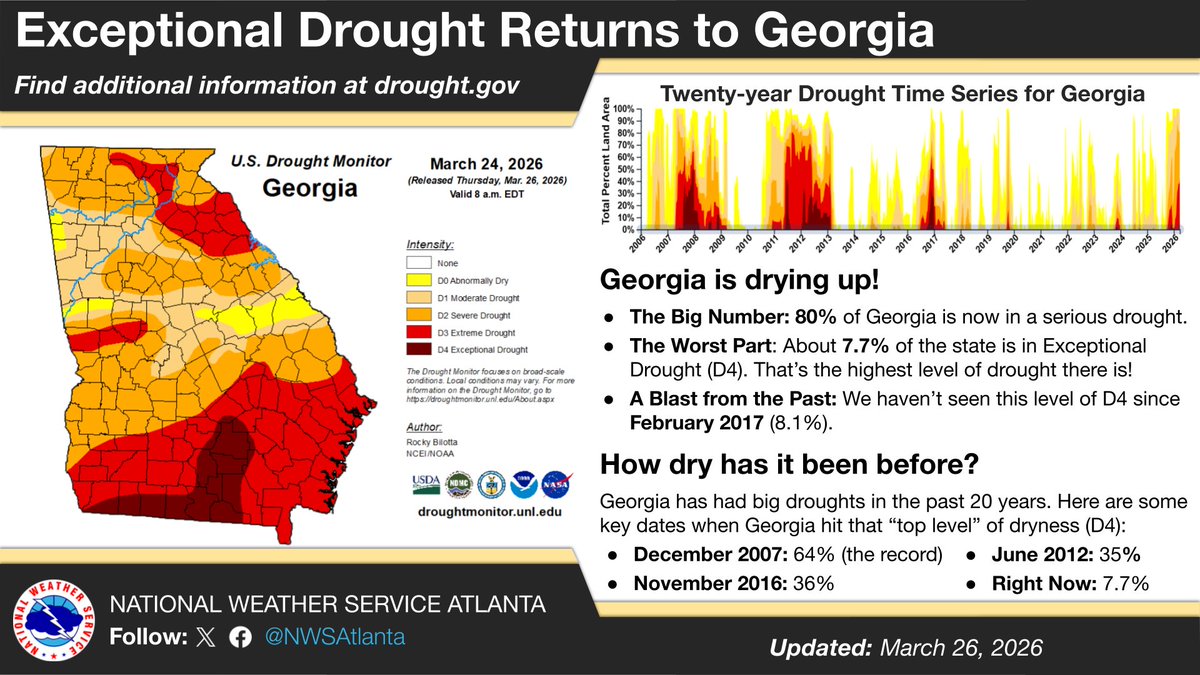
Did you know that Georgia is currently in its worst drought in nearly 10 years? The latest Drought Monitor shows 80% of Georgia in at least Severe Drought. Check out this graphic to see how this compares to other big Georgia droughts in the last 20 years. #gawx#GeorgiaDrought
Come learn about the Severe Storms Research Center (SSRC), our new weather radar and second Lightning Mapping Array, and future plans including an ionospheric monitoring cubesat mission data Tuesday morning at #AGU25
A paid opportunity for a couple of students to do some interesting work with GLM. Not limited to Georgia Tech (look for the GOES-R graphic among the projects). https://t.co/XSCAWkC6wA
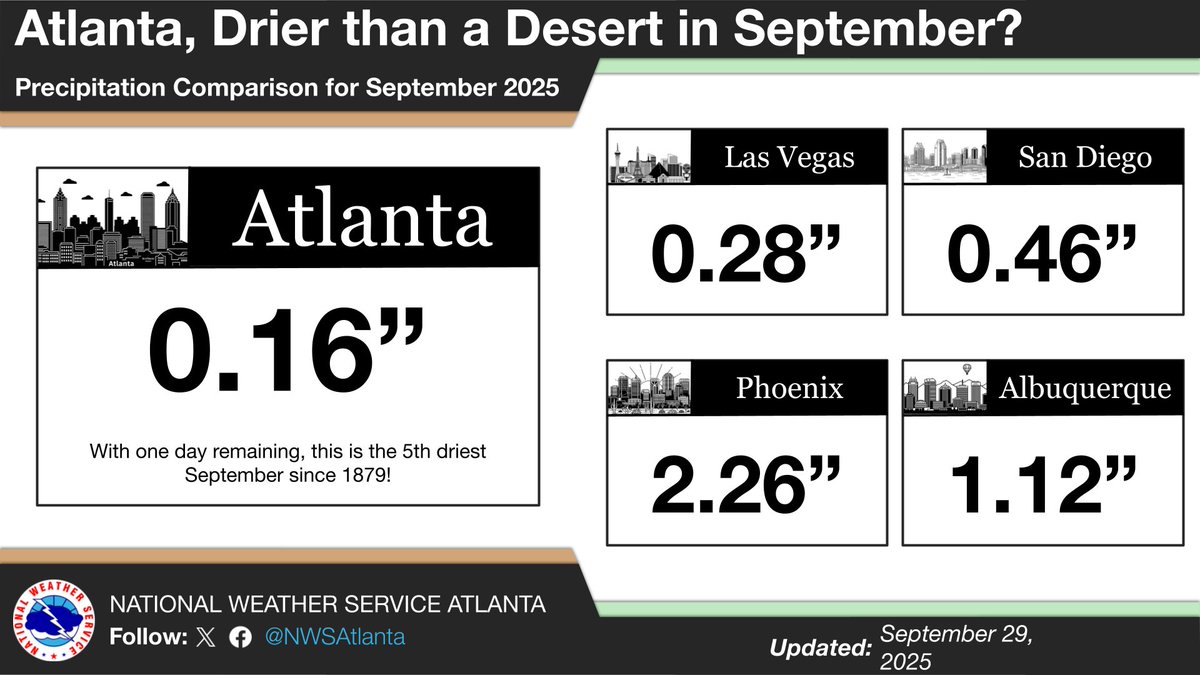
Atlanta's been giving off desert vibes in September. Four cites in the Desert Southwest have recorded more rainfall than Atlanta since the month started! Has it felt like you've been living in a desert the last couple of weeks? #gawx
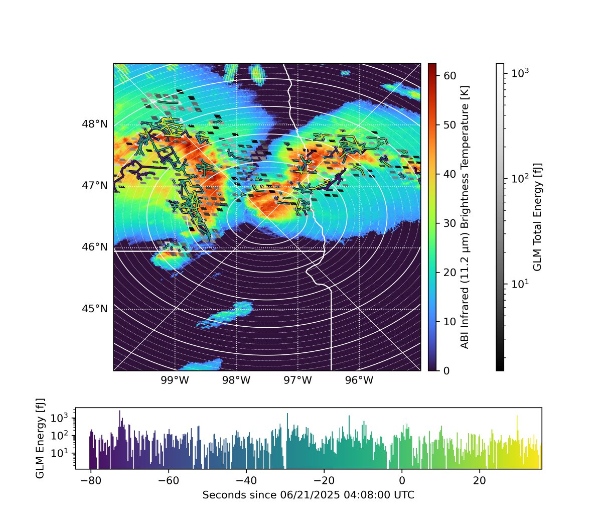
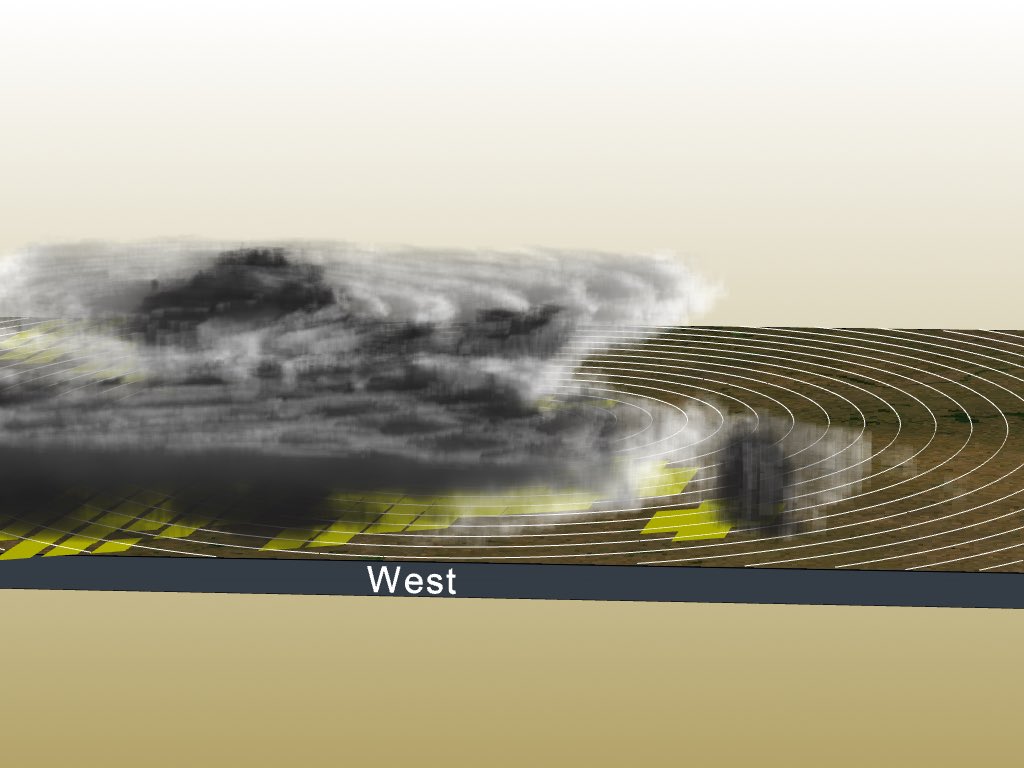
I’ll also note that my gridded imagery is based on full optical pulse (group) detections rather than illuminated imager pixel (event) detections - the typical approach. This change is desirable because it mitigates biases from light scattering into non-electrified clouds.
New GLM lightning web app up at https://t.co/ZFP3qlRuSu Still in beta, but it’s not just another plotting tool for NOAA operational data - it reprocesses the GLM data in near real time and generates imagery from the repaired GLM flashes. It aims to show flashes at all sizes
This photo, 20 years later, remains one of the greatest images ever taken inside Hurricane KATRINA.
The Hurricane Hunters view of KATRINA’s eye, with the eyewall visible. At the time, it packed winds of 150 kts (175 mph) and a pressure of 902 mb.