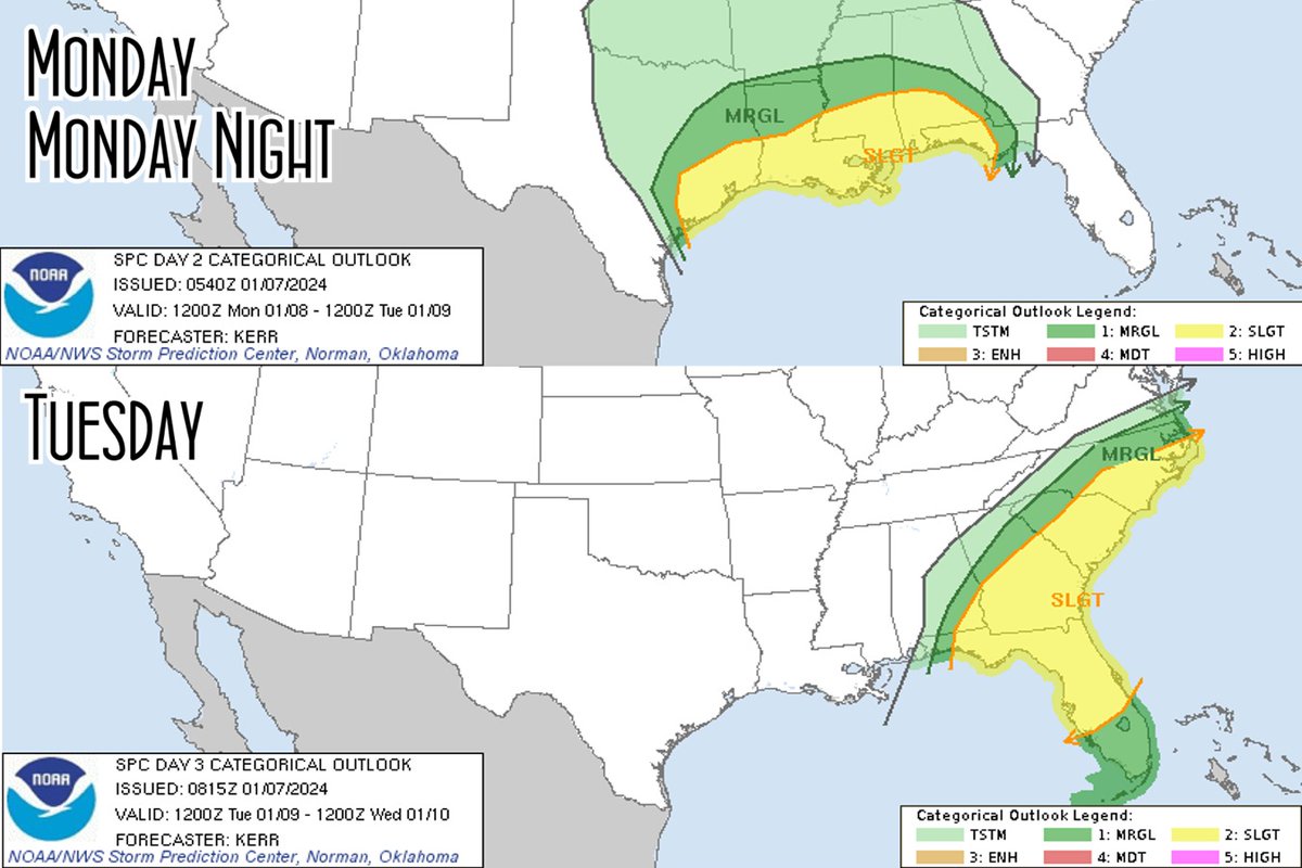
SPC Storm Prediction Center maps for Monday and Tuesday here. Deepening low pressure still expected to dip deep then pull NE bringing severe weather with it. Lots to watch with this one as far as impactful weather goes. Most of the eastern US will feel something. https://t.co/0EQMEw6Iu0
Tropical Depression Two has officially formed off the #FL Panhandle. Impacts to the Sunshine State will be felt, especially across South Florida where the risk of flooding will persist through Friday.
Read the latest forecast updates here: https://t.co/ymOqiOJIN5
It’s SPAGHETTI SEASON y’all
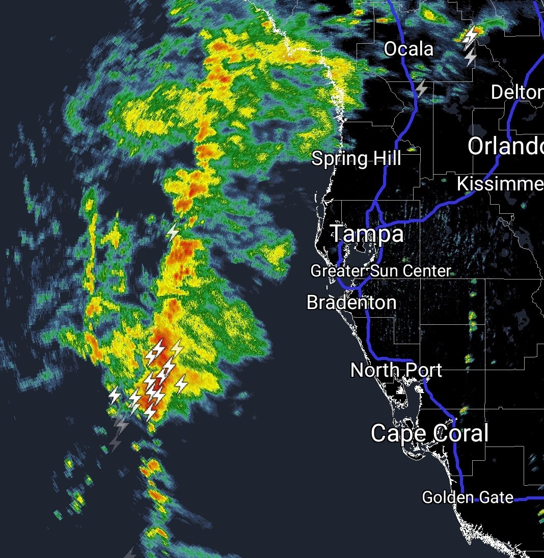
Look for high rain chances today into this weekend as invest 91L is expected to drift southward, making things humid as h*ck
Image from https://t.co/5fozfvhnfR
Not applicable to June Disturbance but definitely applicable to all of hurricane season - you really don’t have to go to Tennessee to evacuate a low-lying area or an unsafe location in a storm. It creates shortages and causes dangerous traffic issues.
❌MYTH: Evacuations must be 100s of miles away from your home.
✅FACT: Evacuations can be 10s of miles inland to a location that can withstand hurricane impacts.
⛽️ This hurricane season, keep gas tanks & EV's half-full to evacuate quickly & avoid long lines at the gas station.
And of course, without rainy season clouds and showers, Florida would become completely uninhabitable in summer. So let’s say bienvenidos to the June Disturbance, and remember to take an extra pair of shoes with you on vacation.
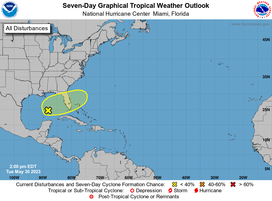
Tuesday 2pm EDT: An area of showers and thunderstorms in the Central Gulf of Mexico is associated with a surface trough interacting with an upper-level trough.
This system has a low chance of formation (🟡10% 2-day / 🟡20% 7-day) as it meanders over the eastern Gulf of Mexico for the next several days. The system is then forecast to move across the Florida
Peninsula this weekend and emerge into the southwestern Atlantic Ocean by early next week.
But the Cool Climatological Thing about a June Disturbance is that it’s frequently just what the Florida peninsula needs to raise daily moisture levels to the point where seabreeze storms because a regular occurrence- thus, kicking off the rainy season
Hello!!!!!
It’s time to get crazy with FLORIDA WEATHER!
So play along with me as I dip my toe back in the water on this account and don’t be shy with those sweet cloud pics and rainbows over The Land and whatnot
4/29 905 PM | A second round of strong to severe storms will impact east central FL late tonight thru Sunday morning. Have multiple ways of receiving alerts, specifically ones that will wake you up from sleeping. Keep phones charged & on, & be sure to turn on emergency alerts!
Okay, so with this latest update, we now have new impact threats.
Highest threat is hail. The orange means a medium chance of hail, but the black lines mean the hail could be 2"+ in size. BIG concern here.
Low-Med concern for damaging winds, and now a low threat for tornadoes.
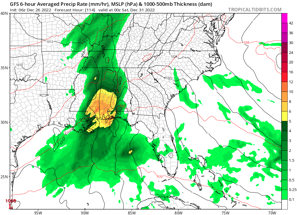
Weather coming up. Exact timing/details not solid but upper Gulf rains.. some heavy.. will be building and pushing east in a few days. Timing here GFS Friday. New Years weekend could be wet for some across the south and east. https://t.co/Hk3pbO84Yf
Still looking like a juicy Gulf blob rolls into the Florida peninsula Tuesday/Wednesday next week. Some heavy rain possible. Tuesday Latest ICON on https://t.co/3cvwpwdjTA here for Tuesday PM. https://t.co/Hk3pbOp80f
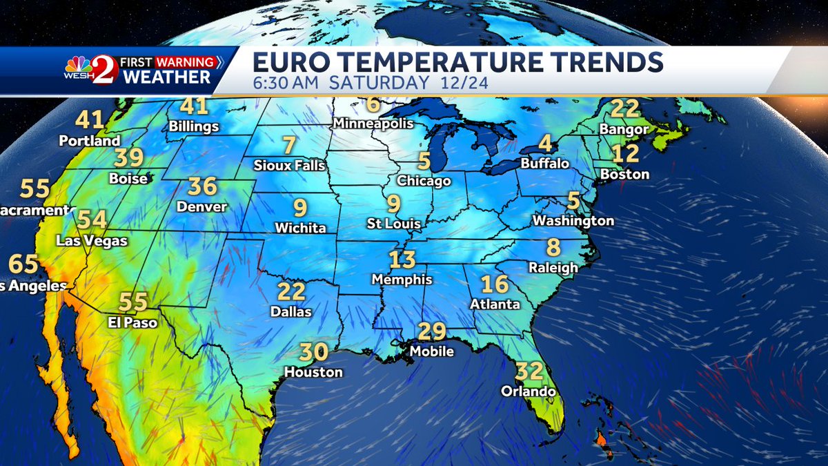
Computer models are showing a HUGE arctic air mass for Christmas Eve and Christmas day, making it all the way to us;
Noting set in stone, but let me tell you- it's about to get perhaps cold!
Active weather pattern kicks up for us Thursday, as this storm system works into the area;
Then we get cold... and then we get MORE rain... while cold... on Saturday late into Sunday.
It's going to be interesting...
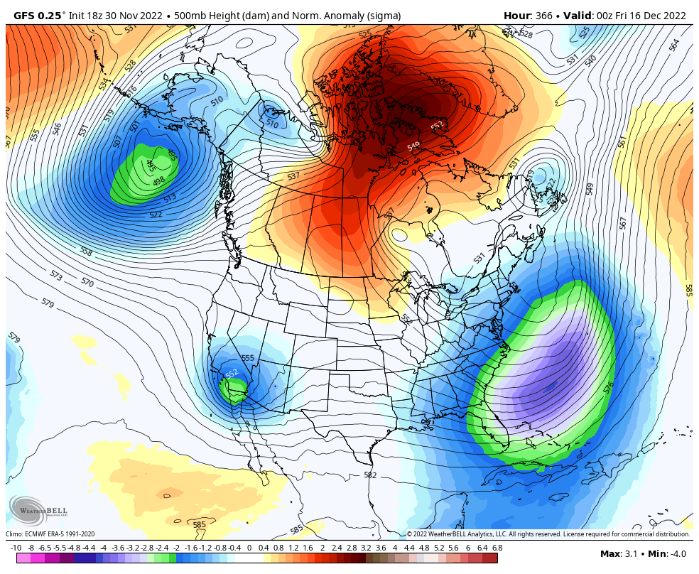
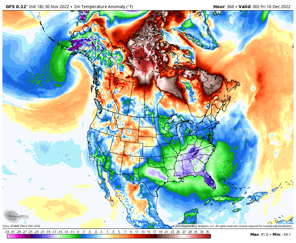
Those of you looking for a legit Florida cold front, we may have a shot in mid-December. Huge Greenland block should drive trough down east coast. Potential east coast snowstorm is in the mix too. It's way out there, so take it FWIW, but definitely something to watch day by day.