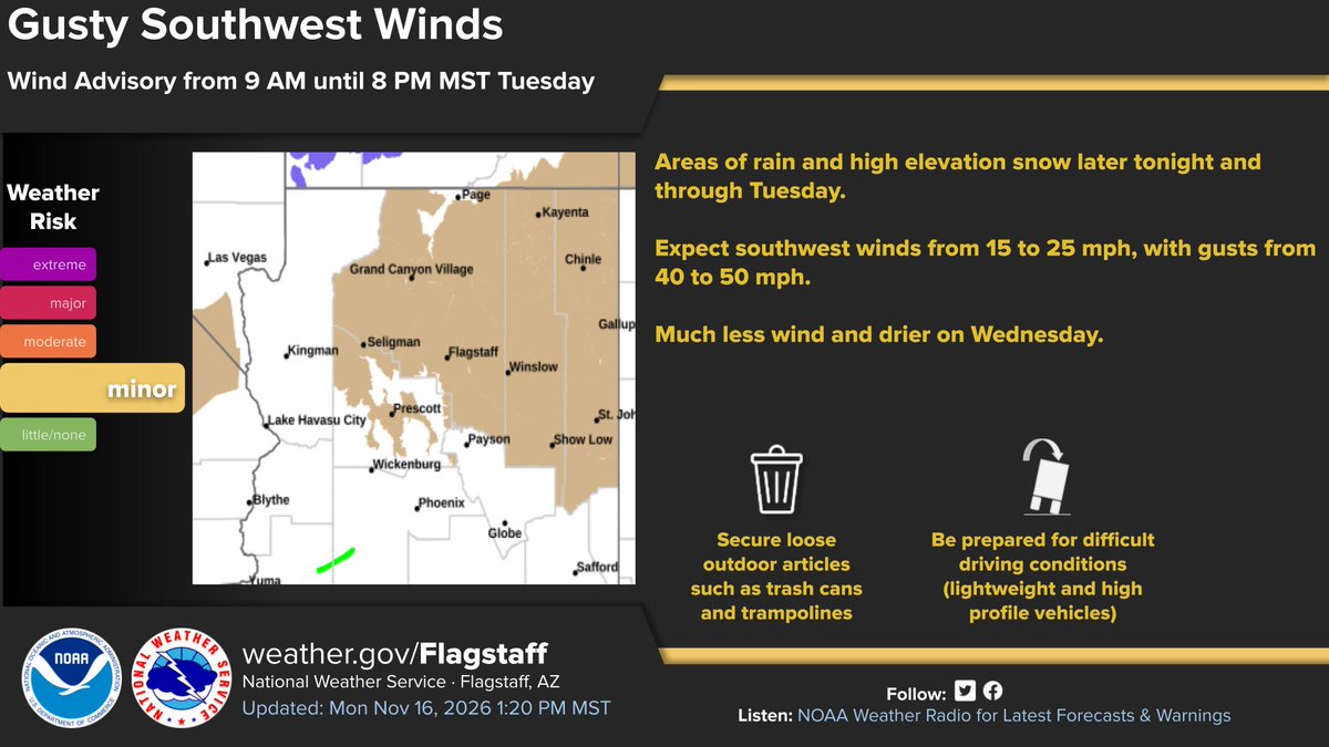
A storm system will bring areas of rain and high elevation snow to the region later tonight through Tuesday. Gusty southwest winds develop ahead of the storm as well, with a Wind Advisory in place on Tuesday for most of northern Arizona. Drier weather returns on Wednesday. #azwx
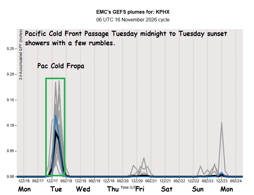
Warm B4 storm 80F today followed by midnight- Tues sunset showers/t-showers. Rest of week will quite cool with highs 67-73F and lows in the 50's. Sprinkles are possible Thu and Sat as Pac disturbances cross NAZ. Looking ahead a Thanksgiving weekend storm may be brewing. #azwx
The subtropical jet is forecast to strengthen sharply through late November as El Niño’s influence on U.S. weather builds.
That could drive powerful storms around Thanksgiving and into early December, though timing and tracks are currently uncertain.
Things dry out for Sunday and most of Monday before the next weather system moves in late Monday night. This will bring rain showers back to the region with areas as low as 7000 ft seeing a rain snow mix or snow showers by Tuesday night. #azwx
A brief warm-up lasts through Monday before more storms cool things down again. Expect gusty SW winds Saturday & Tuesday, plus shower chances Saturday and Tuesday into early Wednesday. #azwx
CW3E's CCA seasonal precipitation forecasts for Nov 2026 - Jan 2027 and Jan-Mar 2027 based on October SSTs are showing a canonical El Niño pattern, which tilts the odds towards wetter than normal conditions in the Southwest US.
Click here for more information about this product: https://t.co/rCTuQg60zS.
Rain chances return across northern and central Arizona today and tonight, with the best odds (40–65%) along and south of the Mogollon Rim. Drier weather holds across northeast AZ. 🌧️
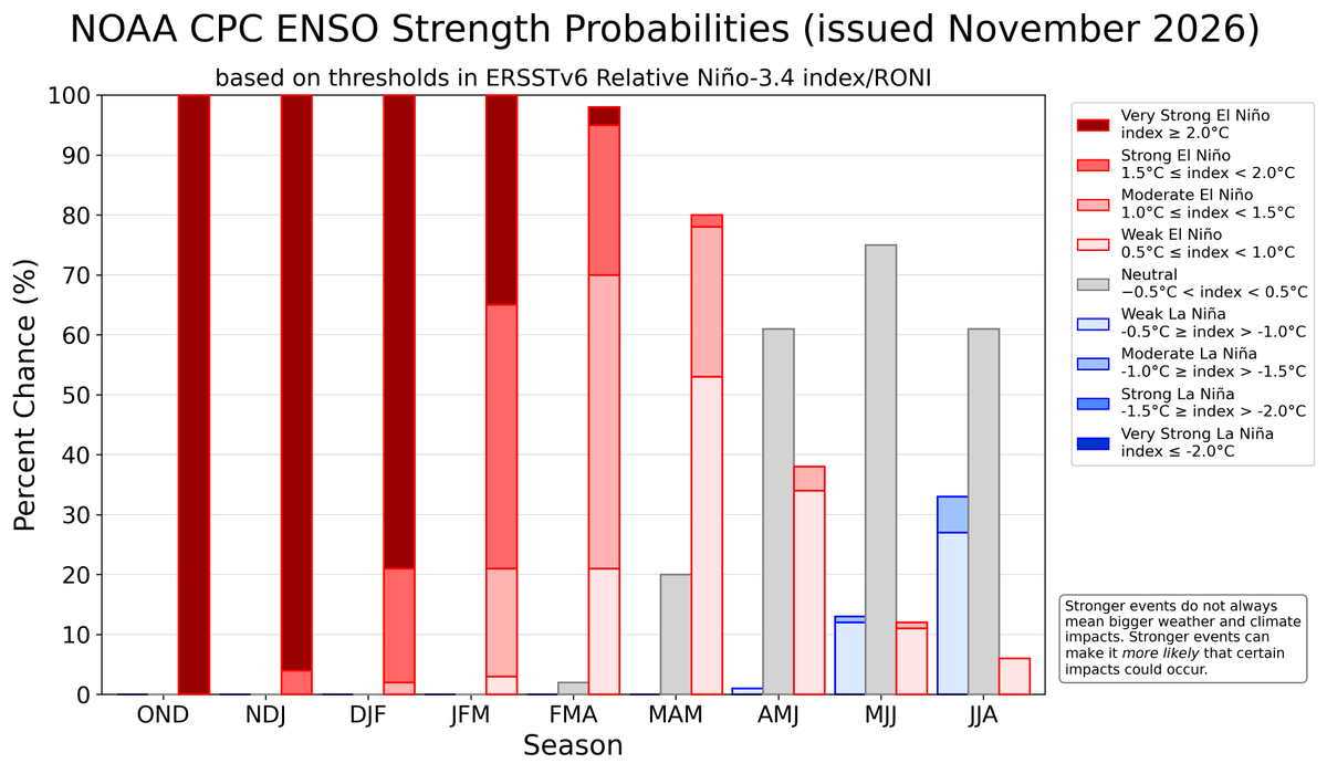
El Niño continues to strengthen, with a strong-to-very strong El Niño likely through January-March 2027 (remaining greater than a 79% chance). An #ElNino Advisory remains in effect. #ENSO https://t.co/5zlzaZ1aZx
The new November data for Winter 2026/2027 takes another step toward a colder and snowier pattern across a large part of the United States, while Europe stays in the mild Super El Niño influence.
But two major models now show a potential Polar Vortex disruption in mid-winter, and that could change the second half of the season on both sides of the Atlantic.
https://t.co/PPydKvtpqW
Next week leans wet for most of the US, especially the Southwest and Central Rockies. The Northeast, Mid-Atlantic, eastern Midwest, and WA lean dry.
Temps: Warmer than normal likely for most of the US. Cooler for CA/NV and surroundings. https://t.co/7rdkxQYyjk @NOAA@NWS@NWSCPC
🌤️ Weather Outlook: Expect temperatures to gradually cool through the first half of the weekend. Gusty southwest winds and a chance for showers are also on tap for Saturday and Tuesday. Check the latest forecast for your area at https://t.co/5w578IBpL7 #azwx