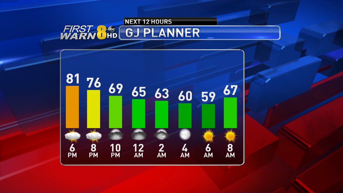
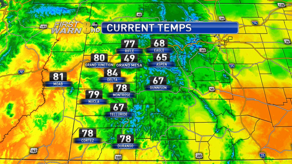
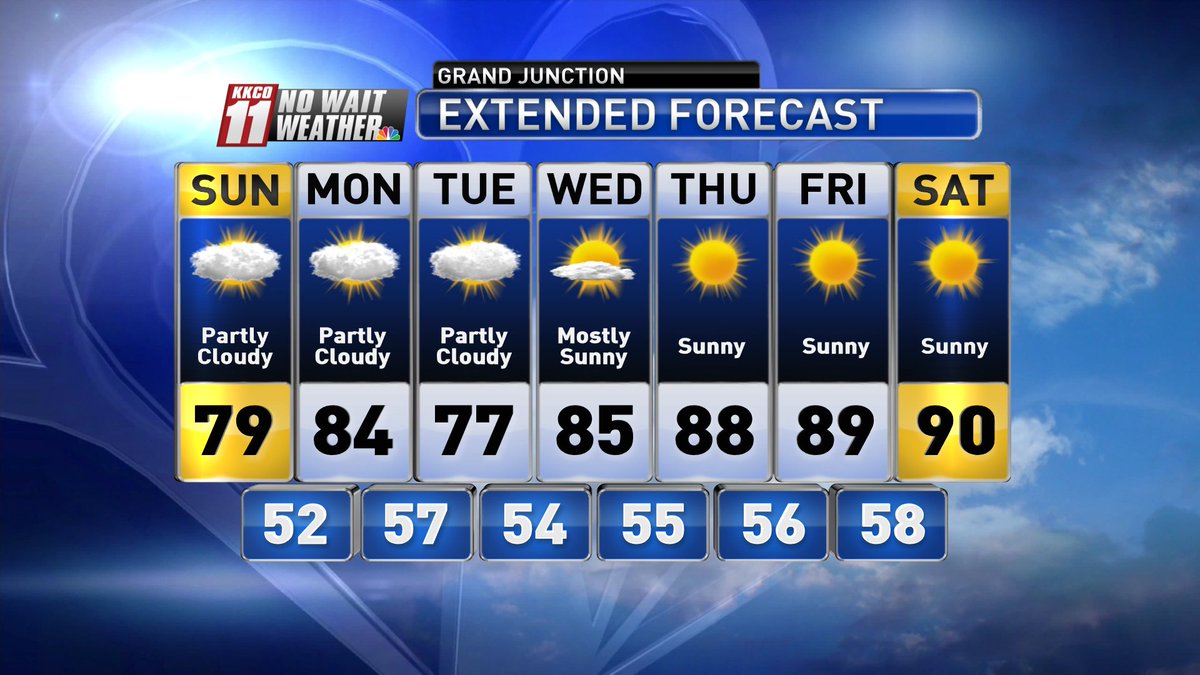
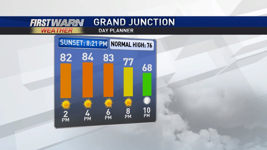
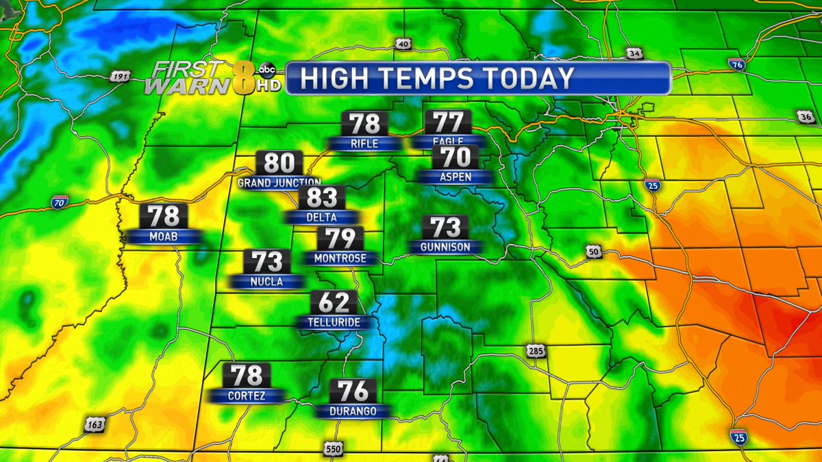
A beautiful day outside. So far, our high temperature for the day is at 89 degrees. Not as hot, as what we have been feeling... but tomorrow temperatures are going to be even cooler! Head outside Sunday and enjoy some mild temperatures!
Ready for the heat? Wednesday looks like it could be a triple digit day!
Download our new Weather APP to track the heat and the weekend storms!
Google Play: https://t.co/g4dLF6ARuN
Apple App Store: https://t.co/yUsbG2iUcv
Today much of Western Colorado is under a Red Flag Warning from dry, hot and windy conditions. That continues for tomorrow... Sunday will be another day for Red Flag Warnings... use extreme caution when outside this weekend. @KKCO11News@KJCTNews8
Hot, windy and dry conditions on Thursday give way to not so hot, windy and dry conditions on Friday. Red Flag Warnings exist for today until 10 pm and again tomorrow, 10am until 10pm.
#gjwx#sharegj#JucoWS@westernslopewx
Breezy conditions early tonight with a clearing sky later. Storms are moving through the region up until sunset, but we should stay dry. A mild start to what will be a hot Thursday.
https://t.co/qpTD76F2qk
Feeling pretty good outside! This is what a typical late May day should feel like. Warmer for the next few days and the return of the windier conditions. Details tonight at 5:30.
https://t.co/qpTD76F2qk
An hour ago, Grand Junction had a 43 mph blast and now we are one degree away from a temperature record tie!
https://t.co/lYRWye0We5
#gjwx#sharegj#JucoWS@WesternSlopeWx
Working on the rain deficit in both locations & will do so through this evening. GJ almost 3/4 of an inch negative. Montrose is past 2 inch negative mark for the year.
https://t.co/lYRWye0We5 #gjwx#gjshare@WesternSlopeWx
Most locations will have clouds, storm associated wind gusts & dry conditions, but there is always the hope. Any area near those MTN storms could benefit from some valley drift! Another shot at the wind & rain TUES.
https://t.co/lYRWye0We5
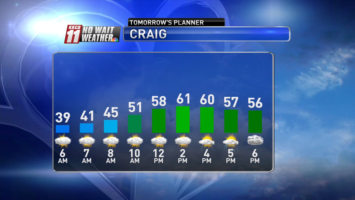
Looking for rain or storms? Head north Saturday afternoon/evening for a quick hit around Craig, CO. MTNS will do best this weekend with the unsettled weather/valleys have to wait and see on SUN.
https://t.co/lYRWye0We5
#shareGJ
GJWX
Just as warm, if not warmer, THURS with stronger wind/gusts into the 30+ mph zone. Grand Valley not under a Red Flag Warning THURS, but much of the Western Slope is. Burning is strongly discouraged!
https://t.co/qpTD76F2qk
#gjwx@WesternSlopeWx
We're in for another warm afternoon, with our highs climbing into the low to mid 80's. Sunshine dominates once again today, and our winds will likely pick up tomorrow.
Mostly sunny TUES & more of the Sunny & Dry. Temps do go warmer for the midweek. Tune in tonight at 5, 6 and the TEN to find out if we have records in sight/any rain in the forecast.
https://t.co/lYRWye0We5
#gjwx@WesternSlopeWx
Go fly a kite! Less warm this afternoon but just as windy as Friday. Could even blast a few wind gusts better than 37 mph later... very dry conditions continue as well.
https://t.co/qpTD76F2qk
#gjwx@WesternSlopeWx#kstr
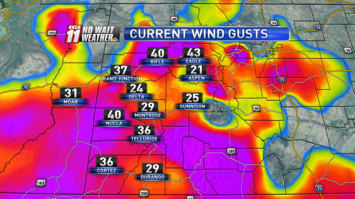
Near 40 mph wind gusts happening on the Western Slope. Forecast calls for more of the same this evening and again Saturday with very dry conditions in place.
https://t.co/lYRWye0We5
Plenty of heat left in this day to continue setting temperature records across the Western Slope. Grand Junction has already done so with 90° in the book earlier than usual! 1st average 90 degree day happens June 3rd.
https://t.co/lYRWye0We5
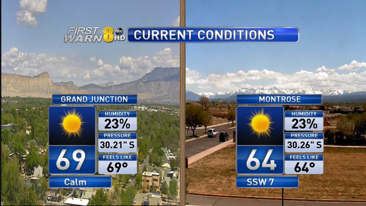
Upper 60s/low 70s is the typical temperature for this time if the year. Plenty of afternoon left to reach those numbers for Grand Junction and Montrose. The weekend is just getting started!
https://t.co/qpTD76F2qk
#gjwx@westernslopewx
Freeze Warning Saturday morning for a few hours of chilly temperatures, clear sky & calmer wind speeds. Lows range from the teens at Gunnison to lower 30s at GJ.
https://t.co/qpTD76F2qk
@WesternSlopeWx