AlphaEarth Foundations delivers a global, 10m-resolution dataset of analysis-ready embeddings for every year since 2017, ready to use with minimal effort.
Google just released the AlphaEarth Foundations with 64 dimensions of satellite embeddings at 10-m resolution at the global scale! It is very interesting! Check it out
Blog post: https://t.co/RviUl5TRIc
Dataset: https://t.co/mCMafemeE2
Paper: https://t.co/isoE4zOXfZ
#AI #geospatial #remotesensing #geoai
Interesting podcast! How satellite data and Vision Transformers are creating the 10-meter global natural forest map. Also dive into tackling noisy data & uncertainty.
What if we could confidently predict the future of our ecosystems - including how humans are impacting them? 🌳
Our host @fryrsquared and Nature Lead @DrewPurves discuss how AI could unlock accurate simulations of our environment, allowing us to better protect it.
Watch now ↓
However, it sometimes struggles to predict out-of-range values, such as extreme temperatures not present in the training dataset. Even with advancements in machine learning, domain knowledge and process-based models remain crucial for interpreting ML in some cases.
FireSat, a new wildfire detection proto satellite, has launched on SpaceX's Falcon 9! High-res imagery updated every 20 mins will soon help detect 5x5m wildfires globally. Congrats to @MuonSpace, @MooreFound, @EarthFireAll: https://t.co/uyHdBH0LFh
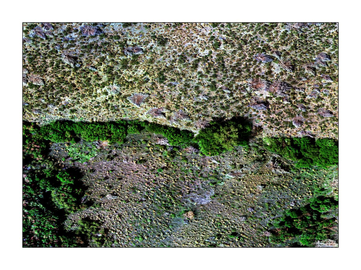
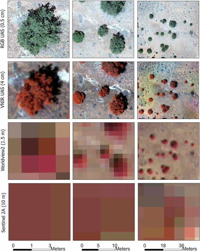
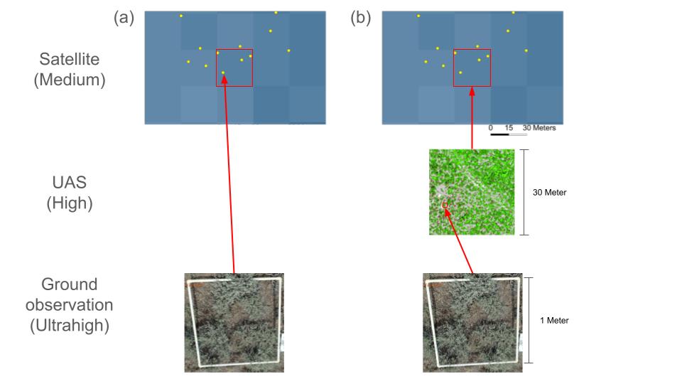
High-resolution UAS imagery offers ecologically relevant information at a much finer scale than moderate-resolution satellite data. Check out this review of UAS applications in landscape ecology: https://t.co/V0U62RLF3m
Our new paper shows how high-resolution multispectral drone imagery can effectively map vegetation cover in spatially heterogeneous landscapes https://t.co/OGX6ud2dE5
High-resolution imagery is useful for estimating plant abundance and informing management decisions. However, users must be conscientious of false negative (missed plants) and false positive (misclassified) errors.
Soil burn severity, crucial for predicting post-fire hydrology, requires laborious field assessments. This paper demonstrates machine Learning models and the explainable AI approach to translate remotely sensed vegetation burn severity to soil burn severity #XGBoost#Shapley
Looking to level up your data analysis workflows? Read all about “Writing functions that work for you!”
This is the first in a new blog series, “Reproducible Data Science with R”
https://t.co/XPAkbP40Hu
#rstats#WDFN#WaterDataForTheNation#Blog