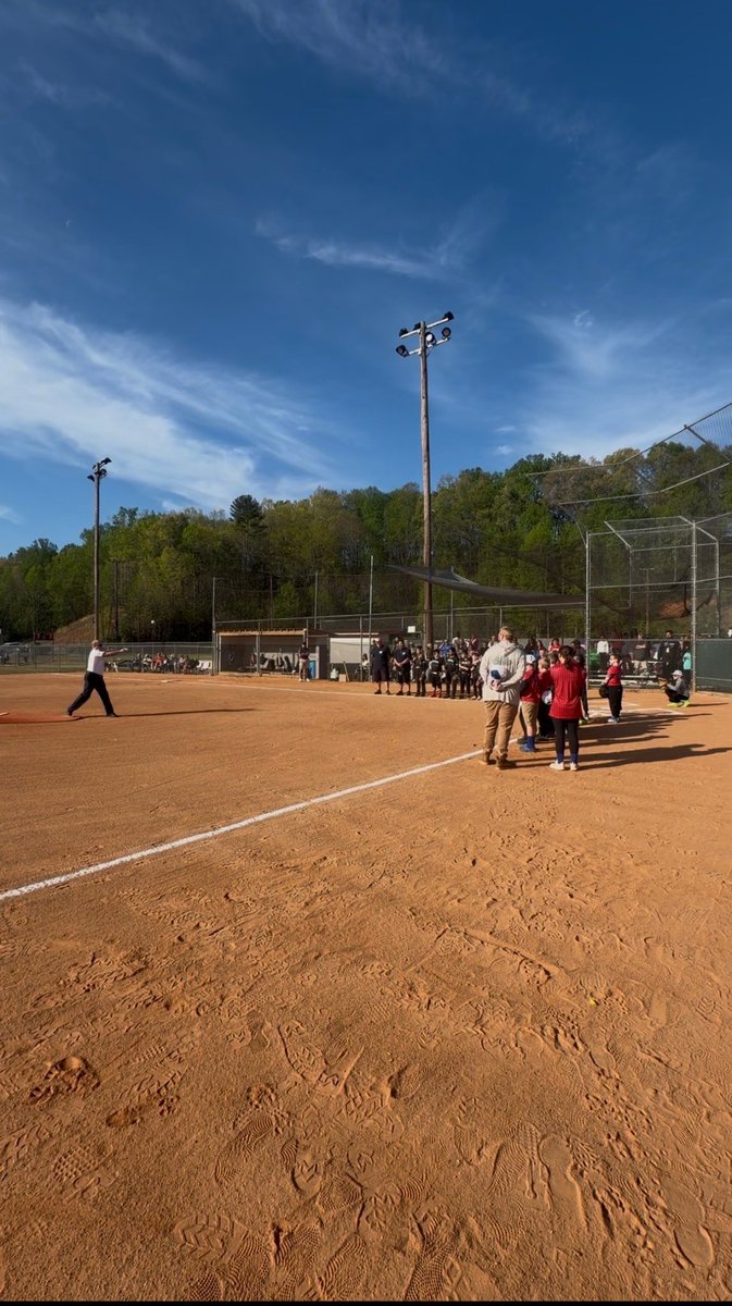
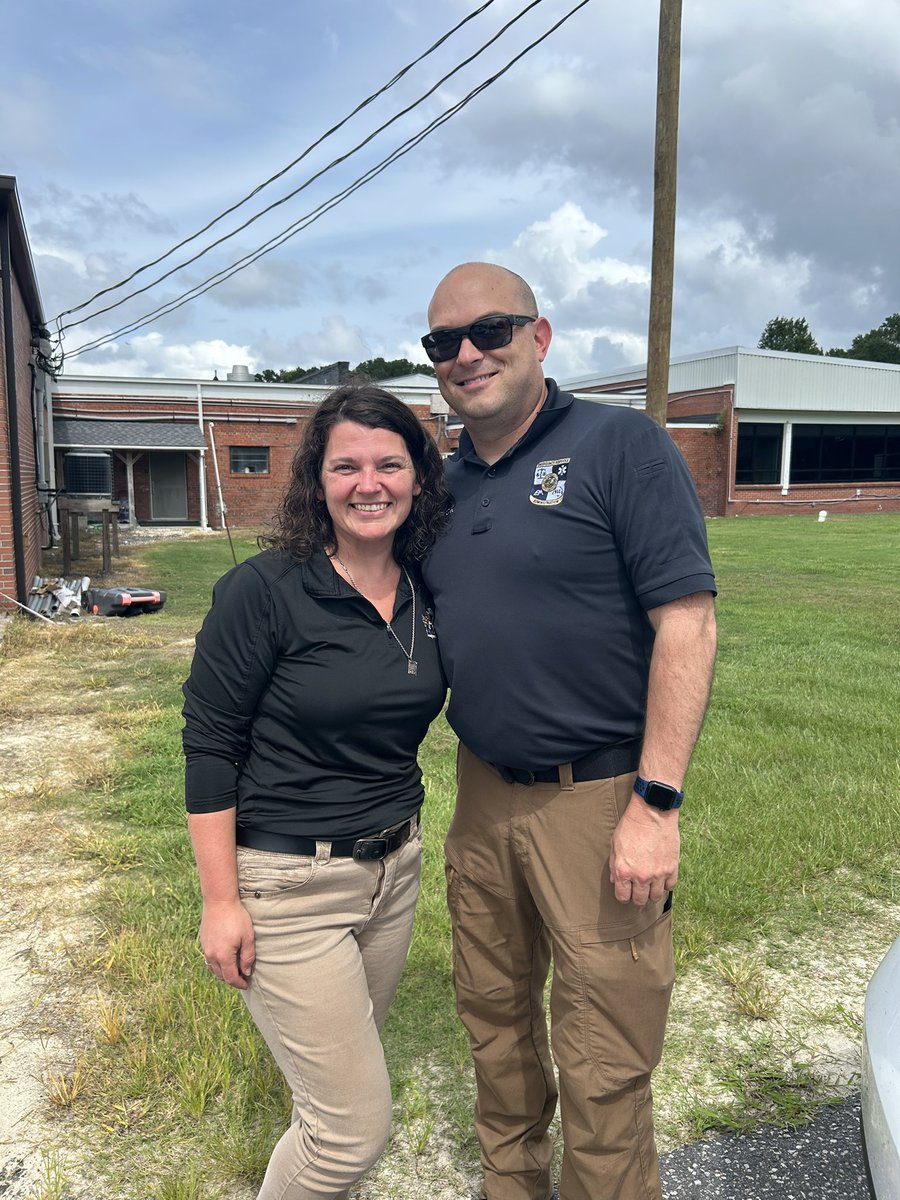
Many thanks to the McDowell Babe Ruth League and the McDowell Parks and Rec. Dept for asking me to throw the first pitch of the season at the park my parents built in the late 80’s. The ball crossed home plate in the air!!
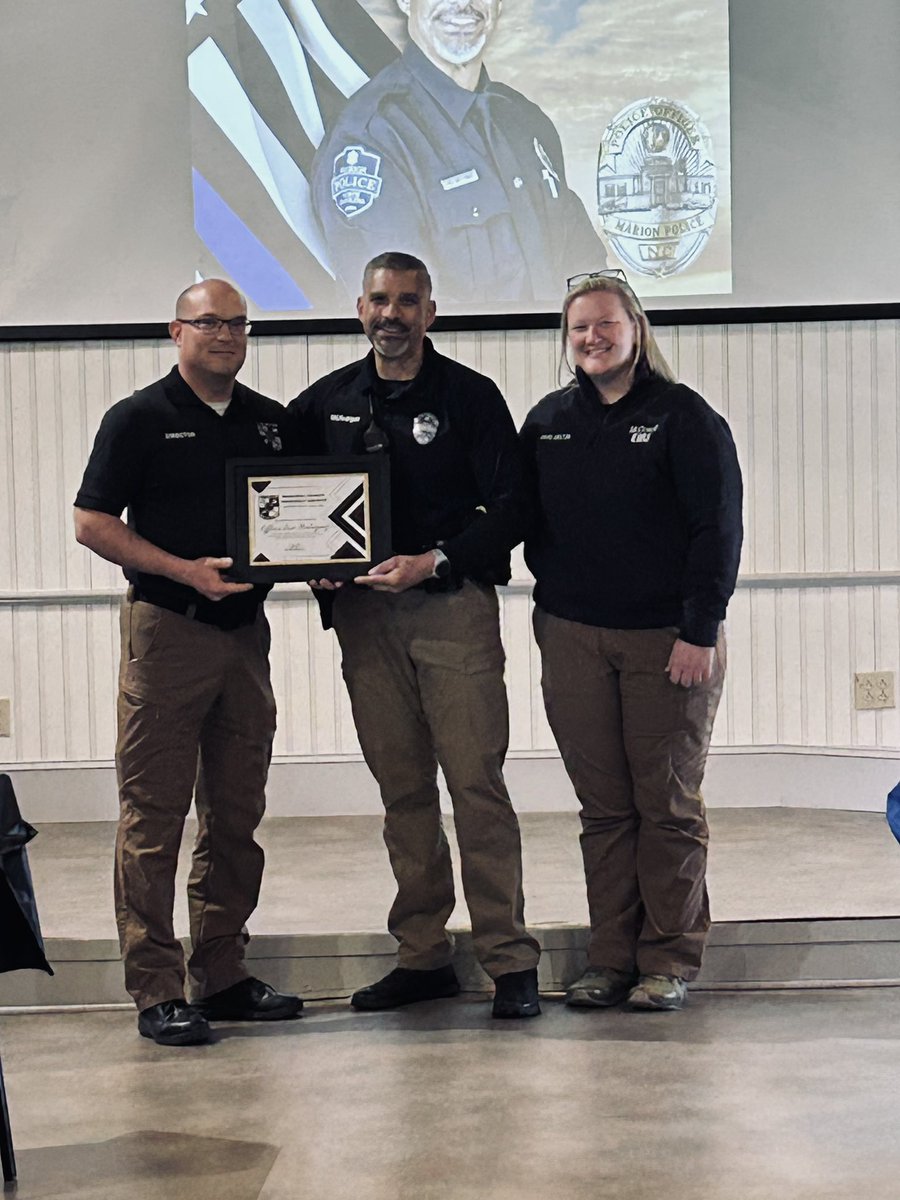
Congratulations to my good friend SRO Eric Rodriguez on his recent retirement. I had the privilege of presenting him with the ES Director’s Award for his steadfast commitment to emergency services.
EXTREME COLD WARNING IN EFFECT FROM SATURDAY AFTERNOON/EVENING THROUGH SUNDAY MORNING ACROSS THE WESTERN CAROLINAS AND NORTHEAST GEORIGA.
Dangerously cold wind chills are expected with -15°F to -30°F across the mountains and as low as -5°F elsewhere.
#scwx#ncwx#gawx
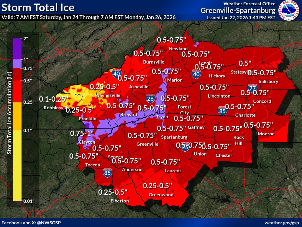
🧊Ice covered roadways will become treacherous and impassable. Widespread power outages are likely due to the weight of the ice on tree limbs and power lines. The outages could last for days in some areas. The hazardous conditions will impact the Monday morning commute.
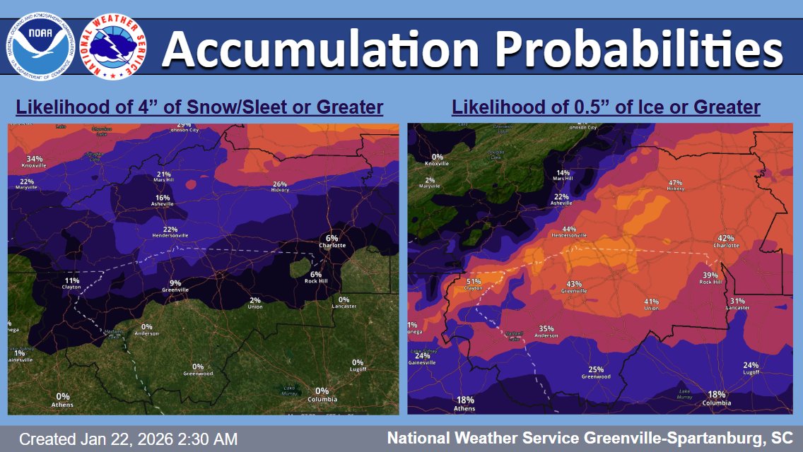
Light rain today mainly west of I-26 ahead of the weekend winter storm. For Saturday and Sunday, a Winter Storm Watch is in effect. The snow chances have moved north of I-40 and more ice/sleet is expected. Continue to monitor the forecast as this evolves.
@scwx#ncwx#gawx
Confidence continues to increase on an expansive major winter storm impacting much of the southern and eastern portions of the Country Friday through Sunday. Key Messages are updated.
@YouTubeTV Quite fitting that you haven’t made a post since 10/30/25. Get your act together and get a contract resolution with Disney. This is ridiculous. The lack of communication with your customers says it all.
As we concluded yesterday’s ceremonies for the one year anniv. of Helene a double rainbow was visible across McDowell County. I’ve seen many rainbows in the mountains but the one yesterday had a completely different meaning on the anniversary of Helene. God is good. 🇺🇸
Still astounding to watch the radar loop from the 3 day barrage of rainfall before and during Hurricane Helene in Western NC last year.
Next week is the one year anniversary.
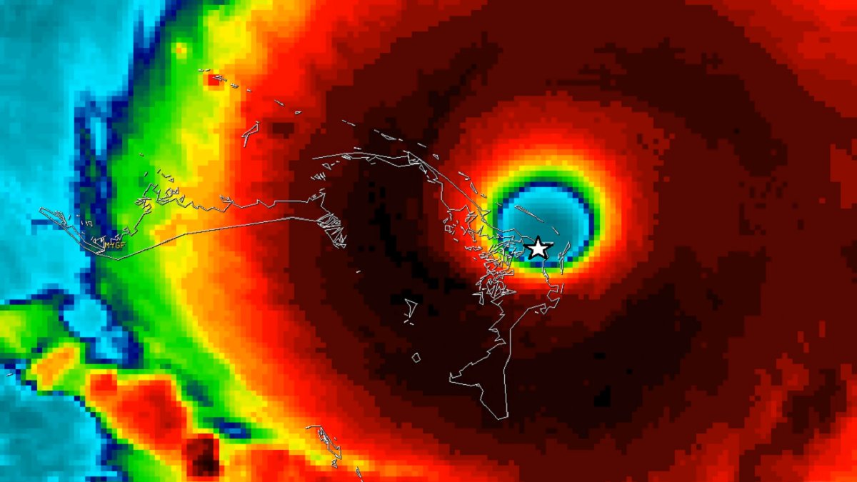
Six year ago today, I survived #Hurricane#DORIAN—the strongest landfalling hurricane on record in North America (tied with the 1935 Labor Day Storm in Florida).
It struck Great Abaco Island in the Bahamas with unimaginable ferocity: sustained winds of 160 knots. I rode it out in a town called Marsh Harbour—in a tiny classroom with 11 other people, including toddlers.
The inner core of the hurricane was a total whiteout—all I could see through the cracks in the shutters was pure whiteness, pure energy. All I could hear was a roar. All I could feel was vibrations in my chest and harsh, painful pressure in my ears. The concrete walls rattled from the sledgehammer force of those terrible winds. And as the storm peaked, we had to pile furniture up against the shutters to keep them from blowing in—even as the sunshine of the approaching eye started gleaming through the cracks.
During the calm eye, I crept outside to discover what looked like the inner radius of a nuclear bomb blast: smashed concrete, cars torn open and thrown like toys, trees reduced to sticks. My barometer read 913.4 mb—the lowest I've ever measured. Our shelter was badly damaged and we needed to move—fast. My new friends and I hastily piled into the three cars between the 12 of us that still worked—one of them mine—and looked for a new place to hunker down. Anything. I drove carefully around the wreckage and just tried to do what I always do in life-and-death situations: STAY ZEN, STAY FOCUSED. My biggest fear was getting caught on the road when the backside winds started up. We would die. Thank God, we found another building and managed to cram inside just as the hurricane winds started up again.
The aftermath was unimaginable. The level of destruction and human misery was worse than anything I've witnessed since Super Typhoon HAIYAN in the Philippines back in 2013. I was trapped on the island for a few days—living in my car, strictly rationing my food and water, and trying to be helpful in whatever ways I could—until I managed to get off the island and back to civilization.
From a meteorological standpoint, I do not expect to top this feat—of perfectly penetrating the stadium eye of such an intense hurricane. The data I captured were incredible—the core gradients I measured in the inner eyewall.
I documented the entire experience on video—the link is in my next post.
One Bay Saint Louis family chose to ride out #Hurricane#KATRINA in their old house on Demontluzin Avenue, near Downtown. It had survived every other hurricane, including CAMILLE. But KATRINA was something different. As their house collapsed from the force of wind and wave, they escaped through a second-story window and grabbed hold of this tree. And that's where they rode out the storm—three people and a dog, clinging to its branches. The noble old tree died protecting them. Later, it was moved to the waterfront, where artist Dale Lewis turned it into this Angel Tree—one of five in the Bay. They're stark monuments to the wrath of KATRINA—sentinels watching the Gulf for future dangers. #Mississippi
Last night, the 53rd Weather Reconnaissance Squadron flew into the eye of Hurricane Erin—and captured imagery of the breathtaking stadium effect.
These missions provide critical data to the NHC to improve forecasts, helping keep communities safe before the storm makes landfall.#readynow #weatherready