Follower Of Jesus Revelation 3:11 Matthew 5:30 Beginner Storm Chaser/Future Meteorologist. 17 Tornado Count/4. I love Weather and CG+ Lightning Youtube WxKeegan
WOW: Haters will say it's fake- but after plenty of review of historic lightning date with @NWSSaltLakeCity - Tucker Ralphs caught jaw dropping video of cloud-to-ground lightning on I-84 near US-89. We located the strike on radar, right outside of Weber Canyon!
#utwx
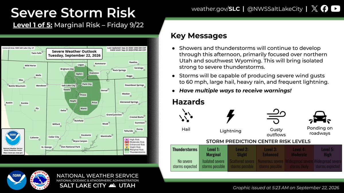
⛈️Strong to severe thunderstorms are possible across UT and SW WY this afternoon, primarily across northern and central UT. Potential hazards include strong winds to 60mph and hail to 1".
#UTwx#WYwx
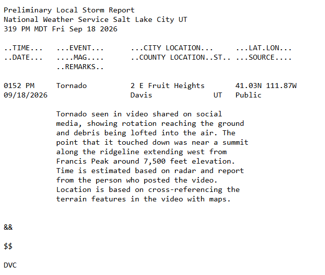
Based on video received via social media, we can confirm that a tornado touched down just before 2pm near Fruit Heights, UT. We're estimating the location by cross-referencing terrain on the videos with maps, supplemented by radar data. #utwx
🍃Tomorrow will see another round of gusty winds through most of the day with the highest winds across western portions of the state. Gusts between 40-45 mph will be possible across this area. #utwx
An unsettled pattern and widespread above-normal precipitation are favored for the West through mid-September. Potential for tropical moisture may produce heavy rainfall for some areas, especially the Southwest.
🚨 NWS CONFIRMS 100 MPH WINDS IN LYNNDYL, UTAH 🚨
The National Weather Service has completed its damage survey from Saturday’s destructive thunderstorm in Lynndyl, and the numbers are remarkable.
🌬️ Estimated peak wind: 100 MPH
⛈️ 17.4-mile damage swath
📏 Up to 2 miles wide
🧊 Golf-ball-sized hail observed
🏠 Extensive damage to homes, vehicles, trees and agricultural fields
🚂 34 empty rail cars were blown over
🏥 1 injury reported
The NWS says the damage is consistent with a significant microburst, with straight-line winds estimated at 80-100 MPH.
The damage pattern was particularly telling. Trees, power poles, roofing and other structures were blown predominantly from west to east, with a divergent wind pattern observed across town — classic evidence of strong, descending air spreading outward at the surface.
Wind-driven hail made the damage even worse. Numerous west-facing windows were blown out, siding and roofs were heavily damaged, vegetation was stripped of leaves, and a nearly harvest-ready cornfield was shredded and flattened.
The destructive wind and hail continued eastward, producing a roughly 17-mile-long by 2-mile-wide swath extending from near Sugarville through Lynndyl toward Leamington.
This was an exceptionally powerful thunderstorm and the NWS survey confirms just how intense it was. My thoughts are with everyone in Lynndyl who was impacted. And a huge thank you to the residents, Millard County Emergency Management and the Millard County Sheriff’s Office for helping with the survey.
⚠️ CONCERNING UPDATE: SEVERE WEATHER WATCH POSSIBLE
The severe weather threat is increasing across northern Utah this afternoon, and the Storm Prediction Center says a Severe Thunderstorm Watch may be needed.
There is currently a 40% chance of a watch being issued through this afternoon.
Scattered thunderstorms are already developing west and southwest of the Great Salt Lake and into eastern Nevada. As these storms continue to strengthen between roughly 3-5 PM, a few could become supercells.
The biggest concerns are:
🌩️ Large hail
💨 Strong to potentially severe wind gusts
⚡ Frequent lightning
🌧️ Heavy rain
The atmosphere is becoming increasingly unstable, with enough wind shear in place to support organized, rotating thunderstorms. That combination is what has me paying close attention this afternoon and evening.
A watch has NOT been issued at this time. But the setup is concerning enough that we are watching trends closely, and that could change quickly.
If you have outdoor plans this afternoon/evening, keep an eye on the sky and have a way to receive warnings. Things could become active quickly once storms get going.
I’ll keep you updated as this evolves. This is one of those days where you don’t want to be caught off guard.
⚡️ LIGHTNING STRIKE IN TAYLORSVILLE THIS MORNING
Dangerous thunderstorms are moving across northern Utah today, and this lightning strike in Taylorsville is a great reminder of just how quickly conditions can turn dangerous.
⛈️ If you hear thunder, go indoors. Strong winds, frequent lightning and other severe weather threats are possible today.
🎥 Video: Tera Ann Backman
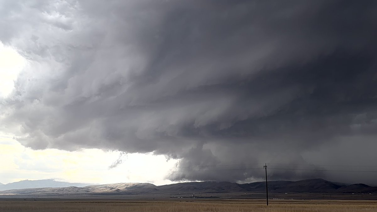
Scattered severe thunderstorms are expected across northern Utah and southwest Wyoming Saturday afternoon and evening. Storms will be capable of producing wind gusts to 70 mph and large hail. Have multiple ways to receive weather warnings! #utwx#wywx