Whether you are boating on Lake Winnipesaukee, hiking in the White Mountains, or planning to visit Old Orchard Beach, all your local recreational forecast needs can be found here: https://t.co/63RrZni2S4
#nhwx#mewx
With potential impactful weather today, please have multiple ways to receive alerts. An unexpected phone line outage has taken our NWRs off the air. If someone you know relies on NWR for alerts, please pass this information along #MEwx#NHwx
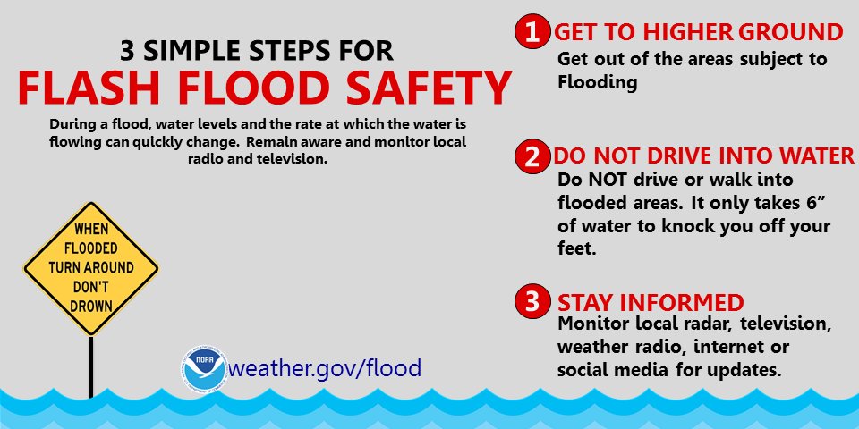
Renewed risk of flash flooding today as heavy showers with embedded thunderstorms redevelop. Similar locations again see this rainfall, and flooding will onset quicker with saturated ground. Severe thunderstorms are not forecast today. #mewx#nhwx
Good morning, Thunderstorms are expected to develop this afternoon. A few storms may become severe, especially across southern New Hampshire. Here's a look at what we are expecting later today. #NHwx#MEwx
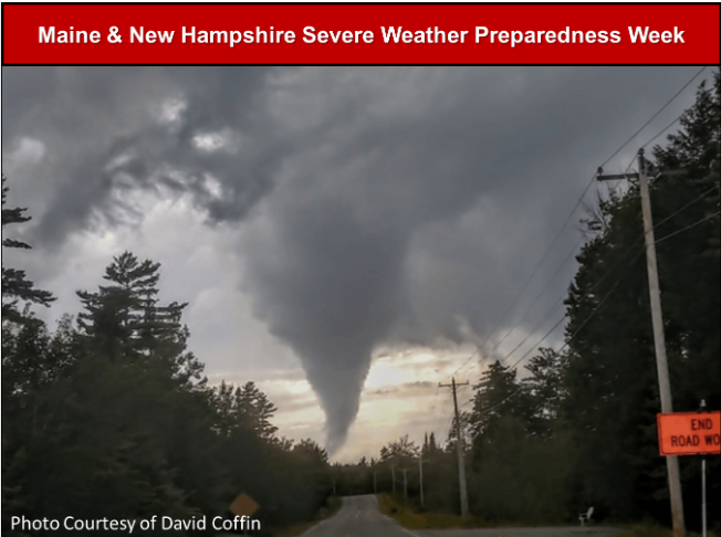
...Maine and New Hampshire Severe Weather Preparedness Week...
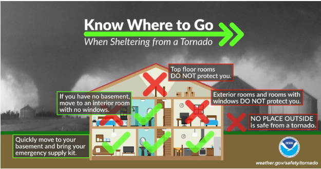
What should you do during a tornado warning? Most of these guidelines can be adapted for strong microburst wind damage and trees falling onto your home. https://t.co/Fhsh7f0XCq #mewx#nhwx
..Maine & NH Severe Weather Preparedness Week..
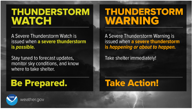
Watch means BE PREPARED (normally issued 2 to 6 hrs before onset of storms). Preparation helps to save lives! A thunderstorm WARNING means TAKE ACTION and seek shelter! https://t.co/C22XRHZLfU https://t.co/ufkZzcVVmD #mewx#nhwx
***Severe Weather Preparedness Week***
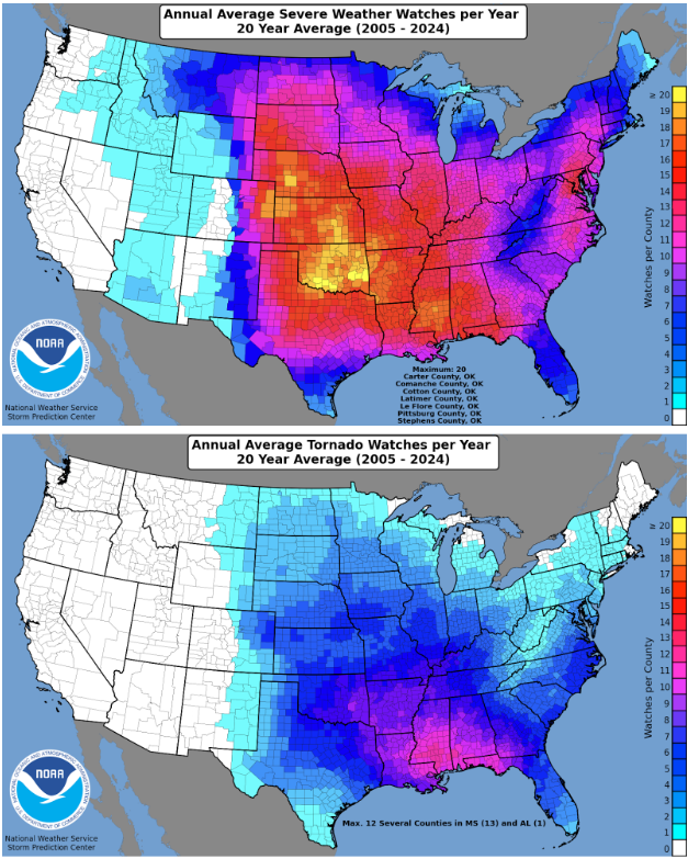
NWS Gray will provide educational information throughout the week to help prepare our community for severe thunderstorms and tornadoes. Visit https://t.co/hsOT3OcnzX for further information. #mewx#nhwx
A cold front will bring showers and some thunderstorms to the area late this afternoon. Depending on where, and how much, the skies clear, some of these storms could produce gusty winds. Here is one model representation of where storms could be. Stay weather aware! #MEwx#NHwx
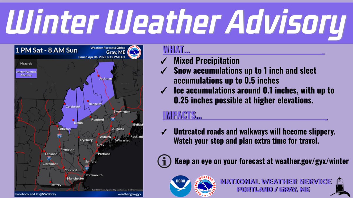
A Winter Weather Advisory has been issued for our northern tier of zones. Mixed precip will move in Saturday afternoon while surface temperatures are still below freezing. Light icing will make for slippery travel through Saturday PM. The icing threat ends Sun AM. #MEwx#NHwx
***April Mixed Precipitation Tonight into Tomorrow***
Expect travel impacts for interior locations tomorrow morning due to wintry precipitation. Plan ahead and give yourself extra time. Go to https://t.co/cG6DfRjAJa to see our precipitation type graphics. #mewx#nhwx
There is increasing confidence for an impactful early spring winter storm to impact the region this weekend. Winter Storm Watches have been issued for portions of the region. #MEwx#NHwx
Snow showers are expected to develop along a front this evening. They may be accompanied by gusty winds which will reduce visibilities, along with briefly heavy snowfall which can quickly coat roads. We also have a weak system coming through overnight. #MEwx#NHwx
An area of heavy snow showers will affect central Yorknorth central Strafford and southeastern Carroll Counties for Coastal York, Interior York [ME] and Southern Carroll, Strafford [NH] till 8:30 AM EST https://t.co/HNDuDgEC3g
We have already seen some pretty impressive wind gusts early this morning. Expect them to continue through much of the day, before calming a bit heading in to the evening. Use caution on the roads as these wind gusts can bring down trees and create road hazards. #MEwx#NHwx
It will be rather dreary today into tonight with rain and fog. Through Thursday morning, rainfall amounts are expected to be in the 0.50-1.00" range, but locally higher amounts of 1.00-1.50" are possible from the White Mountains to the Kennebec Valley and Midcoast. #nhwx#mewx
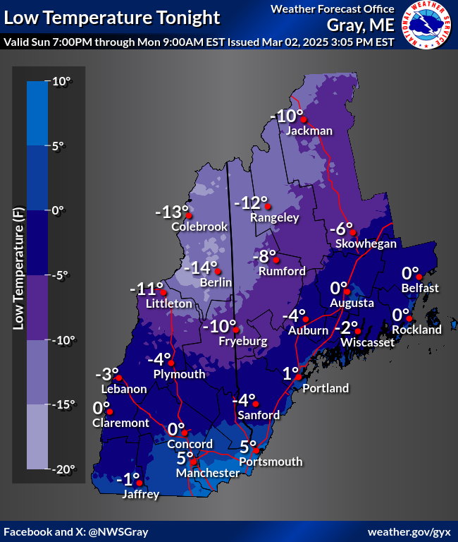
Cooler tonight, but less of a windy bite. Temps rebound in a big way through the middle of the week. Rain is expected to move in Wed, continuing Thurs. Combined rain and melt will aid in river ice movement. For now, this is more likely for the coast and interior #nhwx#mewx
GYX issues Coastal Flood Advisory valid at Mar 1, 10:00 AM EST for Coastal Cumberland, Coastal York [ME] and Coastal Rockingham [NH] till Mar 1, 2:00 PM EST https://t.co/0i8hIuqWYS














![iembot_gyx's tweet photo. An area of heavy snow showers will affect central Yorknorth central Strafford and southeastern Carroll Counties for Coastal York, Interior York [ME] and Southern Carroll, Strafford [NH] till 8:30 AM EST https://t.co/HNDuDgEC3g https://t.co/P6BNwxd0O2](https://pbs.twimg.com/media/GlhP_1jbAAAVyOU.jpg)
![iembot_gyx's tweet photo. GYX issues Coastal Flood Advisory valid at Mar 1, 10:00 AM EST for Coastal Cumberland, Coastal York [ME] and Coastal Rockingham [NH] till Mar 1, 2:00 PM EST https://t.co/0i8hIuqWYS https://t.co/F7b9g7BOpE](https://pbs.twimg.com/media/Gk9b3z-XoAADyao.png)


