Extra 1 | In addition to the previous GOES-16 image of #Beryl, a #Copernicus#Sentinel2 🛰️ shows much more detailed eye where we can even see some waves in the ocean. This time the measurement throws about 22 to 25 kilometers diameter || #HurricaneBeryl 2024-06-30 🌀
Keep forecasters at @NWSWichita, @NWSNorman, @NWStulsa, @NWSSPC, & other affected offices in your prayers today. Their dedication to the mission is 2nd to none, you are in good hands. But that dedication when your own community/family is under a 5/5 threat, can be very stressful.
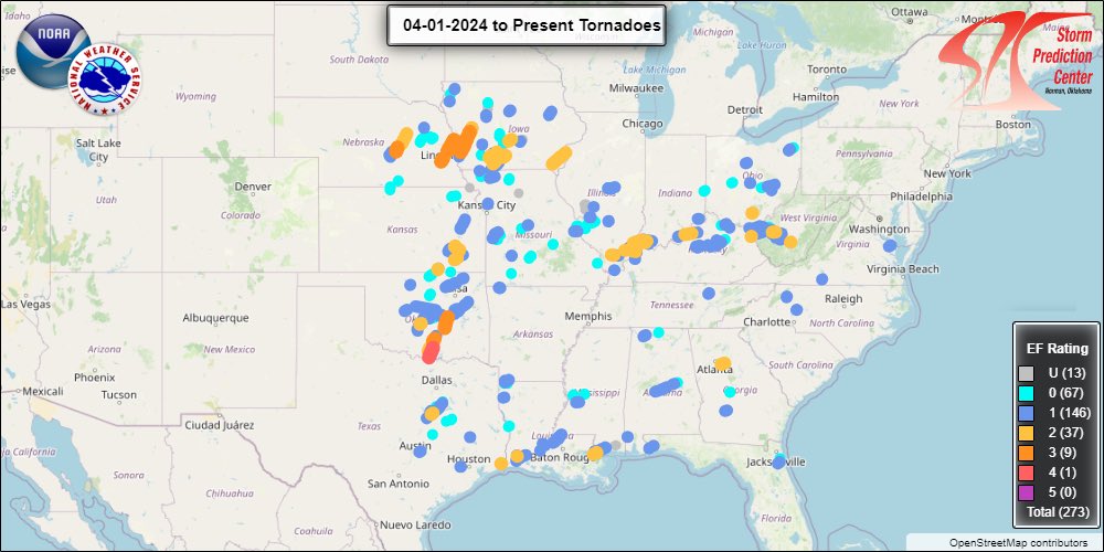
A look at the 273 (and counting) preliminary tornadoes from April 2024.
We have now preliminary passed 2019 (272) for the 2nd most April tornadoes on record.
Strongest winds all night just happened here in Phillipsburg around 250am. Apparently strong enough to knock out a transformer at the end of this clip. Winds now much calmer. #kswx @NWSHastings
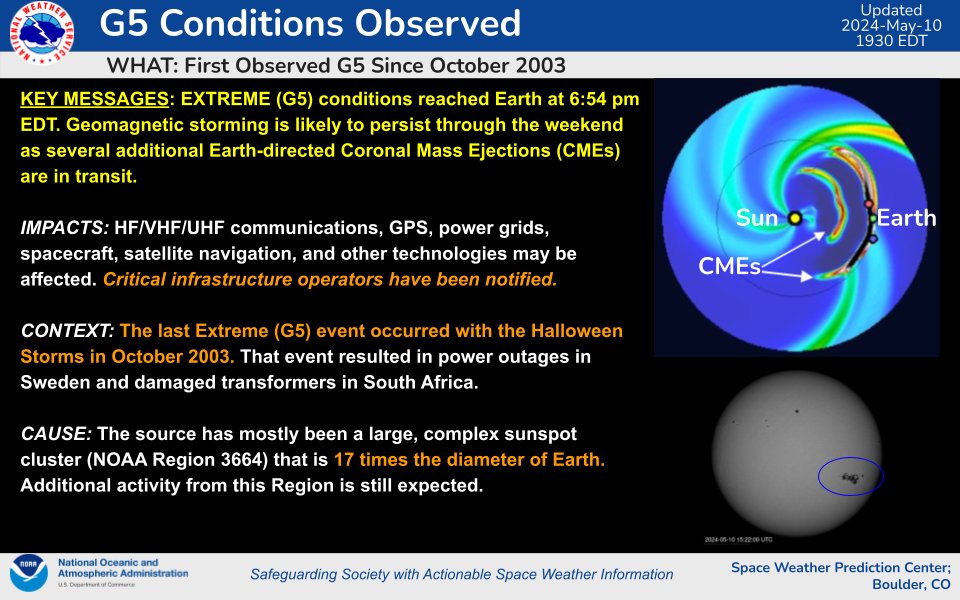
The 23 March CME arrived at around 24/1411 UTC. Severe (G4) geomagnetic storming has been observed and is expected to continue through the remainder of the 24 March-UTC day and into the first half of 25 March.
🌞🌡Enough of that cold & rainy stuff, who's ready for a sunny & warm weekend?!?
Here are the chances our forecast models are giving of us reaching 70°F Saturday. We're forecasting 3-5 days of highs near 70°F for the Willamette Valley, starting Friday. #springtime#orwx#wawx
Here's a timing loop for the upcoming winter storm set to impact the area Fri night/Sat morning through late Sat.
Expect mainly snow for the Portland Metro, freezing rain in the south Willamette Valley, & a mix of snow, sleet, & freezing rain in the central Valley. #ORwx#WAwx