@Brady_Wx thought you'd appreciate it, I highlighted StormNET's success last night in my LinkedIn newsletter. It has a few hundred subscribers, but more importantly, I felt the recognition was important.
https://t.co/EZvASw0mMb
@Sausius_wx The satellite has been deceiving the entire time with this storm because of the shear. You can clearly look at the radar and see the core is still relatively healthy.
@reid_lt Looks can be deceiving. The recon planes still found 140 mph flight level winds in the east eye wall and 120 in the west. Just like 20 minutes ago.
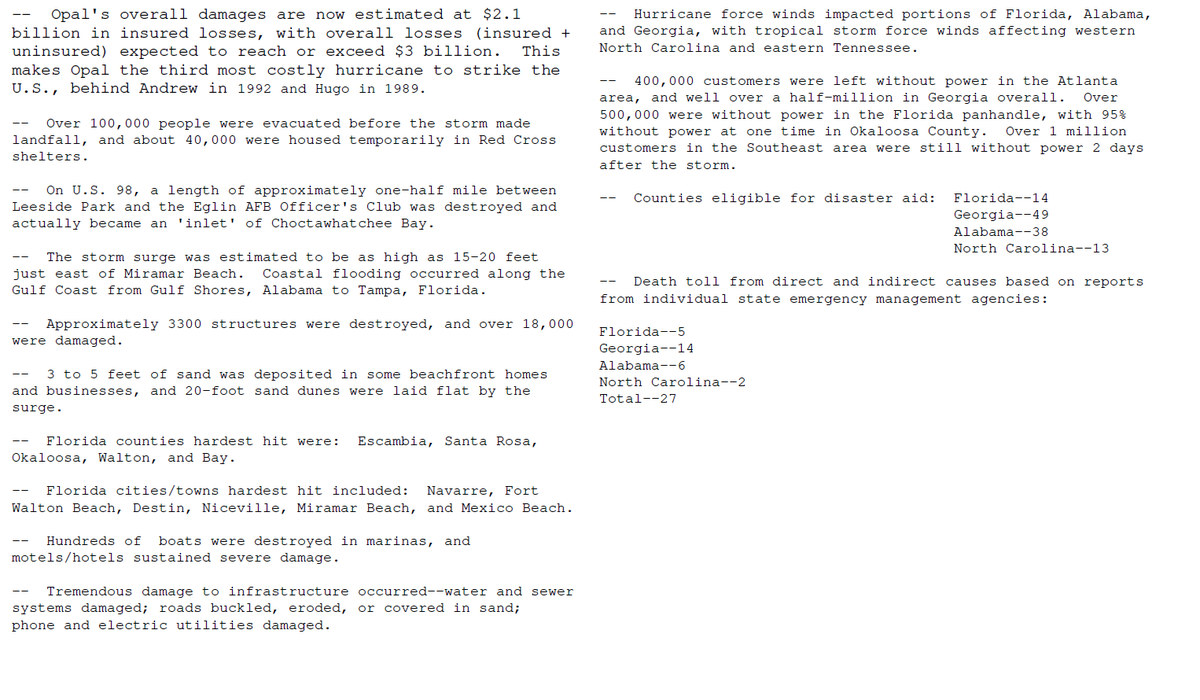
Because hurricane impacts can be infrequent events for specific areas (thankfully), we can look to previous storms to help form an idea of expectations with a current one. Opal comes to mind and likely shows the upper end of what is possible from Isaias. It was over 30 years ago but some still remember how it devastated the panhandle beaches and dunes, not to mention resulted in loss of life in the dozens.
Opal was weakening when it came ashore but had enough inertia so to speak, it was still a very destructive hurricane.
@P_SimmsWX They will definitely issue a special update. It's clearly a 3 right now and the Recon is about to punch the center again in a few to confirm it. The eye is the clearest it's been yet.
For folks in Tallahassee and the surrounding area, I would pay close attention to the severe threat and make sure you have a way to get warnings overnight Friday even if you're asleep. I don't think we'll get widespread power outages like some of the storms there recently. But the tornado threat is real and could be pretty bad if one ends up in the wrong spot.
Hey everyone! I don't have a huge following, but I've been working on a site I think will be useful for this storm. It's called Tropic Intel and is meant to be a bit of an intelligence desk for tropical weather. I'd love for you to check it out! https://t.co/8sWX2wrVpN
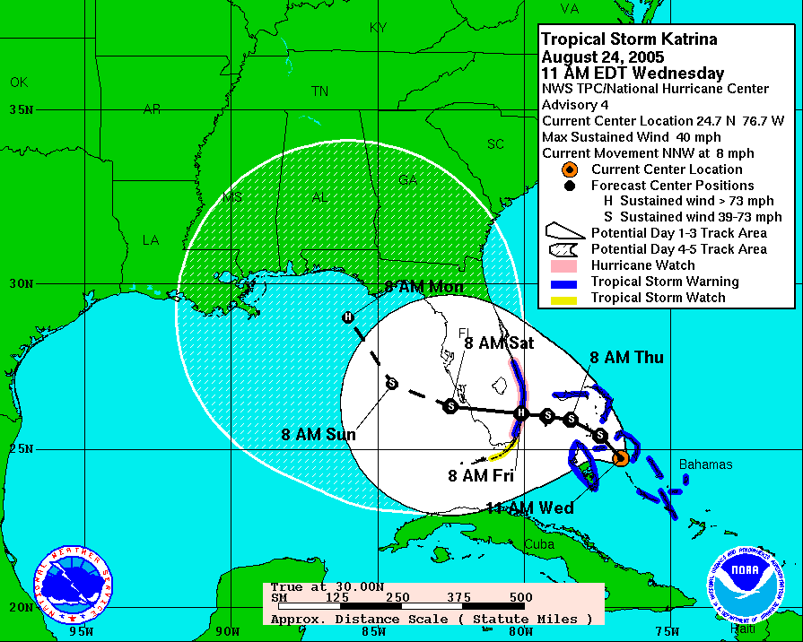
20 years ago today, we were five days away from #Katrina making its horrific Gulf coast landfall. One thing I wonder is what would happen if the models were like they are today - would the forecast be more accurate this far out? This was the 5-day forecast AT THE TIME.
TEAL 75 is lining up to pass through the 'center' of Invest #99L. So far they’ve found 32 kt at flight level on the NE side. Next up, we’ll see if a closed circulation shows up.
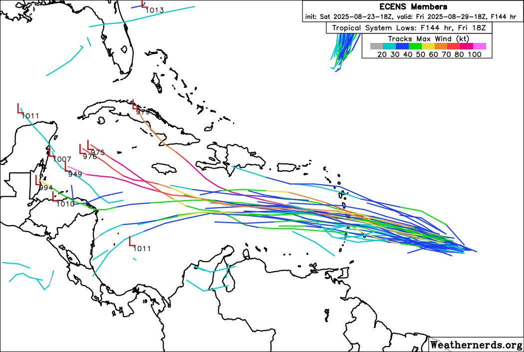
Whatever #99L does in the short-term will greatly affect what it is able to do in the longer-range. Notice how the 18z EPS members either have it as a #hurricane or doesn't have it at all, this is to the make-or-break moment it will go through in the East Carib!
#wx#hurricane
Here's the 12z Genesis Probabilities. About the same as earlier this morning. We'll see if it can get its act together before it enters more hostile territory.
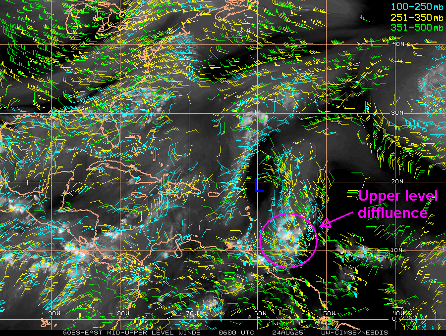
Satellite loops this Sun morning show #99L has a small circulation. This is confirmed by two satellite wind estimates (ASCAT and microwave-based MIRS). 99L's location SE of a well-defined upper low is enhancing diffluence helping to fuel deep convection: https://t.co/yFvuSdz4jD