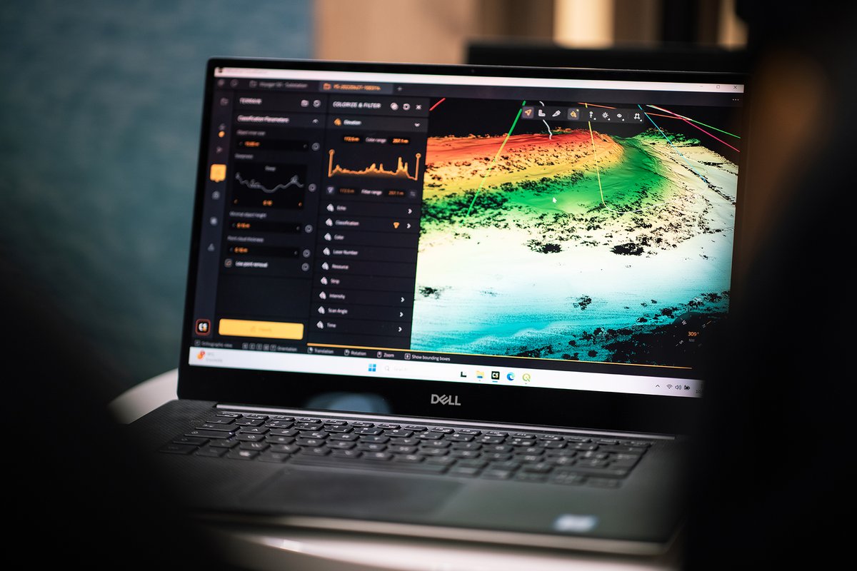
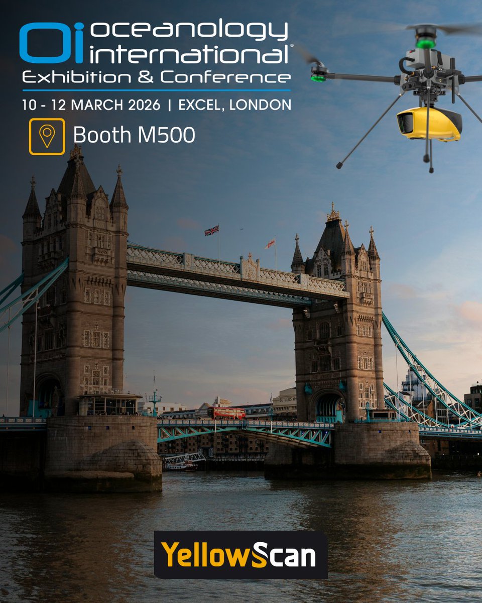
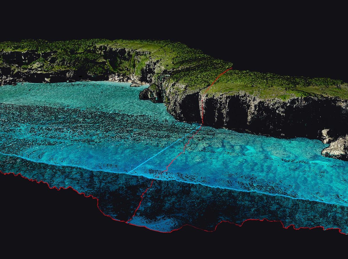
🌊 Oceanology International D-7 !
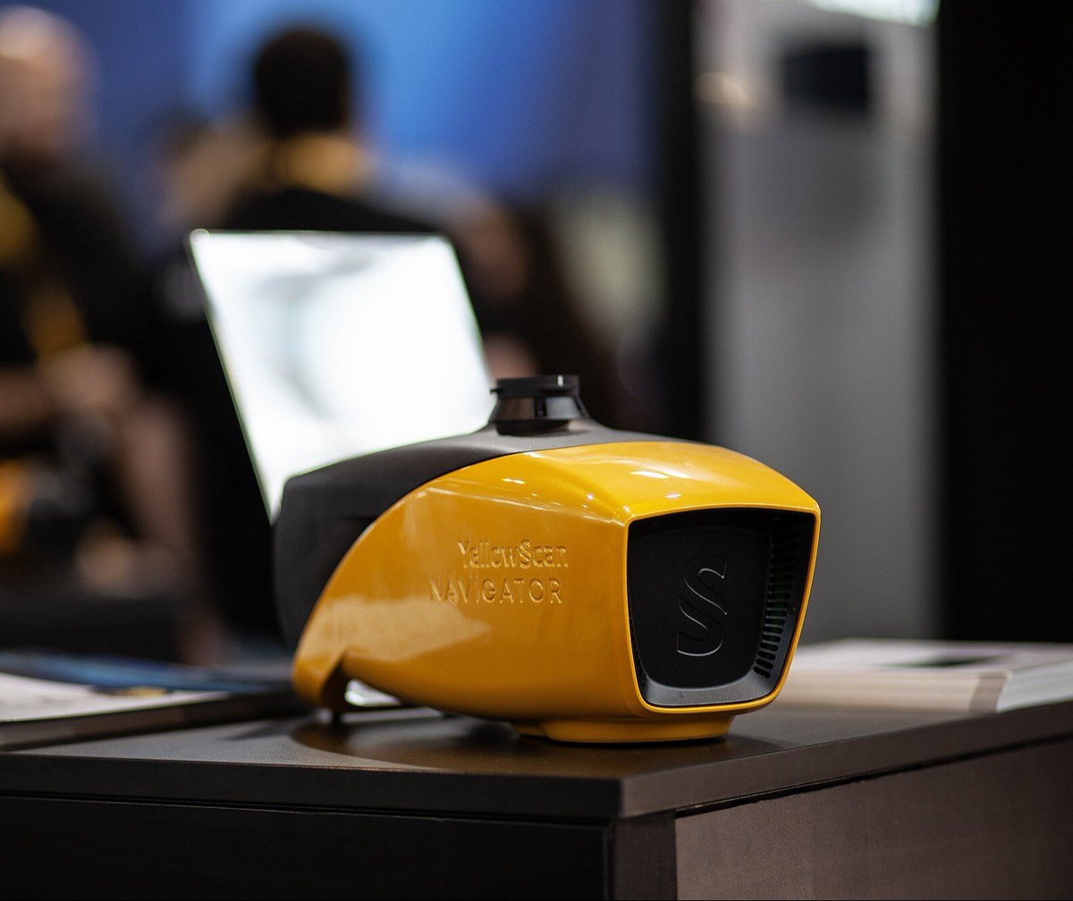
Over the past 2 years, the YellowScan Navigator, has been used by customers around the globe.
📅 March 10-12, 2026
📍 Booth M500 - ExCel London, UK
Looking forward to seeing you!
#Mapping#Oceanology#LiDAR#Hydrography#Bathymetry#Shoreline
We are delighted to welcome Trimble Applanix as Gold Sponsor of the YellowScan LiDAR Convention 2026!
📅 Save the date April 15-16
📍 Aix-en-Provence
🎟️ information and registration here: https://t.co/W2p158Iryb
#LiDAR#Applanix#Trimble#Mapping#UAV#Surveying
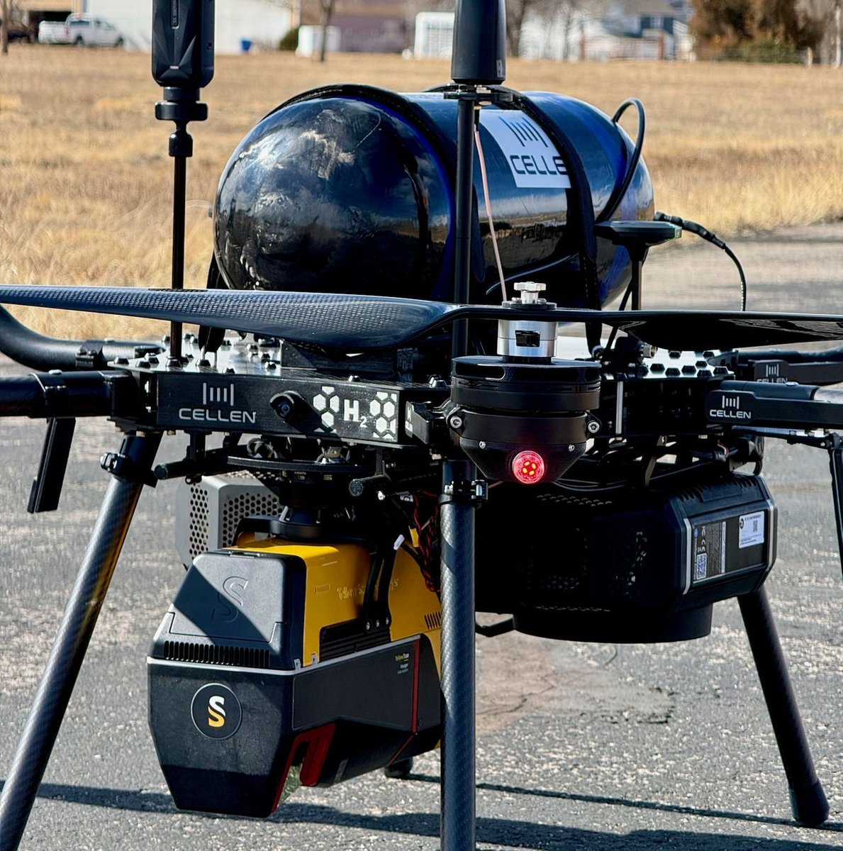
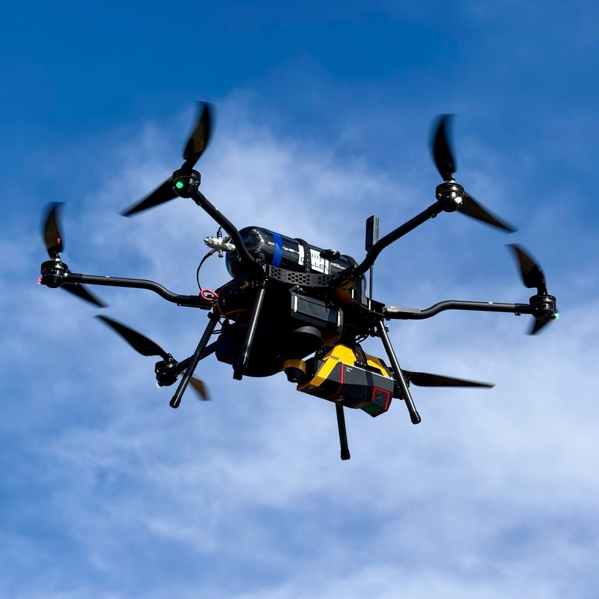
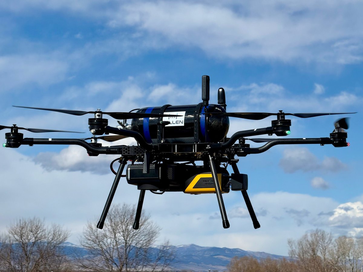
📰 We are delighted to announce LiDAR integrations with Cellen to Deliver Long-Endurance Hydrogen-Powered LiDAR Solutions 🚀
Discover more about this partnership here: https://t.co/zjjkxFKsUb
#Drone#LiDAR#UAV#Hydrogen#Mapping#Surveying
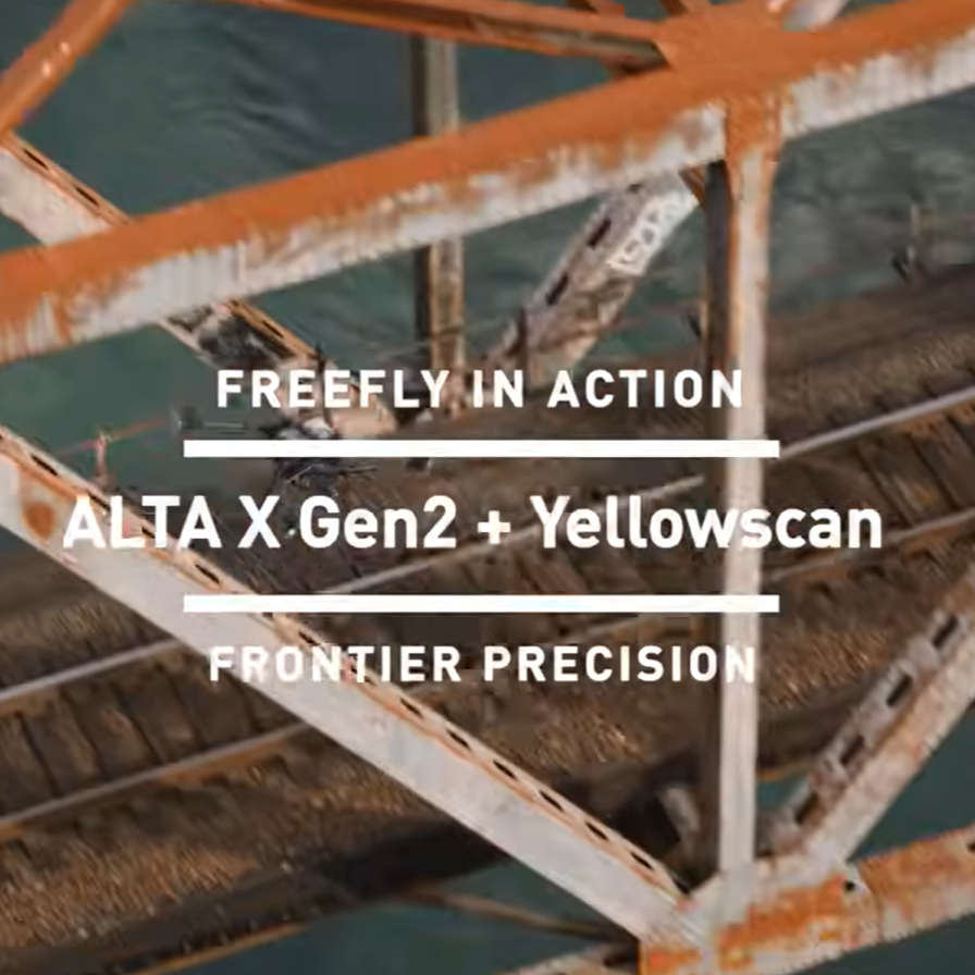
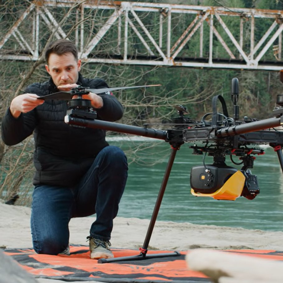
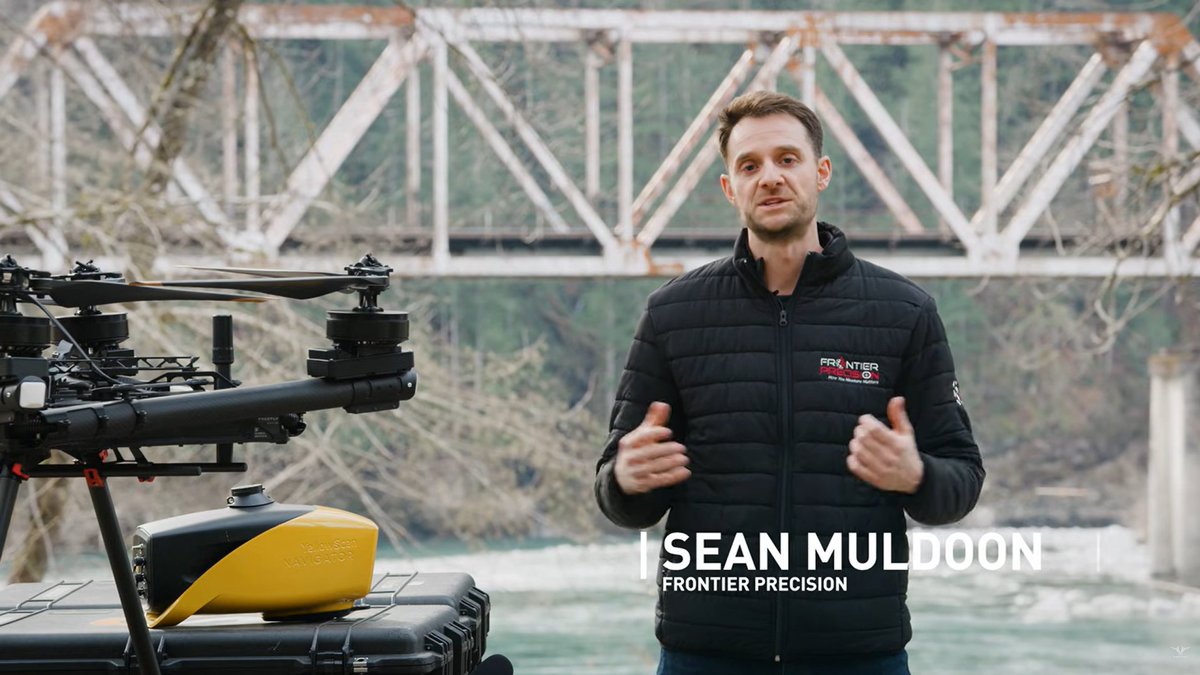
🚀 Unlocking new missions in surveying!
We’re thrilled to share an incredible video featuring the Freefly Alta X Gen2 drone, seamlessly integrated with the YellowScan Navigator and Voyager.
👉 Watch the video here https://t.co/8naAz959qR
#LiDAR#UAV#Drone#Mapping#Bathymetry
Something is coming... 🔦
🗓️ February 16–18, 2026
📍 Booth 1114, Colorado Convention Center, Denver, CO
👉 Don’t miss Tristan Allouis, CEO of YellowScan, delivering a keynote on Tuesday, February 17 at 5:00 PM.
#LiDAR#Surveying#Mapping#UAV#GeoWeek#Topography
Join us at Geo Week! 🚀
We are pleased to announce our participation in this tradeshow to meet the geospatial and professionals.
🗓️ February 16-18, 2026
📍Booth 1114, Colorado Convention Center, Denver, CO, USA
#UAV#Mapping#LiDAR#Surveying#Topography
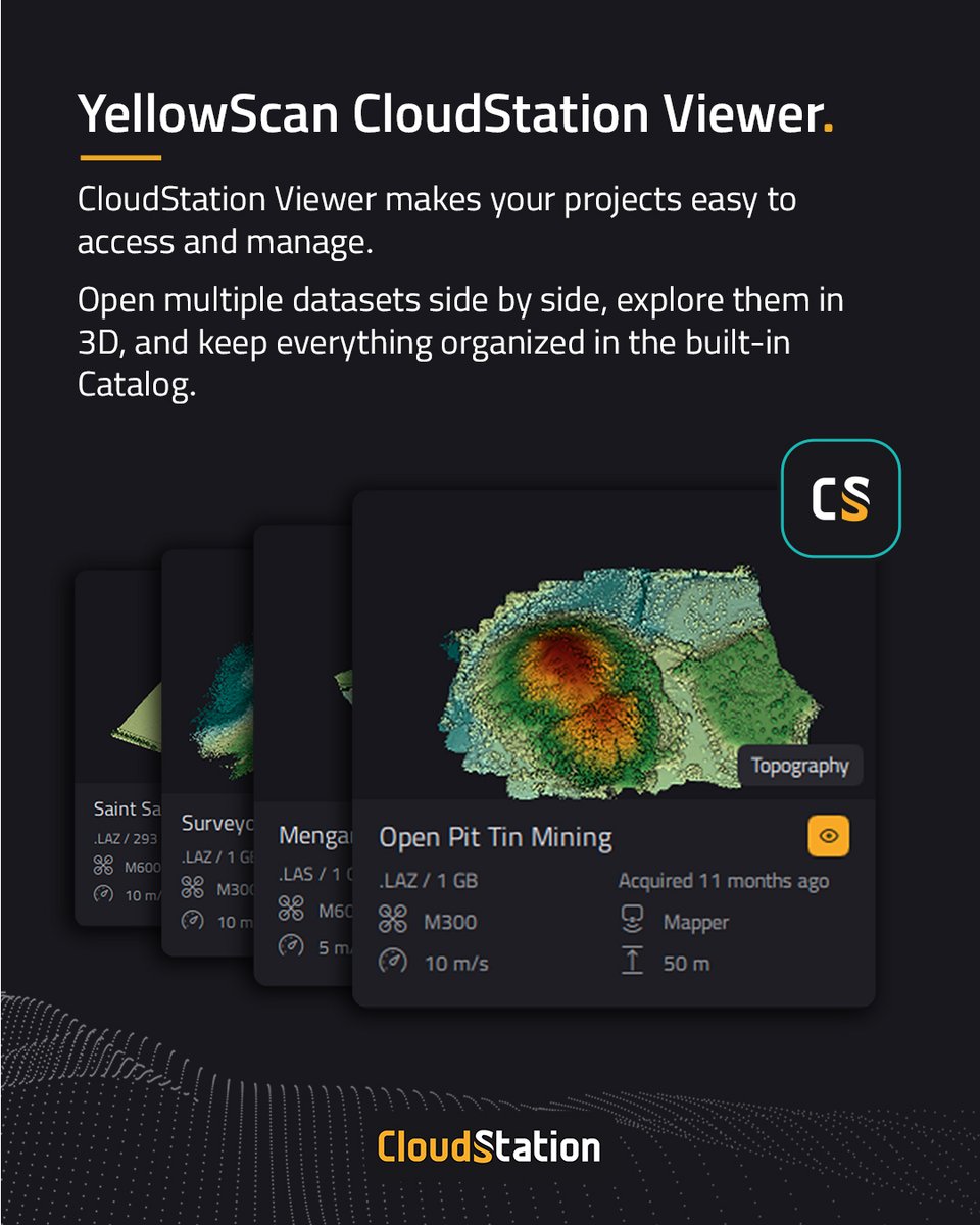
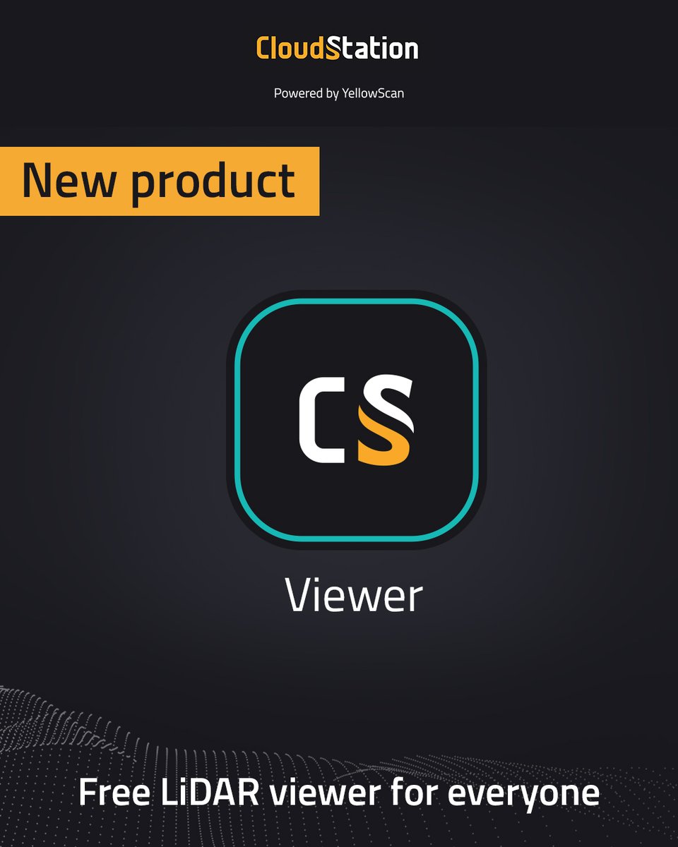
Announcing CloudStation Viewer: Free LiDAR Viewer for Everyone! 🎉
universal LiDAR viewer that makes point cloud exploration accessible to anyone curious about LiDAR.
👉 Download it for free: https://t.co/Tt3je3F5Y0
#ViewYourData#technology#software#PoinCloud#CloudStation
D-7 before the CES 2026! 😃
For the third year in a row, we are thrilled to exhibit at the biggest innovation tradeshow 🚀
📅 CES 2026 6th-9th January – Las Vegas
📍 Booth 60401-9
See you in Las Vegas!
#CES2026#Technology#Innovation#LiDAR#Bathymetry#YellowScan
The YellowScan team wish you Happy Holidays! 🌟
We hope this season is filled with warm moments with your loved ones.
Merry Christmas to all! 🎅
#LiDAR#Mapping#Surveying#Technology#GIS
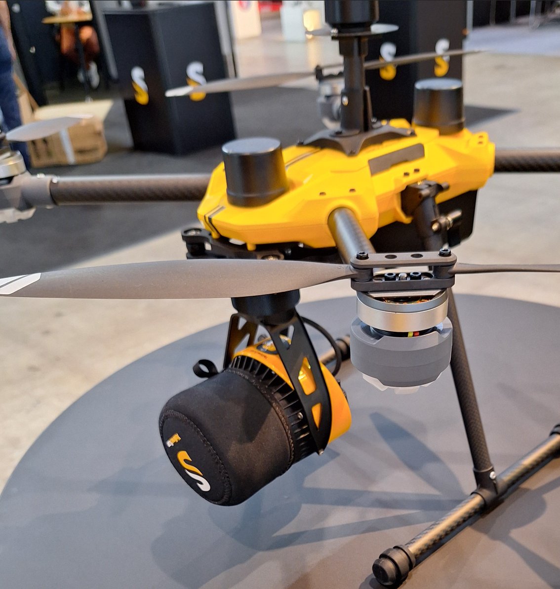
The new DJI M400 is compatible with YellowScan LiDAR systems! 📢
We are delighted to share here the first photo of the integration of the YellowScan Surveyor Ultra with a camera module with the #DJI M400.
#UAV#Drone#Mapping#Surveying#YellowScan
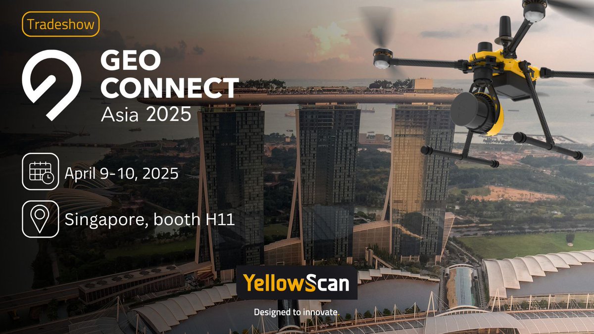
@GeoConnect_Asia 2025 is coming ! 🌏
YellowScan is happy to participate in this premier event is the hub for geospatial and location intelligence.
📆 April 9-10, 2025
📍 Booth H11, Sands Expo & Convention Centre, Singapore
#LiDAR#Geospatial#GIS#Mapping#Surveying#UAV
Meet Tristan Allouis, CEO at @YellowScan and his team at #GeoConnectAsia2025 on 9th & 10th April to discover their latest innovations! 👉 Booth No. H11
🔗 Discover more about GCA 2025: https://t.co/uUfrRCWahd
🎟️ Secure your complimentary pass: https://t.co/Vuzocdiwas
All the best wishes from the YellowScan team for 2025 🎉
We wish you 365 days of happiness, health and success in your projects for this new year!
Stay connected, we will share very soon some exciting things 🚀
#Surveying#Mapping#LiDAR#Topography#Bathymetry
The YellowScan Team wish you a merry Christmas 🎅
We hope you have a wonderful time with your family and friends.
This is a time of joy and peace, we wish you all the best 🎁
Have a great holiday 😀
#LiDAR#Mapping#Topography#Technology#Surveying
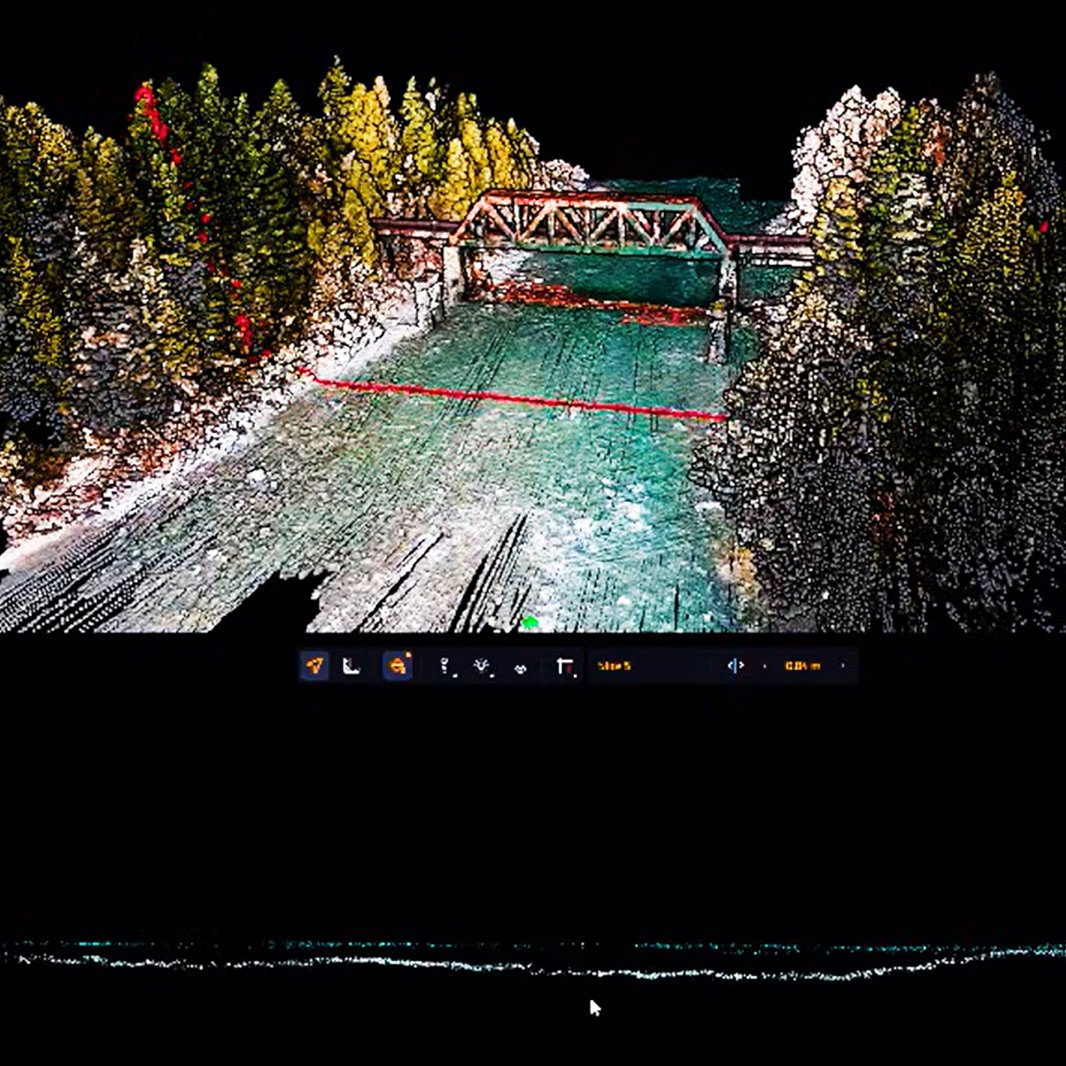
Success story: Mapping Mountainous Regions as Part of Forestry Management Surveys ⛰️
Discover the details of this success story online here: https://t.co/7X96FDuaNi
#Forestry#Mapping#Surveying#Wood#Topography
Christmas is almost here 🎅
The YellowScan team wishes you and your family and friends a very enjoyable time 🎉
2025 is fast approaching and we will have some surprises for you 🎁
#LiDAR#Topography#Mapping#Surveying
We attended Intergeo 2024 alongside DeltaQuad, our UAV manufacturer partner for LiDAR integration.
Watch the complete video here 👉 https://t.co/Oq3b6LR02k
#LiDAR#Mapping#UAV#Drone#Surveying#Topography