Most AI emulators of the Earth system let you watch. We built one you can interact with. 🌍
Earth System World Model: burn, log or replant a forest and see the whole ecosystem respond, live in your browser.
#SIGSPATIAL2026#WorldModels#DigitalTwin
https://t.co/Bvh2ZoQSCe
Excited to share our latest research on foundation models in remote sensing! We've compared them with traditional ML and deep learning models to see which really performs best for pixel-level classification.
https://t.co/nBU5oSjkeV
@umdgeography#remotesensing#foundationalmodel
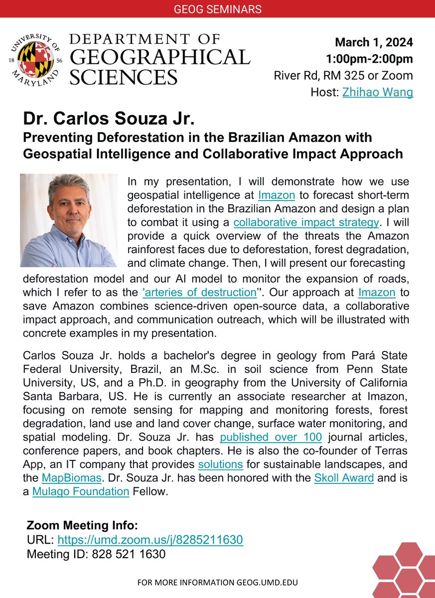
📢 Tomorrow, March 1 at 1 p.m. EST via Zoom: Learn how Brazil's @Imazon uses geospatial intelligence to prevent deforestation in the Amazon, w/ @CMSouzaJr
Details here ⤵️ https://t.co/jCRmt4Hu7O
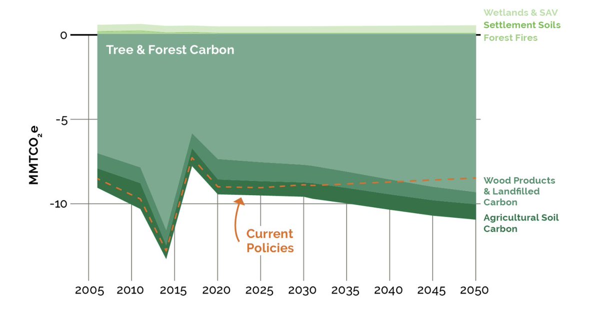
We contributed to the modeling of the forestry and land use sector. We estimated the potential carbon sequestration benefits of various afforestation and reforestation scenarios, along with the associated uncertainties stemming from indeterminate planting locations.
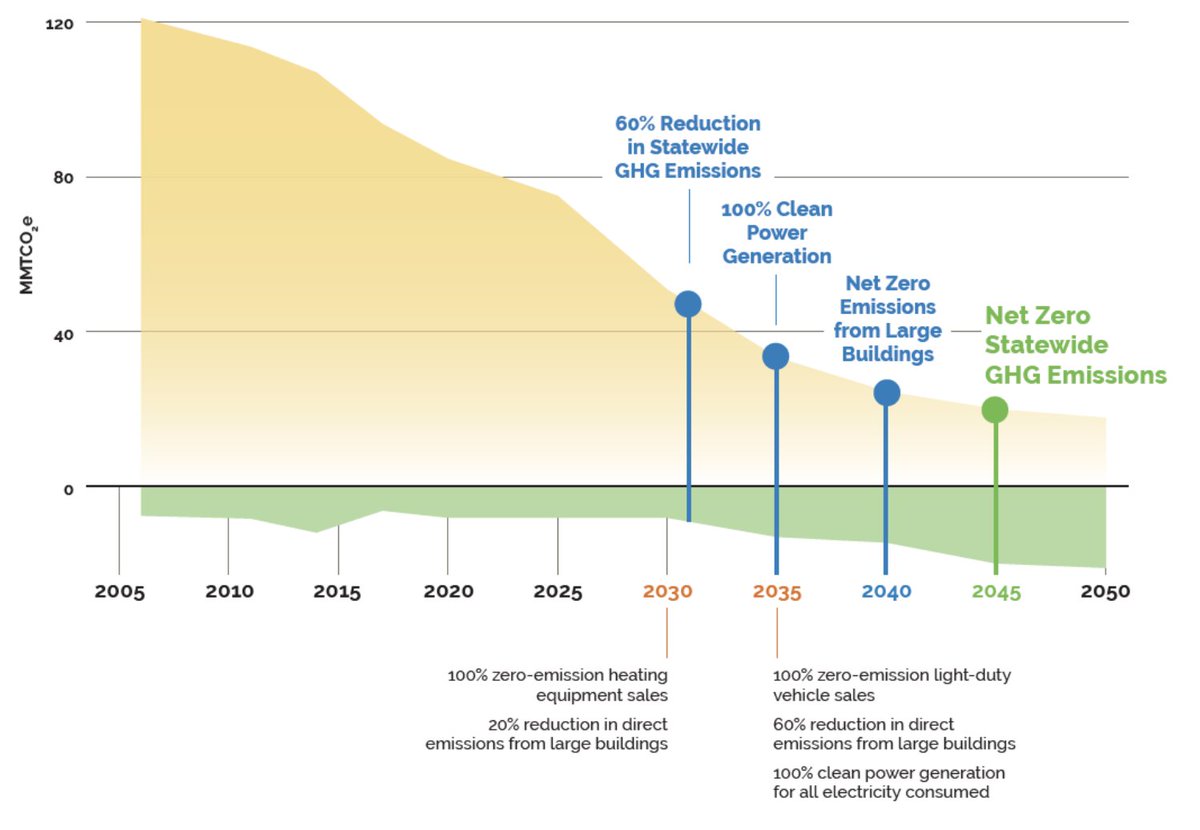
Maryland's Climate Pollution Reduction Plan, including insights from GEOG's @georgehurtt + @leima8815
+ Quan Shen, outlines strategies to reduce emissions 60% by 2031 and achieve net zero by 2045, w/ @MDEnvironment
https://t.co/DavaZjP7Xd
We're thrilled to announce DeepED, the AI-driven model for Ecosystem Demography (EDv3), part of NASA's CMS and GEDI mission. DeepED transforms ecosystem modeling, enabling advanced, scalable computations and extensive projections, marking a new epoch in global carbon monitoring.
🗺️GEOG PhD student Zhihao Wang w/@leima8815@georgehurtt + more unveil "'Deep-ED," an AI-powered ecosystem modeling of forest carbon dynamics with better spatial resolution.
Learn more: https://t.co/79zGzYdXa7
🗺️GEOG PhD student Zhihao Wang w/@leima8815@georgehurtt + more unveil "'Deep-ED," an AI-powered ecosystem modeling of forest carbon dynamics with better spatial resolution.
Learn more: https://t.co/79zGzYdXa7