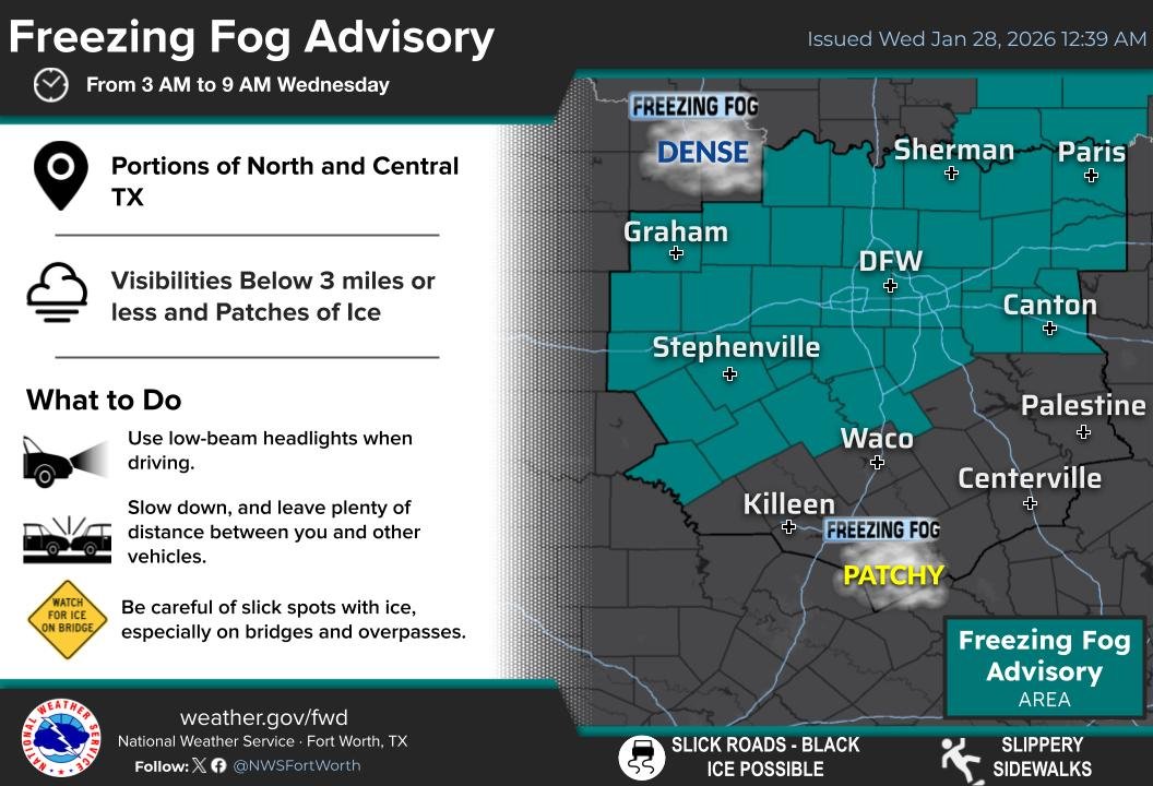
Areas of dense freezing fog are expected this Wednesday morning across portions of North & Central Texas. Light ice accumulations on surfaces may occur, including roads, so be sure to take extra caution if driving! Leave plenty of space! #dfwwx#ctxwx
There is potential for freezing fog both tonight and again Tuesday PM across portions of North and Central Texas, with worse visibility reductions on Tuesday night. Light ice accumulations on surfaces may occur, so make sure to take it easy and slow in the mornings. #dfwwx#ctxwx
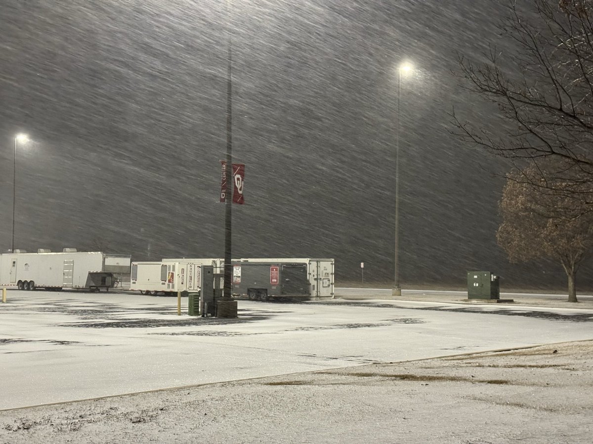
At midnight, we had about 2.6 inches of snow at our office here in Norman. Snow rates will be a bit lower for the rest of the night, though we'll see occasional bursts of light-to-moderate snow through midmorning.
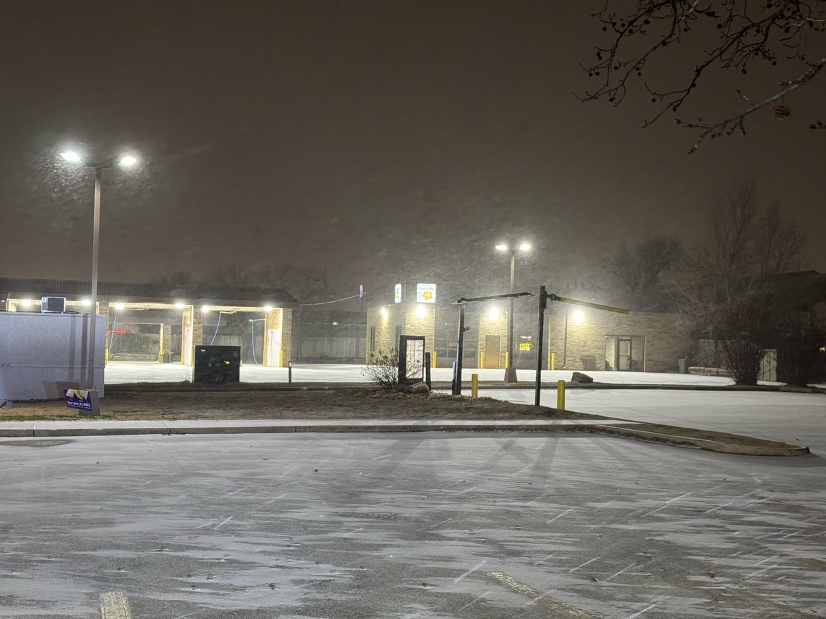
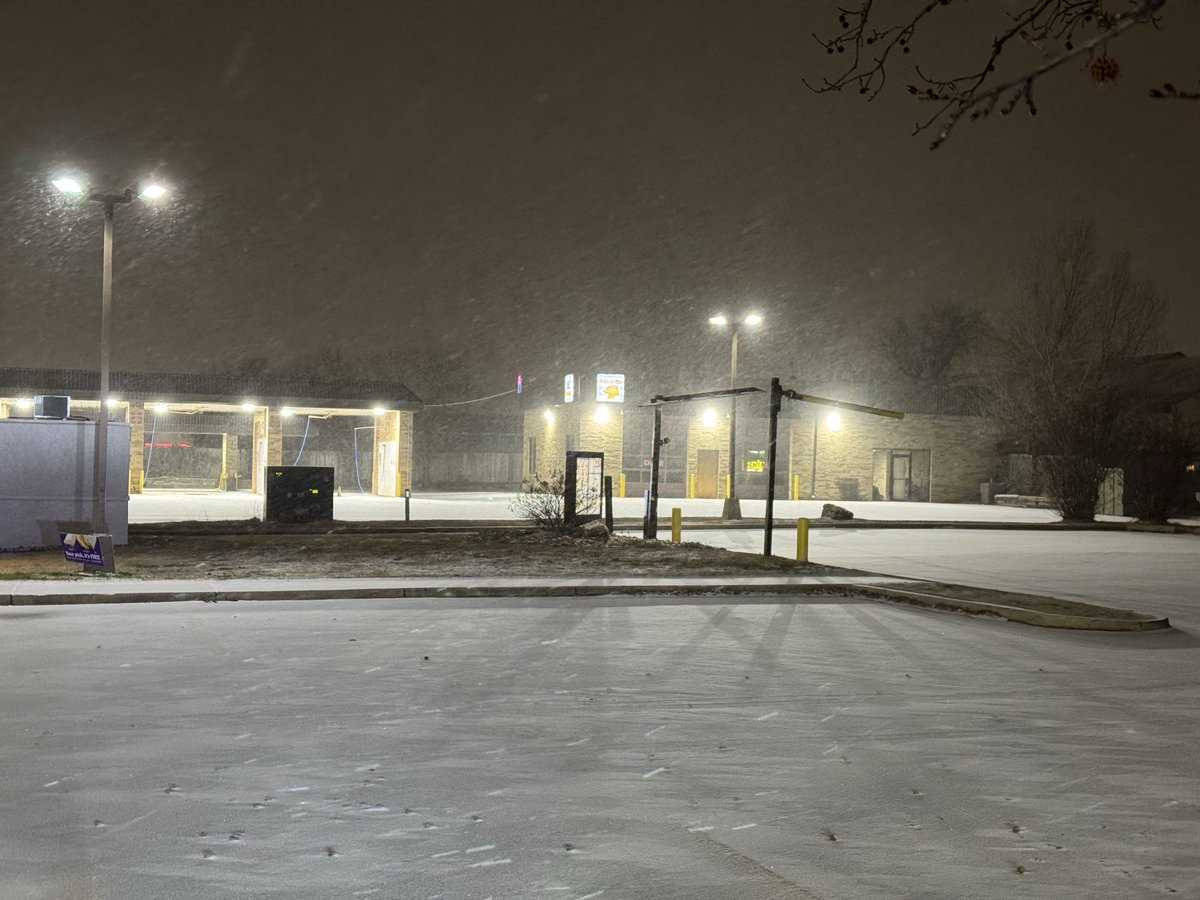
We have moderate to heavy snow pounding Oklahoma right now, and the roads are already snow-covered… 🥶
I’ve already seen several vehicles spin out and/or get stuck, especially on roads that were not heavily treated.
#okwx#ok#oklahoma#winterstorm
Currently in Norman, OK, tracking the heavier wintry precipitation.
We had a bit of sleet earlier; however, it has now transitioned into moderate snow… 🌨️
Winds picked up quite a bit as well…
#okwx#ok#oklahoma#winterstorm
Currently in Norman, OK, tracking the heavier wintry precipitation.
We had a bit of sleet earlier; however, it has now transitioned into moderate snow… 🌨️
Winds picked up quite a bit as well…
#okwx#ok#oklahoma#winterstorm
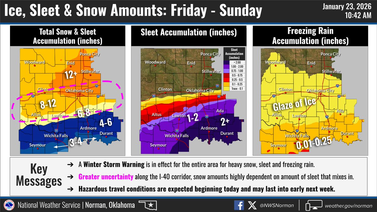
*Forecast Update* - Snow amounts are trending up across north-central and central OK, though greater uncertainty remains across the I-40 corridor as the amount of sleet that mixes in could raise/lower snow amounts here.
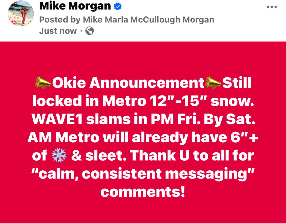
❄️The stage is set for a major winter storm to produce widespread heavy snow & dangerous ice accumulations. Travel will be dangerous to impossible in the hardest-hit areas. Frigid temps in this storm's wake will make for treacherous travel conditions into early next week.
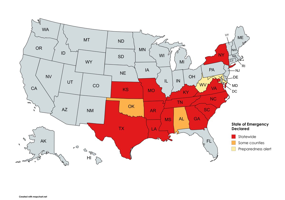
Here is the UPDATED map of states that have declared a State of Emergency (through midday Friday) ahead of this massive storm. The list has been expanded to at least 15 states + DC. #winterstorm
A quick refresher on measuring ice and snow before it arrives this weekend. We will need your reports (when it's safe for you to do so)! Please send us:
📷📏 Photos (especially at eye level of your ruler)
⏰ Time of observation
📍 Location
#dfwwx#ctxwx#txwx
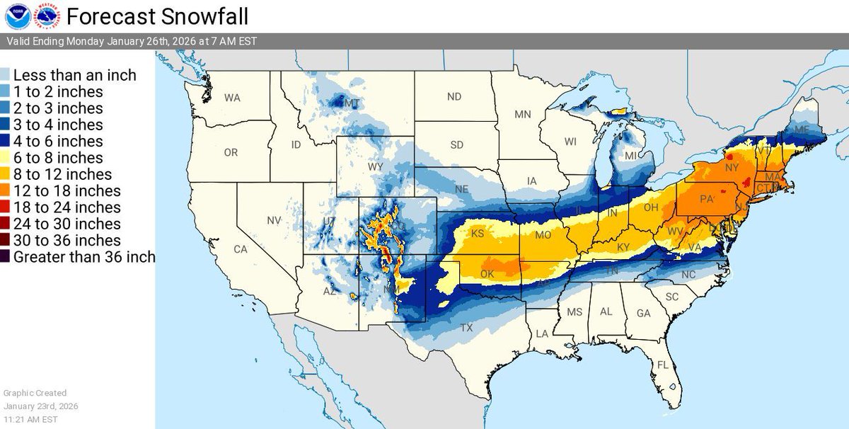
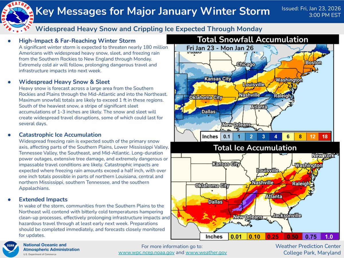
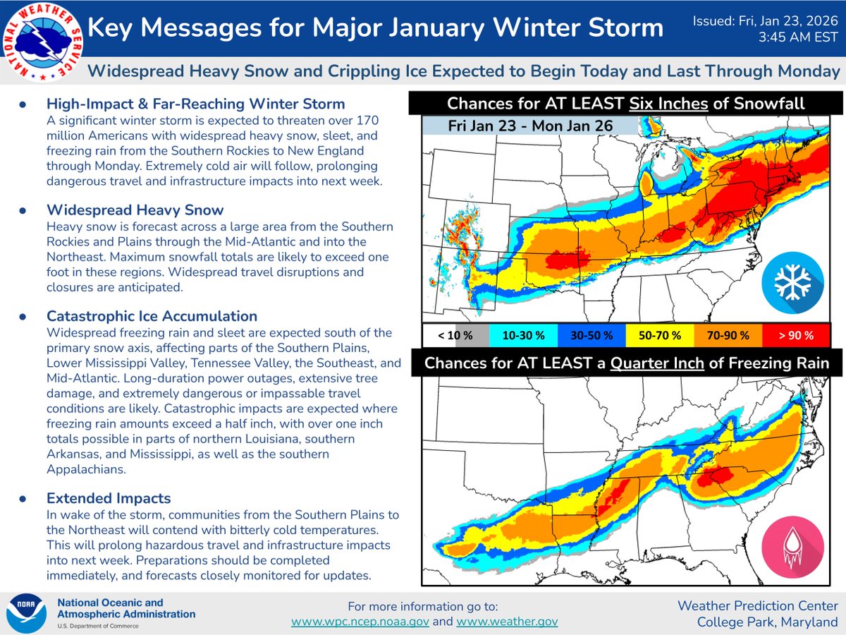
Winter storm watches, warnings, advisories and ice storm warnings are in place millions of Americas. Heavy snowfall is forecast from Oklahoma to the Northeast where over a foot of snow is possible for some locations through Monday.
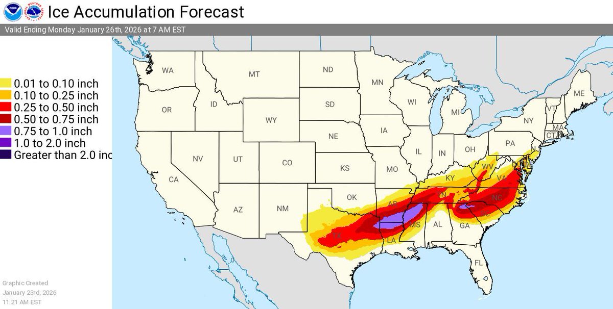
In addition, widespread freezing rain and sleet are expected across the Southern Plains, the Lower Mississippi Valley, the Tennessee Valley, and the Southeast.
The storm will cause significant to locally catastrophic ice accumulations with the potential for long-duration power outages, extensive tree damage, and extremely dangerous or impassable travel conditions.
Be prepared and stay up to date with the latest forecast for your area at https://t.co/qk3BcVP5M8.
@jackwac70045766 DFW could see a mix of sleet and snow, especially with round 2 of the system, if the area stays well below freezing.
I’d say around 1-3 inches of sleet and snow
🚨 Major Winter Storm Begins Today 🚨
Heavy snow and crippling ice will impact a large region, along with over 170 million Americans from the Southern Rockies/Plains today towards the Northeast by Sunday.
Be sure to stay safe and follow winter safety: https://t.co/DXnRXKLJ8L