📢 📢 📢 Our `blsp` https://t.co/dlBF6Odq1B R package now supports getting Landsat time series from @Microsoft Planetary Computer for producing ~40 years of phenology at 30 m scale, another option besides the GEE script we provided earlier. Thank @ecoterrestrian and @ocsmit!
Floods 🌊are deadly; satellite data can track them 🛰
Great news brief by @NASA_Landsat featuring our @NASA funded work showing that we need frequent satellite observations such as NASA’s Harmonized #Landsat - #Sentinel 2 data to quantify #floods:
https://t.co/Bdb3V8o8NQ
Really cool @NCSUgeospatial PhD seminar by @_ViniPerin_ (advisor: @MirelaGTulbure), who used satellite imagery analysis to identify and study ag water reservoir surface area spatio-temporal trends. 🚜💧🛰️💻 (1/5)
We've got TWO #GeospatialAnalytics PhD students defending this month! First is @_ViniPerin_ (advisor @MirelaGTulbure), whose public talk about quantifying the dynamics of on-farm reservoirs will be on Zoom and in person at 1:30pm ET, Fri. 9/9. Learn more: https://t.co/H93bjMtc5f
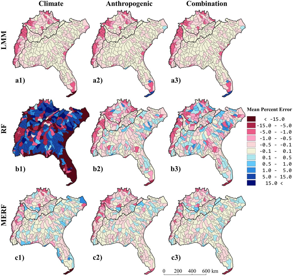
So proud of my @NCSUgeospatial Ph.D. student, Mollie Gaines, on her 1st paper in @AGU’s WRR using data-driven models to estimate surface #water area based on #climate, land cover/land use, and #Landsat inundation datasets in the SE United States:
https://t.co/PsrcEcu9W9
Daily monitoring on-farm reservoirs using the next generation of analysis ready datasets, Planet Fusion and Planet Basemap provided by @planet.
Thanks @planet, @NASA, @NCSUgeospatial and @MirelaGTulbure for all the support!
https://t.co/pLUMteeICw
3/3 By improving the surface area observations cadence and providing the surface area uncertainties, the approach presented in this study has the potential to enhance water conservation plans by allowing better assessment and management of the on-farm reservoirs.
Research roundup (4/4)
• Long-term annual phenology w/a Bayesian hierarchical model | Research led by #GeospatialAnalytics PhD student @MrJGao is the first to estimate >30 yrs of land surface change w/30-m #Landsat imagery, w/pixel-wise uncertainty: https://t.co/bSAaOslDJb
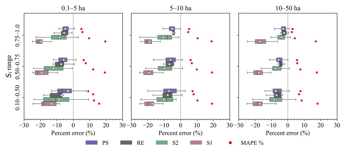
1/5 Do existing inundation datasets based on #Landsat capture dynamics of small on-farm #irrigation reservoirs?
Read 👇 our latest paper led by my @NCSUgeospatial PhD student Vini Perin (congrats on the 1st PhD manuscript, Vini!)
https://t.co/25GB5h3RtT