Working as an IT Architect @VITO_RS_. An IT architect with a very big interest in technology. Also indulging myself into the world of viti- and viticulture.
Had some fun experimenting with the #chatgpt APIs and #midjourney . Amazed how easy it is to integrate. Result: upload your resume, define scoring criteria and see how you are doing. Thanks AI for also generating the content and images! https://t.co/PrC1O8enwc
How it started🤓 How it's going🤩
Kom tijdens de #DVDW22 langs en ontdek hoe we al sinds 1998 data, van #satellieten tot #drones, omzetten tot objectieve info voor verschillende toepassingen! 👨🌾🌲🌊🏗️
🗓️ 27/11
⏰ TABLOO, Dessel
➡️ https://t.co/9oEXAB17H9
A crop map tailored to your needs?
#deeplearning and #AI allow us to automatically detect #agricultural field boundaries and recognize the crop types based on #Sentinel1 & #Sentinel2 radar and optical #EOdata🛰️🌱
Read more & discover our online #cropmap
➡️https://t.co/yirv9I6JAq
The @NextGEOSS Summit is already over. THANK YOU to all participants and to the partners who have shared with enthousiasm the offers from the project and their experience to new potential partners. Presentations will be published on https://t.co/gJah8DbUZJ.
Did you know that we still have a few spots left for the on-site training on our data hub and platform tomorrow 2. July ?➡️https://t.co/JbbvPIin95 This is your chance to learn from the best! 😇🌎🌍🌏starting immediately after the end of the Summit
#Belgian day today at #ParisAirShow2019 🇧🇪🙌
Drop by our booth - Hall 2b and discover the platform #WatchITgrow.
By combining #satellite, weather, #soil & machinery data with field data, #WIG helps growers to improve both quantity and quality of #yields
https://t.co/SFWI13NlN7
Hurry, and register for the #NextGEOSS Summit! 1️⃣&2️⃣July ➡️ https://t.co/xclS8FtkLK New‼️FREE onsite TRAINING 2️⃣July afternoon ➡️ https://t.co/JbbvPIin95 Combine it with the @eurogeoss workshop same place 3-5 July #EO4Europe#opendata#EarthObservation
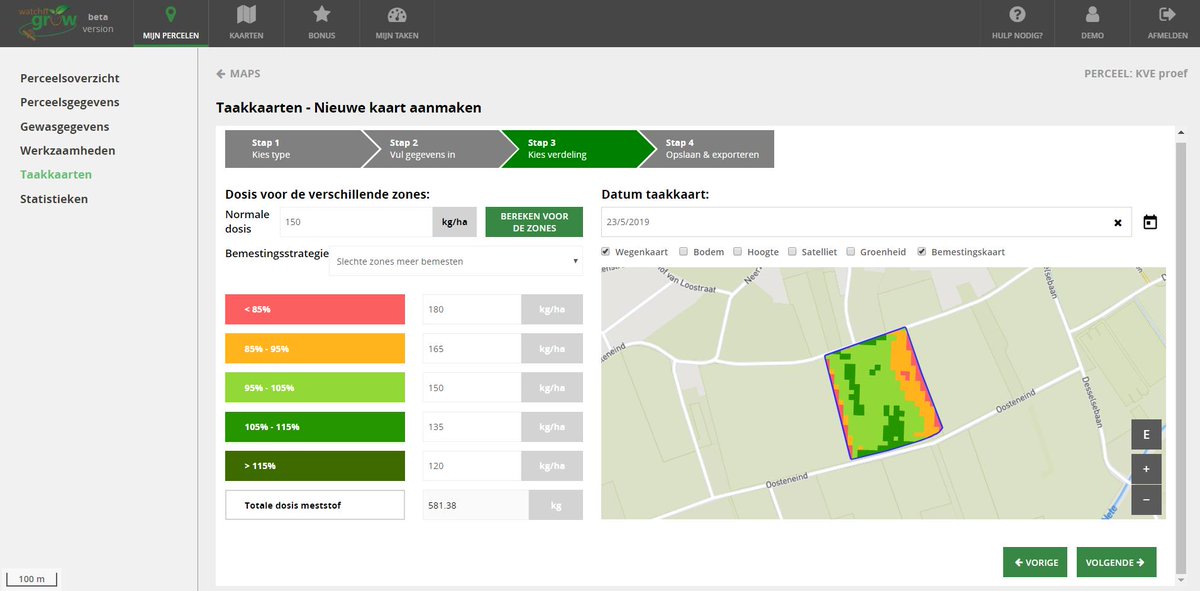
#WatchITgrow, het platform om vlot uw landbouwgewassen op te volgen, lanceert enkele nieuwe functionaliteiten.
Taakkaarten voor variabele bemesting, accuratere groeicurves dankzij #CropSAR, waarschuwingen bij snelle loofgroei, ...
Ontdek ze allemaal op https://t.co/qW71BZw0EY
Interested in digital #crop monitoring? Visit our booth at #LPS19 and discover #WatchITgrow, the online platform which uses e.g. #satellite data to supports growers to monitor arable crops & vegetables!
Discover more: https://t.co/SFWI13NlN7
@romaincools@Boerenbond @J_decloedt
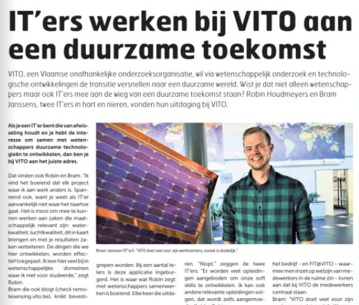
Voor wie @DeZondag heeft gemist: @VITObelgium zoekt #ITers om samen met onze andere experten te werken aan een duurzame toekomst. p57 https://t.co/akK2GCECtR
Are you at #EGU19 ? In Vienna? Come join our hands-on training on using NextGEOSS data hub and platform for YOUR data and applications TODAY 10:45 Room 0.16! Viennese food will be served 🎼 #opendata#EO4Europe#EGU2019
Almost ready for the Geospatial World Forum! @StevenKrekels will show #WatchITgrow, a nice example of how research turned into an operational tool to support the agricultural industry using #EOdata & #remotesensing
Join him next Thursday at 9 AM or visit https://t.co/uj4YMCjd1f