#Dolly had some struggles earlier today yet currently she’s producing some nice convection despite unfavorable conditions. For now we wait and see what she does.
#Tropics#TropicalWeather#HurricaneSeason
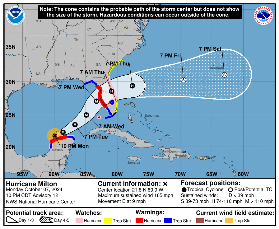
#MILTON is running to the right of the NHC track. This is a very important trend to monitor in SW Florida. Small wobbles now will make a big difference of who get the 10-15+ foot storm surge tomorrow. #flwx
I’ve watched every model run for days. Looking for trends. The early morning ensemble model tracks did shift a bit to the south. Need to see if other models follow along. #Milton
A bit of good news with the latest forecast track. NHC now believes #Milton will be a strong Cat 3 at landfall, rather than a Cat 4. Landfall has nudged southward to Bradenton Beach (previously was St. Pete Beach).
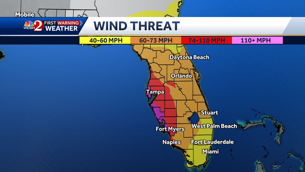
Here's a really good way to visualize what kind of winds we're looking at.
Based on the current forecast, here's a breakdown...
This will change as the forecast hones in, but for now, we should expect strong tropical storm force sustained winds, with hurricane force gusts;
2 pm Milton Close up cone. Includes Northern Broward. REMEMBER this ONLY shows where the eye or center of the storm may be. Mother nature does not recognize man-made boundaries. If the eye tracks into Palm Beach & the system is 100 miles wide.... Broward & Miami Dade will get hit
From the NHC discussion: “As a result of this re-positioning and initial motion, there's been a southward change to most of the guidance this morning. The new NHC forecast is adjusted south of the previous one, especially early on, and further southward adjustments could be required if the guidance trend continues.” #Milton #FLwx
#Milton Florida heads up once again. Storm looking fairly well on satellite, where exactly it’s going is impossible to say. Once models have Hurricane hunter data I will then take them more seriously. #hurricane#HurricaneSeason#HurricaneMilton#TropicalStorm
Radar data continues to suggest that the eyewall is increasingly dominating the secondary band that had been preventing consolidation of the inner core wind field. Simultaneously, subsidence warming in the eye is strengthening leading to a clearer eye on IR imagery. This probably means max winds in #Helene's eyewall are increasing further, unfortunately.