❄️ What an amazing snowfall, especially for May! We've had 5cm of snow in the Brindabellas, with more coming down.
Snow is now starting to fall over the hills in #Canberra this afternoon, with the suburbs only a few degrees above 0.
⚠️Severe Weather Warning has been issued for damaging winds developing across the alpine region later on Friday. It will become very windy across southern NSW on Friday and eastern parts on Saturday. Monitor for updates at https://t.co/aSN3kzTYQP 🌬️
Feeling a little chilly today? Could be worse, you could be up on Mt Coree, where one of our fire tower cameras just captured this!
The @BOM_ACT is warning there will be gusty winds across parts of the ACT through this afternoon and into tomorrow, and possible ice on the roads.
❄️ Snow is possible this coming week.
At this stage, the snow level is looking likely to fall to between 800m and 900m on Monday. Accumulations between 1cm to 5cm are possible across the mountains.
This forecast is extremely uncertain, so keep your eye on the situation.
#Canberra is having a cold start today. After falling to a low of -6.2°C this morning, temperatures are still struggling to warm above 0°C as thick fog traps the cold.
❄️ On Thursday a cold front is likely to impact the region. There is still a bit of uncertainty regarding the potential for snow but, at this stage, we can expect 2cm to 8cm above 1000m, with flurries possibly falling to 750m.
☀️ Stable and settled weather is forecast across this week in the ACT.
Under the influence of a slow-moving high-pressure system, we are set to see fine days with above-average maximum temperatures in the mid to high teens. Nights should be cooler.
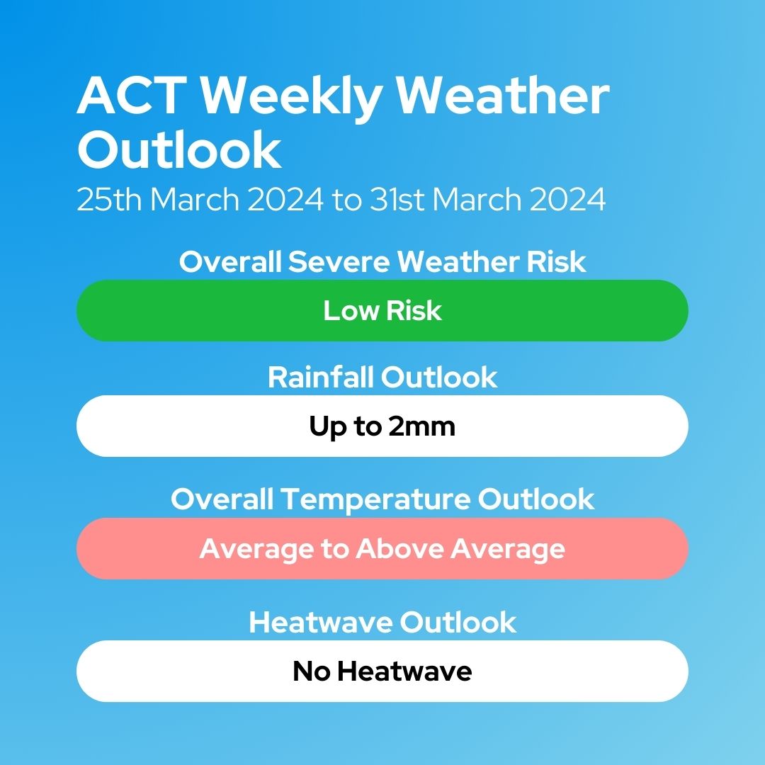
🌦️ We're likely to see more of the same once again this week in the ACT. No major weather is forecast for the week with primarily settled weather likely.
Overall, low rainfall is likely. Temperatures are likely to be average to above average for this time of year.
🌦️ This week in the ACT, generally fine conditions are forecast. Temperatures are likely to be below average.
However, moving into the weekend, there is significant uncertainty surrounding the forecast, with the chance a significant weather system may develop.
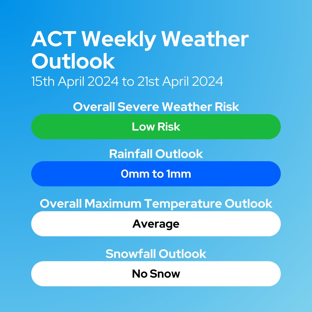
☀️ Fine weather is forecast for much of, if not all of this week. Almost no rainfall is expected throughout the week. Temperatures should remain near average, possibly a bit above average for this time of year.
Overall, there is really not much to note about the weather.
🌧️ This week, the main feature is a cold front moving through on Tuesday. 2mm to 10mm of rain is possible this week.
❄️ There is a chance of a dusting of snow about the highest peaks of the ACT on Wednesday morning.
🌡️ Temperatures are likely to be below average.
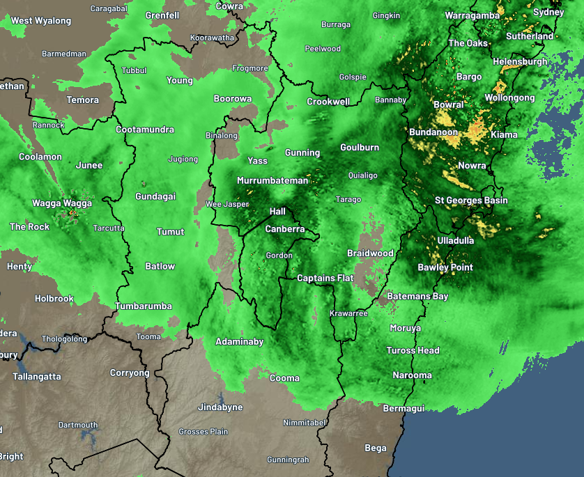
🌧️ Overnight tonight and into Saturday morning, we can expect persistent rain, heavy at times. This is likely to bring between 20mm to 80mm of rain to the #ACT over the next 24 hours. Storms are also possible in #Canberra tomorrow, possibly severe.
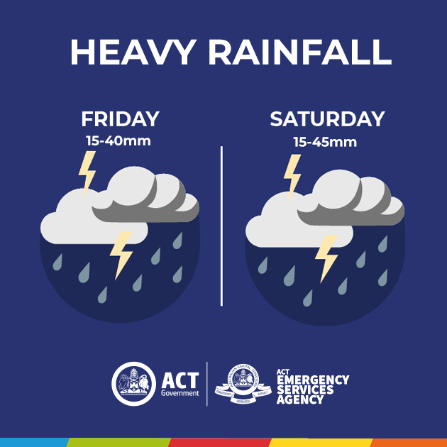
Heads up Canberra, we’re expecting some significant rainfall today and tomorrow.
The Bureau of Meteorology is predicting that 15-40mm could fall on Friday afternoon and evening, and a further 15-45mm on Saturday.
If you can, take the time to prepare your home and property for a storm:
🚗 Move your car under cover and away from trees
🌩️Clean your gutters of debris
🔒Secure or put away loose items around your house, yard and balcony
🪵Trim overhanging trees and branches
During a severe weather event, remember:
🚧 Never drive, walk, or ride through floodwater
🌳Keep at least 8 metres away from fallen power lines or objects that may be energised, such as fences
🏠 Stay indoors away from windows
If you need support during storms and floods call the ACT State Emergency Service on 132 500. In a life-threatening emergency call Triple-Zero (000).
The weather conditions can change rapidly, check https://t.co/BIhyiIUAil for weather updates and warnings
🌧️ A cold front moving through southern Australia is likely to bring gusty winds and showers to our region overnight tonight.
🌀 From Friday onwards an east coast low may develop and bring rain and winds to the region
🌡️ Maximum temperatures are trending below average.
☀️ Fine weather is likely to dominate the forecast this week, with warm temperatures and minimal rainfall expected.
Days should stay in the mid to high twenties, with mornings in the single digits at the start of the week, moving into the low teens by the weekend.
🌧️ Rainfall overnight has delivered 10mm to 25mm across the ACT, with the higher falls recorded over the Brindabellas.
In the wake of the cold front that has brought this rain, we can expect much more settled weather - but a cool change.
This week in the ACT we can expect to see some wetter weather, with showers possible from Monday. Overnight Tuesday into Wednesday could be fairly wet, with periods of rain bringing the bulk of the week's rainfall. There is a chance we could see storms on Tuesday and Wednesday.
📣 Exciting news, from next week I'll be bringing back weekly outlooks to the page.
These were a staple of ACTWW/ACTSW back in 2021, but due to personal circumstances I wasn't able to commit the time to produce them - this has now changed.
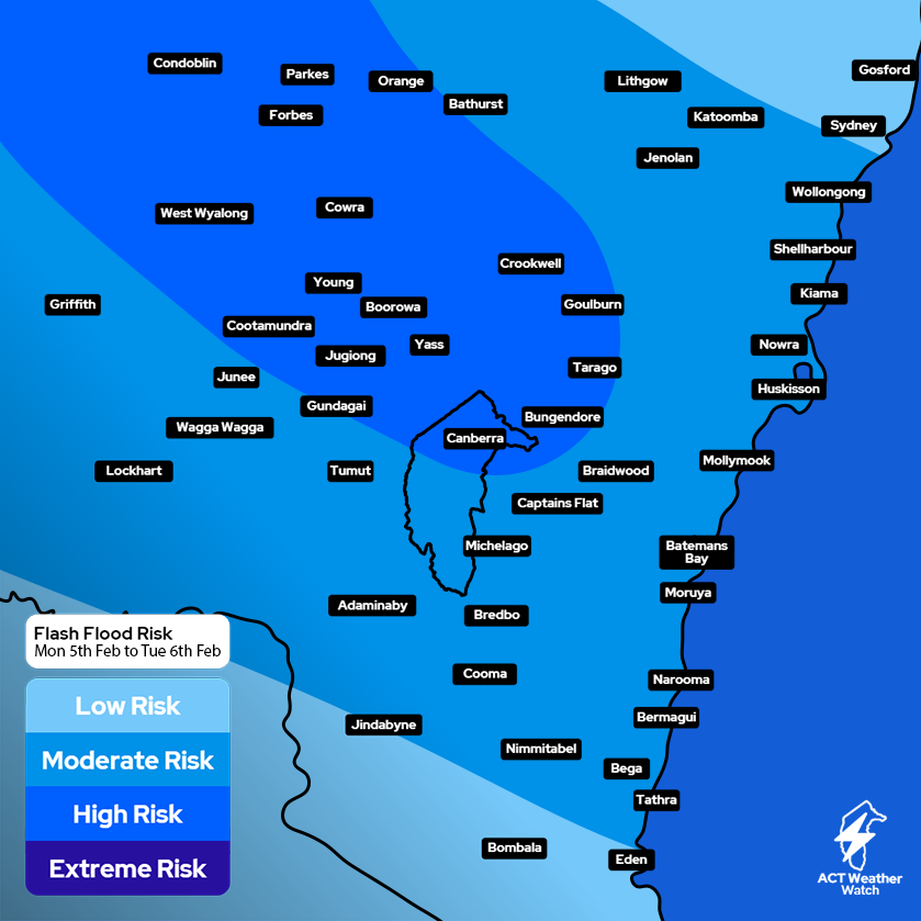
🌧️ Ex-Tropical Cyclone Kirrily is forecast to move over the ACT from late Monday evening, bringing with it heavy rain that could lead to flash flooding on Tuesday morning.
Rainfall totals between 40mm to 120mm are possible over Canberra.