Specializing in affordable solutions, capacity development and consulting services with a focus on the use of drones for self-sufficient high accuracy mapping.
Our Kumasi Workshop on new #technologies for #landrights in #Ghana made the TV #news. Go to 6:52 of the clip. Great discourse and enthusiasm for drones in cadastral surveying.
@OmidyarNetwork @MeridiaLand @COLANDEF
https://t.co/pWLRw1r1nQ
Drone pilot study results discussed by Licensed Surveyors of Ghana #LISAG, Ashanti Region Head of Surveying and #Mapping Division, Urban Planners, Valuation Surveyors, Engineers, Academics and Students. https://t.co/beqakXxxSm
On #GTVNewspk Accra, #Ghana tonight at 7pm, coverage of the official handover of equipment donated by Micro Aerial Projects on behalf of the #OmidyarNetwork. Honored to be shaking hands with his Honorable Kwaku Asomah-Cheremeh, Minister of Lands and Natural Resources.
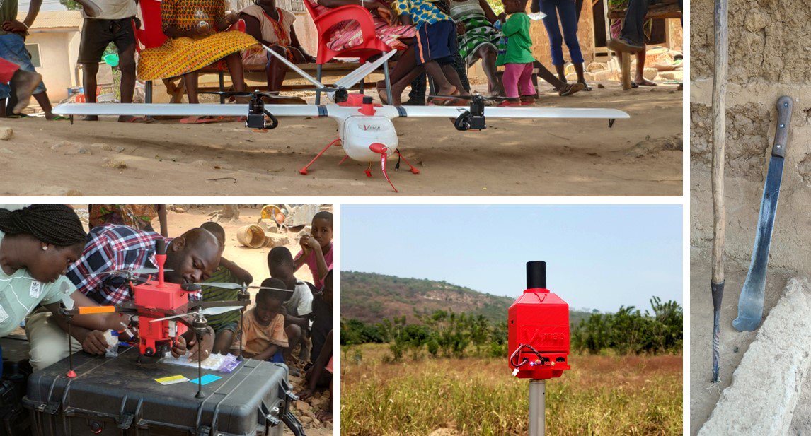
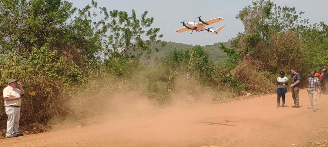
With support form @OmidyarNetwork we are introducing a hybrid VTOL/fixed wing #VMap mapping platform in #Ghana for testing in virtual surveying of parcels in difficult rural terrain. Hybrid platforms have longer endurance than multi rotors and are easier to fly than fixed wings.