Today's the day! Tune in this afternoon at 1:00 PM EDT to our Critical Issues program's webinar on landslide risk assessment and reduction, kindly sponsored by @COGeolSurvey and @GolderAssociate
Our landslides webinar is now over, but we would like to take the opportunity to express our gratitude to our webinar sponsors one more time. Colorado Geological Survey and @GolderAssociate: thank you for making this webinar possible! #CIWebinar
EW: Hazard mitigation strategies include: land use planning and zoning, transportation and infrastructure planning, prevention and protection actions, education and outreach, and sample ordinances and codes #CIWebinar
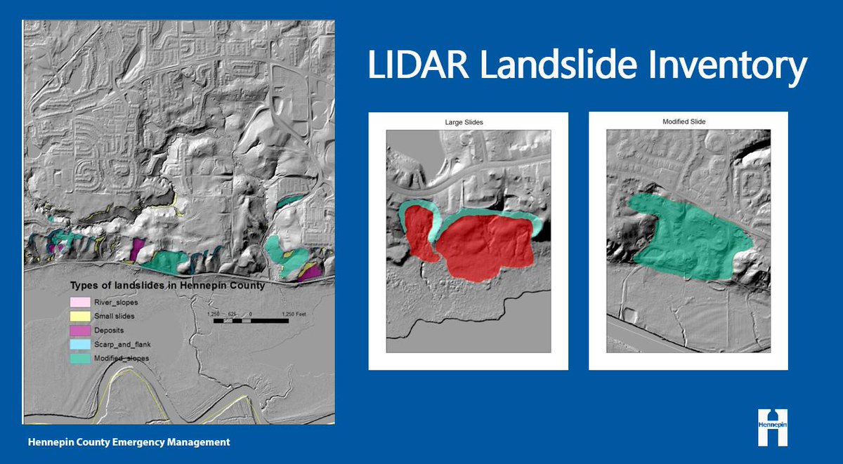
EW: Hennepin County Landslide Assessment Group, comprised of federal, state, and local individuals, created a #LIDAR landslide inventory that identified over 1,000 past landslide sites #CIWebinar
JG: #Comingsoon: @USGS and @NASA, in partnership with state geologic surveys, are launching an interactive national-scale map for #landslide inventories as part of USGS’s Landslide Hazard Program #CIWebinar