We have a problem…too many storm chaser making for a dangerous situation and many of them are reckless on the roads. Could easily see this being a legal debate in the near future from a safety perspective.
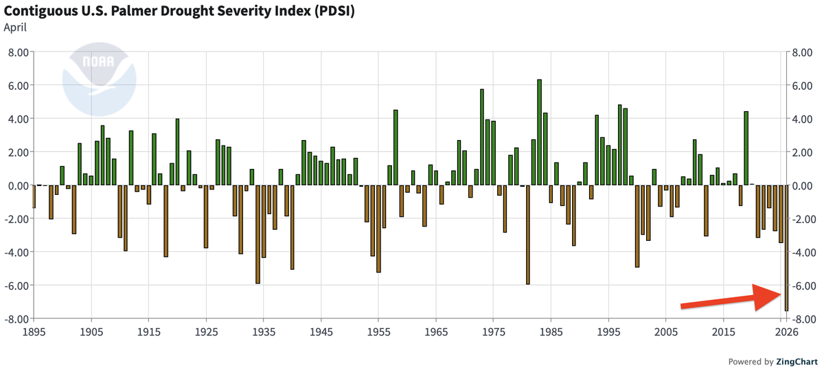
I’ve been saying since 2020 we are in another dust bowl, but without the agricultural practices of the 1920’s and 1930’s that allowed fields to just blow away. Irrigation systems help too, but that doesn’t take away from that we are dealing with the driest weather on record.
We just observed the highest Equatorial Pacific oceanic heat content for *any* month since 1997 and the highest for April in the entire satellite era.
If it wasn’t clear to you before that we were headed for a “Super” El Niño later this year, hopefully it is now.
Chase called off. Too many people that aren’t using common sense and nearly rear ending reed. This is beyond dumb and I’ve never seen a day like this ever in 11 years
Apparently, The Dominator has entourage of 67 Cars following it at all times. I don't think these chasers can actually think for themselves.
Storm chasing is cooked
The latest NMME climate model ensemble is out. Trending stronger with El Niño. Unsurprisingly, that means a very hostile look in the Atlantic, with dry precipitation anomalies all across the Main Development Region through peak season. As we get closer to the start of hurricane season, confidence is growing that this might be the quietest season since 2015, unless something very unusual happens. Of course, we could see an impactful storm somewhere (it only takes one), but this setup doesn't leave much leeway for the Atlantic to have a lot of action.
El Niño forming by May, potentially becoming strong by August — new ECMWF seasonal modeling.
By the numbers:
• 22% chance of a super El Niño by August
• 80% chance of a strong event
• 98% chance of a moderate event
That's according to data from 50 ensemble members.
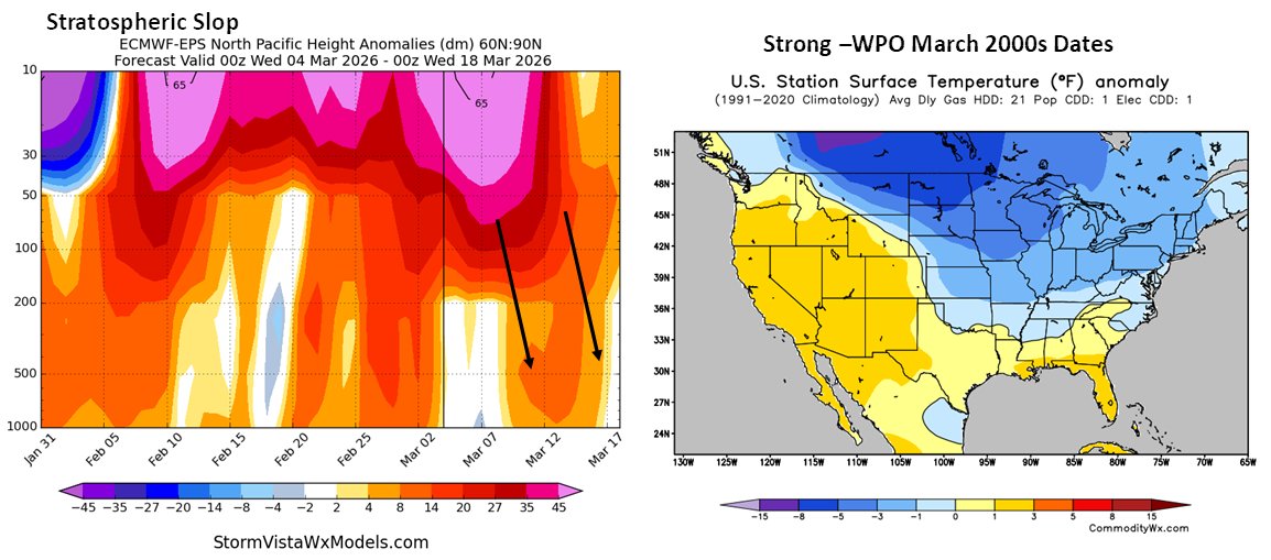
While it's been a little slow to get going, warmth is still the name of the game through much of next week in our region...but a "winter's revenge" trough setting up just beyond the middle of the month is looking more and more likely.
Stratospheric warming seems to be only translating to troposphere for strong negative Western Pacific Oscillation, which supports the mid-month cooler shift.
Watching this sudden stratospheric warming event (SSWE) closely, as it could impact our large-scale wx pattern later this spring & summer
The last 2 yrs had a late winter SSWE that gave way to +NAO in the summer, as described by Dunkstone et al (2023):
https://t.co/MYFptD3RYx
Odds of a big ticket El Niño event continue to climb as the equatorial trade wind environment continues to feature aggressive WWB’s that enforce down-welling Kelvin Waves eastward at depth, which resurface in the Eastern Pacific and give rise to El Niño.
Another high-end, locally record-breaking westerly wind burst is ongoing in the western Pacific.
It's still early, but this burgeoning El Niño appears to be built different and so far has characteristics similar to big events in the past.
Love these percentile maps from Ben. It's showing up in the Hovmöller Diagrams as well...very anomalous westerlies even in an ensemble mean. Should continue to charge the warm water volume in the West/Central Pacific, generate another downwelling Kelvin Wave, and help push us towards El Niño.
Good lord.
This Westerly Wind Burst in the Tropical West Pacific late month is so strong on the Euro weeklies it's wrapping the scale 😂
If there was any doubt we weren't getting an El Niño later this year, this just about does it.
I’ve closely studied/followed ENSO for the better part of the last 10-15 yrs
I can confidently say that this is the biggest mid-winter collapse of La Nina that I’ve ever seen in real-time
It’s incredible to see westerly wind bursts out to the Int’l Dateline this early in winter
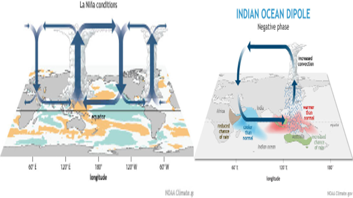
Latest weekly IOD Index is back to neutral at -0.26°C. Atmosphere will take some time to decouple. The circulation associated with the weak #LaNina will likely delay a truly neutral Walker Circulation until late boreal winter or early spring.
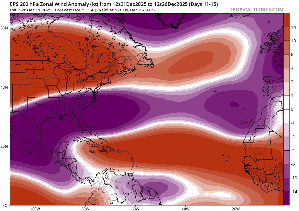
A Kelvin Wave will move into the W Hem next week (left), opening up a westerly wind duct over the Tropical Atlantic & Equatorial Africa (red, right)
This is key to strengthening the subtropical jet over the Atlantic, which triggers & enhances a ridge over Scandinavia in week 2