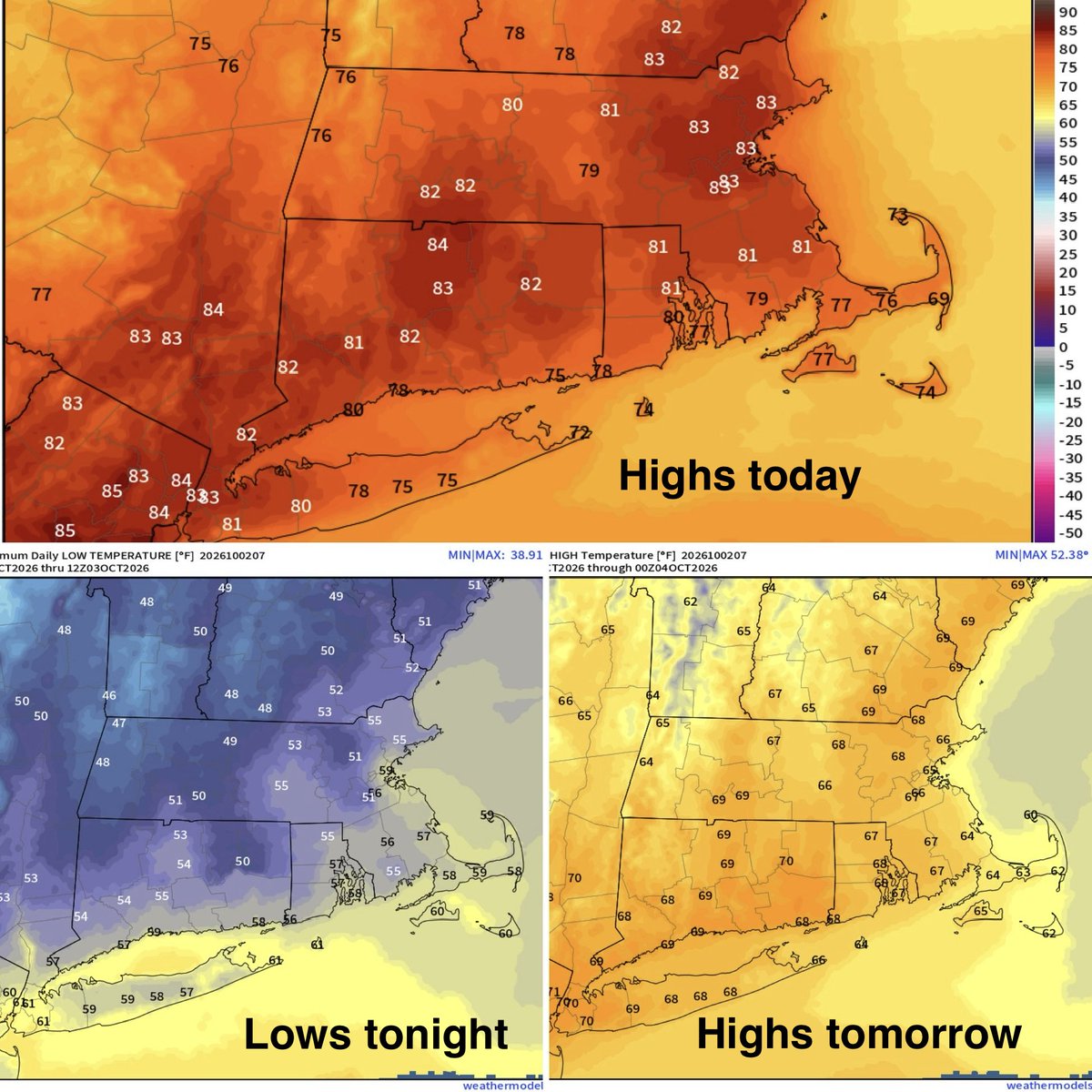
🐇🐇 Welcome to October! So-so today with a band of AM clouds and a shower/sprinkle to some sun and 70s with humidity too. Warmer 77-82 tomorrow with evening spotty showers and Saturday is pick of the weekend! Rain late day Sunday. Join us on @WTNH !
Here’s the detailed forecast for the week ahead:
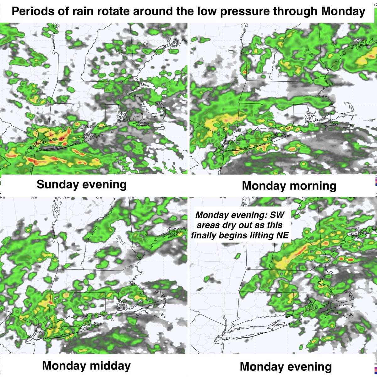
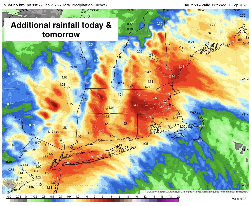
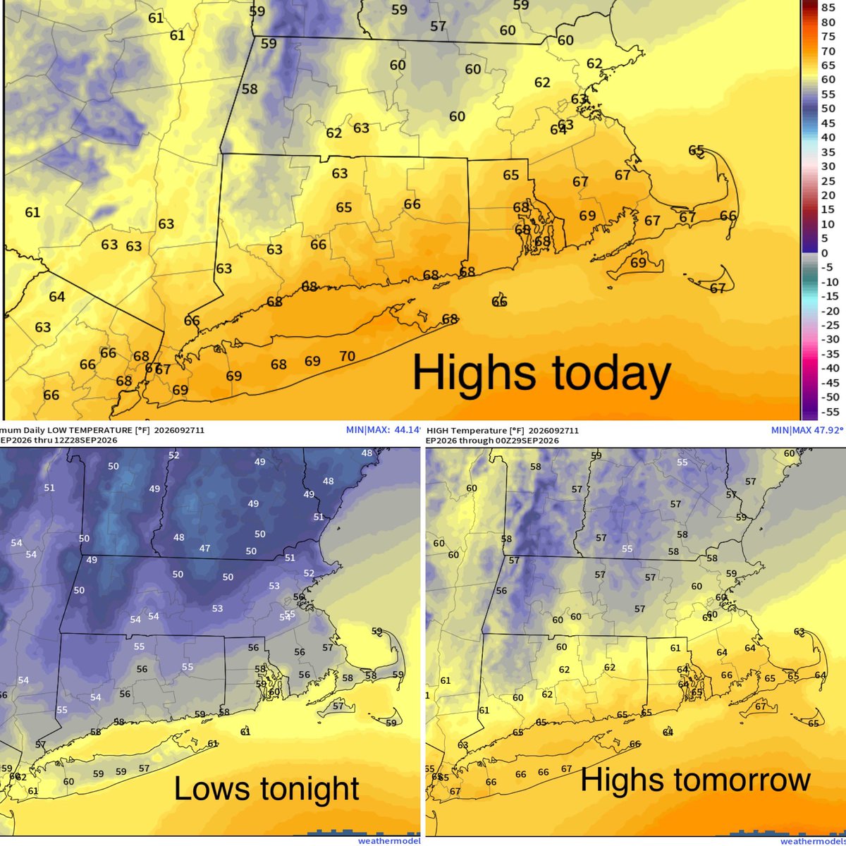
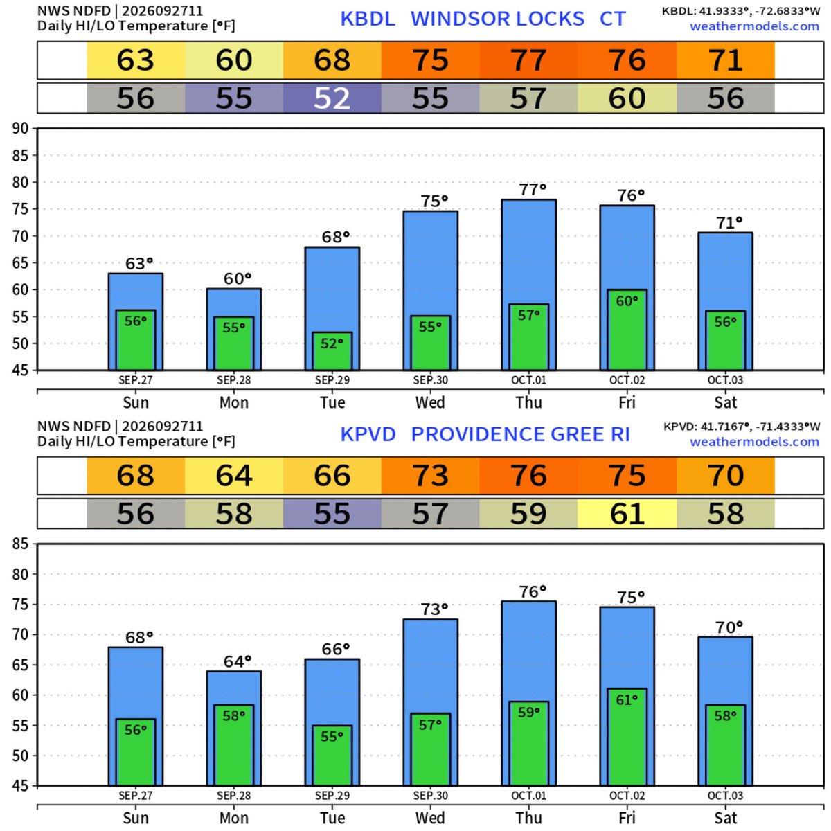
Today: ☁️🌧️💨 Cloudy with periods of rain. At times there may be lulls and at times the rain may be heavy. Continued windy but much better. Highs in the 60s except upper 50s western hills.
Tonight: Periods of rain continue. Breezy inland, continued windy at the shoreline. Lows in the 50s.
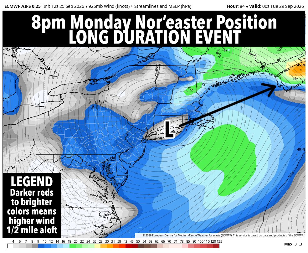
Monday: 🌧️☁️💨 Periods of rain continue. Late in the day SW areas finally begin drying out as the rain finally begins to lift off to the NE. Very breezy, especially at the shore, but manageable. Highs in the low to mid 60s. The hill towns stay in the mid to upper 50s. Possible dramatic sunset for western areas.
Monday night the last of the rain finally exits eastern areas.
Tuesday: ⛅️🌤️🌥️ A mix of clouds and sun. Milder and lighter winds. Highs in the mid to upper 60s.
Wednesday: 🌤️⛅️ Mostly sunny early trending toward a mix of clouds and sun during the afternoon. Milder. Highs in the low to mid 70s except cooler across SE coastal areas.
Thursday: ⛅️🌤️🌬️Partly sunny during the morning trending toward mostly sunny. Highs in the 70s. Cooler once again across SE coastal areas. Breezy SW winds.
Friday: ⛅️ Partly sunny. Highs in the low to mid 70s except around 70° for SE coastal areas.
🏆 Saturday: 🌤️ Mostly sunny. Cooler. Highs in the mid 60s to around 70°. The pick of the week.
Sunday: ⛅️🌥️☁️ Increasing clouds. Rain should hold off until Sunday night. Highs in the mid to upper 60s.
The coastal low is now weakening. From 992mb to 996mb in last few hours. This is great as it would have caused greater problems if it deepened into the 980s before approaching the NJ shore. The worst of the nor'easter is behind us. We only have rain and wind left that we've seen many times before. Don't be surprised if rain shuts off earlier for tomorrow after falling overnight tonight. Be safe! JC
WINDS RAMP UP
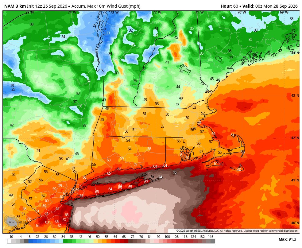
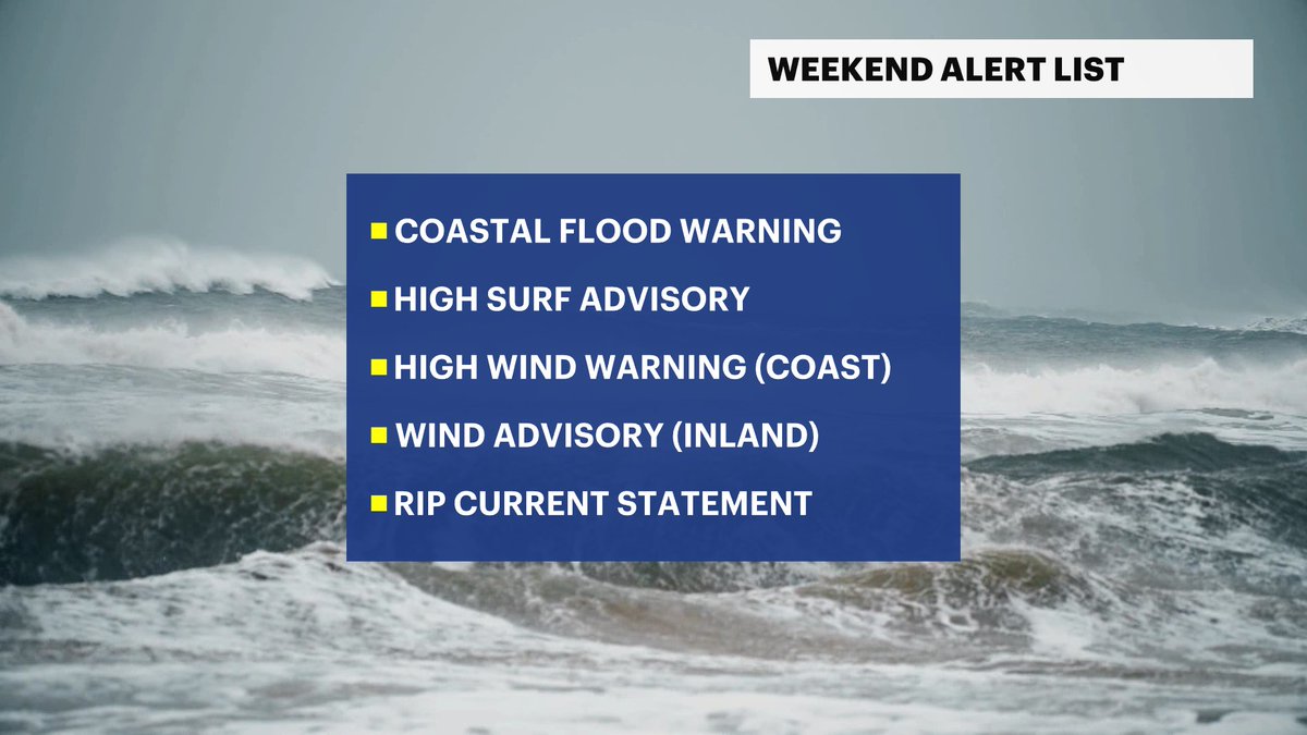
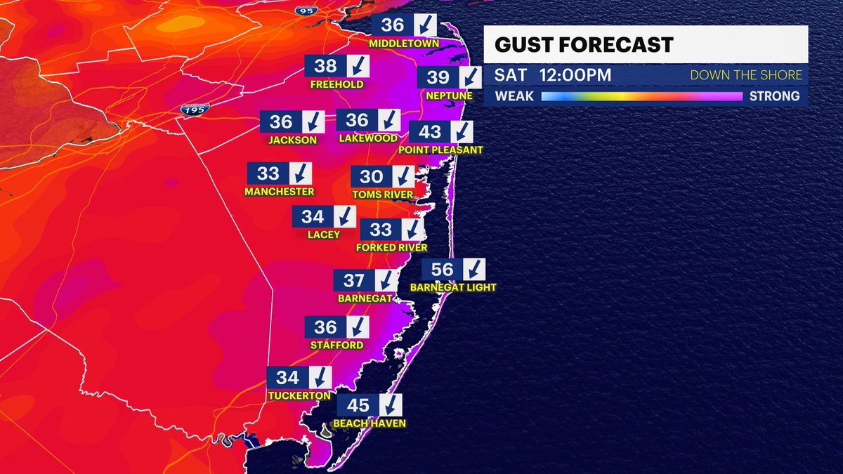
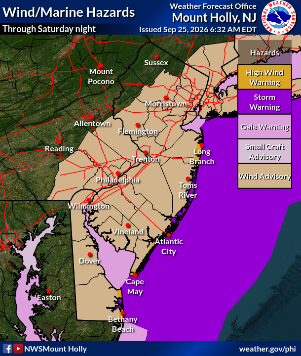
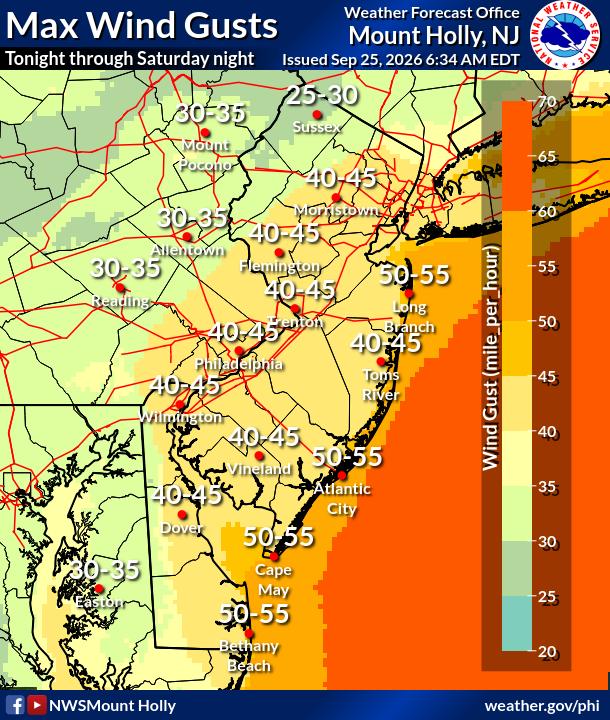
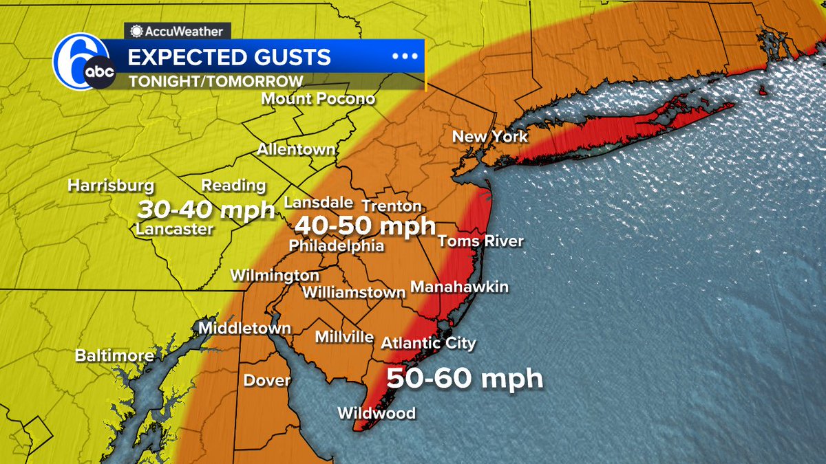
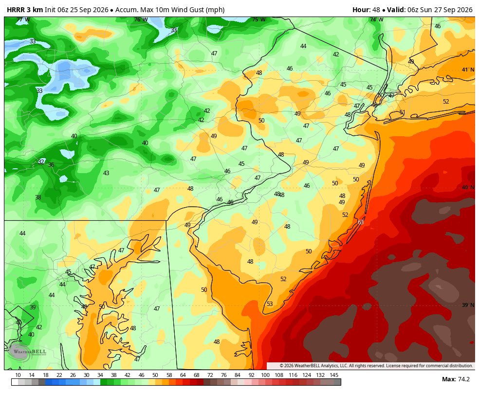
A high wind warning has been issued for the coast with gusts up to 60mph. For the I-95 corridor and much of interior New Jersey gusts could reach 50mph. Watch for downed tree branches; especially when driving at night.
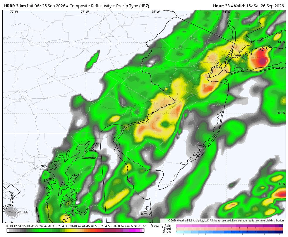
Here’s the rest of the midday hi res guidance. They are all impactful. The NAM with the strongest storm. I know it is typically well overstated, but in this situation it should not completely be dismissed.
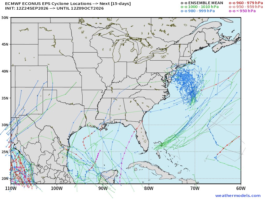
FUTURE TRACKER
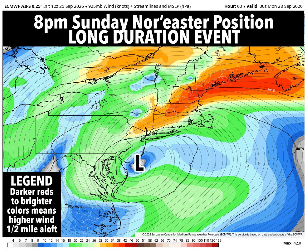
Shows the progress of our upcoming nor'easter as it heads into the Jersey Shore on Sunday morning. Expect periods of rain throughout the weekend with the heaviest early Sunday morning.
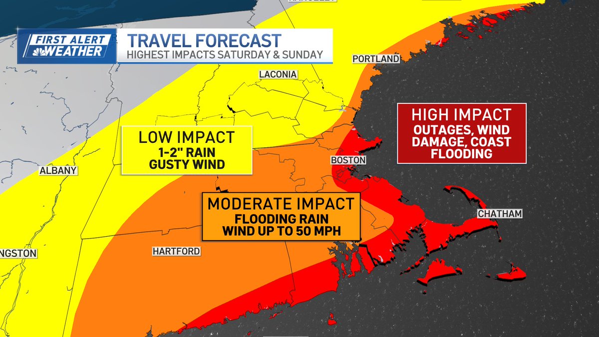
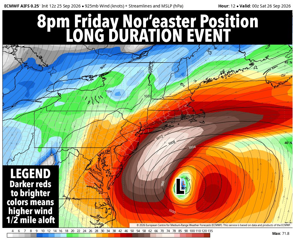
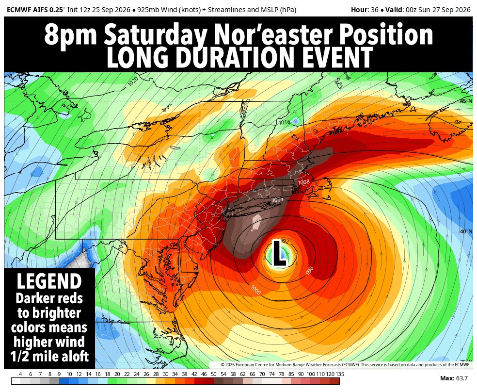
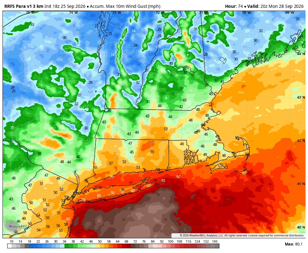
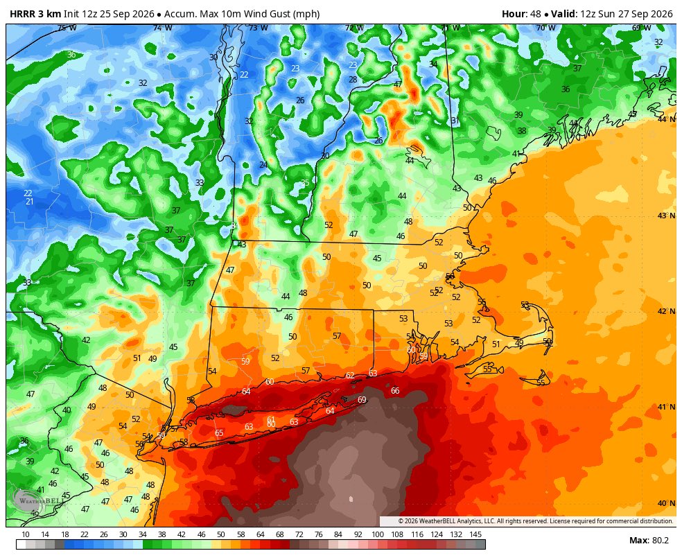
The big story for our early-season Nor'easter is that it's a long duration, 3-day storm event... the peak of which (for the greater WMass region) pushes in Saturday night into Sunday afternoon with peak wind gusts of 35-55mph on Sunday morning with periods of rainfall... wild...
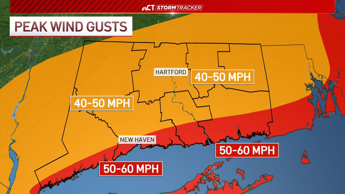
Afternoon Nor’Easter Update: Gusts 50-60 mph along the shoreline Sat-Sun AM, lower inland. Trees/power lines may come down.
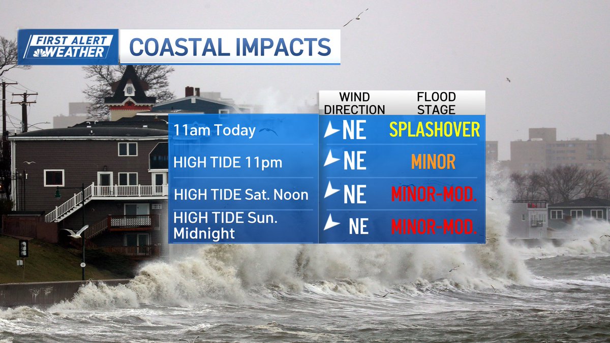
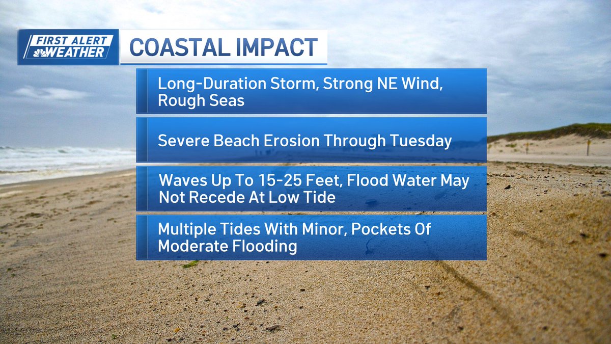
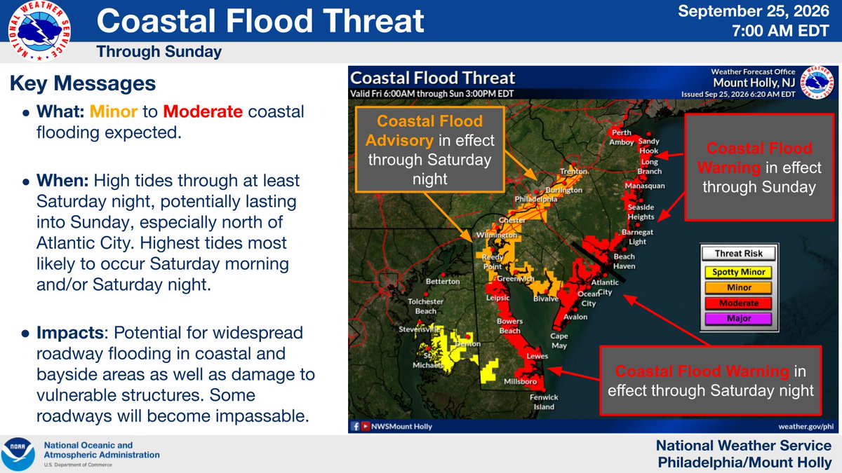
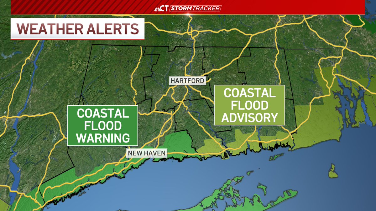
Coastal flooding likely at vulnerable spots on the Sound, especially Sat & Sun AM/midday high tides. Storm surge of 3 ft possible.
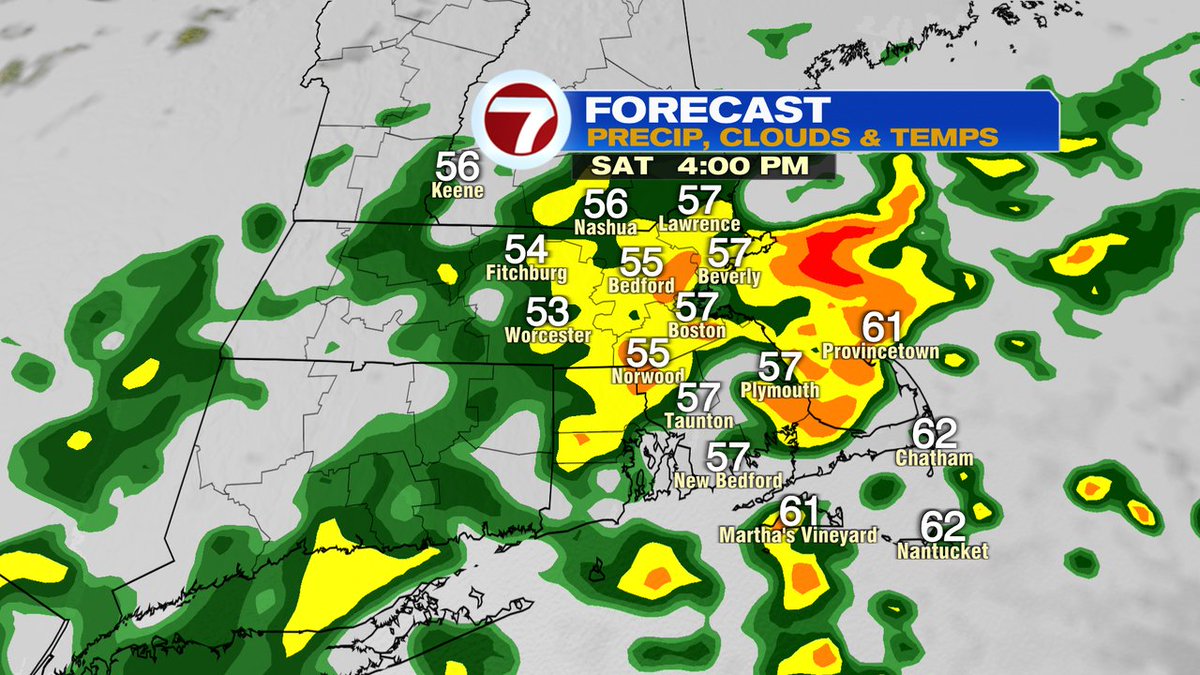
NOR'EASTER looking impressive on satellite as it spins in the ocean more 300miles to our south. Winds picking up now and peak Saturday-Sunday AM gusts 50mph+ near coast. Squally bands of rain are heaviest Saturday afternoon-Sunday. Rain lingers Monday but winds come down #WCVB
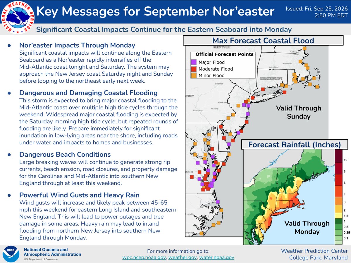
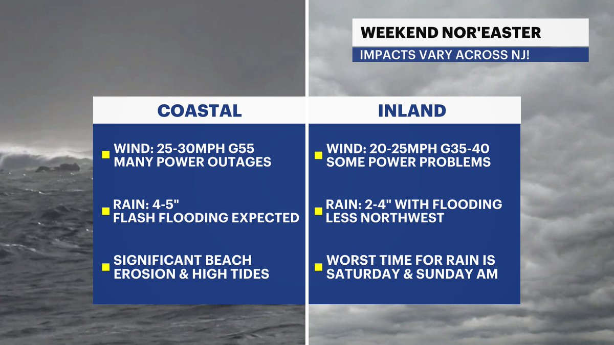
A nor’easter is bringing severe weather to NJ through the weekend.
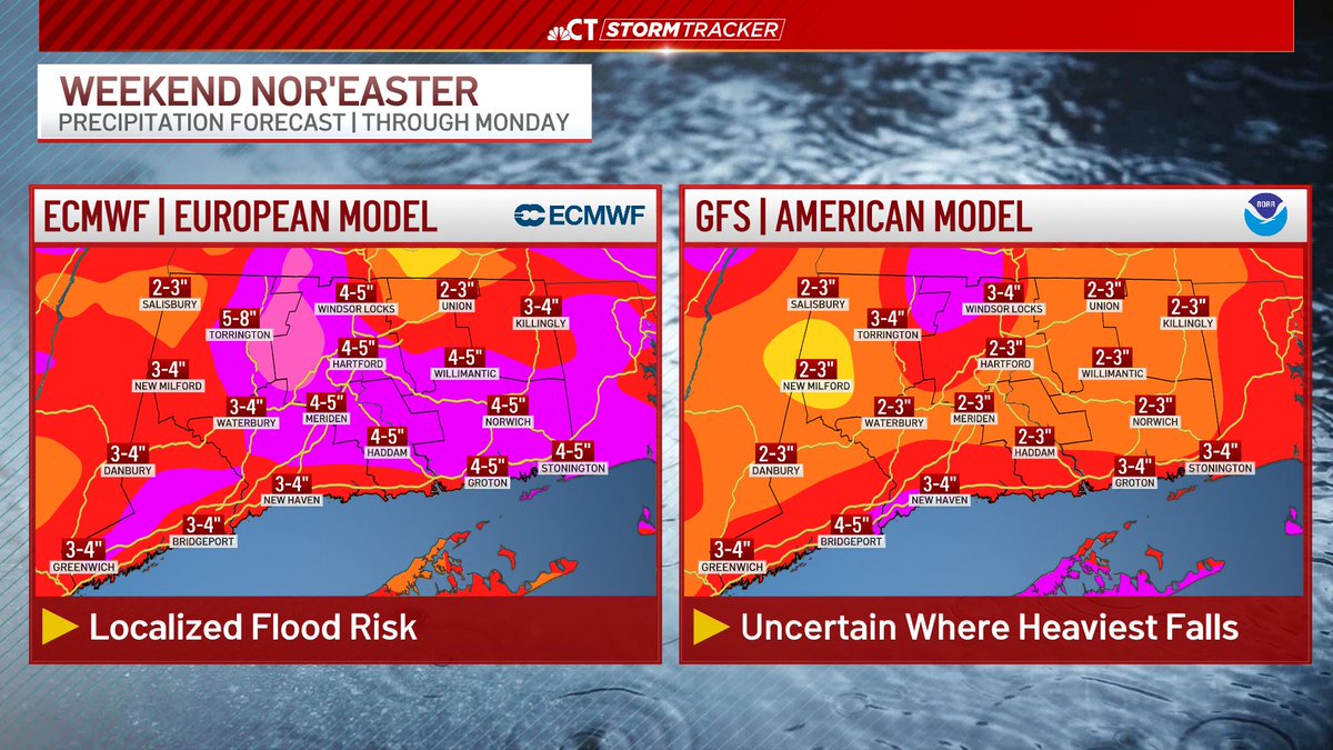
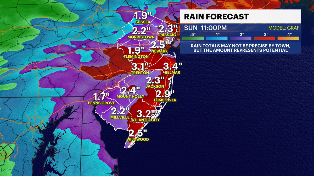
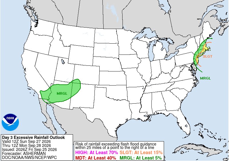
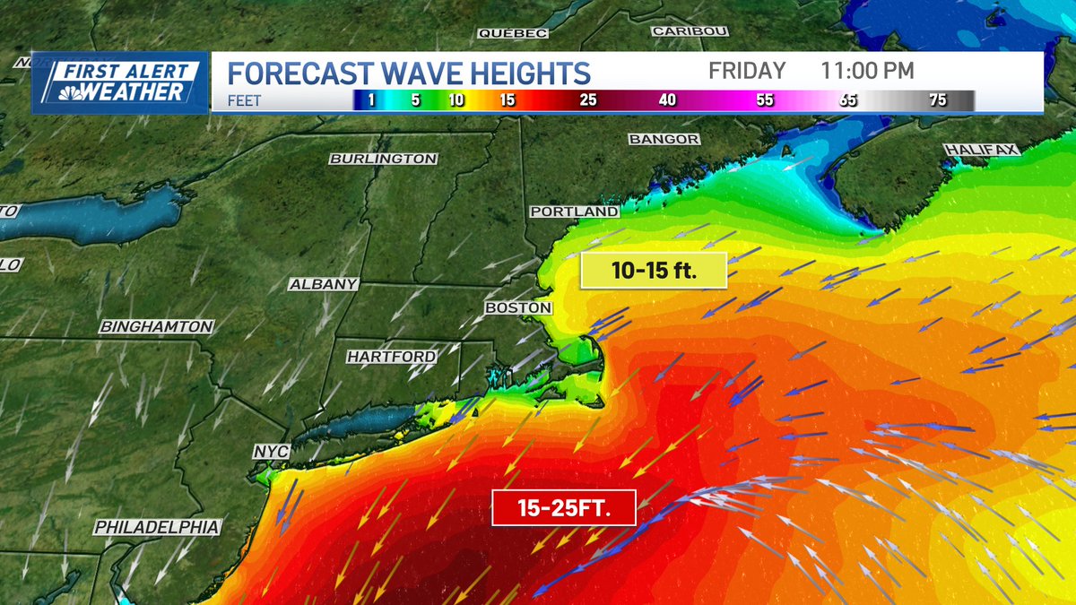
Expect 3-5" of rain, flash/coastal flooding (hardest hit: Barnegat Bay backbays), 11-14ft breaking waves, dune erosion, and gusts up to 55 mph with potential outages.
@News12NJ#NJwx
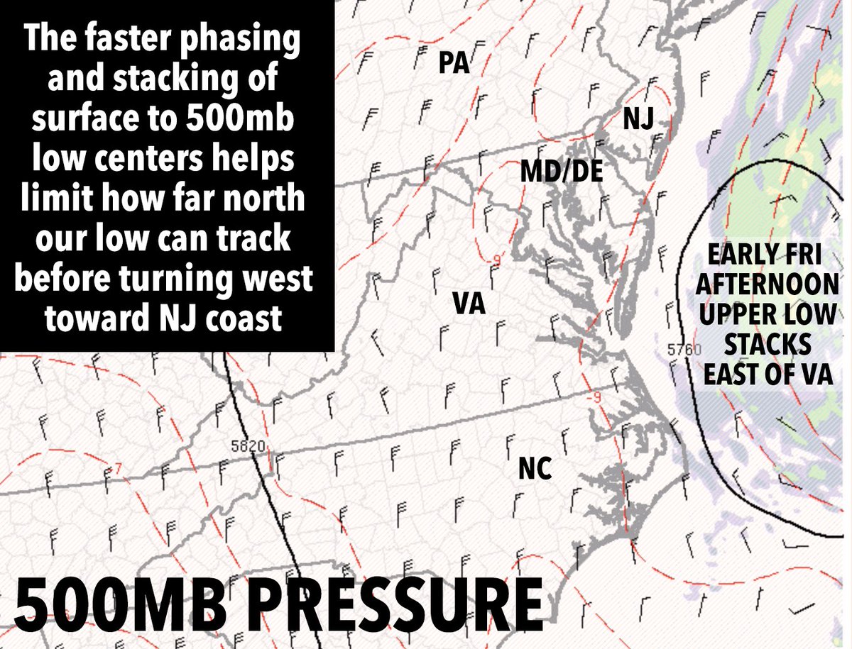
By early afternoon or so, our 500mb low will already be consolidating and stacking on top of the mid and surface low centers of our ocean storm... this is why I believe areas south of the Pike will see the brunt of this system for rain and wind. CT/RI/SE.MA = scattered outages.
⚠️🌬️🌊 A strong nor'easter will impact the region through this weekend. Strong winds may lead to tree damage and isolated power outages (tonight-Sat night). Coastal flooding is forecast to peak during the Saturday morning and/or evening high tide. (1/2) #PAwx#NJwx#DEwx#MDwx
Rain will move in starting late Friday night. Heaviest rain will be Saturday into Sunday. Wind gust map here too. Will be busy today so won’t post much till late afternoon