We’re proud to announce an investment of $63.8M in the Flood Hazard Identification and Mapping Program to help Canadians better plan and prepare for future floods.
Learn more: https://t.co/yhiVGvxvOG
#FloodMapping#FHIMP@Safety_Canada@environmentca
https://t.co/BtTYAhjQpt
"For the first time in more than 20 years we have a new leader of the pack: the Python programming language. The long-standing hegemony of Java and C is over."
Have you watched the @osgeo annual general meeting video yet?
Video has chapters!
AGM part is first 5-10 mins
Leaving an hour or so of great community updates!
https://t.co/LEI6yjKIBq
#Developers from around the world are invited to develop and test #OGCAPI Records. This specification enables the discovery of geospatial resources by standardizing #metadata collections. Register Now: https://t.co/mpiJ2lS0tg
Multilingual support has landed in pygeoapi! Thank you/ευχαριστώ/grazie/dank u/merci to @geosander , @pvangenuchten and @geocat_bv for this valuable contribution! Read all about it at https://t.co/3JZdLsTXcC #foss4g
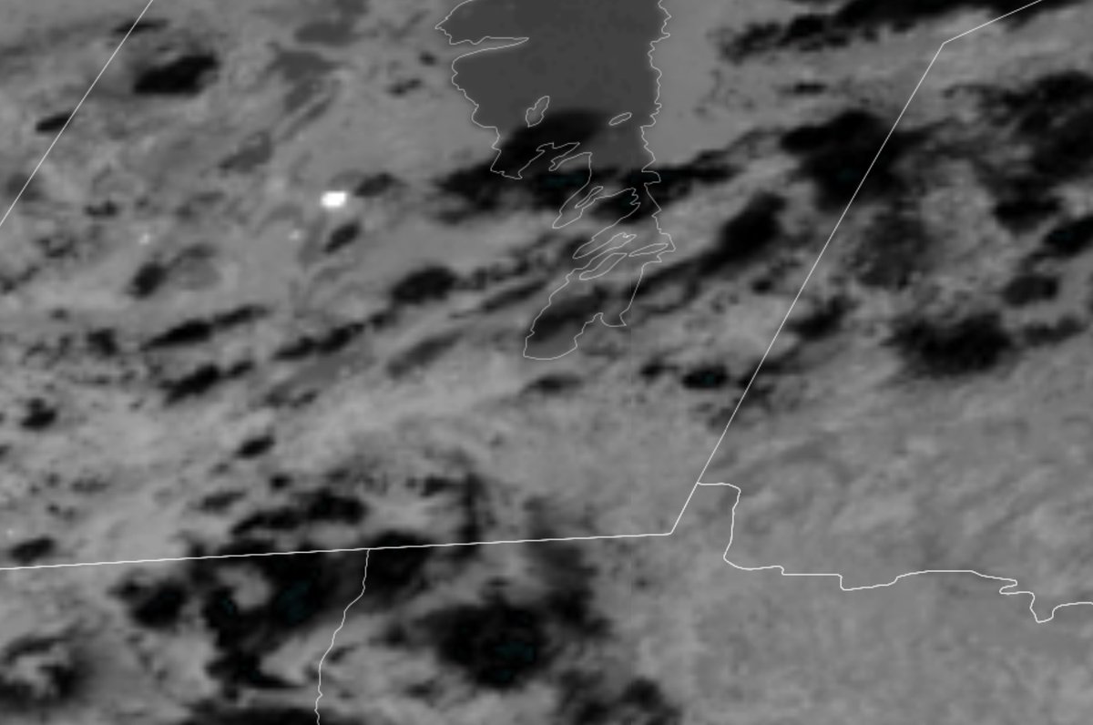
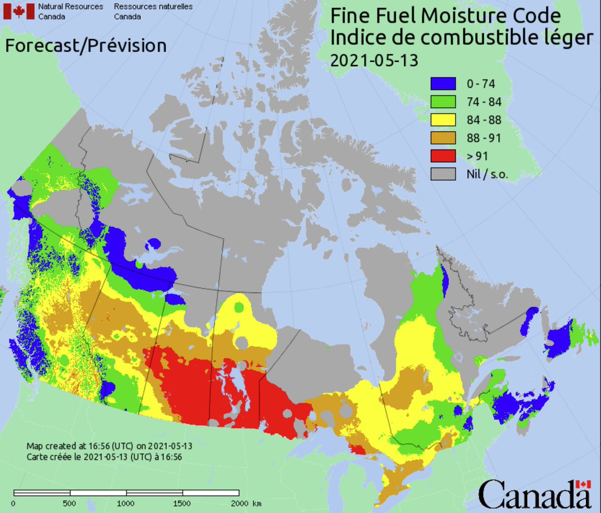
Wildfire in Manitoba, intense and growing. See GOES East mid-ir band - bright white indicates active fire. Also, attached is the fine fuel moisture code (ffmc) map- areas greater than 91 ( red areas) means that dead fuel moisture is 10% or less. Very dry fuels.
pygeoapi 0.10.0 has been released! OGC API - Records, OGC Environmental Data Retrieval API, OGC API - Processes asynchronous job management, and more! https://t.co/MlYKvSxUPr @OSGeo@opengeospatial#foss4g
The OGC Member Meeting is starting on March 17. The agenda is packed with special tracks for #health, #newspace, and #devs. See them all: https://t.co/ZZHqNxmRcM
Congrats to the OSDP Team on the release! Note: all of the open datasets from the Federal Geospatial Platform are synchronized and discoverable on OSDP.
We launched the Open Science Data Platform for #cumulative effects today. The OSDP provides access to data & scientific publications: https://t.co/je8XHqRSEA
The 1OGC Member Meeting is halfway over, but there are still more sessions, awards, and highlights coming. Don't miss us on December 9 at 12pm EST when we congratulate Prashant Shukle for his contributions to #geospatial with a lifetime achievement award: https://t.co/BjMy3dWgE8
Today is #MandelaDay2019, when the legacy of Nelson Mandela is honoured through community service. The South African firefighters assisting #ABwildfire in High Level will be volunteering locally tonight after their work on the Chuckegg Cr wildfire. Thank you @wo_fire!
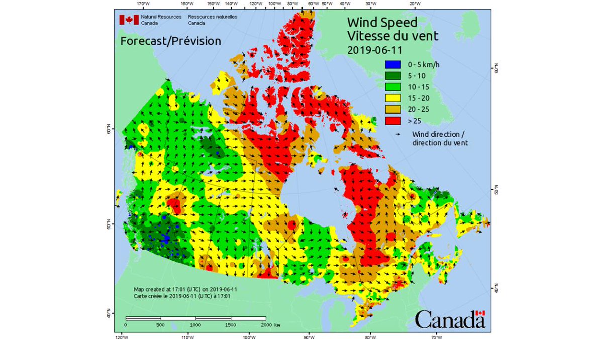
Did you know that #CWFIS has a daily wind speed and direction map? Daily weather observations are required for the Canadian Forest Fire Weather Index (FWI) System calculations. Check out all of the other maps we have at https://t.co/luQEU11NuZ! 🔥🇨🇦