I defended my PhD on micro to mesoscale modeling under tropical cyclones last week and the pride (and relief!) I feel is unreal! So much work went into this accomplishment and I can’t wait to see what’s next.
Take part in the Scuba Training Camp in Jamaica, on June 30-July 8. It's organized by our ECOP Programme Caribbean node coordinator Dayne Buddo, PADI Master Instructor and Marine Scientist.
To register your interest, please fill in this form by March 31: https://t.co/pkpGVLJqEZ
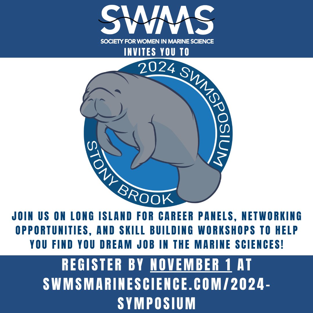
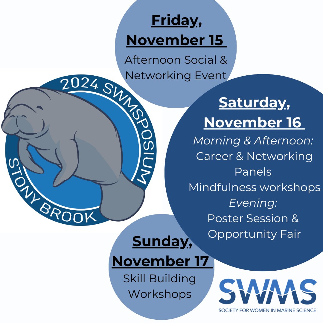
I was honored to participate as a panelist in the Society for Women in Marine Science (SWMS) Symposium at Stony Brook University on November 15-17th. I spent the weekend inspired by intelligent, powerful, and caring women. Grateful for this community.
I am happy to announce that I am actively looking for two PhD students to join my research group starting Fall 2025 at @MiamiRosenstiel! These positions are fully funded. Please see the slide for more info and feel free to reach out with any questions via email or DM here.
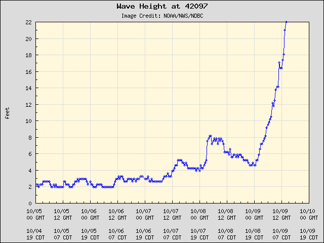
Inside Hurricane Milton, @saildrone reported wave height of 28.12 feet and wind gusts as strong as 75.95 mph while 40 nautical miles from the center of the storm. This research represents a collaborative endeavor to better understand the role of the ocean in hurricanes.
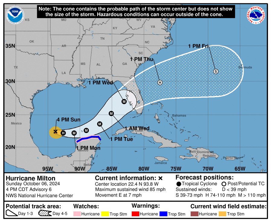
Hurricane #Milton Advisory 14A: Air Force Reserve Hurricane Hunters Find That Milton'S Intensity Has Rebounded. Today is the Last Full Day For Florida Residents to Get Their Families and Homes Ready and Evacuate If Told to Do So. https://t.co/tW4KeGe9uJ
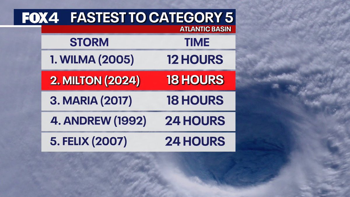
Hurricane Milton is undergoing one of the fastest rapid intensifications ever observed in the Atlantic.
It is now a 155 mph Category 4 storm, just 2 mph shy of Category 5 status.
Not a single weather model predicted the storm would strengthen this quickly.
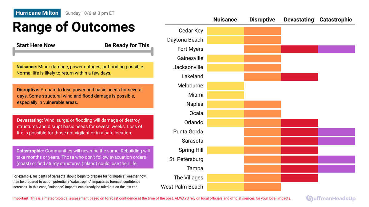
Need a break from maps and models on Hurricane #Milton? I wanted to help with clarity and simplicity.
Today and Monday are the days to consider your range of outcomes. Don't delay on the low end because you must allow time for the high end. 1/2 #FLwx
Can't emphasize enough what a serious situation this is. A category 4 or 5 hurricane with a near perpendicular angle of approach to the surge prone SW Florida coast. The wind and surge impacts are going to be catastrophic near and to the south of wherever #Milton makes landfall.
I read so many social media conversations about #Helene coming out of nowhere, which resulted in either mistrust of forecasts or complete conspiracy theories.
In reality this was a well forecasted but rapidly developing and intensifying storm.