A warming trend is in the forecast this weekend for Fathers day. A cool front rolls through Monday allowing storm chances to increase and temps to decrease.
Flood watches in effect rom 9pm this evening until 9am Friday. 3 to 5 inches of rainfall locally in isolated locations. Threat level 2 of 5 for your flooding risk and a threat level 1 of 5 for your convective risk across SW Oklahoma!
Heat advisories in effect until 8pm this evening for heat index values up to 110 degrees! A cool front puts an end to the heat as it comes through tomorrow afternoon. Somewhat of a flooding and severe risk Thursday evening through the overnight hours!
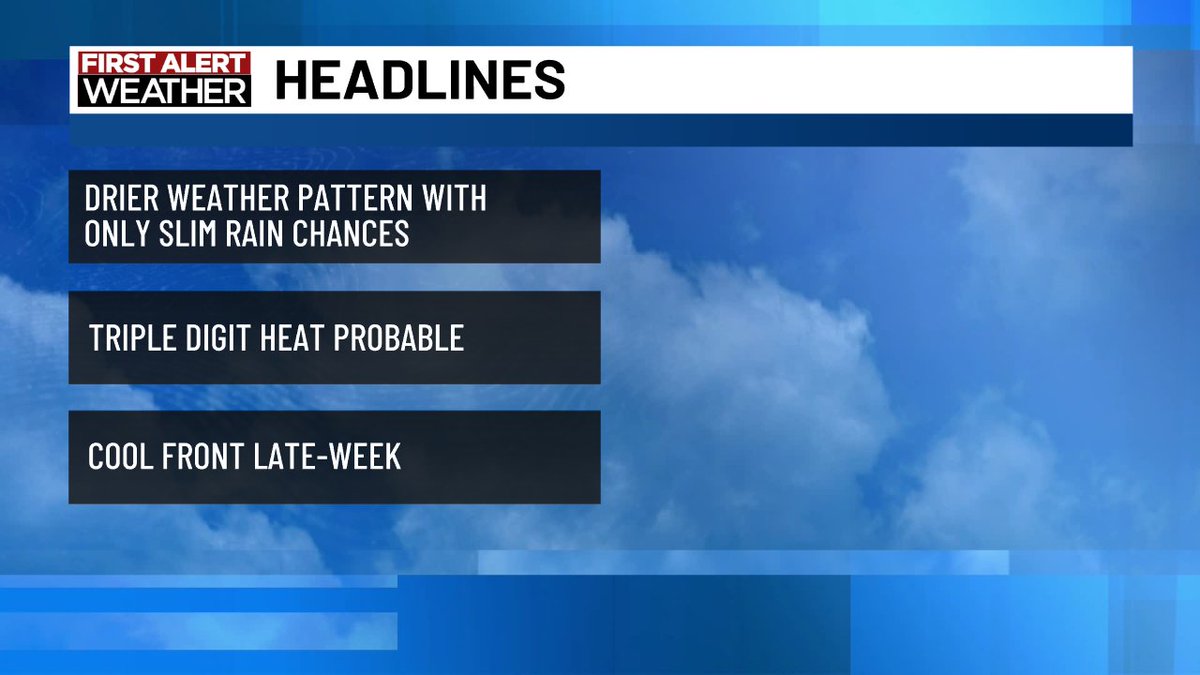
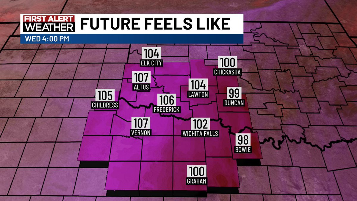
Heat advisories in place for Texoma Wednesday from 1pm until 8pm. Heat index values from 105-110 degrees expected! A cold front rolls in Thursday afternoon increasing rain and storm chances.
A storm system is bringing some activity that will carry through Saturday. During this time flooding in low-lying areas will be possible along with isolated severe storms.
Isolated severe storm or two possible in our northwestern areas this evening. Damaging winds are the main threat with any storm that develops in this area. Isolated to widely scattered chances continue Friday.
A disturbance increases rain and storm chances a bit Wednesday evening and again Thursday evening. Stray severe storms are possible Wednesday evening in our northwestern areas. Flooding in low-lying areas will be possible as well.
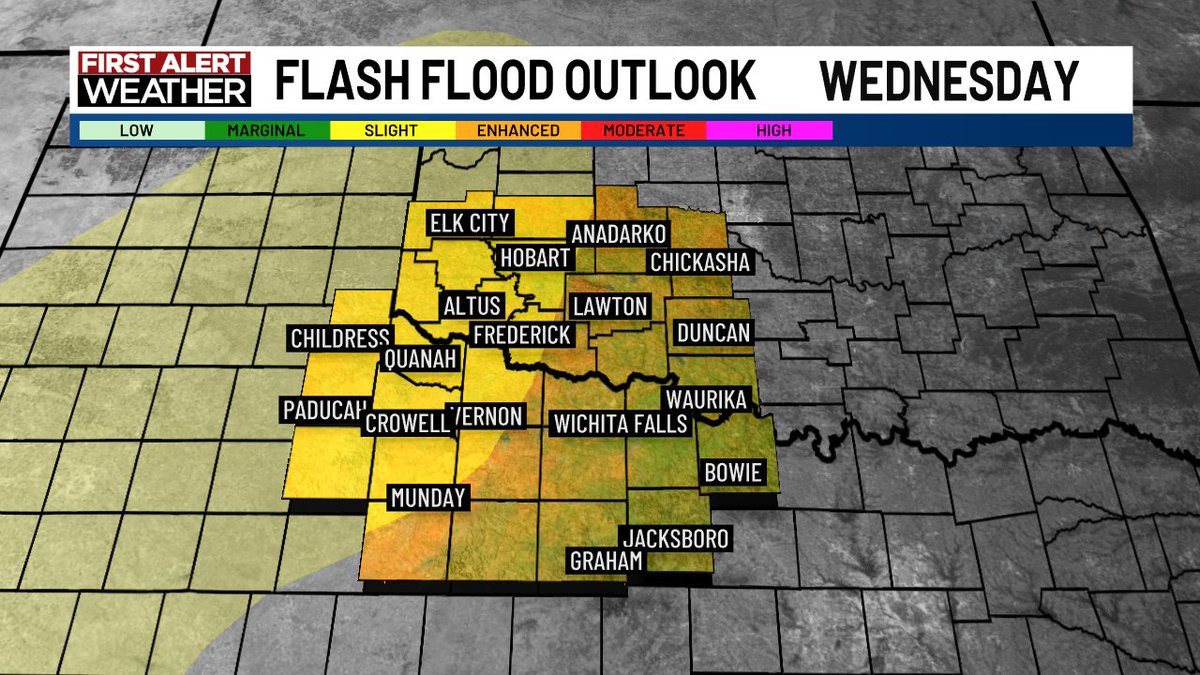
Rain chances increase over the next couple of days. Flooding will be possible in low-lying areas Wednesday evening into the early overnight hours for the western of I-44!
It's going to be another hot one today! Temps in the upper 90's with mainly dry conditions. Isolated activity looks to be around with only 20% coverage across SW Oklahoma. Mostly sunny skies ann light south winds
Severe thunderstorm watch for the far western area until 10pm. Isolated to scattered severe storms possible along and west of I-44! Isolated severe storms possible once again Saturday evening.
Isolated to widely scattered rain chances continue through the weekend. Not much of a severe threat expected although there is a threat level 1 of 5 Friday afternoon through the evening. Damaging winds and hail will be the two primary threats.
Rain and storm chances will continue through the weekend! Flooding in low-lying areas will be possible along and south of the Red River Tuesday evening into the overnight hours as well.
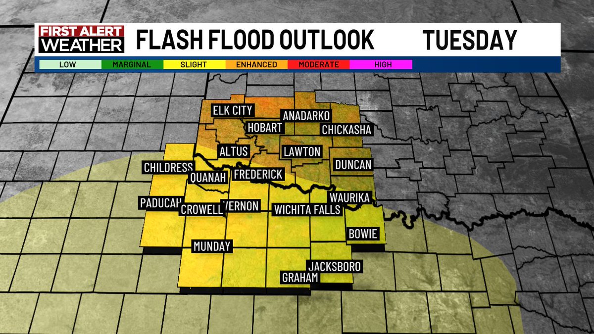
Rain chances increase for the next couple of days. In fact, a slight risk of flooding exists Tuesday into Tuesday night for the southwestern half of Texoma!
Severe storms are possible across Texoma this evening into the overnight hours! Severe thunderstorm watch is in effect for our far western areas until 11pm tonight as well.
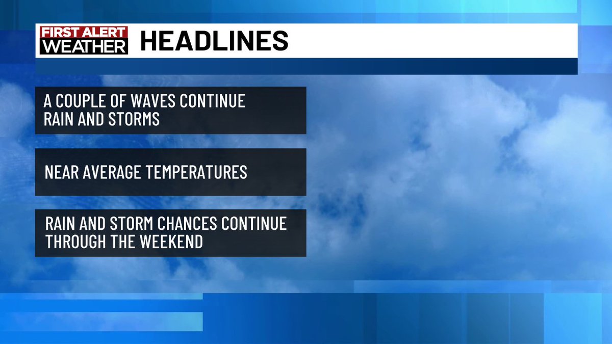
Upper level waves will continue rounds of rainfall for the rest of the week! Our next upper wave brings somewhat of a severe risk with scattered severe storms possible west of I-44.
Beneficial rainfall in the forecast as a couple of upper level waves roll through Texoma! Somewhat of a flooding risk for parts of the area Thursday with the first wave and somewhat of a severe risk for parts of the area Friday evening with the second wave.
Beneficial rainfall in the forecast Wednesday night into Thursday with somewhat of a small risk of flooding in some areas. Another disturbance will roll into the area Friday night into Saturday allowing for somewhat of a severe storm chance for parts of the area as well.
Tornado watch in effect through midnight for much of Texoma! The is a low end risk of isolated tornadoes but the primary threats will be the large hail and damaging winds. The risk of severe storms will last through non Tuesday as a cold front pushes through
Severe thunderstorm watch in the far western areas through 1pm this evening. Red flag warnings also in effect for western areas through 9pm. Isolated severe storm chances continue through the weekend.