Curve-Fitting. If you ever worked with a quantitative dataset in academia or in the world of business you might feel personally attacked. I for one sure like clicking "smooth lines" in Excel 😬 Source: https://t.co/2n1gGNwodq
Edgybees SKY is now native to GXP!
Come see our demonstration of our imagery georegistration tools integrated with BAE products at GXP360 at booth #1.
See you there!
@SlackHQ Wonderful - thanks for the update and status. Fixing this will help any geo org collaborating over slack. And if you want to know more about the data we’re using, please see the OGC geotiff data standards.
@GeoWithJustin@Dragons8mycat To get pedantic, to me ‘graphic’ implies a study of relationships between things. ‘Spatial’ is one of those dimensions. I like graphic because it’s all encompassing. But spatial is fine if you want to be specific to spatial or distance-like relationships.
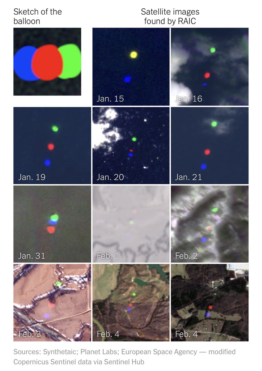
.@Synthetaic's imagery analysis platform RAIC unearthed a dozen photos of the balloon from millions of square miles of satellite imagery based on a sketch drawn by the company's founder @CoreyJaskolski. https://t.co/Px0uMJlem7
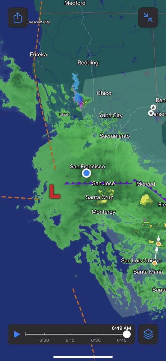
Models are starting to converge on a bomb cyclone making landfall near the Bay Area tomorrow as California gets hit by yet another significant storm.
Widespread heavy rain, flooding, damaging winds, and heavy mountain snowfall is likely, especially for Central CA/SoCal.
@mouthofmorrison@alexgleith We do both! We have customers who want precision to their own 'relative-to-the-problem' reference, and customers who want to co-register to an absolutely accurate truth
@mouthofmorrison@Edgybees I also see huge impact where speed-to-decision is important. If it takes time to review pixel accuracy, it takes time/labor to interpret what is going on.
@mouthofmorrison Thanks for the @Edgybees bump in the thread! I work day-to-day in this problem space at EB. Accurate and precise data matters, especially for the data to be trustworthy and actionable via human review, and especially via automated/AI tasks