A lot can be gleaned from the old birds eye view maps, both in what is portrayed and omitted. This is Portland, Oregon in 1890. Population at the time said to be under 50k.
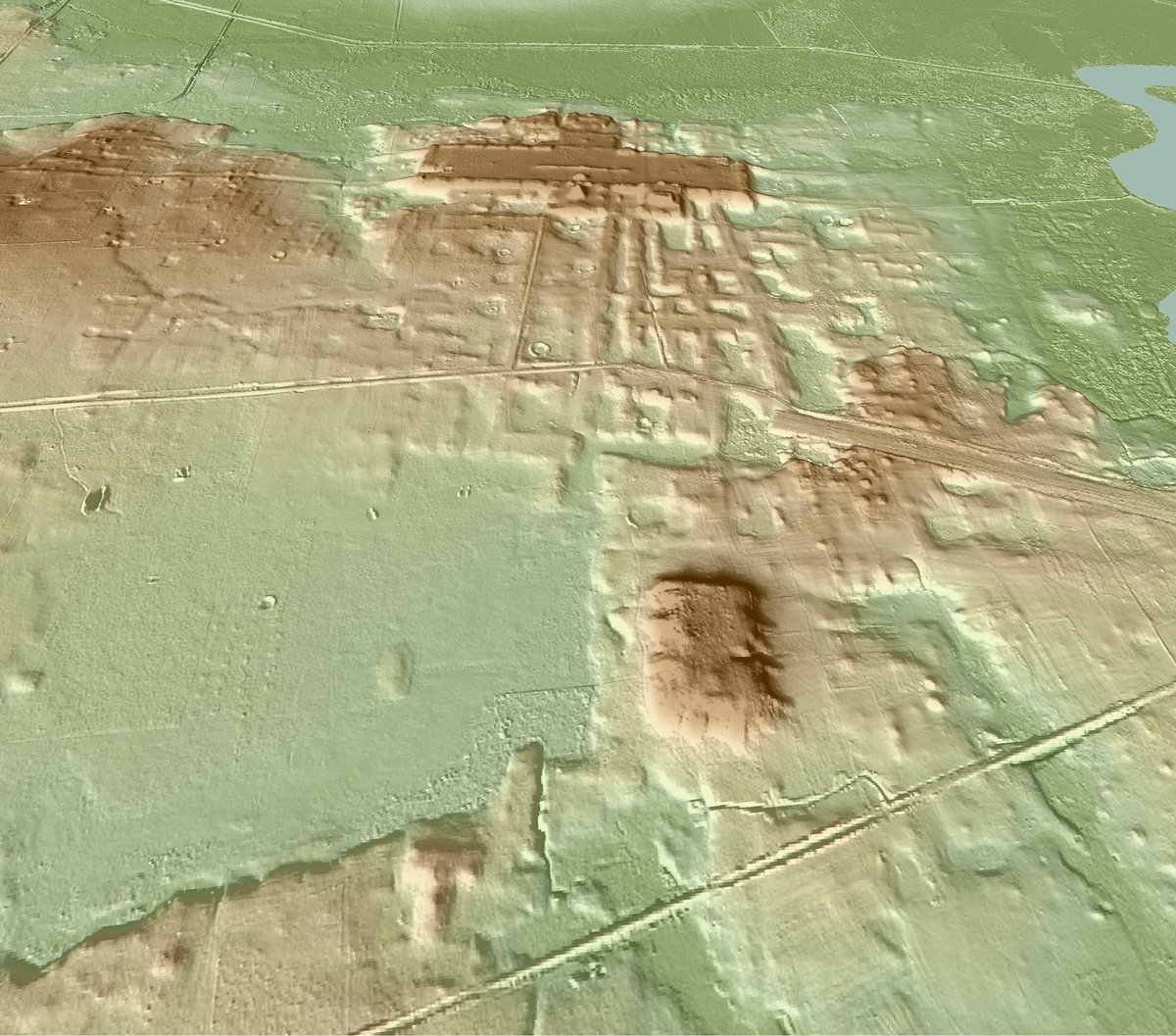
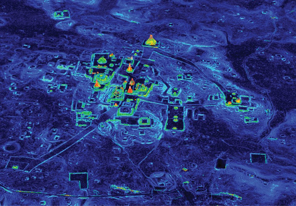
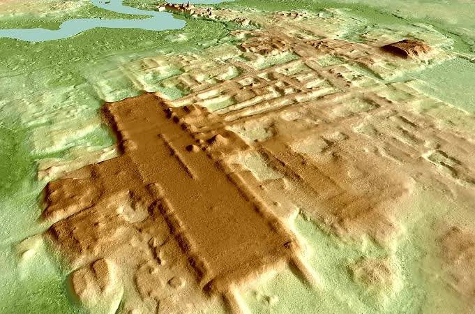
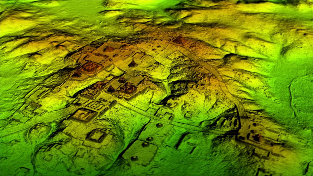
LiDAR is quietly detonating the old maps.
Under forests long labeled “empty,” scans are revealing earthwork complexes, road systems, agricultural grids, and engineered landscapes that never disappeared… they were just hidden by canopy.
How much of the continent still hasn’t been scanned.
if they’re lying to your face about things happening right now in real time with cameras everywhere and the internet at your fingertips imagine how bad the history books are
imagine you're in the world suffering by yourself, but actually millions of super intelligent beings are watching you from afar rooting for your success