I will do a morning vlog tomorrow, but I am okay with these being my final call maps. Snow to start, then lots of sleet, 1-2" of both. Then, there will be freezing rain on top, lots of icy roads, and terrible travel until the afternoon on Saturday. Ice will be one thing you aren't ready for and could surge. Stay Weather Aware! #snOMG #ice OMG #cltwx #ncwx #scwx #wcnwxc #wxbrad
Imo, the "sweet spot" in tonight's potential snow event in central NC is going to be somewhere just NE of Charlotte or so in the southern-southwestern Piedmont of NC
Here, low-level forcing for ascent will be maximized along a convergence axis extending NE of a mesolow that develops over upstate SC in response to vortical stretching off the mountains.
Given how this event has been evolving upstream today, the rather pronounced/discrete forcing mechanisms at work & the cold air temperatures in place, some lucky folks are probably going to see a lot more than just some flurries later tonight.
☃️
#ncwx #scwx
⚠️ DO NOT travel to western NC. Rescue crews are continuing to work in impacted areas. Utility crews are also at work to restore power, cell service and other vital infrastructure. Keep the roads clear for them.
Messages I keep receiving all I can do is spread the word at this point. "My brother, his wife, four young children (one newborn) and others who evacuated are stranded at Bat Cave Baptist Church on Chimney Rock Rd in NC. They have some provisions for now, but all roads around them washed out. All emergency numbers that 911 gave me do not answer."
Our station received this email from Banner Elk in Avery county.
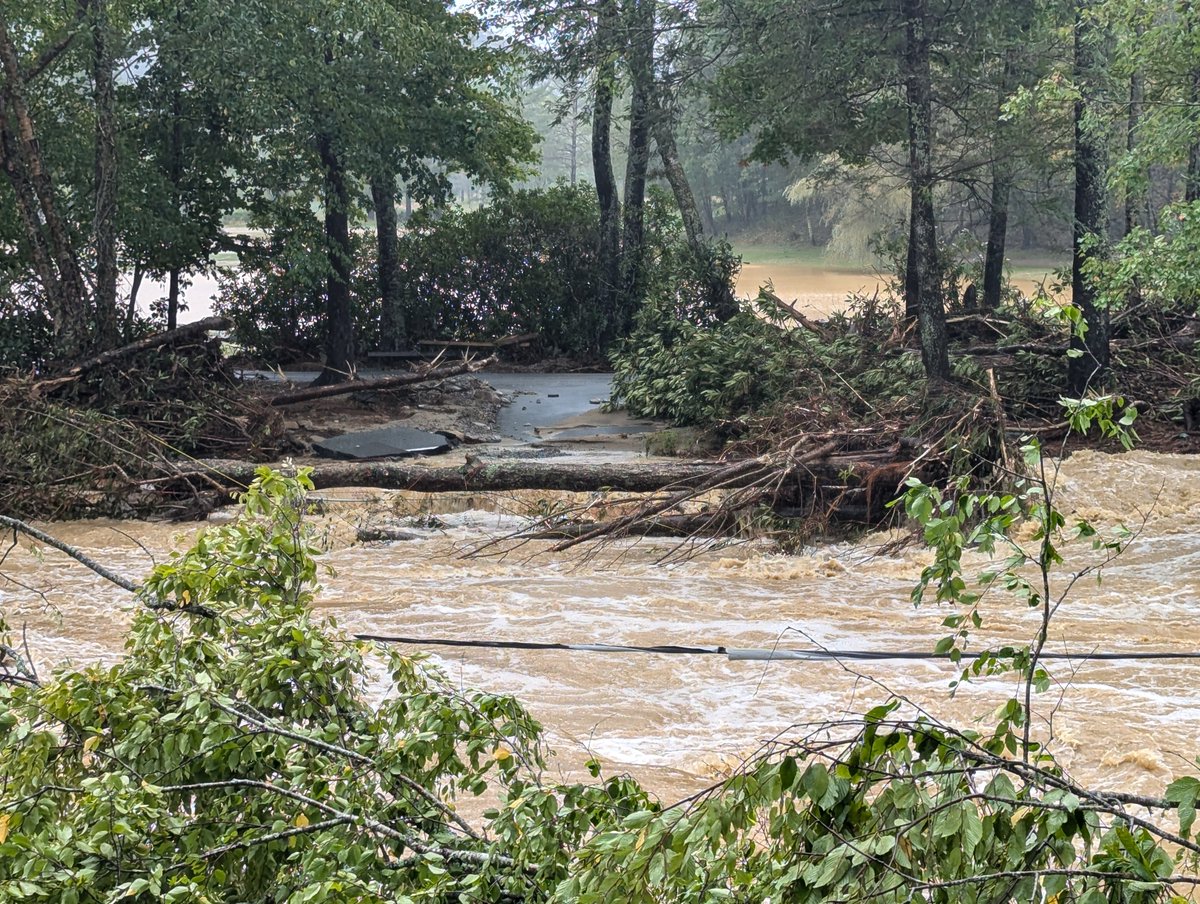
"I am hoping to open a line of communication with the "outside world". Residents of Elk River in Banner Elk are completely stranded. Attached is a picture of what used to be the bridge which is the only way in or out of the community. We have no power, water, cell service.... We do have a generator and wifi at the clubhouse, which is how we are sending this. Most of the residents are elderly, and there is no way to get out if there is an emergency. If nothing else, maybe you guys can help us communicate information to/from the outside.
Scott" #Helene #ncwx #wncwx
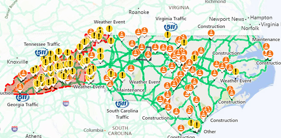
As of this morning, over 400 roads remain closed in NC. All roads in Western NC should be considered closed.
Remember: As crews work to clear and inspect roads and bridges, please give them room.
Go to https://t.co/AGDVnBcrXk for the latest road information.
🚨 All roads in Western NC should be considered closed 🚨
Do not travel unless an emergency or seeking higher ground
Do not drive through standing water
Respect barricades and road closures
#TurnAroundDontDrown#Helene#ncwx
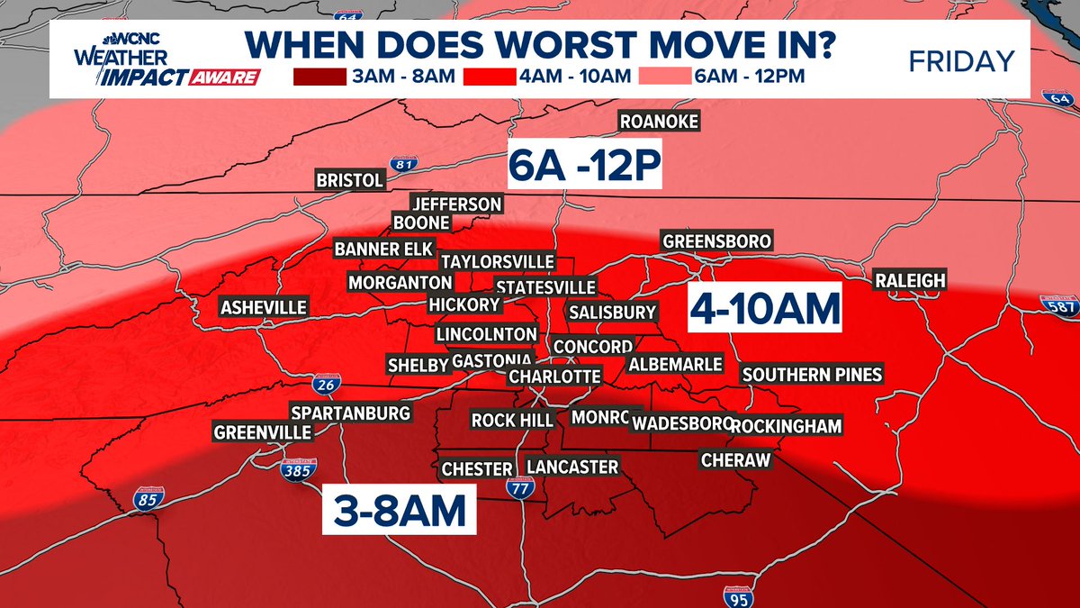
The latest timing for when the worst parts of #Helene will move in. Heavy rain, gusty winds to 60mph and isolated tornadoes with these bands early in the morning on Friday. #cltwx#ncwx#scwx#wcnc#wxbrad
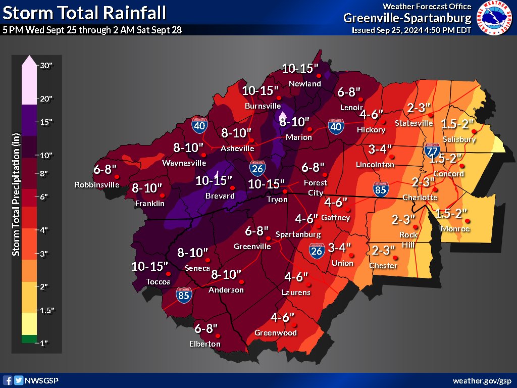
UPDATE FOR HURRICANE HELENE: Multiple rounds of heavy rainfall are expected through Friday afternoon. Total rainfall of 10-15" with locally higher amounts expected along the Blue Ridge with widespread 5-9" expected across the rest of the mountains, NE GA, & western Upstate SC.
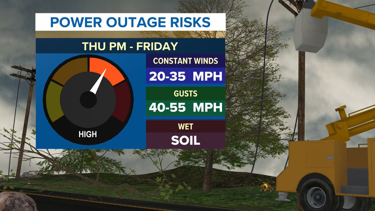
Power Outages look likely for parts of the western Carolinas. Ensure you have a plan for power outages that might last a few days in some locations. Charge devices and have backup battery packs ready to go. #cltwx#ncwx#scwx#wcn#Helene
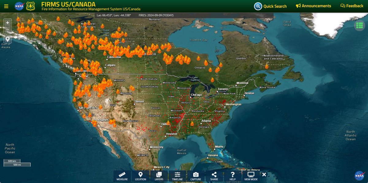
Western U.S. and Candian wildfires bringing smoke in the mid and upper levels over the Carolinas today. That's why it's so hazy out there. #cltwx#ncwx#scwx#wcnc
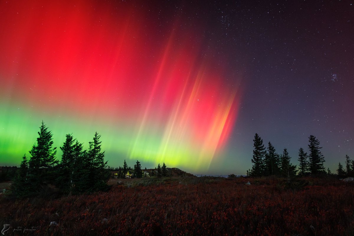
Timelapse of the two aurora substorms last night - first at 11pm, second at 2am est. Stitched timelapse from cameras shooting still frames. SNP, Virginia.
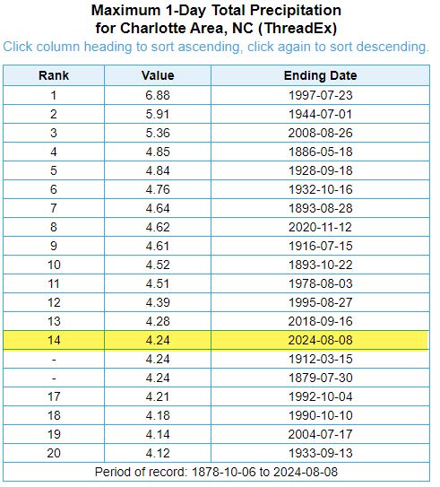
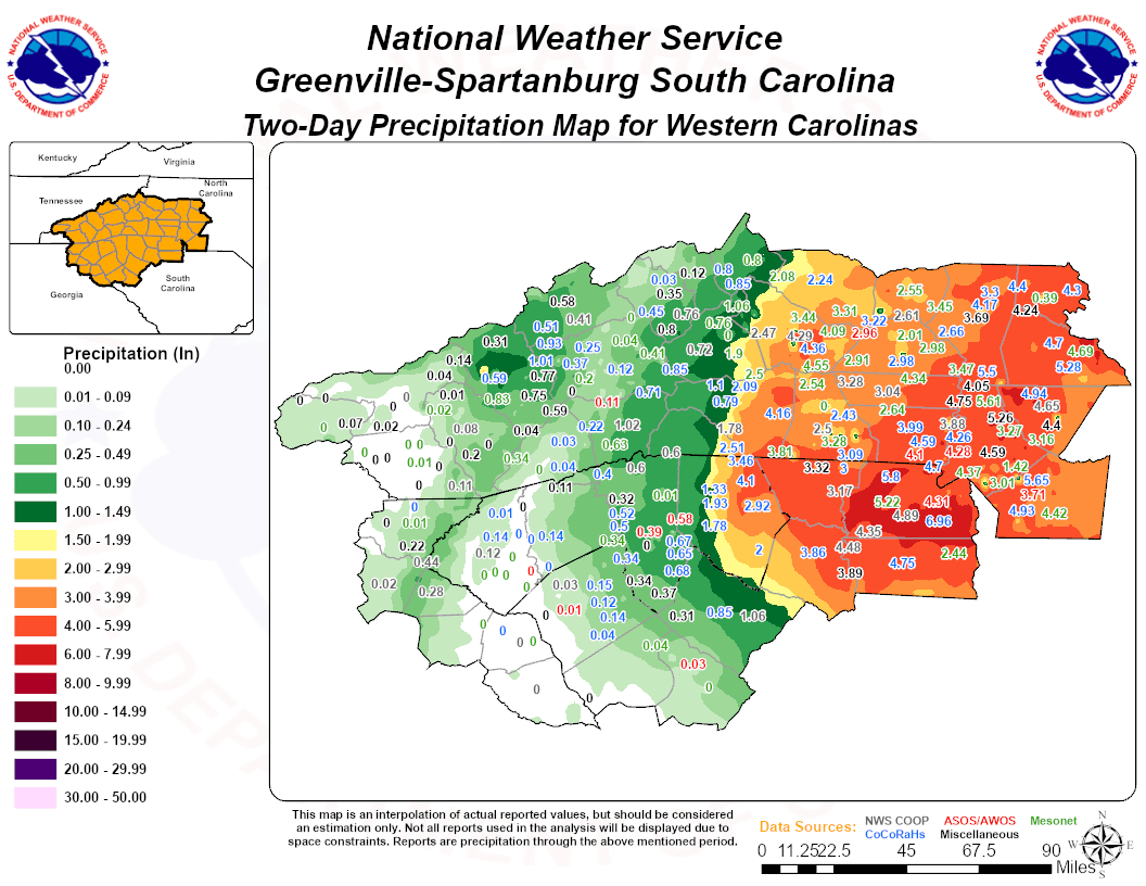
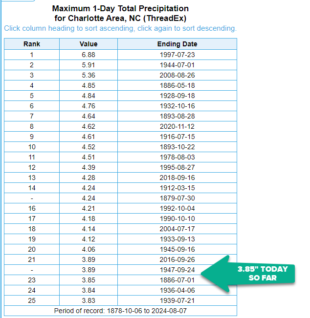
Here's a recap of storm total rainfall from #Debby. #Charlotte ended up with its 14th wettest day on record. Other selected totals from gauges are on the maps. If you have a gauge and total, please add it to the comments with your location. #cltwx#ncwx#scwx#wcnc