🥶FREEZING NIGHT TONIGHT...
Heads up! Temperatures will drop sharply tonight, and many of us will wake up to frost or even a freeze tomorrow morning. This will be the coldest night in a long time, with areas expected to drop below the freezing mark (pink areas). Localized areas of a hard freeze (sub 28F) are not out of the question, favoring the deepest valleys in the pink zone. Those along the immediate Lake Erie lakeshore and across the Philadelphia region will be warmer, but I would still take action in moving/covering plants in case of locally cold pockets that can support frost.
🪴If you have tender plants or garden vegetables outside, now is the time to cover them or bring them in. It’s also a good idea to disconnect and drain your outdoor hoses and make sure any outdoor pets have a warm place to stay. 🐶😺
#PAwx #Frost #Freeze #PennsylvaniaWeather
A severe thunderstorm watch has been issued for parts of District of Columbia, Maryland, New York, Pennsylvania, Virginia and West Virginia until 8 PM EDT
We've got a bit of a wild weather ride ahead of us, with much warmer air moving in by this afternoon, a stormy evening, then windy and colder weather with a chance of frost in much of the area by tomorrow night.
⛈️ A strong cold front will bring showers and storms today. Some storms could be strong-to-severe, bringing damaging wind gusts. Be weather-aware today, storms will begin across portions of NW PA late this morning and continue moving southeastward throughout the day. #PAwx
Widespread winds of 30-60 mph are likely tomorrow. 60-70 mph winds will be possible in the red area; note that the main area of damaging winds may shift north. Regardless, these winds will be VERY widespread and will also have a low embedded weak tornado threat...
A potent cold front arrives later Friday. Some severe thunderstorms with damaging winds are possible later in the afternoon and evening. The main wind risk with thunderstorms may be in the form of a narrow squall line. It turns much colder Friday night. #pawx#njwx#dewx#mdwx
🌧️ I think it’s safe to say we put a BIG DENT in the drought!
Regardless of the official totals, these estimates show that we definitely received rainfall at or above expectations this past weekend!
🌧️ WEEKEND RAINFALL TOTALS
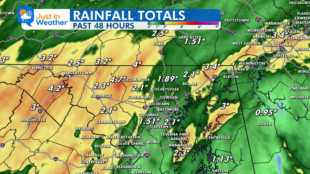
This map shows Doppler radar estimates for the past 48 hours, ending this morning (Monday). These are NOT official rain gauge measurements, but they provide a good overview of where the heaviest rain fell.
📊 GENERAL RAINFALL RANGE:
Most of the region picked up 1.5 to 4 inches of rain, with some areas receiving considerably more!
I have already received reports from backyard rain gauges measuring between 5 and 6 inches!
🌧️ REMINDER: Up to 2 inches of rain fell overnight in Northeast Maryland, adding to the weekend totals.
📍 RADAR ESTIMATES HIGHLIGHTED ON THE MAP:
WESTERN MARYLAND / EASTERN PANHANDLE
Hancock area: 3.2”
Hagerstown area: 2.5”
Western Washington County area: 3.2”
Eastern West Virginia Panhandle: 4.2”
CENTRAL MARYLAND
Frederick: 2.3”
Westminster area: 4.7”
Eldersburg: 2.1”
Cockeysville: 1.89”
Bel Air: 2.1”
Columbia area: 1.51”
Severn: 2.1”
Germantown: 2.1”
EASTERN MARYLAND / EASTERN SHORE
Northeast Maryland near Elkton: 3.4”
Kent Island / Centreville area: 3.0”
Annapolis area: 2.3”
Easton: 1.13”
SURROUNDING REGION
York, PA: 2.5”
Lancaster, PA: 1.51”
Philadelphia area: 3.4”
Winchester, VA: 3.0”
Dover, DE: 0.95”
💧 WHAT ABOUT THE DROUGHT?
This was a much-needed soaking rain, and it should go a long way toward improving our dry conditions. The official drought assessment will take more than one storm into account, but this is certainly a welcome change!
📣 NOW I WANT TO HEAR FROM YOU!
How much rain did you measure in your backyard?
Please share your TOWN, COUNTY, and RAINFALL TOTAL in the comments.
I’m especially interested in hearing from those who measured 5 inches or more!
Remember, radar estimates and actual rain gauges can differ, especially with the heavier bands of rain.
#Maryland #Rainfall #Drought
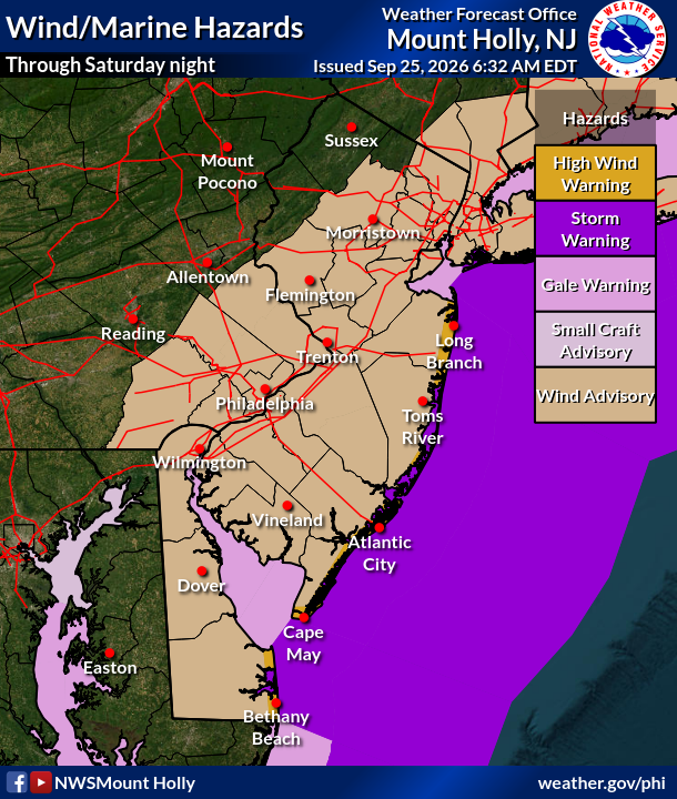
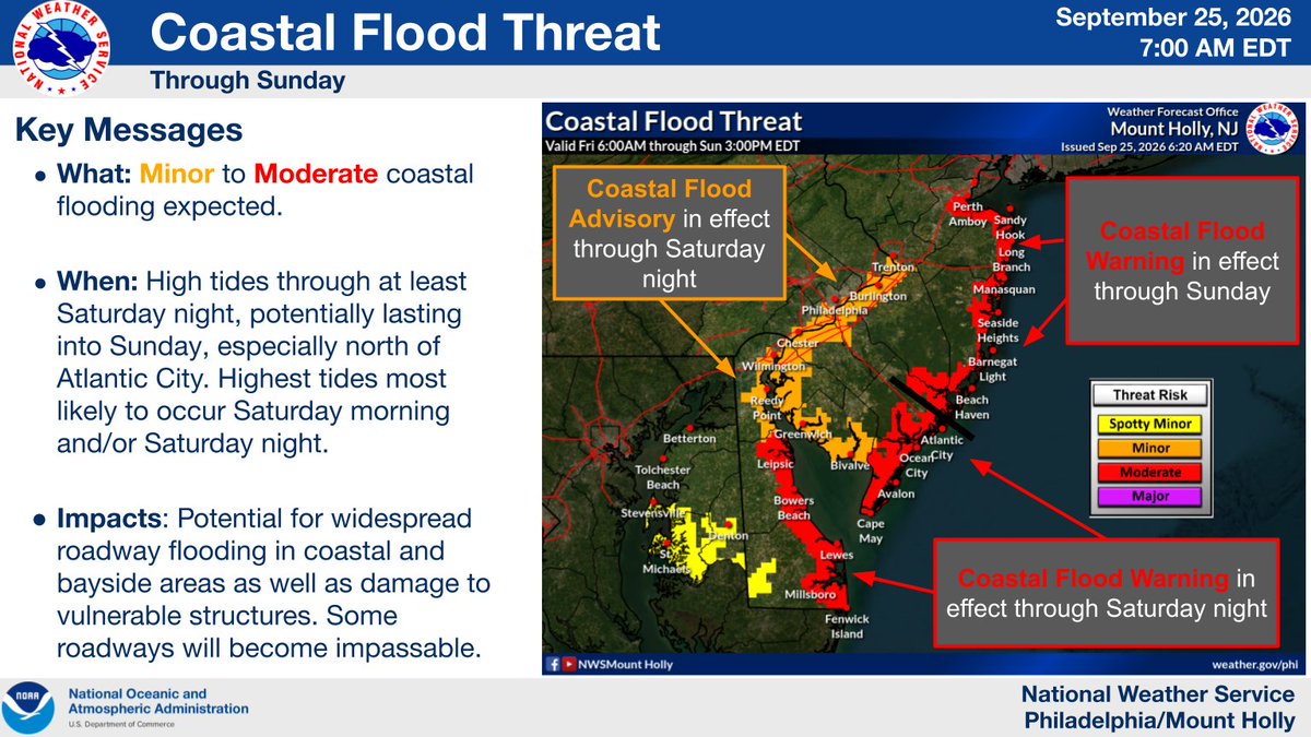
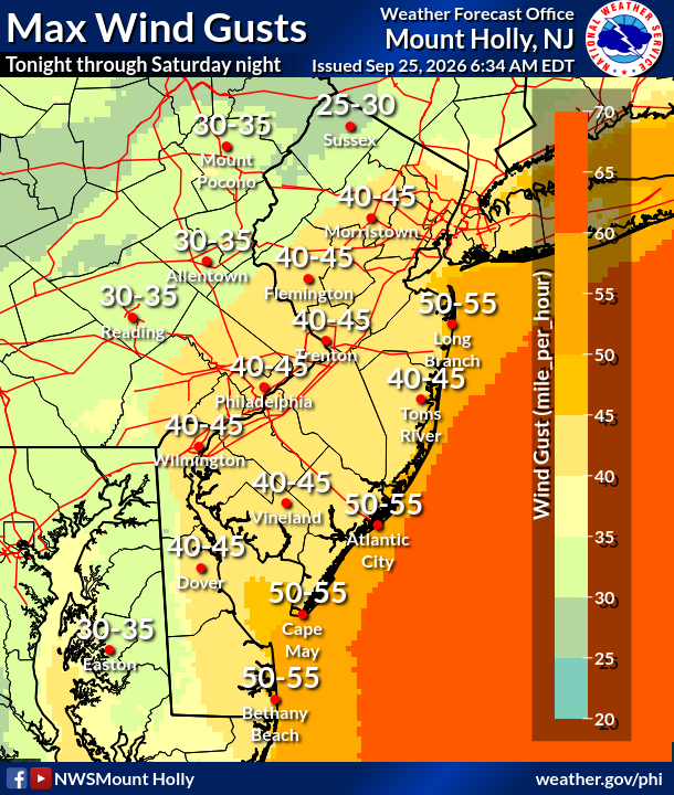
⚠️🌬️🌊 A strong nor'easter will impact the region through this weekend. Strong winds may lead to tree damage and isolated power outages (tonight-Sat night). Coastal flooding is forecast to peak during the Saturday morning and/or evening high tide. (1/2) #PAwx#NJwx#DEwx#MDwx
🌎 EARTHQUAKE (minor)IN MARYLAND OVERNIGHT
Did you feel it?
A magnitude 2.1 earthquake was recorded in Rising Sun, Maryland shortly after midnight.
📍 Epicenter: Rising Sun, Cecil County
⏰ Time: 12:41 AM Wednesday
📏 Magnitude: 2.1
⬇️ Depth: About 3.2 miles (5.1 km)
The epicenter was essentially right at Rising Sun, according to preliminary USGS data.
An earthquake of this size is considered minor, but when it occurs this close to populated areas — and relatively shallow — some people nearby may notice a brief rumble, vibration, or jolt.
🌎 Did you feel anything overnight?
If so, let me know where you were and what you noticed.
#earthquake
#Maryland
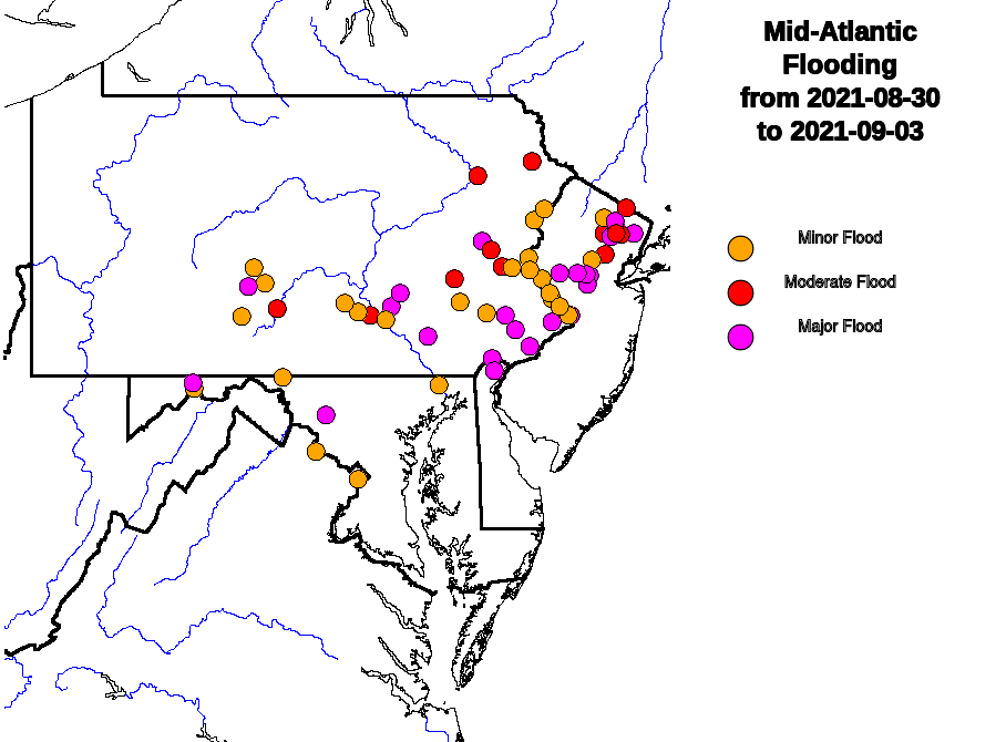
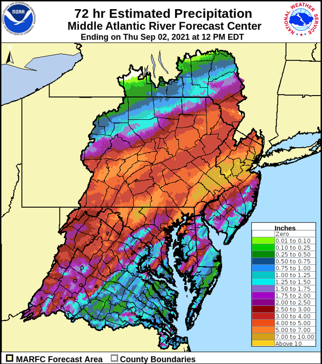
5 years ago this week, #HurricaneIda brought record-setting downpours and catastrophic flash & river flooding to the Mid-Atlantic & Northeast.
As we remember the storm, we also remember the dozens of lives lost and the countless others whose lives were changed forever.
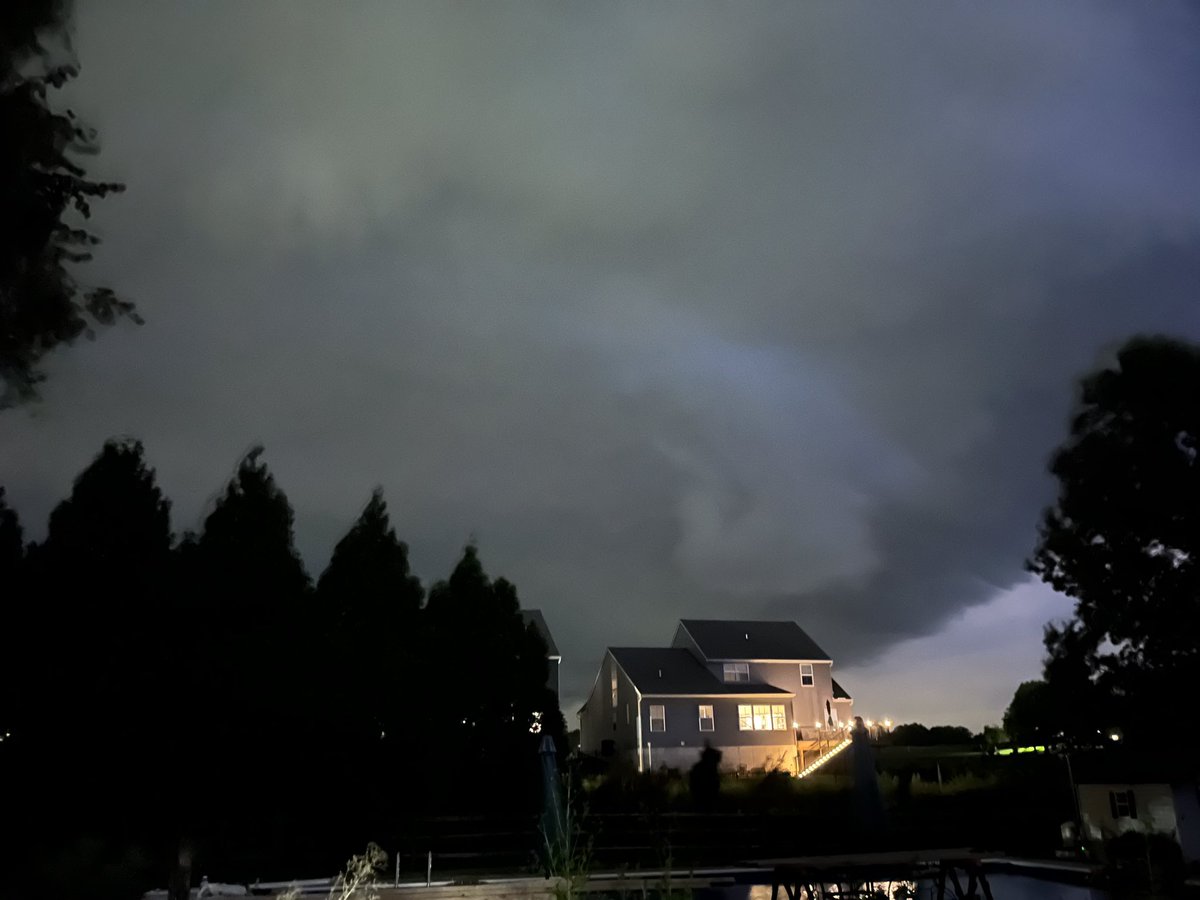
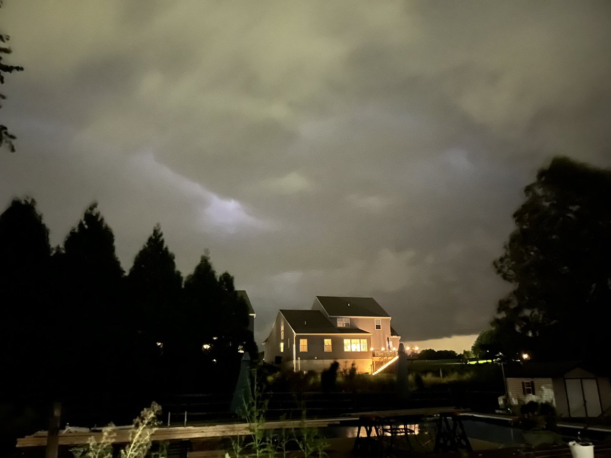
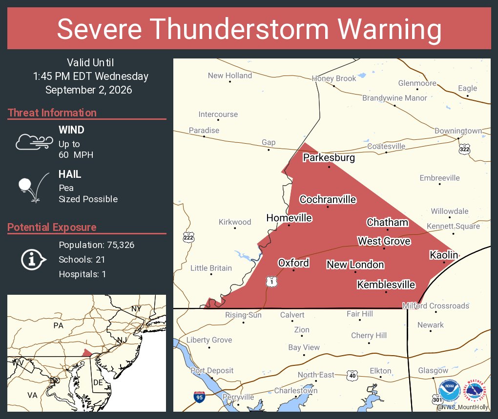
Severe Thunderstorm Warning continues for Wilmington DE, Newark DE and Bear DE until 9:15 PM EDT. This destructive storm will contain wind gusts to 80 MPH!