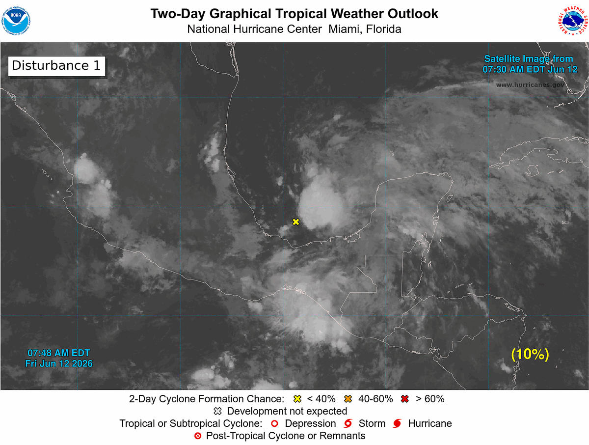
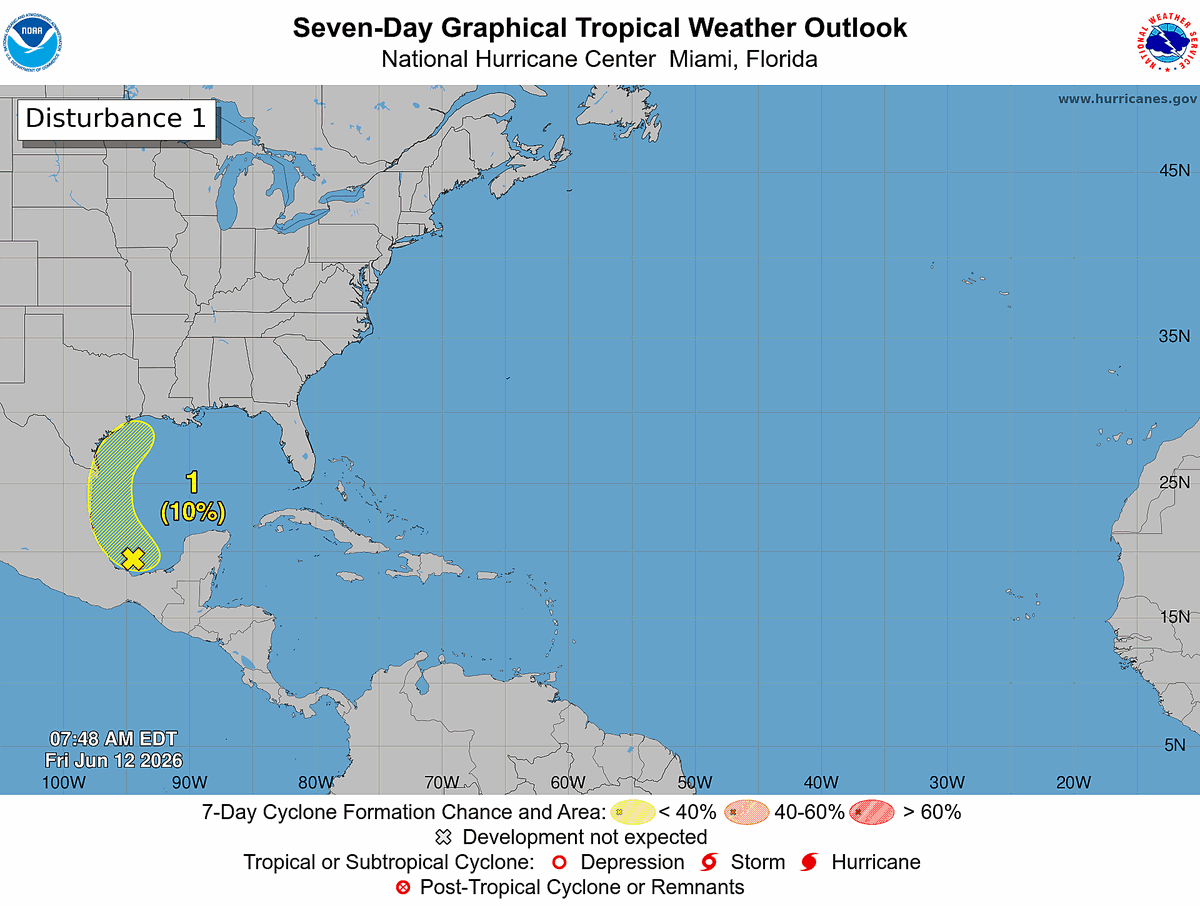
8 am EDT Fri, Jun 12: A broad area of low pressure over the southern Bay of Campeche is producing disorganized showers and thunderstorms. Any development before the system moves inland over eastern Mexico this weekend is expected to be limited. The system could re-emerge over the northwestern Gulf next week, but formation chances remain low (10%) through 7 days.
Monitor https://t.co/Wq6ZtKfHp9 for the latest forecast.
Outlook has a 10% Chance area over the Gulf from a trough and remnants of Cristina in the East Pacific. Recon tentatively scheduled later this week to fly to investigate. Chances are low anything develops, but will bring heavy rain to Mexico and possibly parts of Texas later.
Although still very unlikely to develop or be very strong, there could be an area to watch in the in little more than a week out from energy currently associated with the systems in the East Pacific.
Tropical Storm Amanda is in the east pacific, with two other areas there with chance to develop closer to land on the Pacific side. On the Atlantic side it remains very unlikely for anything to develop over the next week or two, although energy may wind up in the Gulf from the east Pacific, although a few models hint at something, the shear will likely cap anything from actually developing.
Still quiet in the Atlantic while the East Pacific has its first tropical depression. Through at least mid June unlikely to see any tropical system develop that starts from the Atlantic basin.
Today's the first day of the Atlantic Hurricane Season which lasts until November 30th. Right now there's nothing likely for the first week in the Atlantic, and over the next two weeks the most likely place to see development is not in the Atlantic, but in the east Pacific.
First week in June remains to be quiet in the Atlantic coming up, East Pacific is the area to watch in the near term. Wet pattern for the Gulf, however, but shear will likely keep out any tropical development.
Today marks the start of the Eastern Pacific Hurricane Season. Atlantic Outlooks also begin today. New radars, maps, and posting capability this year on https://t.co/A1iFilgcud
If you were fond of the old simple SFWMD radars for florida it's back on our site now. With other hurricane region radars as well in the same style. https://t.co/7cMNXd1B2h
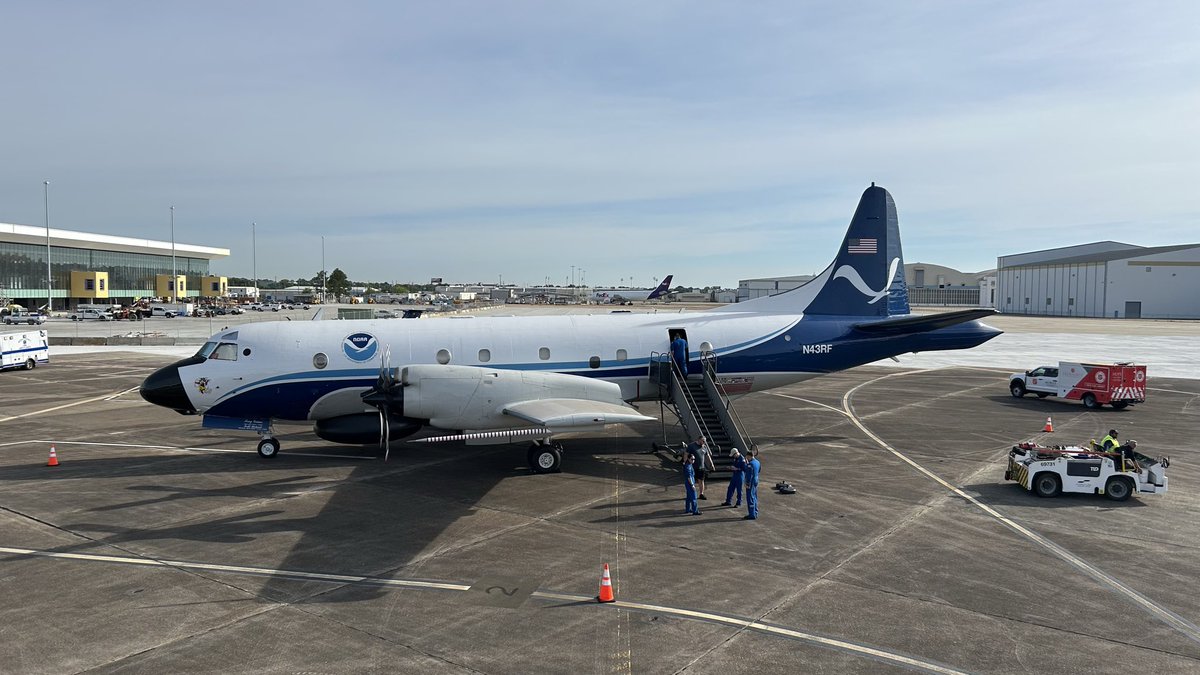
We’ve got some show offs this morning! Today is day 2 of the Hurricane Awareness Tour with @NWSMobile, @53rdWRS, @NOAA_HurrHunter, and @FederalAlliance.
Public tours are this afternoon at Mobile International Airport. More info: https://t.co/OBrgXJZkRF.
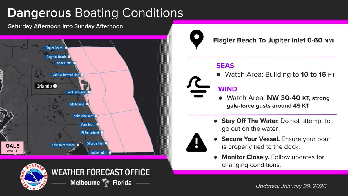
Jan 29 | An Extreme Cold Watch & another Freeze Watch have been issued beginning Sat evening. Frigid wind chills between 7-18 degrees are forecast Sun morning. Very windy conditions Sat afternoon will likely disrupt preparations, so protect pipes & plants by Sat morning