Another year, another entry for the #30DayMapChallenge - Day 8: Blue
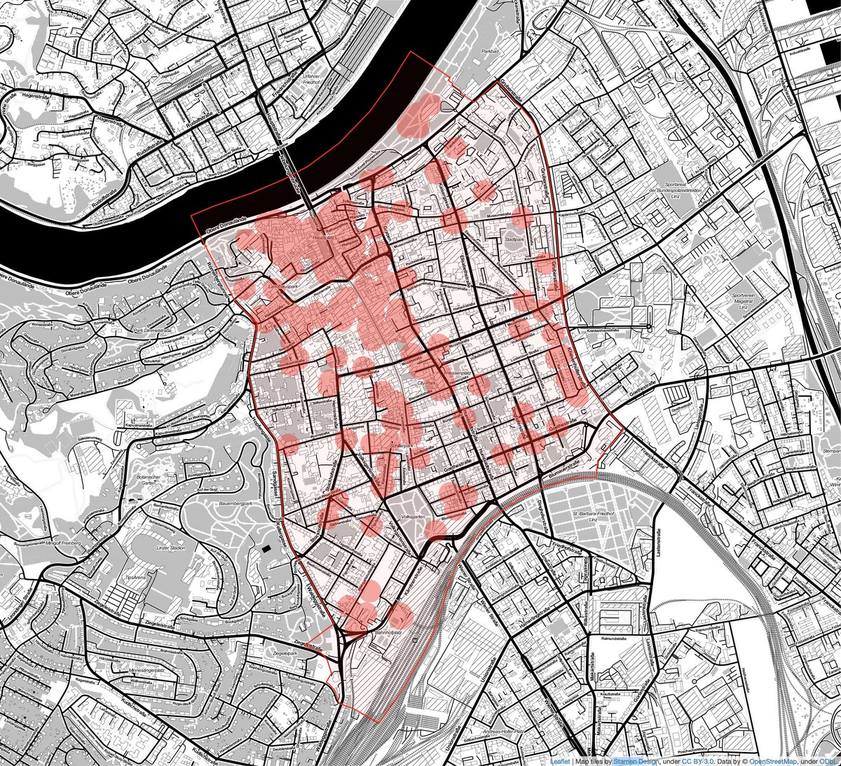
An interactive visualization of areas serviced by the upcoming #Wälderexpress train line in #Vorarlberg
you can also view it live at https://t.co/Bwcye1daBV :)
Today I’ll be talking with Christian Daube about @triply_at‘s journey as a sustainable startup and being a climate entrepreneur!
You can listen in live in a few minutes here https://t.co/FAG2nVudU2
#entrepreneur#ClimateActionNow@ClimateKIC
The first #LocWeb2021 paper "Cross-city Analysis of Location-based Sentiment in User-generated Text" is presented by @chrisstelz https://t.co/rghHKVgv77 #www21#thewebconf
And we are live now with the joint programme of #TempWeb and #LocWeb2021 at #WWW2021@TheWebConf :-) Programme is here, please join us in the MITeams system: https://t.co/rghHKVgv77
Crowd-Power gesucht: einfach in deine Hausgarage 🏠gehen , Parkplätze🅿️ zählen , Autos 🚗 zählen , und hier eintragen. ⬇️
https://t.co/3bM4VxZOGp
Damit wir endlich einmal wissen, wieviele private Stellplätze es in Wien gibt.
@lingosteve Really interesting read, Steve! I feel like patience is definitely one of the most important aspects when learning a language 😅
Do you think the flood of apps/websites for language learning is beneficial for staying focused and on learning a language or rather a bit distracting?
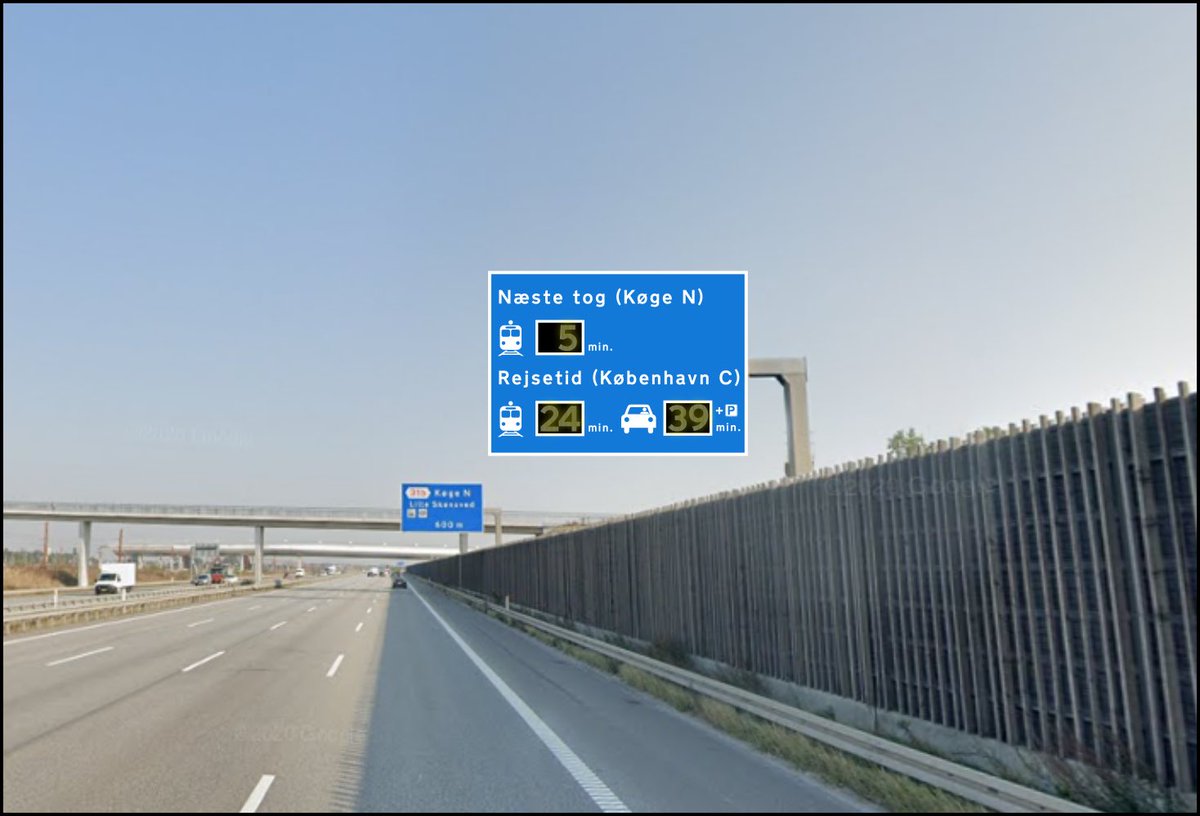
Whenever a train station is located next to a highway, there should be a sign informing about the next train in real time.
This is a proposal at the new Køge Nord station south of Copenhagen. (times based on rush hour situation)
I don't have another map for the last day of the #30DayMapChallenge, but it really was a blast! Thanks @tjukanov for all the cool prompts and thanks to everyone for the awesome #cartography and #geospatial inspirations!
Last day of the #30DayMapChallenge, theme: a map
And perfectly in time to announce the start of our collaboration with #carployee. Together, we'll help companies understand and improve their employees' mobility patterns.
@MikeCoatsDotCom Nice! @TNO_Research also made a really cool npm package for minifying geojson files that also allows you to remove unnecessary whitespace and filter which properties you want to keep or remove.
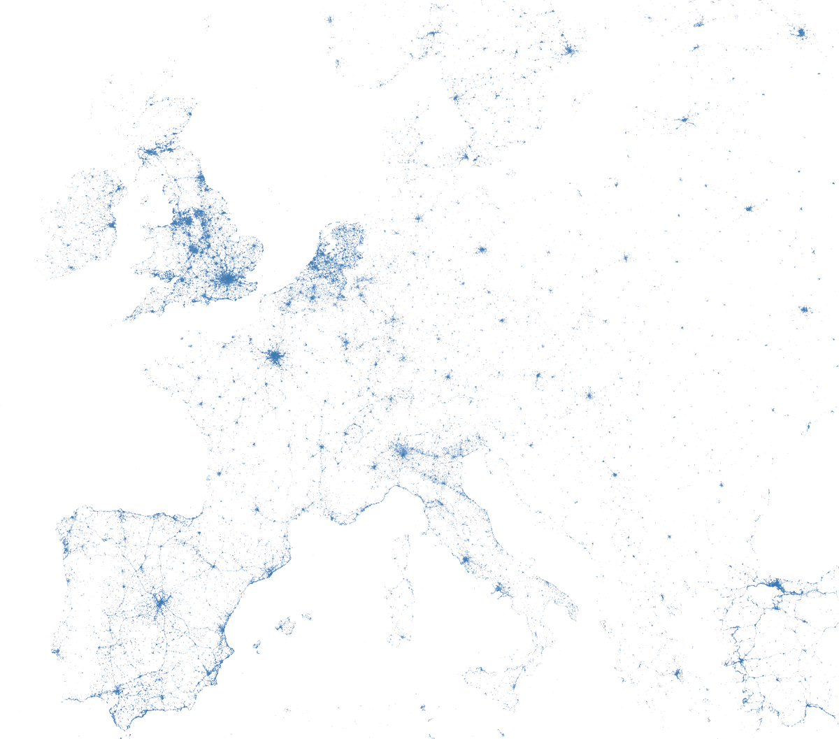
#30DayMapChallenge day 27 - big or small data:
A week of tweets in Europe - big data in cities and small data on the countryside.
Also my first try working with @datashader in python.
@HishamSajid I'm usually just using @matplotlib or geoplot for static maps. I heard that @datashader is supposed to be really fast if you're working with A LOT of data, but haven't yet got to test it.