Meteorologists and engineers achieved a🙌research milestone🙌when phased array radar was used in operations for the first time ever to help @NWSNorman forecasters warn of an EF-2 tornado that hit Caney, OK, on April 28. Read the full story: https://t.co/YzDnu4q2yV
We're co-sponsoring a Hydrology/Meteorology Interface workshop this week with @UA_CIROH, bringing together multi-disciplinary communities working in research on operational forecasting, hydrology & meteorology, and in communicating flood risks with public & emergency managers.
4 capstone students from @ENGINEERINGatOU's School of Aerospace and Mechanical Engineering, mentored by CIWRO, successfully developed a precision landing system for the CopterSonde. Great job, Hudson Brooks, Jesse Hodgson, Sarah Kemppainen and Brady Owens! https://t.co/1bMWbHDFrP
Our free, semester-long, middle school curriculum debuted in August. We now have registered users in 25 states, Taiwan and College Board! We estimate 8,480 students have benefited from "Weathering the Storm." Download it here: https://t.co/YaTS7n0IEc
We asked tornado researchers and emergency-preparedness experts for their advice on what to do and what to have on hand before, during, and after tornadoes. https://t.co/Mh4lPodtsA
If you've always wanted to be a Jedi ... this is your shot! Contribute to the design, implementation, and testing of AI/ML and deep learning approaches relevant to ensemble data assimilation and storm-scale prediction in MPAS–JEDI-based WoFS. Apply here: https://t.co/l5aSvFB2PP
.@CIWRO_ and @NOAANSSL social scientists use your anonymous feedback to help create better ways to get information to the public. Follow the link to share your story.
🌪️Had a close encounter with a tornado lately? 🌪️We want to hear from you!
#TornadoTales to help us understand how people react during a storm so we can improve safety communications.
📲 Share your tale: 🔗 https://t.co/oJ3FDD7skU
You can't have thunder without lightning!⚡️Stop by the CIWRO booth at the OKC Blue game on Tuesday to talk to our weather researchers about wind and lightning! Be a part of the demonstrations. @okcblue tickets start at $10 each: https://t.co/LBdJvGpoed
One Weather Picture. Many Critical Decisions.
⚡📡 The Multi-Radar, Multi-Sensor (MRMS) system combines data from radars and sensors across the country to paint a picture of what's happening in the atmosphere. @NOAAResearch@NOAA
🔗: https://t.co/XKGyiB7PbE
As a result of a nascent relationship between @UofOklahoma and India in weather, we had the honor of meeting the Consul General of India, Mr. D.C. Manjunath, last week @NWCNorman. In addition to leadership, he set aside time to meet with our researchers, students and postdocs.🌍
Blowing snow can drop visibility to near-zero, posing a serious hazard to both ground and air transportation. A collaboration between @NOAANESDIS and citizen scientists @GLOBEProgram is helping scientists better detect dangerous blowing snow.
Learn more about the collaboration and how you can participate: https://t.co/dI43HwmoIm
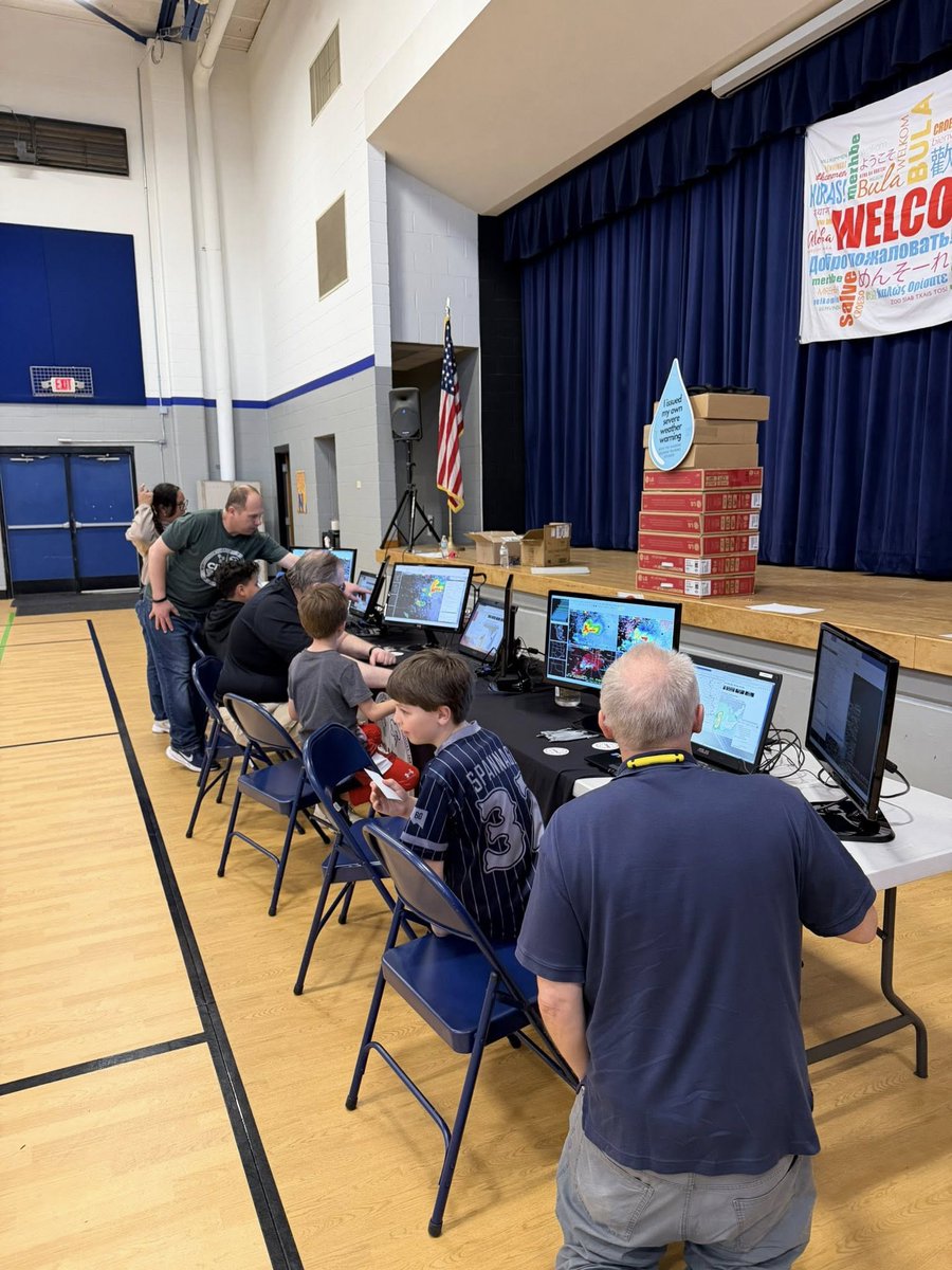
CIWRO researchers along with others from the @NWS Warning Decision Training Division visited Lincoln Elementary in Norman to show families how to issue their own simulated severe weather warnings. @NWSNorman
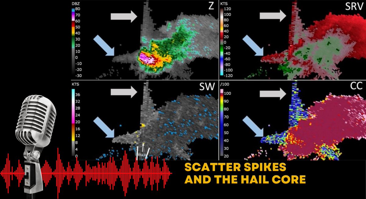
CIWRO researcher Jami Boettcher shares insight into scatter spikes from hail cores in a recent episode of @weatherbrains. Why do these spikes occur, and why do the radar images result in high confidence that hail is occurring? Netcast: https://t.co/XOaSOitY7g
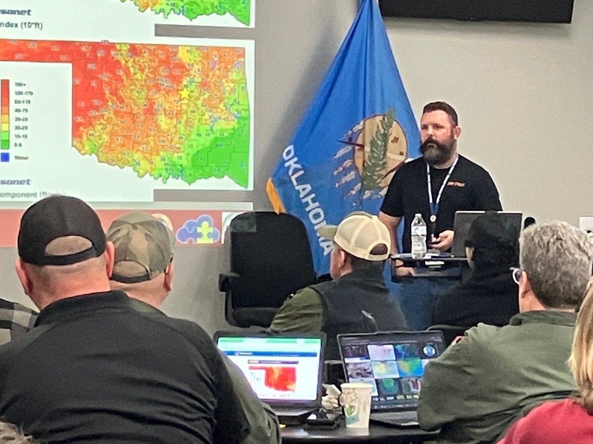
We gave guidance on navigating fire weather in Bartlesville today at @okmesonet's OK-FIRE workshop. Content included case studies and interactive lab exercises designed for landowners, wildland managers, firefighters, prescribed burn associations and public safety officials.
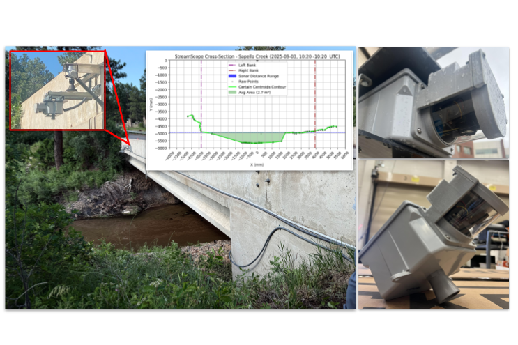
StreamScope is a low-cost, low-power scanning LiDAR solution built with commercial products and components. It is intended to be co-located with other stream sensors, and it provides fully automated, robust cross-section and area estimation for shallow streams. #AMS2026
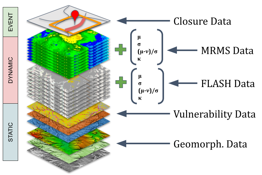
Missouri Dept of Transportation (MODOT) maintains a database of road closures related to flash floods. This dataset has been augmented by combining precipitation and streamflow data, with road vulnerabilities, preparing it for training road-closure prediction models. #AMS2026
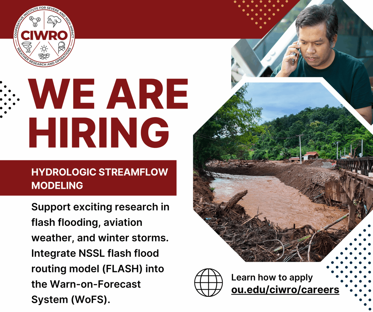
Support exciting research in flash flooding, aviation weather, and winter storms. Integrate the NSSL flash flood routing model (FLASH) into the Warn-on-Forecast System (WoFS). Apply now: https://t.co/flaqvot1i6