🚨 Is your family actually ready for hurricane season?
Your hurricane kit absolutely needs to include at least a 1-week supply of food, water, and medicine for EVERYONE in your house.
How many days of supplies do you usually prep for? 👇
#TropicalTuesday#nws
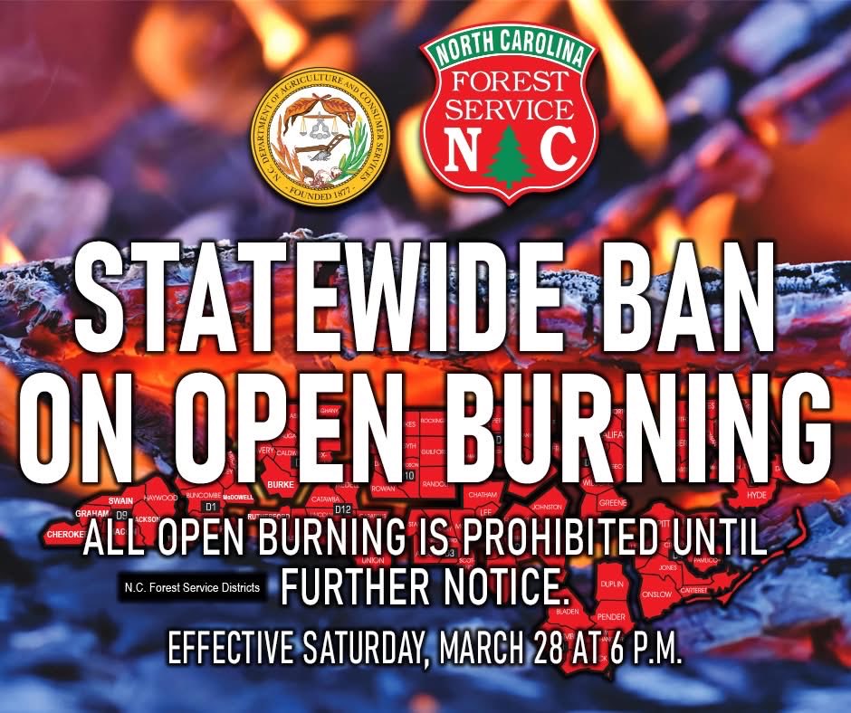
🚫🔥A reminder as you go about your beautiful weekend- a statewide burning ban remains in place!
👎 No burning yard debris.
👎 No campfires.
👎 No small fires on your patio.
👀 If you see someone burning, call 911 so it can be addressed before a problem starts.
#ReadyNC
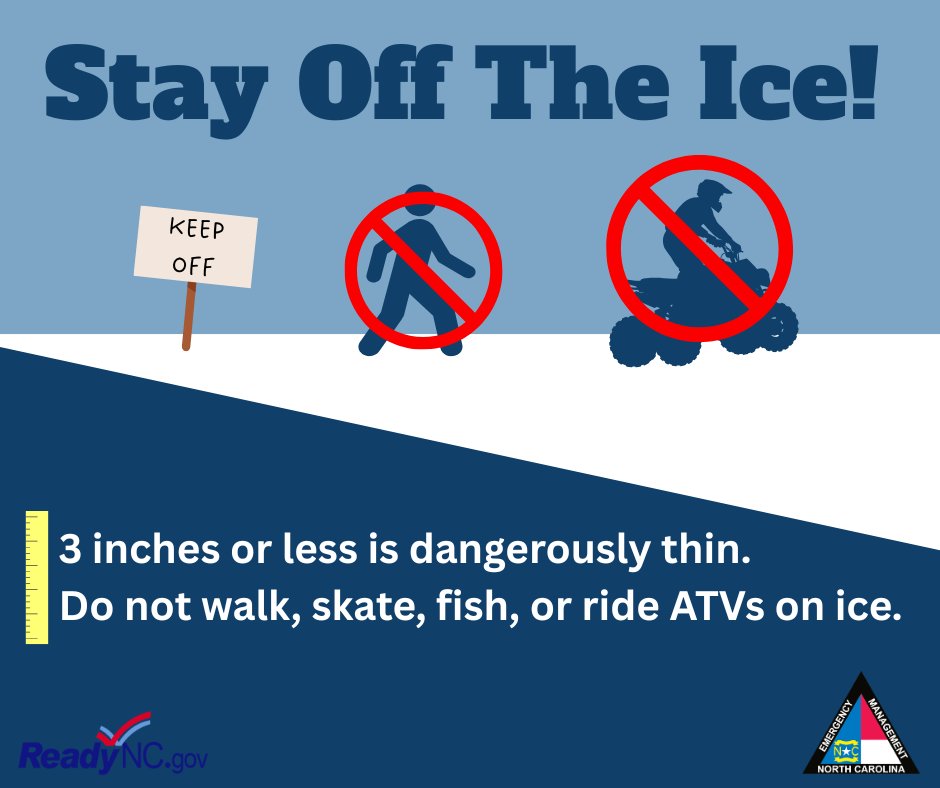
A thin layer of ice has formed on some of our ponds and lakes. While it may look solid, thin ice cannot support the weight of a person or a pet. Talk to your children and make sure they understand that frozen bodies of water are off-limits. #ReadyNC#SnowNC26
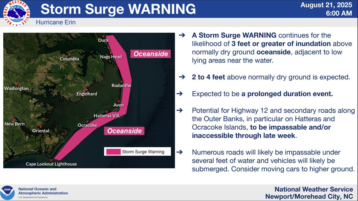
⚠️For those on the Outer Banks, we want to reiterate that the storm surge impacts are not over, even though #Erin is moving away. The next high tide occurs around 7:00 pm this evening, and the impact is expected to be similar, if not worse, than this morning's high tide. #ncwx
⚠Latest Info on #erin: https://t.co/CAZ6pY0eg1⚠
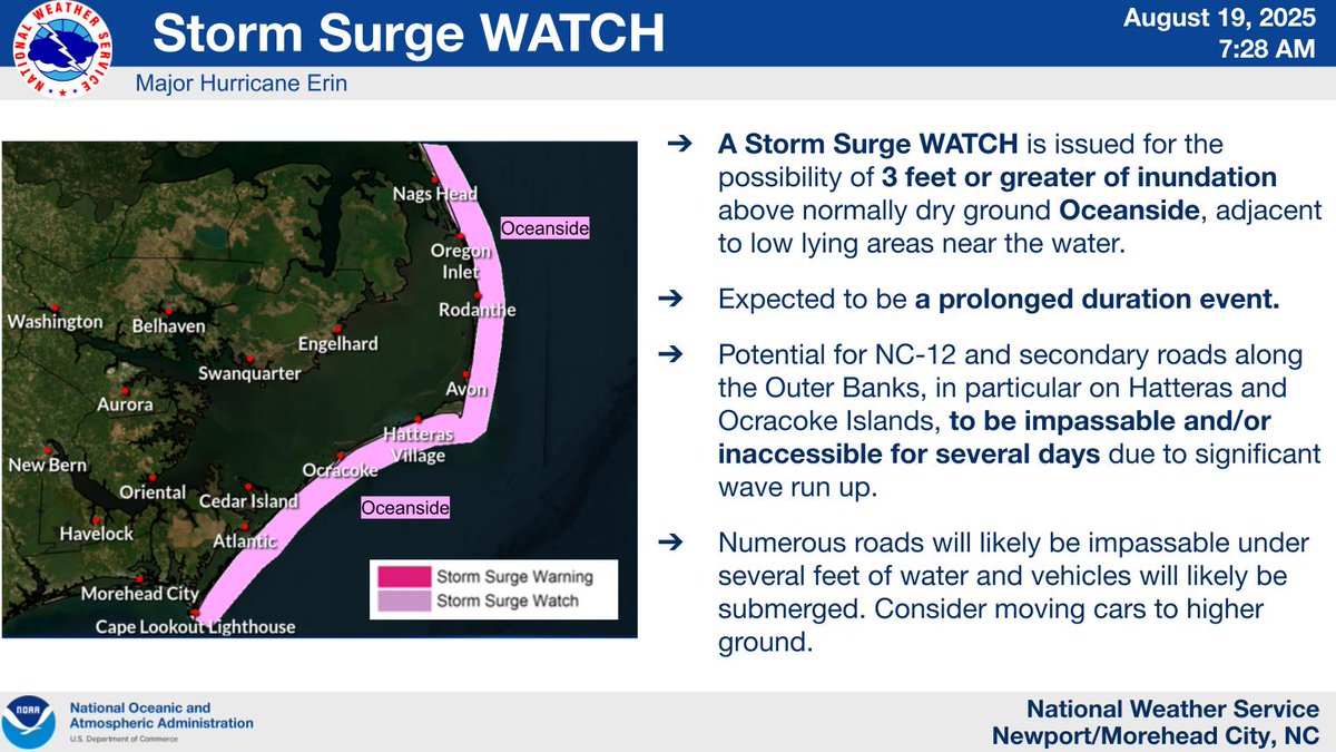
No major changes overnight. We should start seeing the first impacts of Erin later today at high tide along the coast (especially the Outer Banks). This update includes some values for coastal flooding and storm surge. #nws
Dare County remains under a State of Emergency and a Mandatory Evacuation order is in effect for Hatteras Island. Please note that N.C. Hwy. 12 may be impassable by August 19 at 5 p.m.
No mandatory evacuation is in effect for any other areas at this time.
https://t.co/1BSsk8RRsA
Confidence increased overnight for a significant winter storm impacting eastern NC tonight into Wed AM. Highest totals east of Highway 17 with 6-8" storm total, but all areas will likely see measurable snow. Isolated higher amounts possible. Full briefing later this AM.
OBXBeachConditions: DOUBLE RED FLAG conditions at all beaches. Ocean swimming not allowed, stay out of the water! More at https://t.co/U78MOwG18o
Ocean Rescue staffing at offseason levels. Many beaches covered by roving patrol. If help is needed, know your location - call 911!
Eastern scholarships and grants are due May 1st. This year we are accepting paper and electronic submissions. Find more information here https://t.co/H5JrPNoVUi
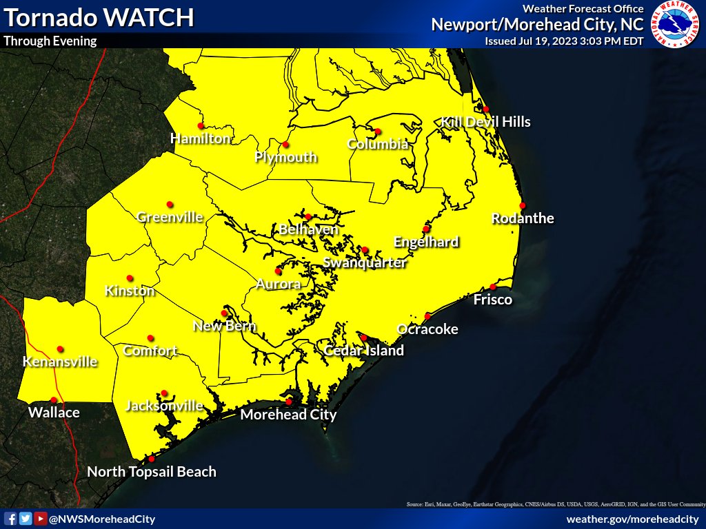
The Tornado WATCH has been extended southward to include most of Eastern NC. A Watch means conditions are favorable for tornado development over the next few hours. Make sure you have a way to receive warnings and be #WeatherReady#ncwx#SevereWeather
Rain fall is expected across the state through the end of the week. If you must drive, please remember:
✔️Make it easier for other drivers to see you. Have headlights on if your wipers are on.
👀Keep an eye out for debris in the roadway.
❌Never drive through flooded roadways.
4 pm - Here's an updated look at the potential impacts through Sunday night for the coastal low that will be moving through Eastern North Carolina. #ncwx
Christmas Day and Christmas Eve are among the leading days of the year for U.S. home fires. If you're hosting overnight guests for the holidays, be sure to discuss your fire escape plan with them. For more #HolidayFireSafety tips, visit: https://t.co/Nq8iKAtDBV
The projected highs for Christmas Day will be the coldest highs on Christmas Day since the late 90s or early 2000s. Don't forget about your pets this weekend! #NWS
Happy Halloween! Commissioner Causey urges families to follow these safety tips:
👻 Wear clothing that can easily be seen at night
🏎️ Walk and drive safely to avoid pedestrian accidents
🎃 Inspect your children's candy before they eat
MORE: https://t.co/FaHgXVxYFY