2026 Washington University McDonnell International Scholarship in USA | Fully Funded
Country: USA🇺🇸
Benefits:
⭐Full Scholarship & Living Stipend
✅Travel Costs
Category: Masters & PhD
Eligible: All Countries
Deadline: January 31, 2026
APPLY↙️
https://t.co/xJU9m8oIFB
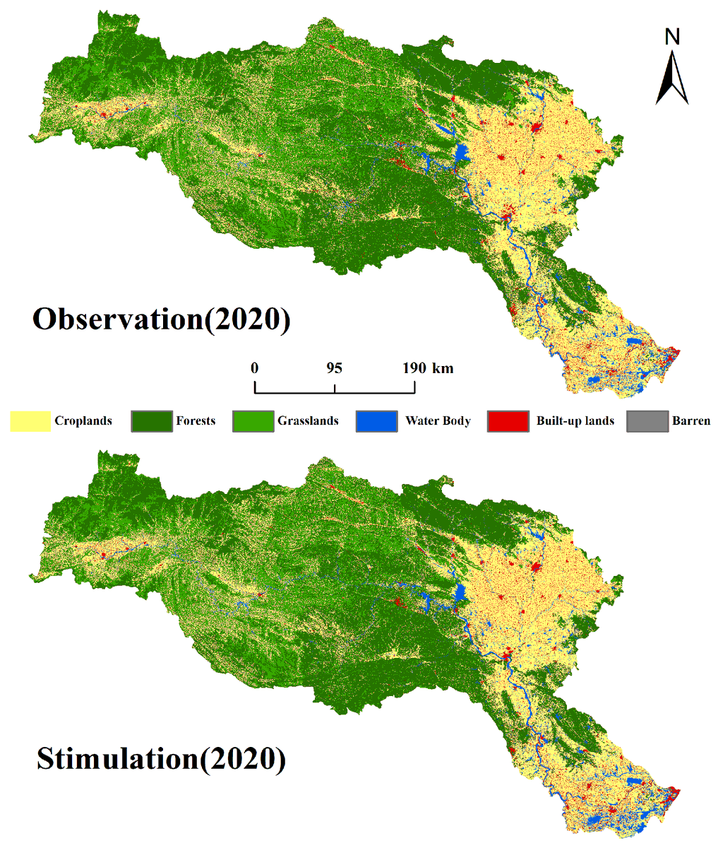
👉👉 Lacustrine #Wetlands#Landscape Simulation and Multi-Scenario Prediction Based on the Patch-Generating #LandUse Simulation #Model: A Case Study on Shengjin Lake Reserve, #China
✍️ Zonghong Zheng et al.
🔗 https://t.co/waD1g0Bm3f
Did you know? 🤩
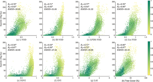
In China, the ability of microwave - derived Vegetation Optical Depth (VOD) to monitor AboveGround #biomass (AGB) was previously uncertain. But here's the breakthrough: L-VOD shows great potential!📈
Read: https://t.co/YSpBK1YnPd
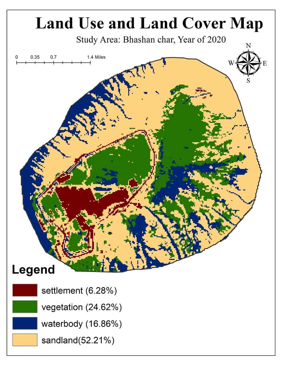
🌍 Exploring the Link Between Land Use Land Cover (LULC) and Climate Using Google Earth Engine (GEE) ☁️🌿
Tutorial Link: https://t.co/4MelubXPnH
🌐 Registration Link info : https://t.co/i4EFoxWxSm
#GoogleEarthEngine#RemoteSensing#ClimateChange#LandUseLandCover
January 4,2023 . W e have reached perihelion. Two week after winter solstice the earth orbit is closer to the sun than at any other of year a result of the earth elliptical .
Excited to present my research on Geospatial Analysis of Environmental Factors Influencing Land Cover Change in Mbeya &Songwe regions, Tanzania at #RemoteSensing2025 in Incheon, South Korea! 🌍🔍 Exploring how data reveals patterns of change over time. #Geospatial#Environmental
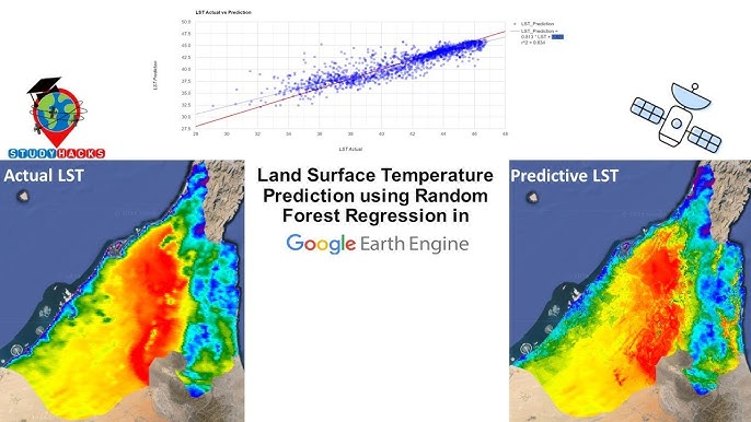
Calculate Land Surface Temperature(LST) classification using Google Earth Engine || Monitoring LST
Tutorial Link: https://t.co/xG53kcKQ4I
The Registration details: https://t.co/i4EFoxX5HU
#googleearthengine#gee#remotesensing#LST#geoscience
SAR Image Processing (Sentinel-1 & Sentinel-3) for Vegetation Monitoring and Time Series Analysis
Tutorial Link: https://t.co/dwRAGAsbGB
The Registration details: https://t.co/i4EFoxWxSm
#googleearthengine#SAR