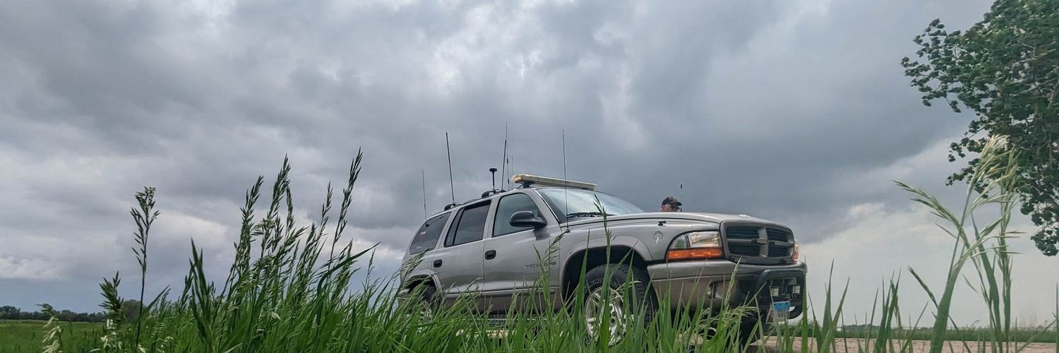
Storm chaser/Skywarn spotter/Spotter Network, former police officer/EMT/Firefighter/Emergency Management Secretary. Personal videos/pictures are my property
The SPC has added two new Slight Risk zones (Level 2/5) for severe weather today across Wyoming and the Ohio River Valley.
Here is a breakdown of the forecast for each region 🧵
A magnitude 5.6 earthquake rattled Northern California on Wednesday. A local resident describes the quake's violent shaking and shares the damage it caused inside her home. This comes ahead of two other major earthquakes in Japan & Venezuela earlier on Wednesday.
Here are the latest Key Messages highlighting a significant heatwave that is expected to impact the central and eastern U.S. later this weekend into next week.
12:56am CDT #SPC Day2 Outlook Enhanced Risk: over eastern Minnesota, much of Wisconsin, central and eastern Iowa, and northwest Illinois https://t.co/Y1WiOd8m1i
There is an Enhanced Risk of severe weather for portions of the Midwest on Thursday, June 11th.
Storms capable of strong tornadoes, large hail, and damaging winds potentially exceeding 75mph will be likely.
More details to come.
WISCONSIN is gonna receive the JOHNSON tonight, with tornadoes and big boy wing/hail all on deck to pound the Badger State. Kwik Trip will never be the same.
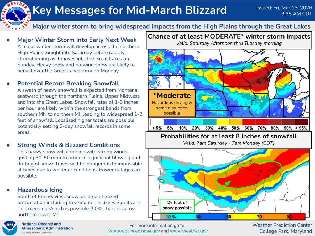
🚨 Major Mid-March Blizzard! ❄️💨
Widespread impacts from the High Plains to Great Lakes through Mon.
1-2+ft snow, Rates 1-3"/hr, Winds 30-50 mph;
Whiteouts likely. Travel will be dangerous/impossible. Power outages possible.
Stay safe! Updates at https://t.co/pGx1JRZdMa
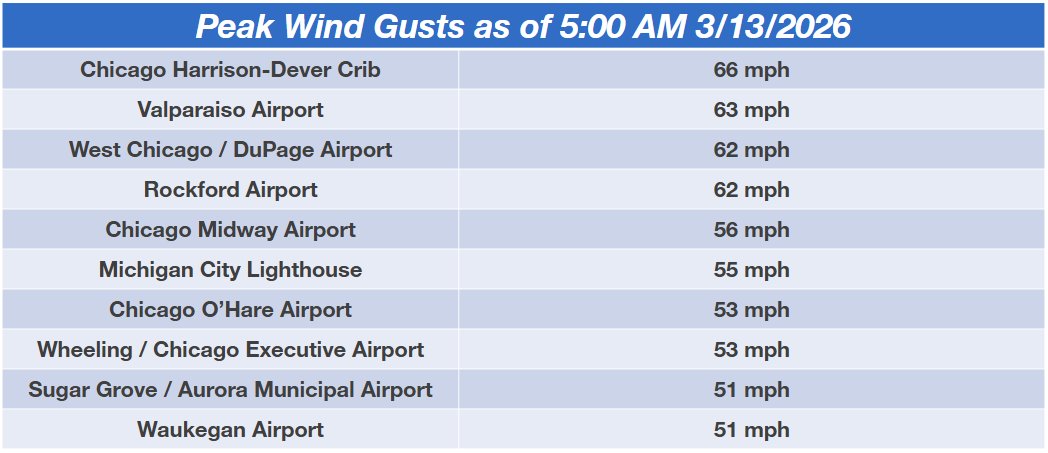
Here's a look at peak wind gusts as of 5:00 AM 3/13/2026.
Southwesterly winds will turn west this morning and routinely gust 45 to 60 mph through this afternoon. #ILwx#INwx
Get ready for a WHOPPER of a storm system Sunday, March 15, 2026. This will be impactful for everybody in the central and eastern United States.
A dangerous severe weather episode will affect much of the Midwest and Mississippi Valley, with the potential for 60-80 mph straight-line winds and tornadoes, a few of which could be significant. We're anticipating a QLCS, or squall line with damaging gusts and embedded kinks of spin.
On the system's cold side, a blizzard is expected with up to 2+ FEET of snow in Wisconsin and the Upper Peninsula of Michigan. The mitten, meanwhile, will deal with a possible ice storm... simulated ice accretions are trending upwards and could bring power outages.
Then, behind the system, strong northwesterly winds will bring rapid drying. That will promote concerning fire weather over the Plains. It's too early to forecast a wildfire outbreak, but the High Plains in particular will be very susceptible to fire weather.
Air travel Sunday will be a mess. You'll have to reschedule flights. Probably best to contact your airline sooner rather than later as soon as fee waivers are issued.