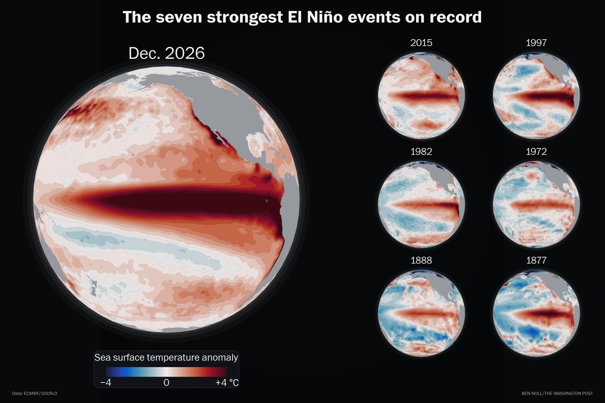
This year's El Niño will dwarf the six other super El Niño events on record.
A projected +4.1°C rise in central Pacific Ocean temperatures by Dec. 2026 would leap past previous peaks of +2.8°C to +3.0°C in 1877, 1997 and 2015.
No one alive has witnessed an El Niño this strong.
Good example why the A.I. assisted Community Notes are often garbage for science. The bot adds that "NOAA states the forecasted El Niño would rank among the largest since 1950, not the strongest in 500-100 years"
--> because the NOAA records only go back to 1950, and obviously can't address my claim/conclusion, which is based upon climate proxies which @grok certainly knows.
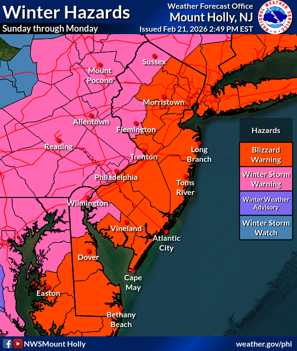
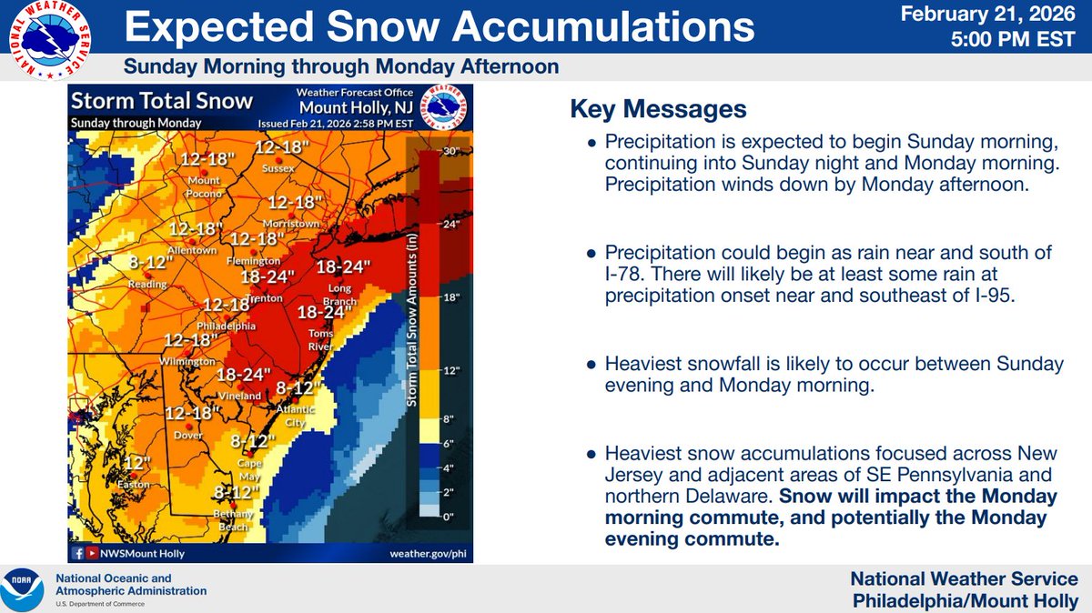
A major winter storm w/ blizzard conditions impacts the region Sunday and Monday.
❄️ Total snow: 12-20", locally 24"+
💨 Wind gusts: 50-60 mph along coast
Expect white-out conditions Sun night into Mon AM. Travel will be dangerous, if not impossible.
💻 https://t.co/TePWIEDYix
⚠️❄️🌬️ There remains high confidence in a significant winter storm impacting the area Sunday-Monday. Blizzard Warnings have been expanded further inland, whereas Winter Storm Warnings are now in effect elsewhere. Heavy snow will begin Sunday night. (1/3)
#NJwx#MDwx#PAwx#DEwx
August 16: 11:20AM AST @53rdWRS find #Erin is now a Category 5 Hurricane with maximum sustained winds of 160 mph. Visit https://t.co/tW4KeGdBFb for the latest
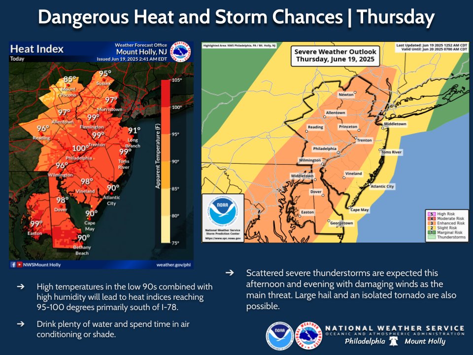
Dangerous heat will continue today, with heat index values of 95-100 expected generally south of I-78. Scattered severe storms are expected this aft/eve, with damaging wind as the primary hazard. Low potential for hail and a tornado or two will also exist. #NJwx#PAwx#DEwx#MDwx
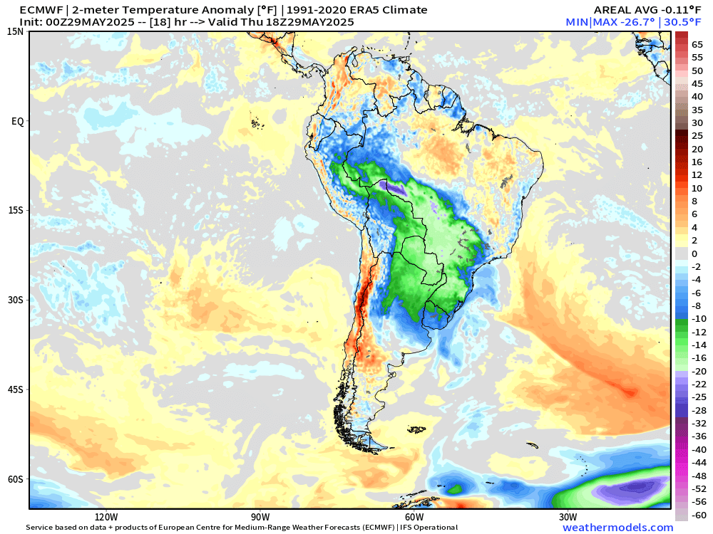
Not everyday you see a cold front draw on the map in South America at 6°S latitude into the Amazon Rain Forest.
Antarctica origin air from days back finally makes its way to the Equator.
@xAI has acquired @X in an all-stock transaction. The combination values xAI at $80 billion and X at $33 billion ($45B less $12B debt).
Since its founding two years ago, xAI has rapidly become one of the leading AI labs in the world, building models and data centers at unprecedented speed and scale.
X is the digital town square where more than 600M active users go to find the real-time source of ground truth and, in the last two years, has been transformed into one of the most efficient companies in the world, positioning it to deliver scalable future growth.
xAI and X’s futures are intertwined. Today, we officially take the step to combine the data, models, compute, distribution and talent. This combination will unlock immense potential by blending xAI’s advanced AI capability and expertise with X’s massive reach. The combined company will deliver smarter, more meaningful experiences to billions of people while staying true to our core mission of seeking truth and advancing knowledge. This will allow us to build a platform that doesn’t just reflect the world but actively accelerates human progress.
I would like to recognize the hardcore dedication of everyone at xAI and X that has brought us to this point. This is just the beginning.
Thank you for your continued partnership and support.
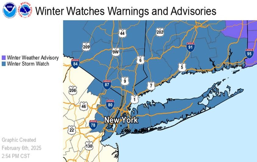
A Winter Storm Watch is in effect for the entire forecast area for Saturday night through Sunday morning. We will have additional details with a briefing in a little bit. #NYwx#NJwx#CTwx
Some Thanksgiving morning rain is expected, with rainfall amounts generally around 0.25-0.75". Following that, a period of below normal temperatures are expected Friday through at least Tuesday with high temperatures mainly in the upper 30s/low 40s. 🥶🥶 #NJwx#PAwx#DEwx#MDwx
Record-breaking #heat is forecast to expand from the Midwest and Great Lakes to the Northeast this week, potentially lingering through early next week. The duration of this heat wave is notable and potentially the longest experienced in decades for some locations.
Remember this date a year ago? The great Canadian smoke-out blotted out the sun as smoke from raging wildfires poured southward across our region. Lets hope this doesn't happen again any time soon!
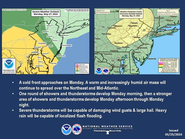
Good evening! There will be some showers and storms moving into eastern PA this evening and some of these could produce gusty winds and heavy rainfall. Widespread severe weather is not expected. A bigger concern for Monday when storms may bring both severe weather and flooding.
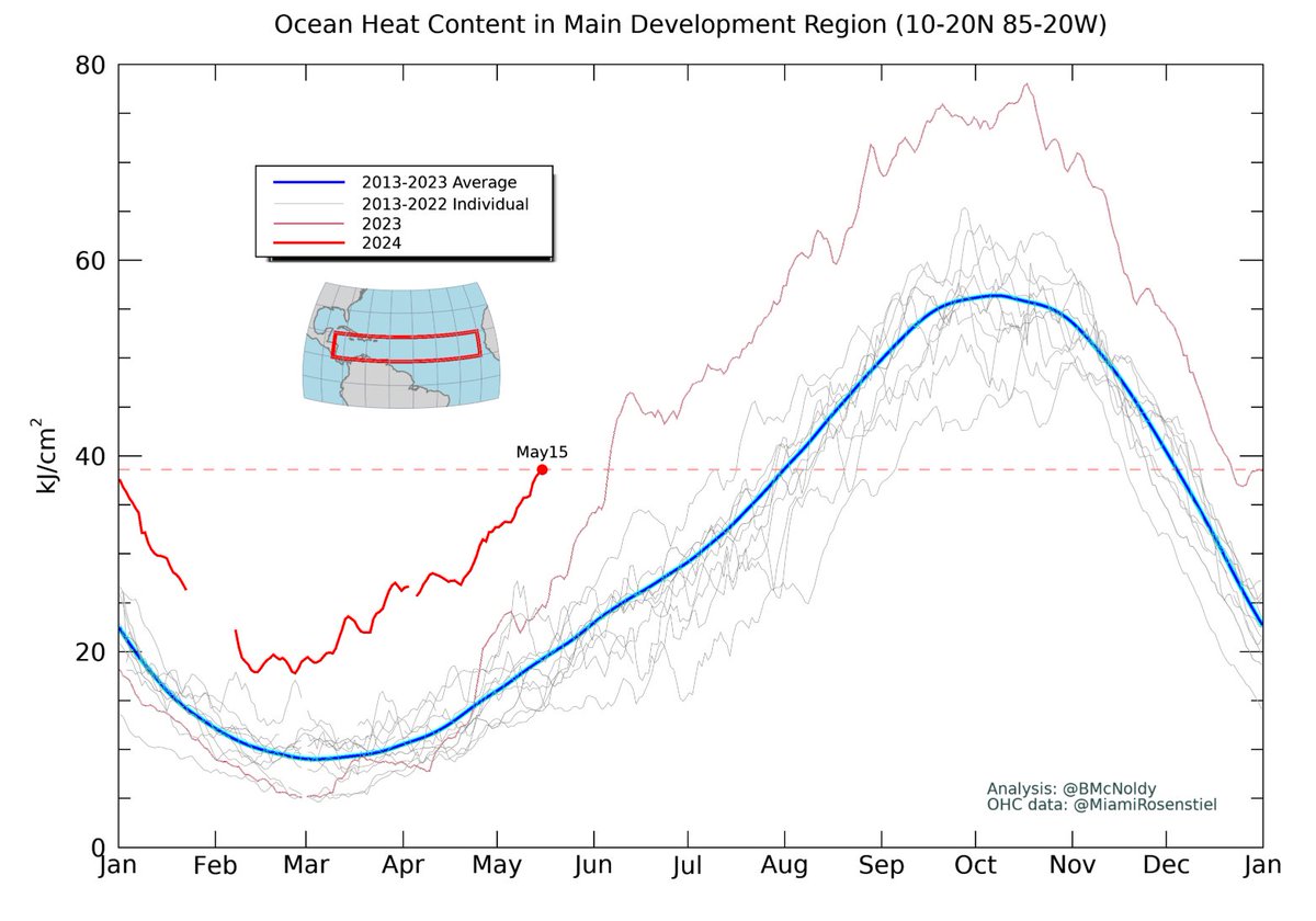
Today's ocean heat content in the Atlantic Main Development Region for #hurricanes is typically reached on August 1st. We're currently running about 2.5 months ahead of schedule.
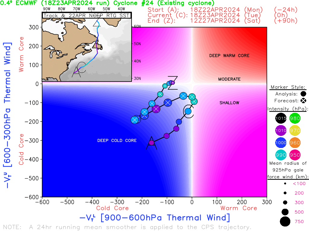
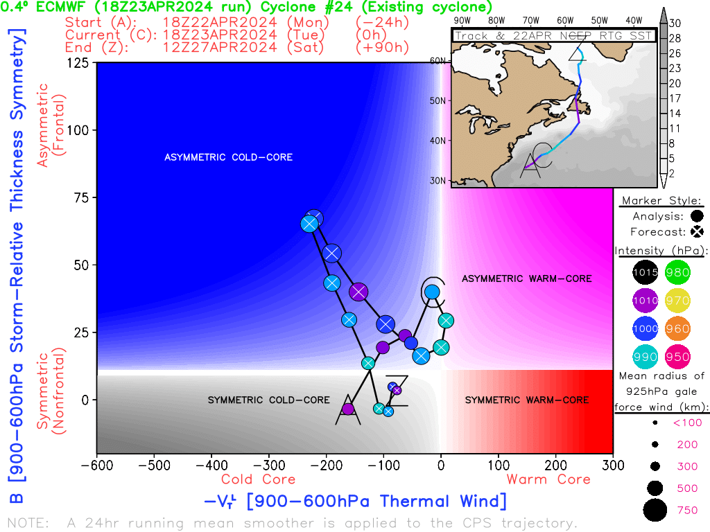
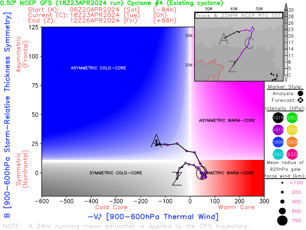
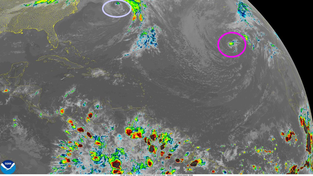
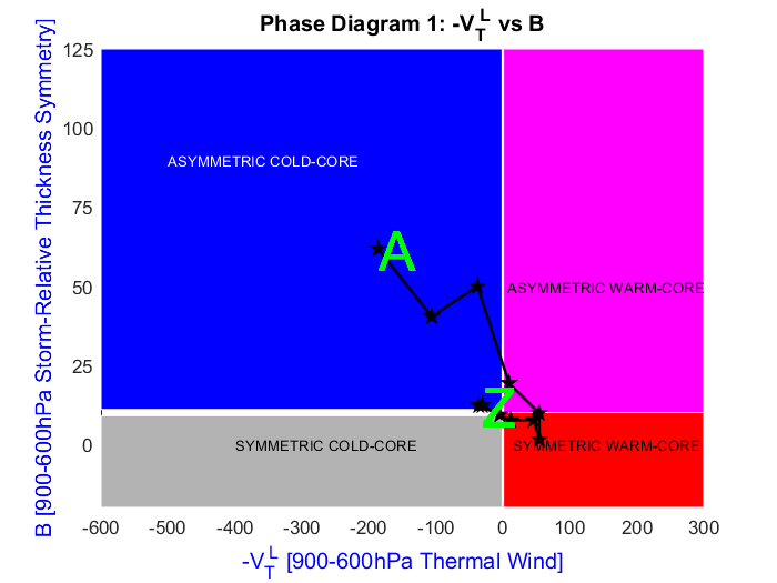
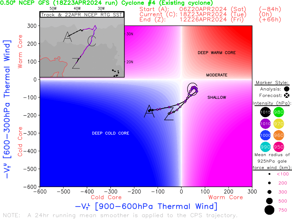
A subtropical cyclone has likely formed in the North Atlantic. The extratropical cyclone well offshore of the eastern CONUS may try to transition into a subtropical cyclone as well within in the next 24 hours.
@KacperWx "For extremely small tropical cyclones, a radius smaller than 500 km may be necessary to accurately calculate the thermal symmetry of the tropical cyclone."
@KacperWx Highly recommend you check out https://t.co/J1Wgqztn3V. From Hart (2003): “Since the radius chosen for calculating B is based upon the mean horizontal size of a distribution of 143 tropical cyclones (Frank 1977), there will be exceptions where the chosen radius is insufficient."