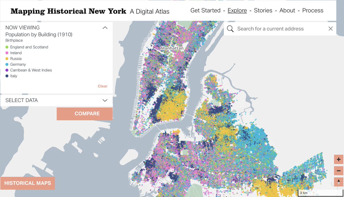
launching a digital atlas today, bringing together census data and historical maps for MN and BK 1850-1910
take a look: https://t.co/eLQhLPWHM7
@c4sr_columbia@CUHistoryDept
New episode! In our third #PLN8 podcast, @nicolette_hayes interviews @danmillr & @ebrelsford about our recent work with Columbia University's Center for Spatial Research on a historical map of #NYC. Learn more and listen to the podcast here: https://t.co/7lQbOtiIoN @c4sr_columbia
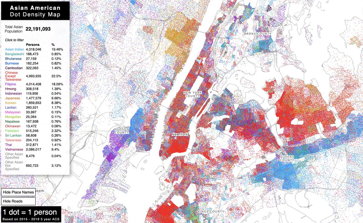
A new project - Asian American Dot Density Map. https://t.co/ZYU669zSHU This takes a few seconds to load... 1 dot per person is a lot of dot density!
And here are some thoughts on how and why I made it https://t.co/nmKTQ3Bjbo
happy to hear so much love for @nypl_labs at this Mapping Historical New York: A Digital Atlas Confirmation talk by @ColumbiaGSAPP https://t.co/1HI3KpcS1V