This is a super cool website.
You can scroll around and look at any country's population pyramid, fertility rate, and mortality rate by year.
Check this out:
235 years of American settlement in one shot. Watch the frontier cross the Mississippi, then look at how much of the map is STILL empty in 2025.
#dataviz#maps
The Empire State Engagement in 3D.
The helicopter is half a mile from the happy couple, but it's really zoomed in, about 100x. So while it looks like it's circling (as the background moves fast), it does not really change angle very much.
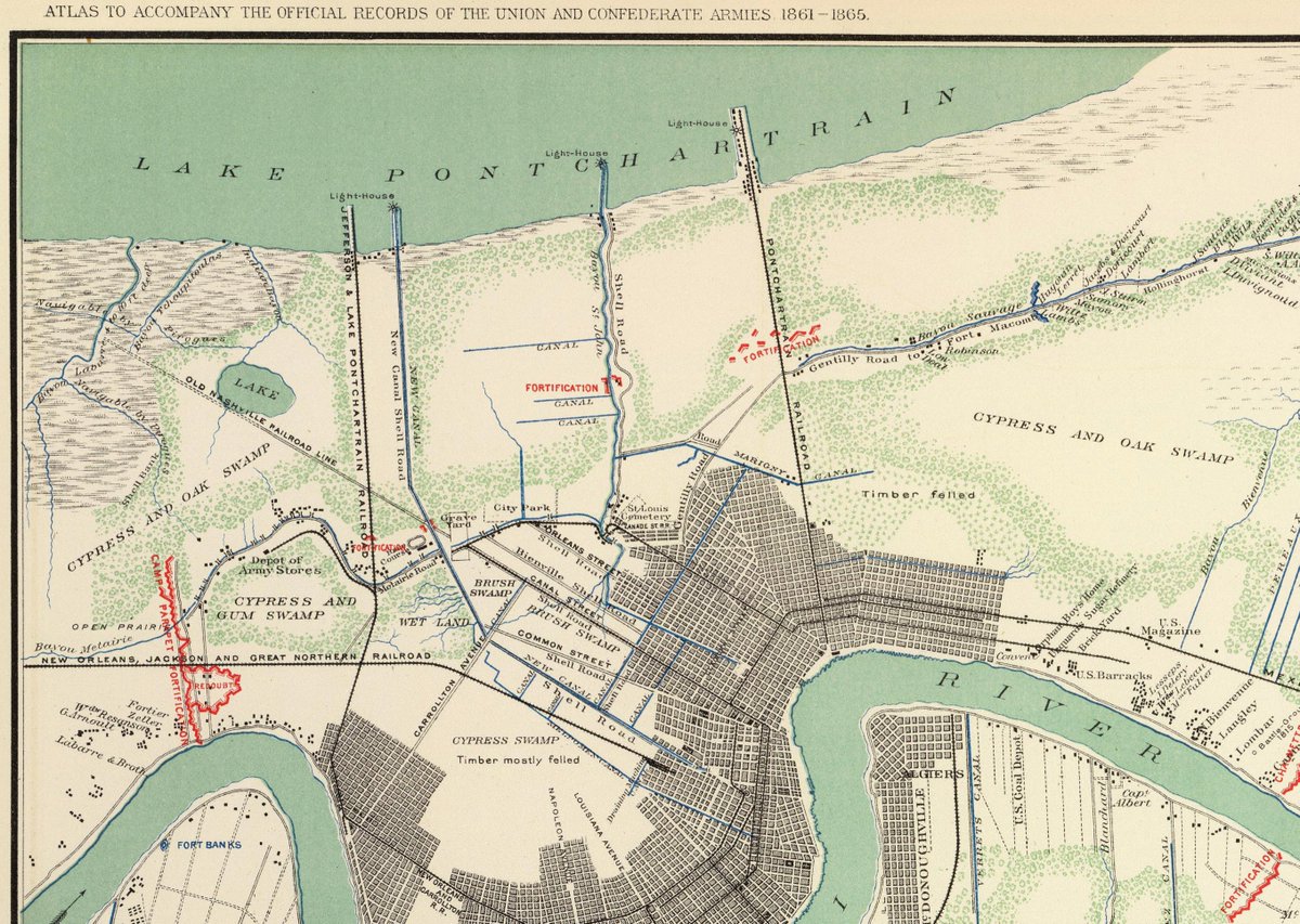
I have always been intrigued by maps, especially those drawn before my time. They sometimes tell and paint a story better than history books. Like this, the "Gen. Banks map" which was drawn during the occupation of New Orleans at the time of the Civil War. It depicts the "New Canal" or New Basin Canal. Note how far into the city it reached from Lake Pontchartrain. To the right, Bayou St. John which reached well into the city. Both were major avenues of transportation. Many are surprised to learn that much of the city commerce began from the Lake and not the Mississippi River. Turning to the west, note the curving Bayou Metairie which is also Metairie Road. And finally, looking at this map, it is no wonder we have pumping stations and drainage canals everywhere. New Orleans and Metairie really were built in a swamp! As for General Banks or "Spoons", that's another story. (map is from Library of Congress)