#StormFloris moves in through tonight and tomorrow with the strongest gusts expected across Scotland during Monday afternoon.
Quite a potent, deep area of low pressure for the time of year.
🚨BREAKING: IT’S RAINING, HAILING, SNOWING & FLOODING IN ITALY - ALL ON THE SAME DAY
In August.
Totally normal, right?
Or maybe someone’s been playing with the weather machine again
After a quiet storm season so far, the Atlantic Ocean is waking up, with a number of tropical waves expected to leave the west coast of Africa during the next week.
These are what can potentially develop into hurricanes.
Statistically, the peak of season is mid-September.
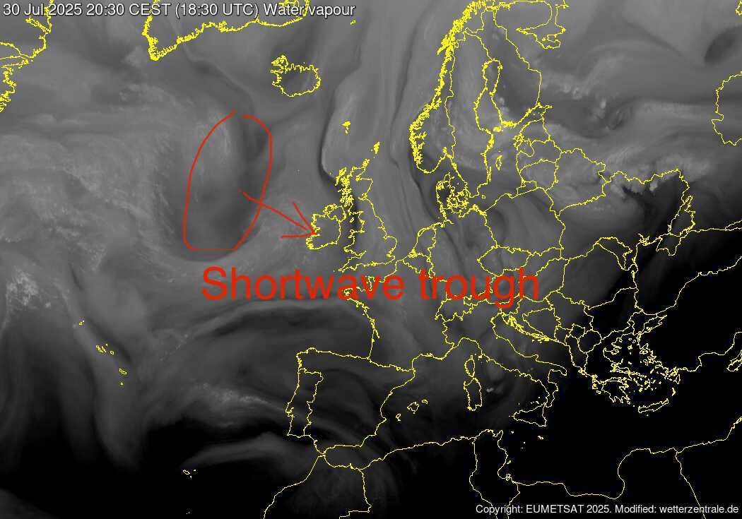
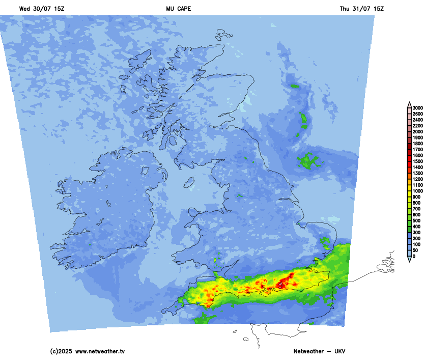
Pictorial explainer of why I have delineated a 60% risk of thunderstorms across coastal southern England tomorrow afternoon due to convergence. However, risk of storms elsewhere across southern UK as shortwave trough moving ESE creates lift of warm/humid airmass across the south
🚨⚡️BREAKING AND UNUSUAL
During the earthquake, while doctors were at work 🚑—despite the intense tremors—surgeons at the Oncology Center in Kamchatka continued performing the operation.
The Ministry of Health confirmed that the patient's condition is stable.
This is insane.
Wildfires are ripping through Turkey following record breaking temperatures.
Drough & strong winds are exacerbating the intensity of these fires.
The BBC and the @metoffice are forming an exciting new partnership to deliver the most trusted and accurate weather service to everyone in the UK
Find out more ➡️ https://t.co/vJnPq6kLLF
Today: Typhoon Gaemi is wreaking havoc in Ningbo, located in China’s Zhejiang Province.
Authorities have evacuated 283,000 residents and relocated them to over 1,900+ emergency shelters for safety.
The details of Monday's disturbance aren't nailed down yet, but it looks potentially significant. A very wet and windy weather looks very possible, especially in the north and west
Sting Jet being modelled here by the ECMWF for next Monday with the rapidly deepening low coming into NW Scotland, Upper trough pattern is highly confluent with 150 Knt Jet core over Northern Ireland and likely strong confluent pressure rises coming into the West. ECMWF is modelling 110 mph gusts approaching Western Isles,
GFS has backed down and has a weaker centre further to the SW which moves east under the warm side of the Jet
~There is some growing ensemble support for a vigorous low to come close to NW Scotland early next week .
The ECMWF Dalmatian plot shows the Deterministic Control run was amongst the deepest of the 51 member future, many were weaker and further south.,
Suggest the op run is kept at around 20% risk at this time, awaiting further support from other met centre modelling and greater ensemble support