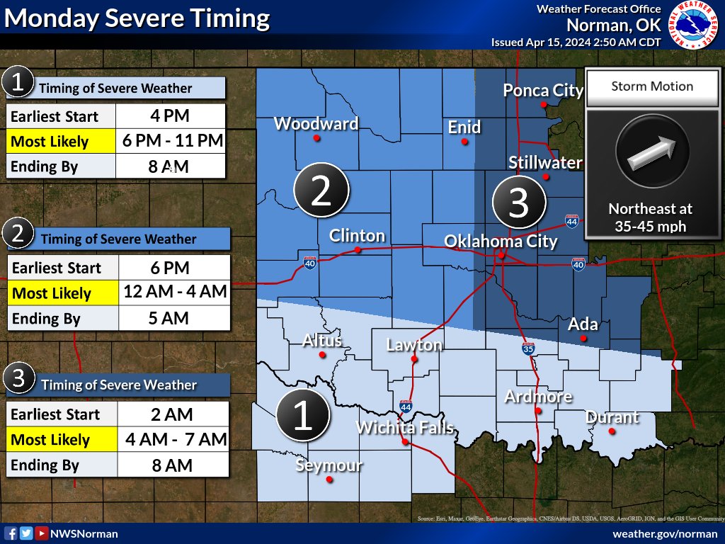
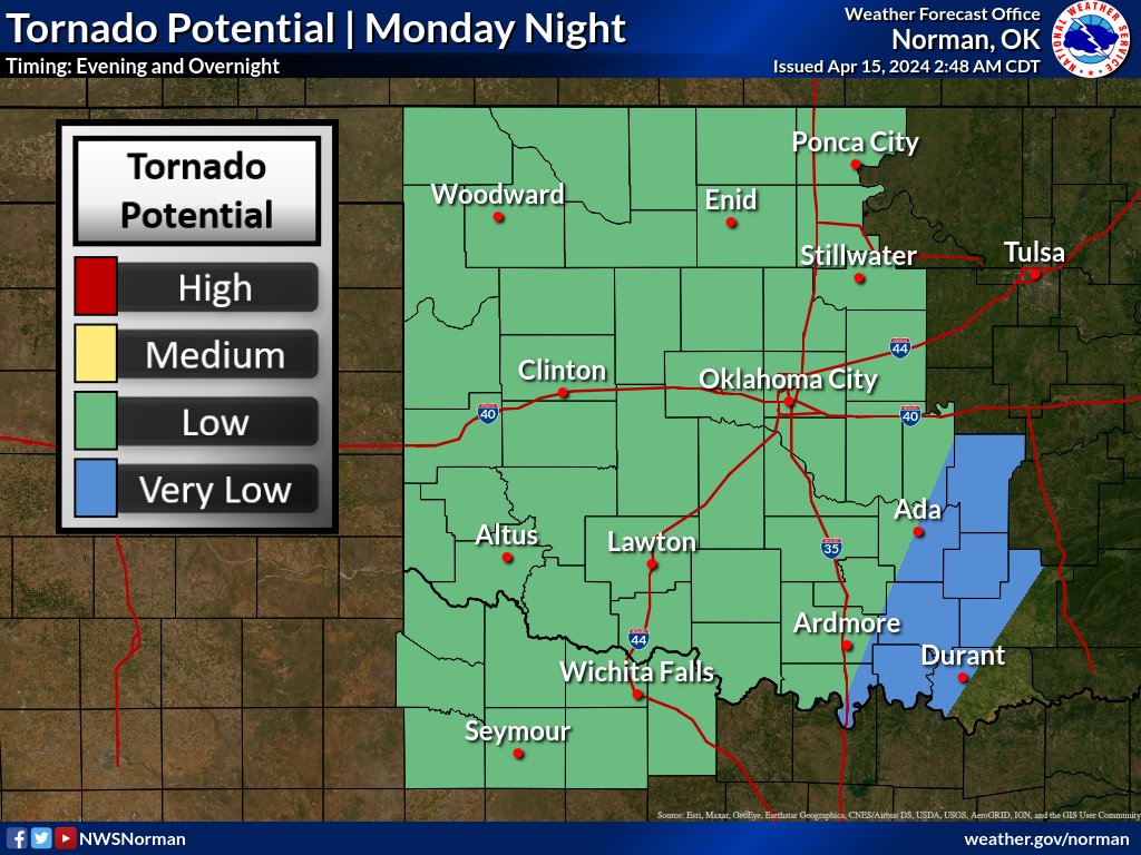
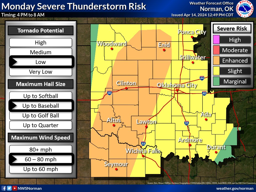
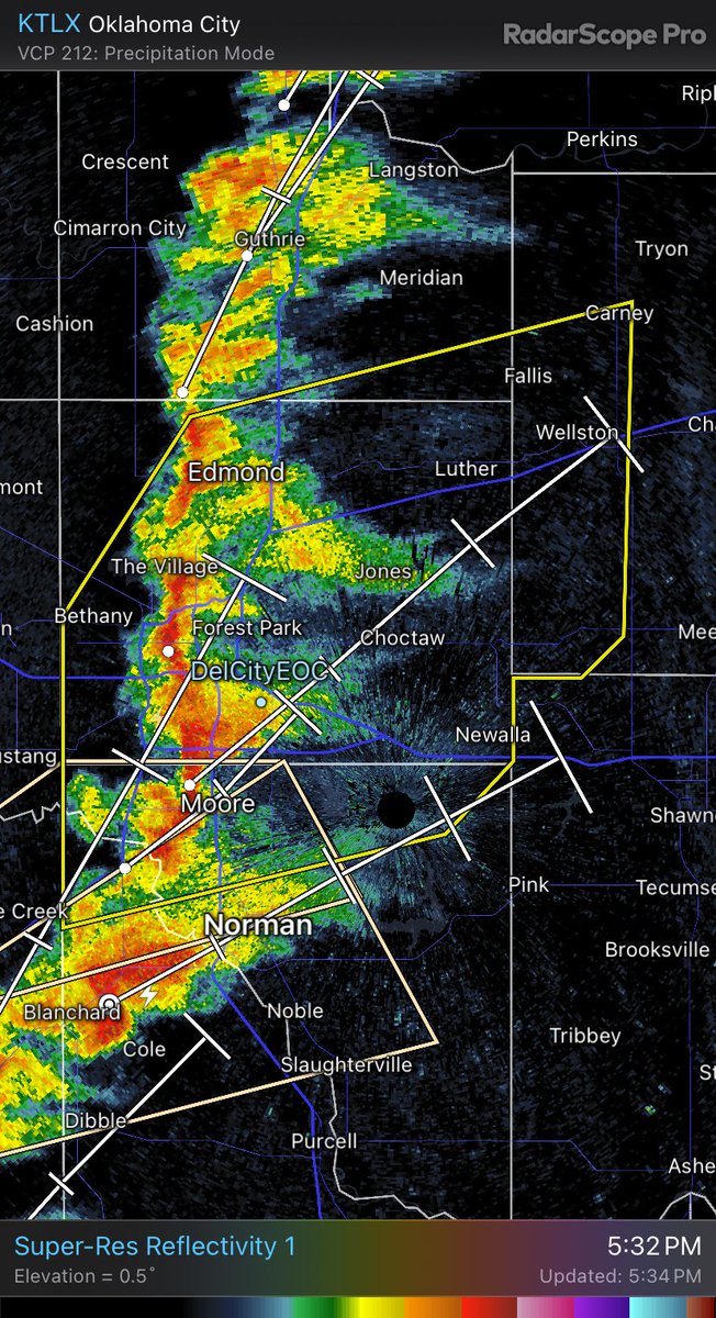
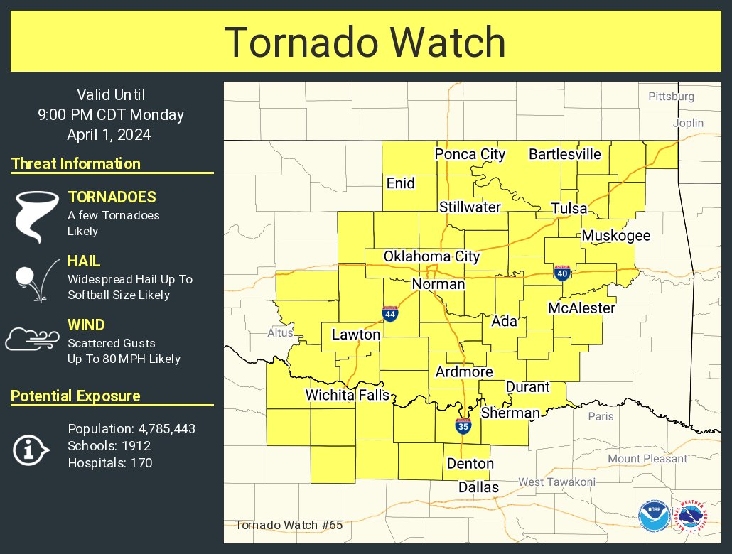
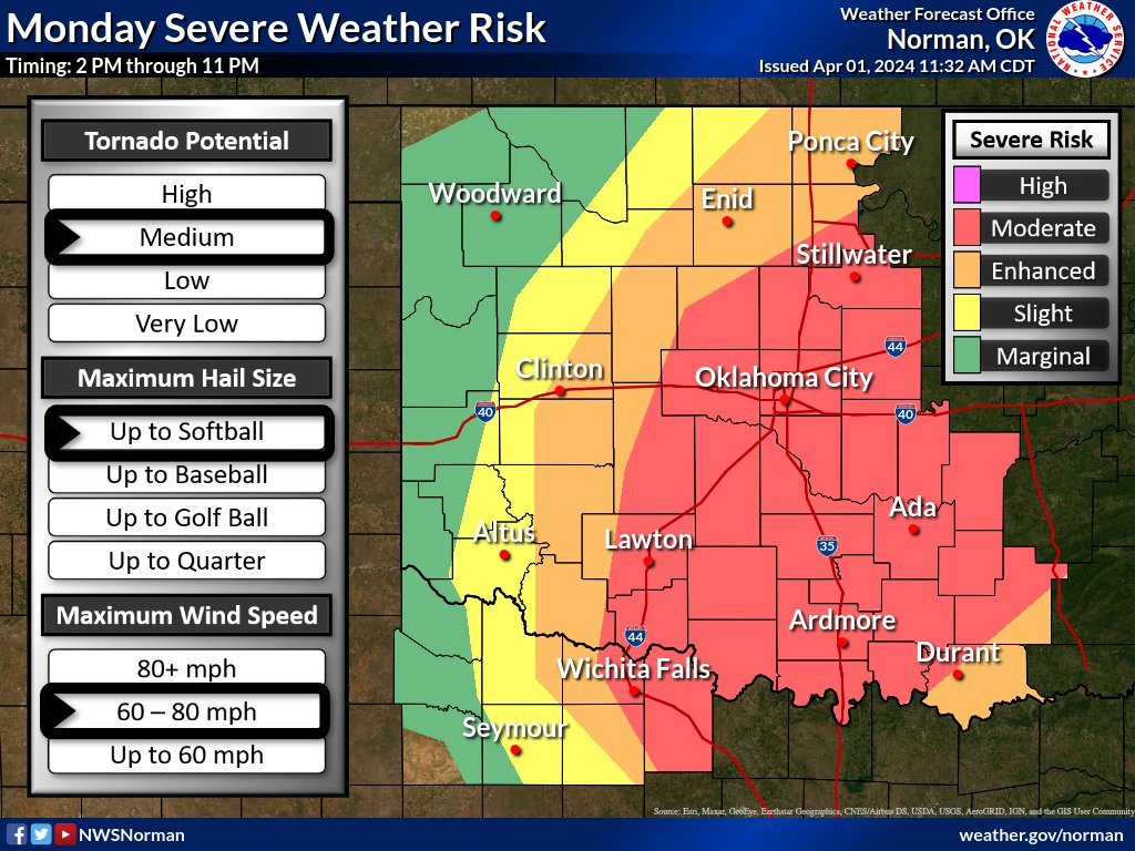
Severe storms are still possible this afternoon through the overnight hours will all hazards possible. Main change to the outlook was removing the enhanced risk from the entire area. Nevertheless, make sure you are weather aware today! #okwx#txwx
1:00 pm Sunday - Severe weather remains likely tomorrow afternoon through early Tuesday morning. The tornado risk will be low, but non-zero. Make sure you have ways to receive warnings even if you're asleep when they're issued.
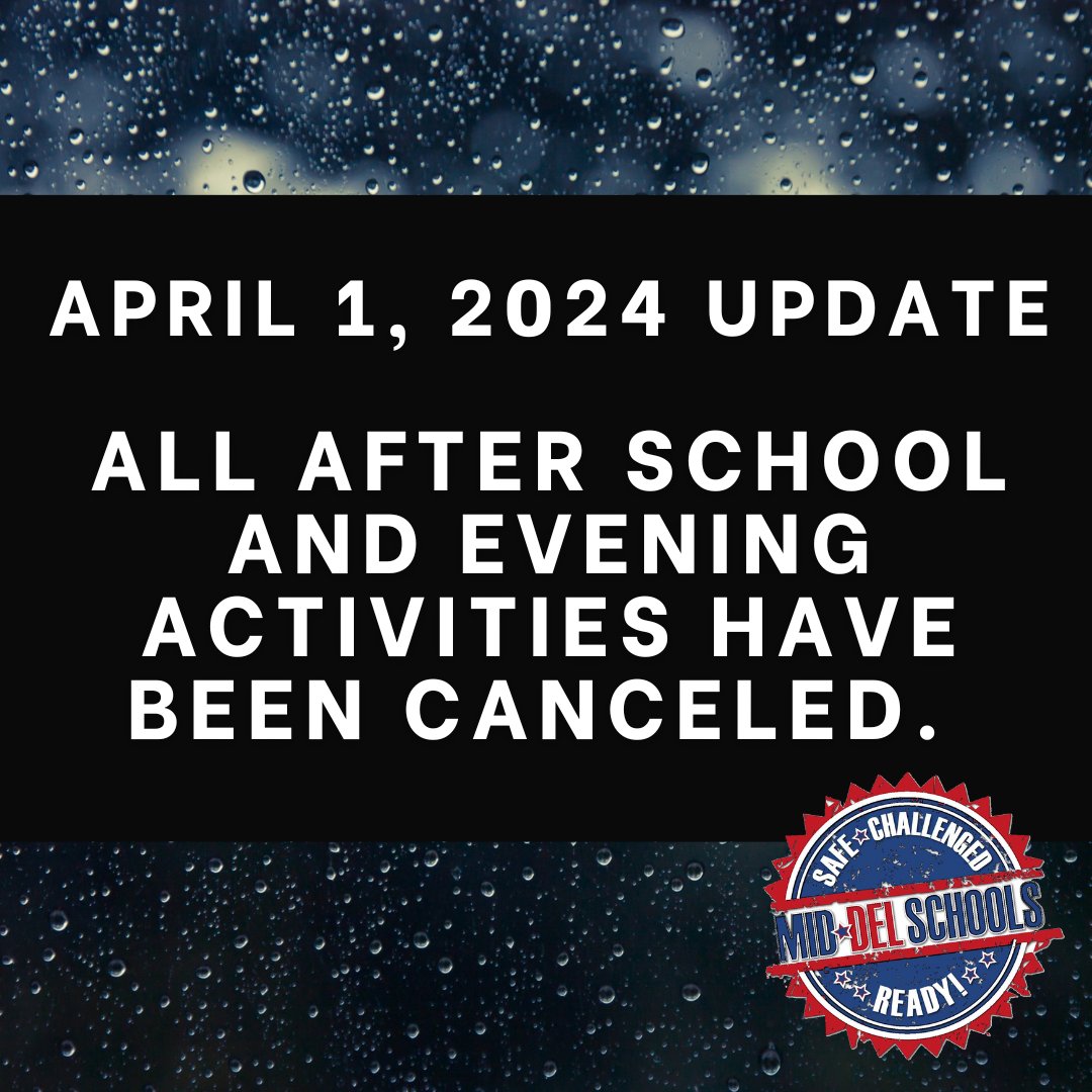
April 1, 2024: Mid-Del officials participated in a webinar with the National Weather Service this morning and have made the decision to cancel all after school and evening activities out of an abundance of caution for our students, families, and staff. #mdpurpose
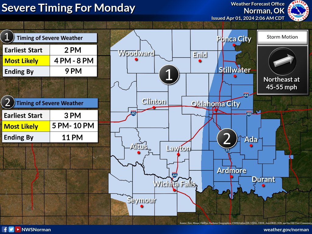
Severe thunderstorms are expected to develop along a dryline and cold front this afternoon and evening. Large damaging hail and winds are possible with some of the storms, especially along and east of Highway 81. #okwx#texomawx
2:00 am CDT: Dense fog is beginning to develop across parts of central Oklahoma. With temperatures hovering near freezing, there's concern that this could cause fog to freeze onto elevated surfaces such as bridges. Be careful if driving this morning.
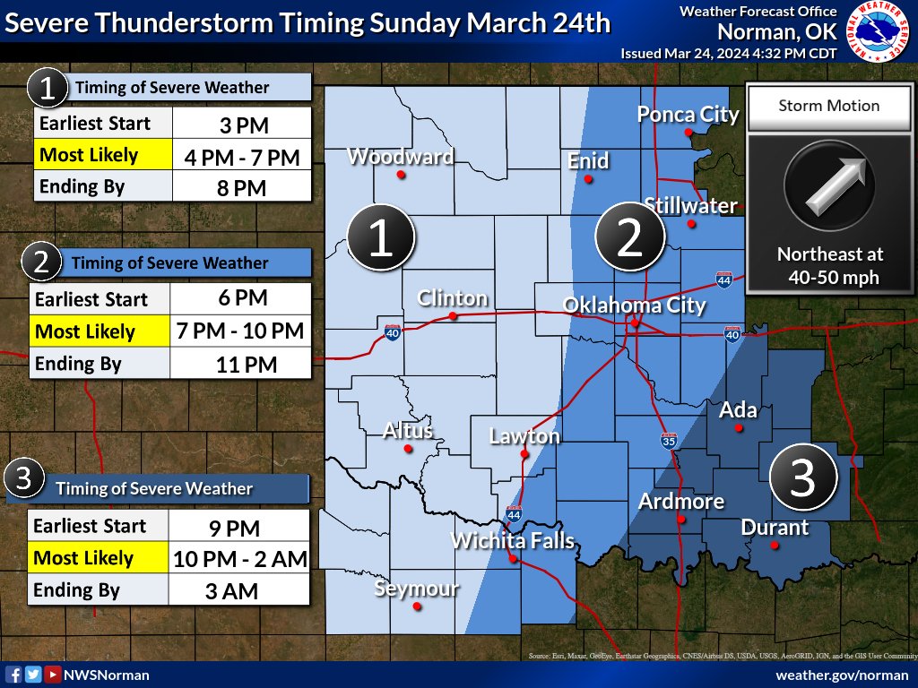
A quick update regarding when severe thunderstorms are expected today. Added a 3rd section to south central and southeast Oklahoma where storms may linger into the overnight hours. #okwx#texomawx
Mid-Del Basketball teams went 6-6 this weekend! All of our teams punched their tickets for the State Tournament! Great work Bombers, Eagles and Titans! #mdpurpose
📸Great pictures from Jay Wiggins and the Midwest City Beacon
It will be windy throughout the entire day today. Some gusts could exceed 50 mph across western OK. These winds, combined with low relative humidity and very warm temperatures, will result in critical to extreme fire weather conditions this afternoon. #okwx#texomawx
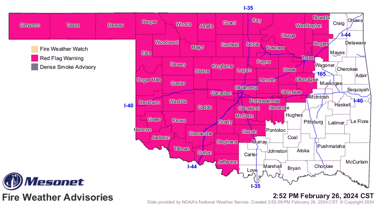
Red Flag Fire Warning in effect for a large portion of Oklahoma, including Oklahoma County, on Tuesday. High winds, high temperatures, low humidity and dormant vegetation will cause any fire that starts to spread quickly. Please do your part to prevent any fire from starting.
A Fire Weather Watch has been issued for Oklahoma County on Tuesday, with elevated fire weather conditions each day. Please do your part to prevent a fire from starting.
With the heat and wind, fire weather is going to be the main topic for the next few days. A fire weather watch is in effect for much of the area on Tuesday. Winds will be strong and very gusty with temperatures 25 to 30 degrees above late February averages!
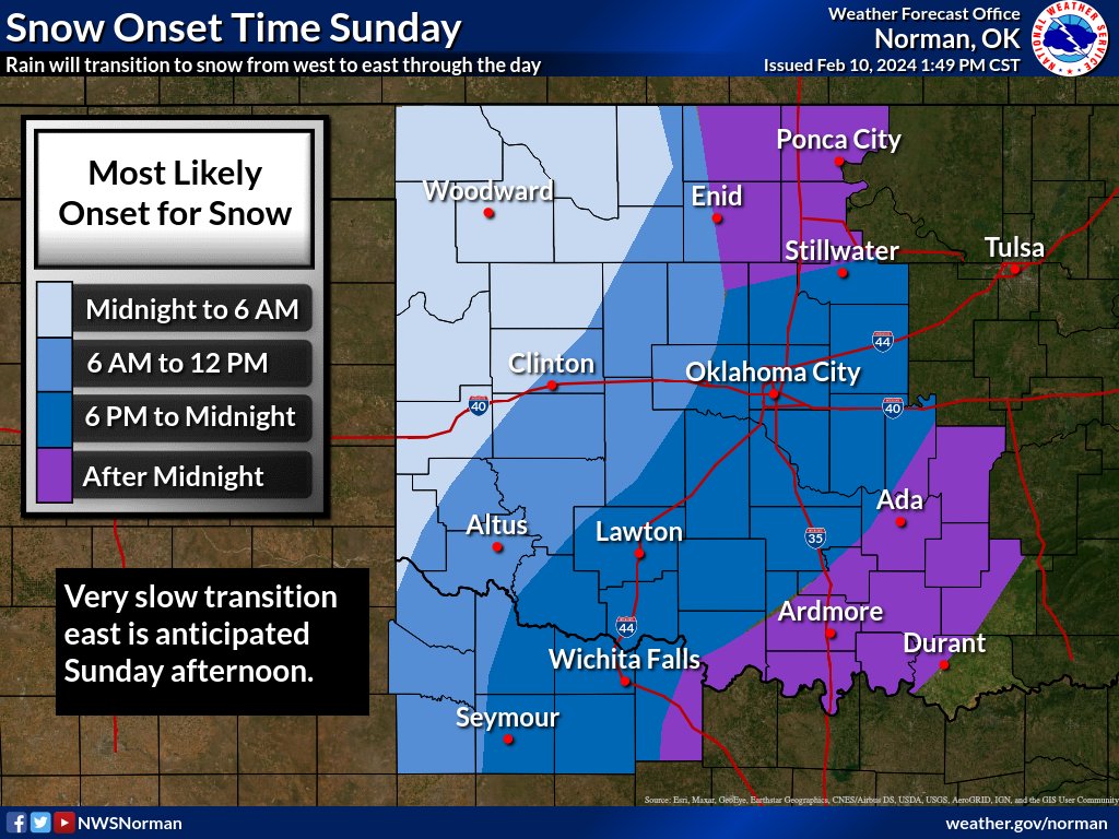
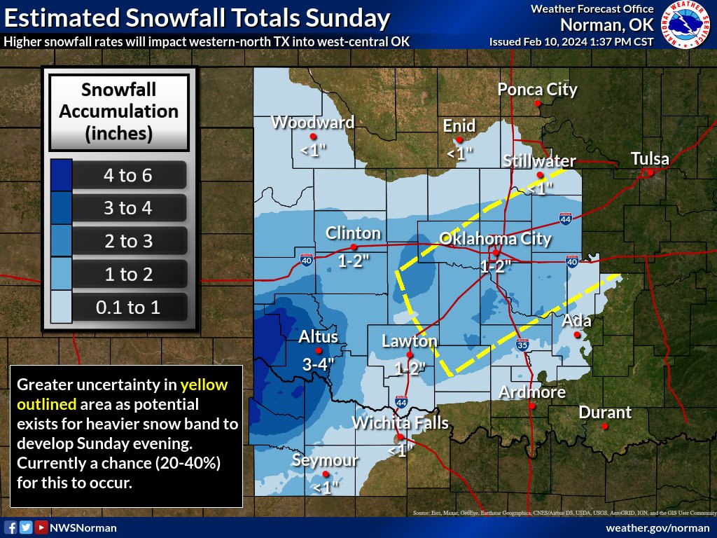
Rain will change to snow through the day from west to east, with the heaviest totals currently forecast across western OK/NTX into central OK. Keep in mind, with temps mostly above freezing, snow will struggle to accumulate at times outside of heavier snow bands. #okwx#texomawx
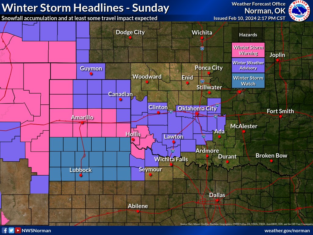
A winter storm will bring accumulating snow to parts of OK and north TX Sunday and Sunday night. Southwest OK and north TX will likely see the higher snowfall amounts during the day with a transition toward the I-35 corridor Sunday evening. #okwx#texomawx
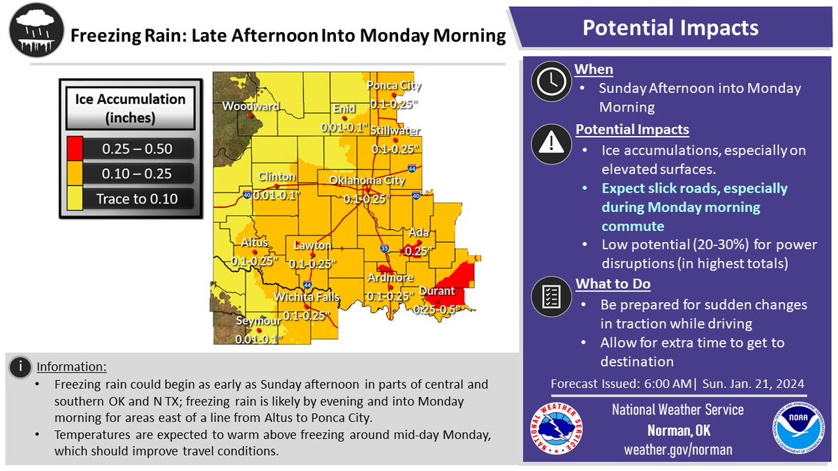
Here is the latest ice accumulations forecast for our area from freezing rain likely to arrive this evening and continue tonight into Monday morning. Expect slick conditions during tomorrow morning's commute - especially on untreated roads.
#okwx#texomawx