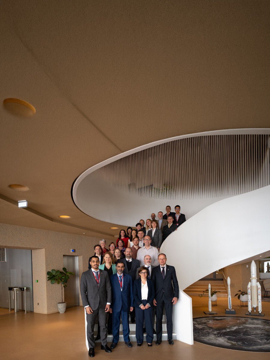
اختتمت وكالة الإمارات للفضاء البرنامج التدريبي الخاص بـ"الميثاق الدولي للفضاء والكوارث الكبرى" في جامعة زايد – أبوظبي، والذي جمع نخبة من الشركاء والخبراء من مختلف الجهات في الدولة، بهدف تعزيز التنسيق ورفع الجاهزية التشغيلية وتطوير توظيف بيانات الأقمار الصناعية في دعم الاستجابة للكوارث.
ويأتي هذا البرنامج بالتزامن مع تولي الوكا��ة رئاسة الميثاق الدولي للفضاء والكوارث الكبرى لمدة ستة أشهر، وبالتعاون مع شركائها الوطنيين: الهيئة الوطنية لإدارة الطوارئ والأزمات والكوارث، ومركز محمد بن راشد للفضاء، وشركة «سبيس 42».
The UAE Space Agency has concluded its training program on the International Charter: Space And Major Disasters at Zayed University in Abu Dhabi. The program convened leading partners and experts from across the UAE to strengthen coordination, enhance operational readiness, and advance the use of satellite data in disaster response efforts.
This initiative comes as the Agency assumes the presidency of the International Charter for Space and Major Disasters for a six-month term, and is delivered in collaboration with its national partners: the National Emergency, Crisis and Disaster Management Authority, the Mohammed bin Rashid Space Centre, and Space42.
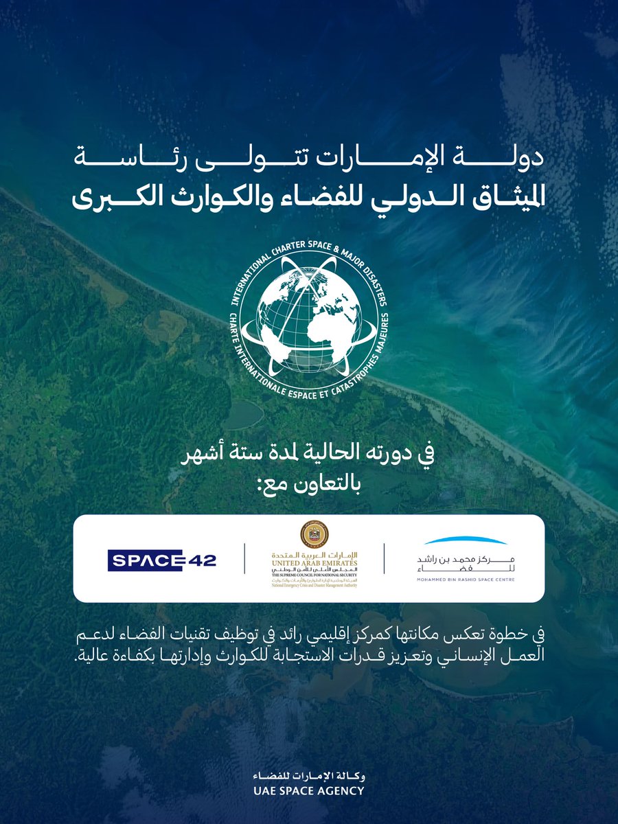
تتولى دولة الإمارات العربية المتحدة، ممثلة بوكالة الإمارات للفضاء، رئاسة الميثاق الدولي «الفضاء والكوارث الكبرى» للدورة الحالية لمدة ستة أشهر، وذلك خلال الفترة من 20 أبريل إلى 19 أكتوبر 2026.
وخلال فترة الرئاسة، ستعمل الوكالة، بالتعاون مع شركائها الوطنيين، بما في ذلك الهيئة الوطنية لإدارة الطوارئ والأزمات والكوارث، ومركز محمد بن راشد للفضاء، وشركة «سبيس 42»، على دعم أعمال أمانة الميثاق وتعزيز كفاءة العمليات التشغيلية، بما يسهم في رفع جاهزية الاستجابة العالمية للكوارث الكبرى باستخدام تقنيات الفضاء.
The United Arab Emirates, through the UAE Space Agency, will assume the leadership of the International Charter: Space and Major Disasters for a 6-month term spanning 20 April to 19 October 2026.
During its leadership, the Agency will work in close coordination with its national partners, including the National Emergency, Crisis and Disaster Management Authority, the Mohammed bin Rashid Space Centre, and Space42, to support the Charter Secretariat and improve operational efficiency, advancing global readiness for disaster response using space technologies.
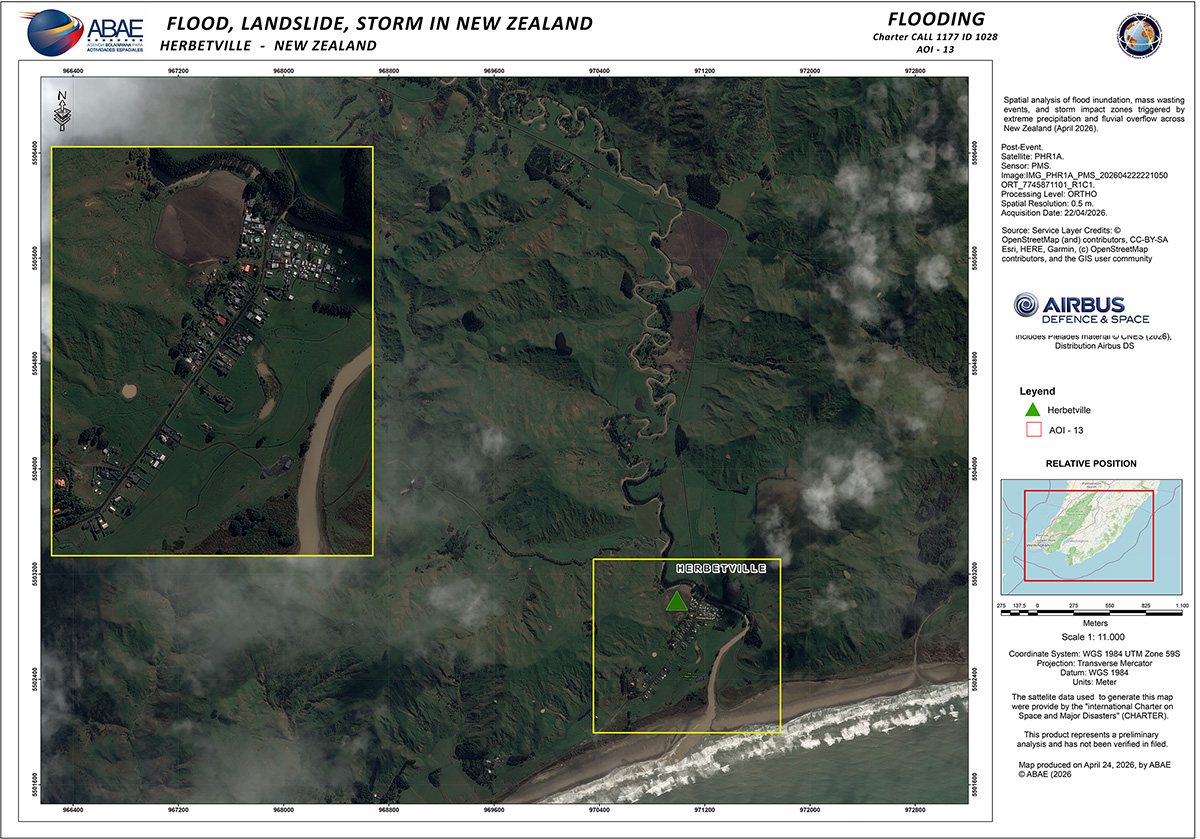
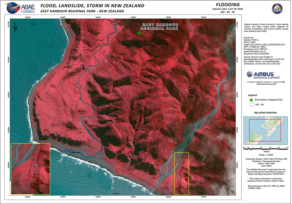
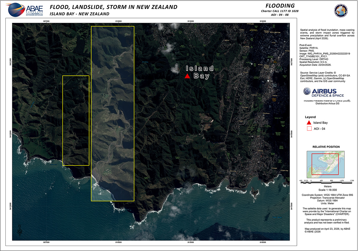
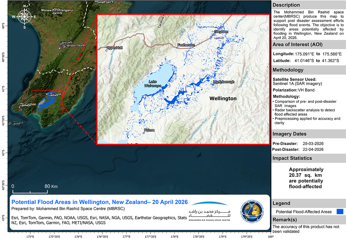
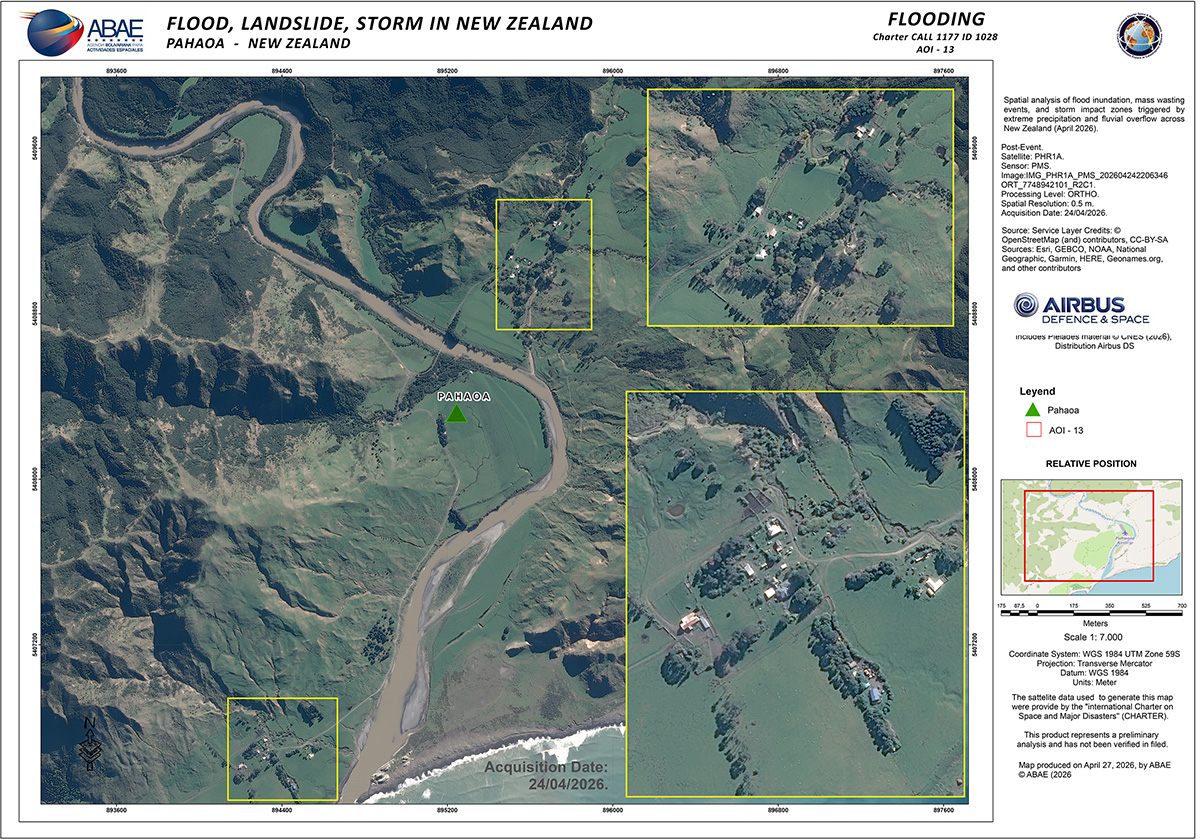
The Charter has been activated to provide satellite data over the flood and landslide in New Zealand: https://t.co/IN3hDzqiTn
We have a series of maps available looking at impacted parts of the country.
The latest issue of the Charter Newsletter is now available, covering recent activities: https://t.co/aG36LvrUA4
In this issue:
- CNES' lead of the Charter over the past six months
- Project Manager/Value Adder training
- Launch of KOMPSAT-7
- The CO3D mission
The Charter has been activated to provide satellite data over #CycloneMaila's impact to Papua New Guinea: https://t.co/iSKInwkTsu
Our first map uses #Sentinel2 imagery to estimate the location of flooded areas in Maiwara.
The Charter has been activated to provide satellite data in anticipation of potential floods in New Zealand due to current heavy rain and strong winds: https://t.co/Kjss3QuEqr
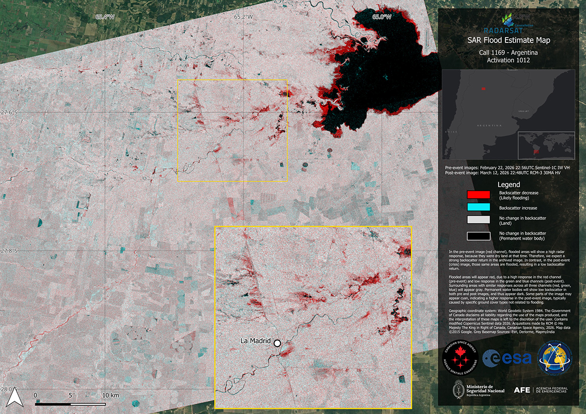
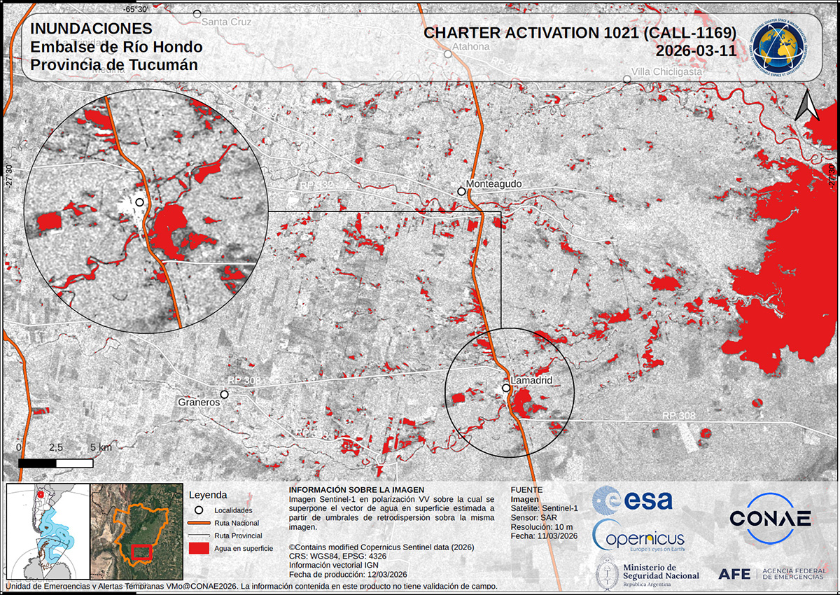
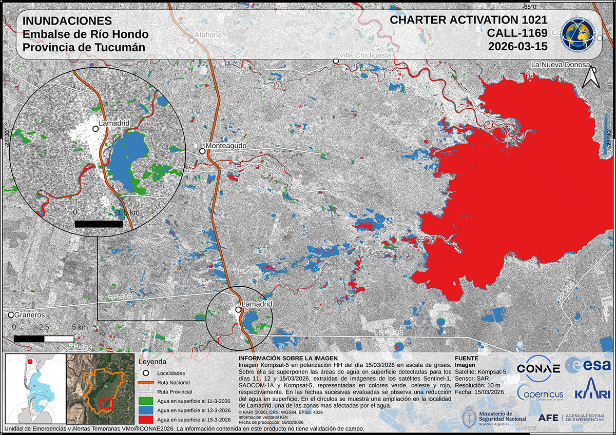
This map estimates the impact of the flood in Tucuman, Argentina. The map lists approximate numbers of people, homes, and more affected by the flood: https://t.co/q1bkI9On4M
These maps use radar data from RADARSAT and #Sentinel1 to estimate the extent of flooding along the Dulce River at Santiago del Estero in Argentina: https://t.co/q1bkI9On4M
These maps use data from the #RCMSatellites, KOMPSAT-5, #Sentinel1, and SAOCOM to estimate flooded areas in southern Tucuman in Argentina as of 12 and 15 March: https://t.co/q1bkI9On4M
The Charter has been activated to provide satellite data over the flood in Argentina: https://t.co/BNOX5TGym2
Our first maps use #Sentinel1 data to estimate affected areas in southern Tucuman.
We've published a new article, in which UAESA look back on last year's 25th anniversary of the Charter, reflecting on achievements and evolution during the past quarter century: https://t.co/Sts1kc1IcJ
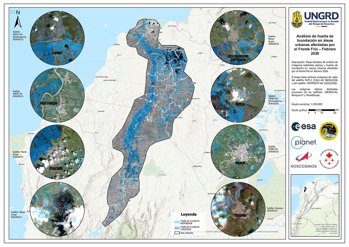
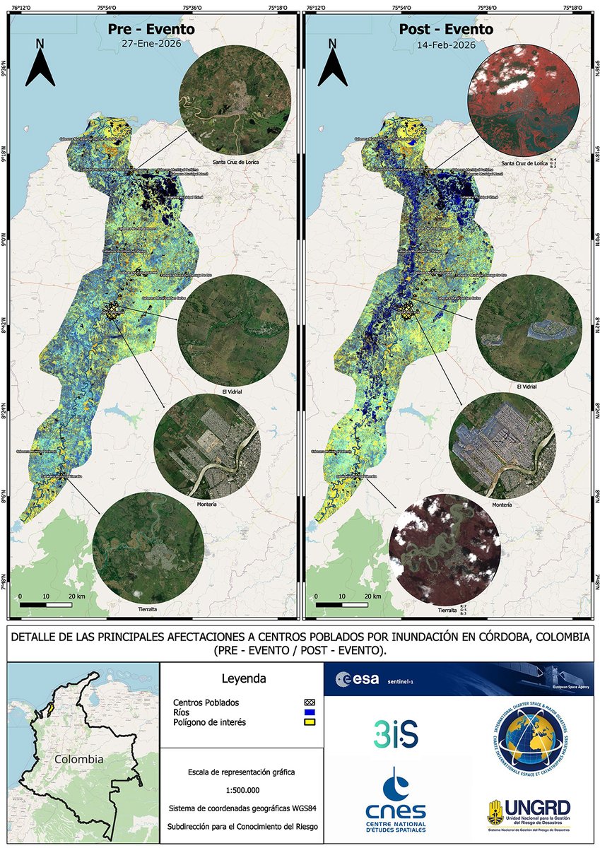
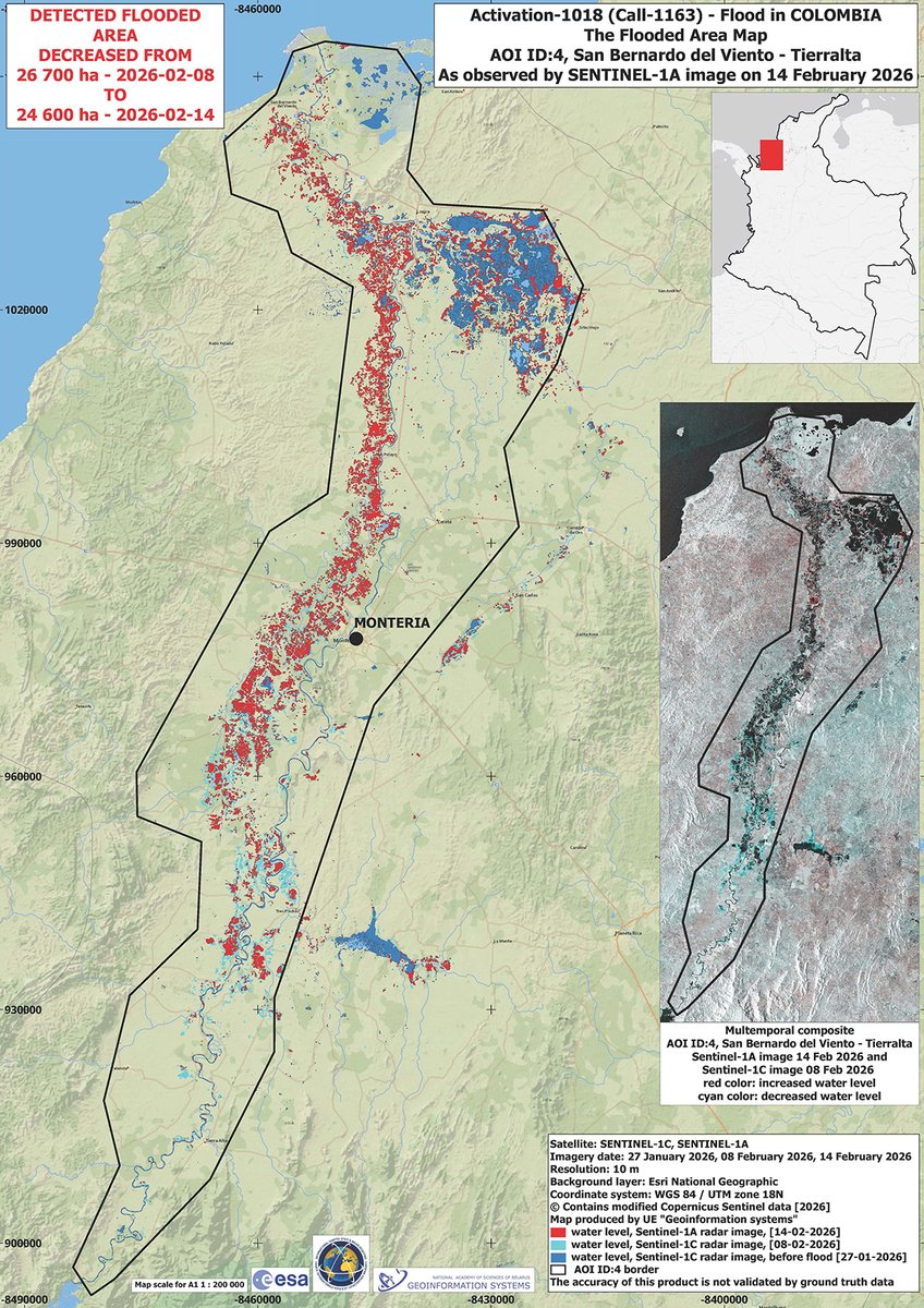
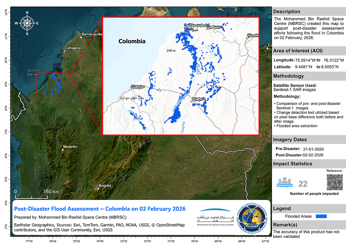
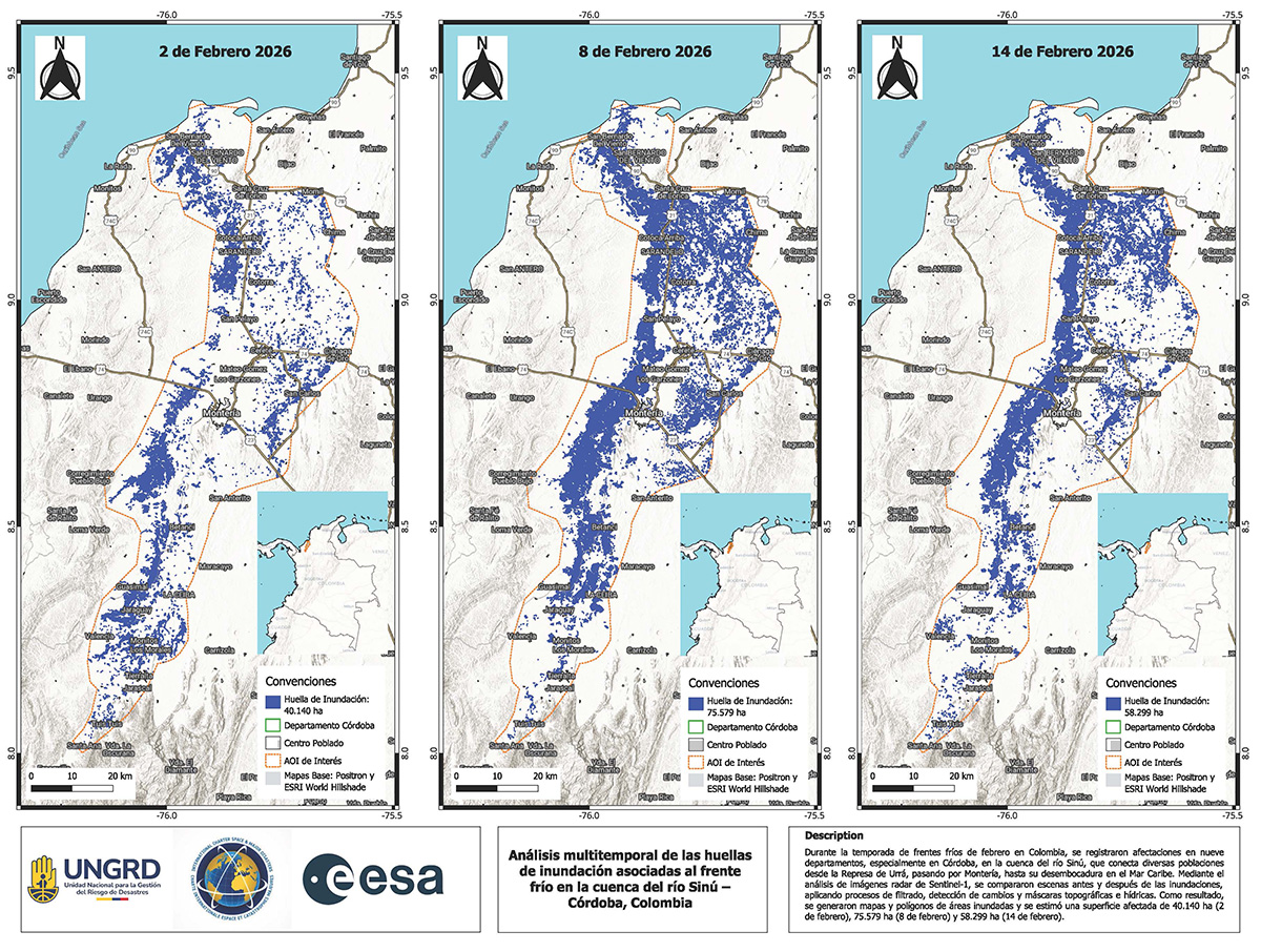
These maps use a combination of optical and radar satellites to estimate the impact of the flood in Colombia, using data acquired before and afterwards: https://t.co/fQ8HwYBkBQ
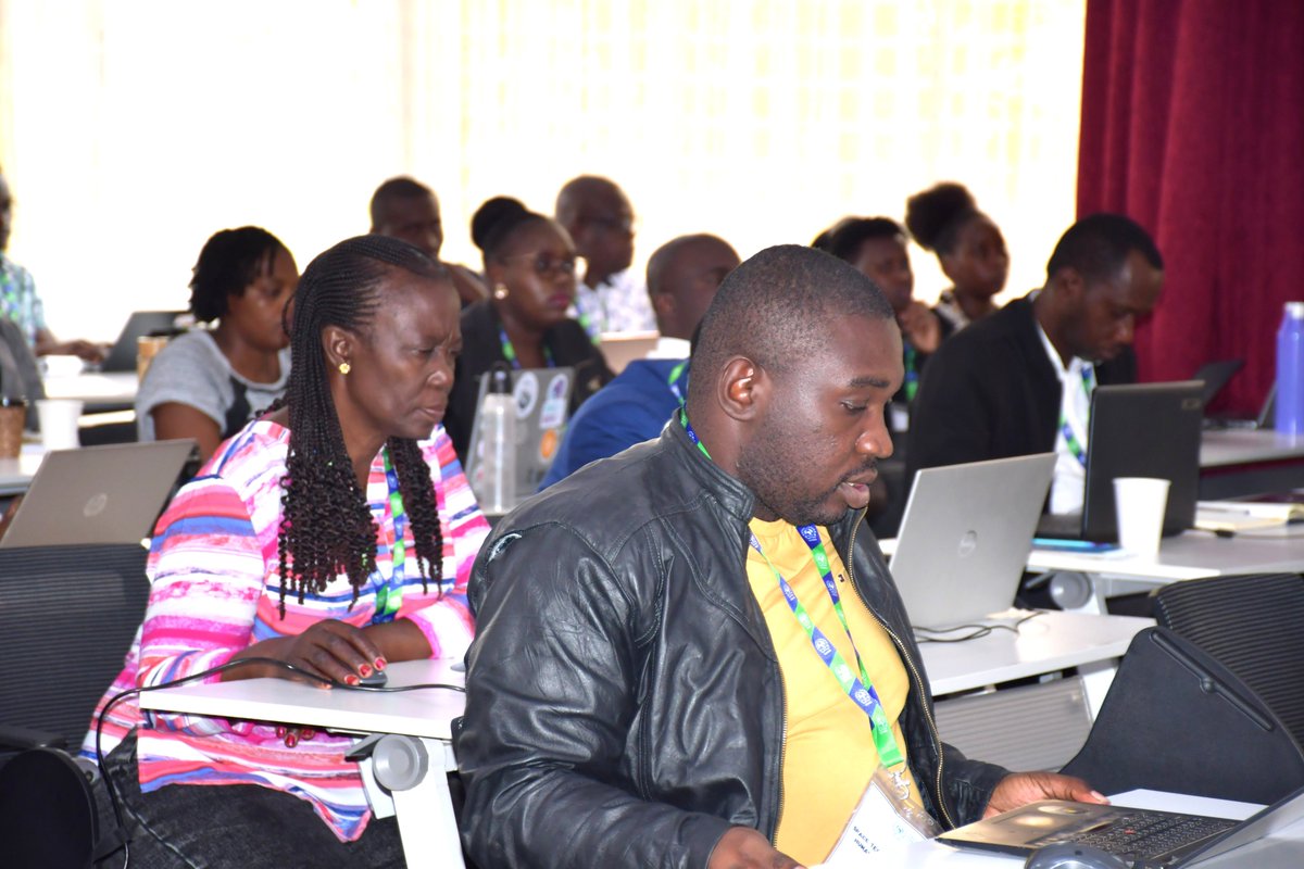
It has been a packed and impactful week of activities at RCMRD.
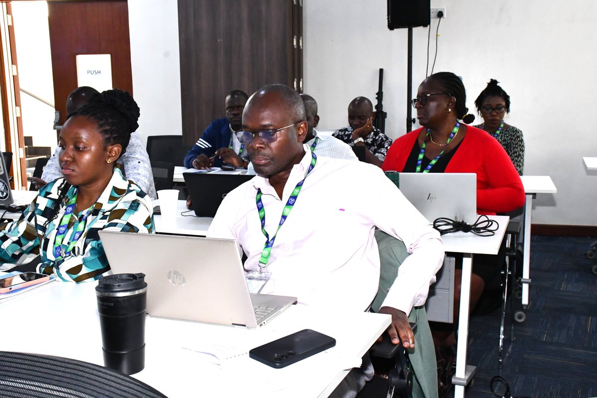
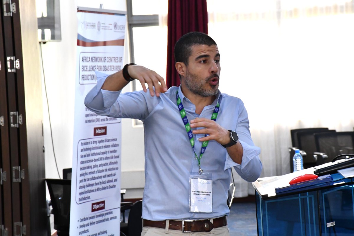
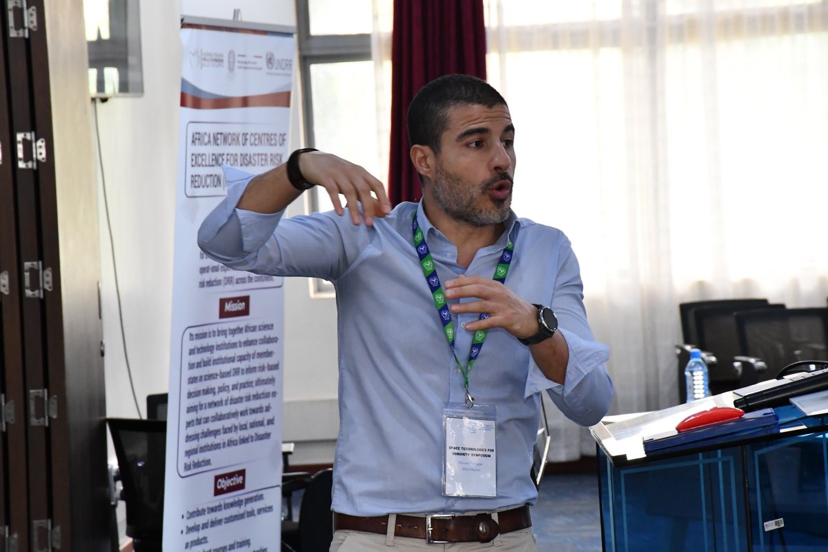
We successfully concluded the Regional Symposium 2026 – “Space Technologies for Humanity” (16–17 February) and immediately transitioned into the Regional Training on Space Technologies for Disaster Management and the Use of COS-2 and the Charter Mapper during Activations (17–20 February).
Organized by RCMRD, the back-to-back engagements were held with the support of the @UNOOSA) through the @UN_SPIDER programme, the University of Bonn – Centre for Remote Sensing of Land Surfaces @ZFL, and the International Charter on Space and Major Disasters.
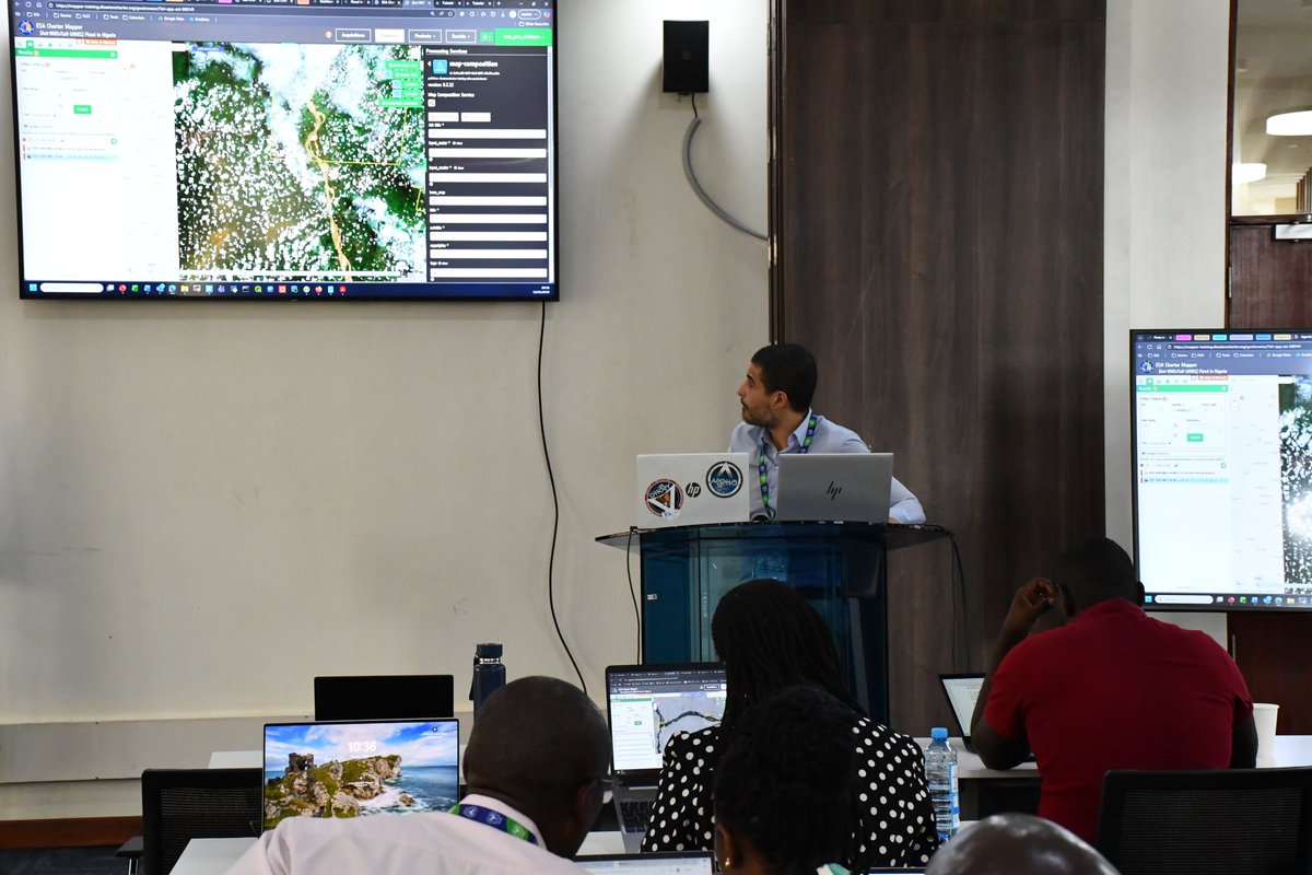
From high-level Disast3r risk reduction dialogue to hands-on operational training, participants strengthened their capacity to activate the Charter through the COS-2 web platform and mapping using the Charter Mapper, translating EO data into actionable information for disaster response.
#DisasterManagement @czaran
#chartermapper
@DisastersChart
Over the past 3 days, participants in the Regional Training on Space Technologies for Disaster Management and the use of COS-2 and the Charter Mapper have been strengthening their skills in applying space technologies to real-world disaster response. 🛰️🌍
Through hands-on sessions, they have learned about the different roles in COS-2 -including Authorized Users, Project Managers, and End Users -and workflows on the Charter Mapper for mapping floods, droughts, earthquakes, landslides, and wildfires.
The final outputs from these workflows can be transformed into actionable disaster response products, enabling faster, smarter, and more effective emergency management.
@DisastersChart@czaran@aamdihun@IGAD_CPAC@allanoware@UNOOSA@UN_SPIDER@Vittorio Trivigno @RobertoBiasutti @MichaelSchmidt
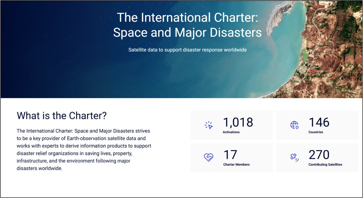
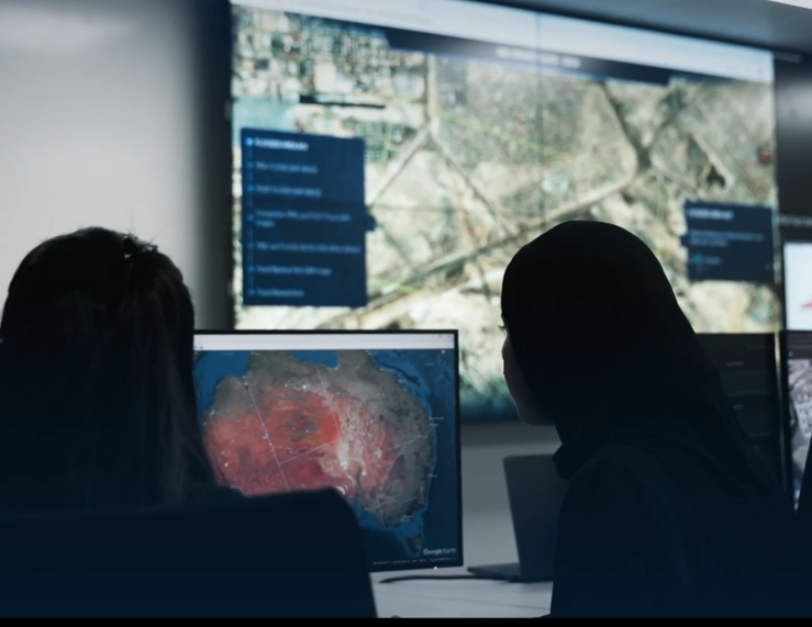
When disaster strikes, response time is critical.
The International Charter on Space and Major Disasters provides free satellite imagery to support countries affected by #floods, #earthquakes, #landslides, #cyclones, and other major disasters.
Authorized users can activate the Charter 24/7 through a single access point - and within hours or days, receive analyzed satellite maps to guide emergency response and recovery efforts.
This global collaboration of space agencies ensures that critical Earth observation data reaches those who need it most -helping save lives, protect infrastructure, and safeguard the environment.
Space technology working for humanity
#DisasterResponse #SpaceForGood #EarthObservation #Resilience #InternationalCharter
@UNDRR@UN_SPIDER@czaran@esa@DisastersChart@NDOCKenya