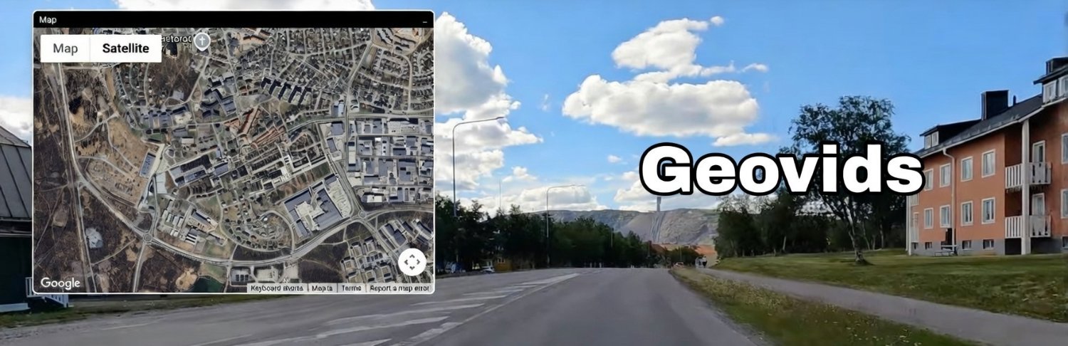
I’ve been working on a new project:
Geovids – watch YouTube walking/driving videos synced with an interactive map. Imagine exploring Tokyo, NYC, or Seoul while following the route in real time.
I’m building this in public and will share progress here.
More updates soon!
I vibe-coded this weekend a Bloomberg Terminal for geopolitics, because we're living in special times.
Here's the story:
30 browser tabs. Reuters, USGS, flight trackers, prediction markets, government feeds. All open simultaneously. All the time. Ukraine. Gaza. Taiwan. Sanctions. Supply chains. Everything connected. Nothing correlated.
So I built World Monitor. One dashboard. 20+ live data sources. Real-time correlation.
What it tracks:
- 45+ news feeds ranked by source authority (searchable)
- 220+ military bases, 111 AI datacenters, 88 pipelines, 55 undersea cables
- Live vessel tracking & chokepoint monitoring
- Internet outages, earthquakes, weather alerts
- Prediction markets vs. news velocity gaps... and more.
What you can explore:
- Search news across all feeds instantly
- Click any pipeline, datacenter, or base for details
- Toggle 15+ map layers to spot correlations
- Filter events by time range (1h to 7 days)
What it detects:
- When 3+ sources confirm the same story within 30 mins
- When markets move before news breaks
- When news velocity suddenly doubles
- The "Pentagon Pizza Index" 🍕
- When military planes & vessels density grows & more
Philosophy: Information density > aesthetics. Correlation > accumulation. Wire services > blogs.
Vibe-coded with Claude. Zero frameworks. Open source.
Access at https://t.co/XJ7GSCRheG
The world is more connected than ever. Your monitoring tools should be too.
P.S.: Inspired by @HipCityReg's work
Oof… looks like YouTube embeds changed.
Whenever the on-screen controls are visible (paused or playing), the video goes dark/black — which makes map-based geo-mapping way harder. 😭
One of my goals with Geovids is to make mapping fun. Ideally, anyone could help map routes for videos they love. Turning “route-mapping” into a hobby instead of a chore.
I watch tons of city-walk and drive-cam videos.
But I always wondered:
“Where exactly is this?”
“What route are they following?”
So I built something to answer that question.
Mapping exact video timestamps to locations turned out to be harder than expected.
The tricky part is interpolating positions between mapped points while the video plays.
Still not perfectly smooth, but when it clicks, it really feels like walking inside the map.
A small preview of the core interaction 👇
The map marker moves perfectly in sync with the YouTube video.
Still rough, but it already feels magical to explore cities this way.