Day 2 of our Fundamentals of Build-It-Yourself Environmental sensors course (https://t.co/dAgCC0sJzr) in Leigh-on-Sea - @markmulligan presenting https://t.co/TqdMNKNWJ7's sensor design and live network #catchment2coast
Excited to share a new paper: design, construction, and testing of an #Arduino-based, in situ water depth sensor, following a low-cost, #opensource approach. A collaborative effort between @drMChad@drkrischan@carlsayerUCL, Bruce Main, and Ian Patmore https://t.co/Yk3MgcQWs4
@geographynicole HUGE congratulations Nicole!!🎓🌟We'd love for you to come back and talk about your research at some point down the line. Celebrate properly in the interim! 🍾🥂🥳
🎉Just released my very first #RStats package!🎁
prepCLMdata helps format climate data for #DIVAGIS. It's easiest than ever to perform past, present & future species niche modelling with ECOCROP using the package🌡️🌧️
#climatemodelling🌍#DataScience📈
👉https://t.co/1KypIcnFmy
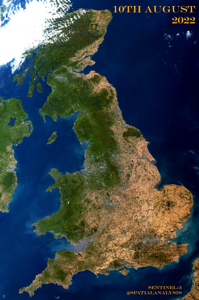
London has had a pretty dry year, and river flows have been notably low according to @EnvAgencySE.
Quite surprising that a little bit of rain yesterday, probably about 15mm, caused this much sewage dumped straight into waterways.
How is this legal?
Environmental researchers - want to learn how to build your own env loggers?
KCL Geography is running 3-day courses on Fundamentals of Build-It-Yourself Environmental Sensors in Apr/May.
Free & open to all. Priority given to PhDs/ECRs and NERC funding.
https://t.co/xokrM1Yxqz
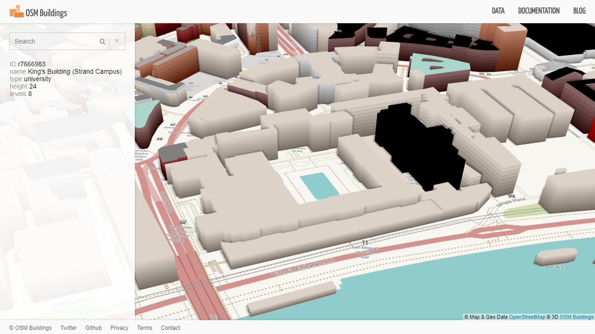
Just discovered the OSM Buildings project (the open-source version) which creates a beautiful interactive cityscape.
@kclgeography
students need some relief from dissertations? Check out the Bush House/Strand campus via the link: https://t.co/55t2sPJtuX
Great day out on Hampstead Heath with our new @kclgeography undergraduates - great to meet so many of you! Here's a quick overview of the pond station and some of the stuff we covered.
Out again on Masters' field courses tomorrow!
Can't help but 😆 prepping the #clustering lecture at the names they gave some methods: CLARA (Clustering Large Applications), PAM (Partitioning Around Medoid), DIANA (Divisive Analysis), FANNY (Fuzzy Analysis), AGNES (Agglomerative Nesting), MONA (Monothetic Analysis). #ml
Brilliant simultaneous in-person & virtual #JBTlab session for the @kclgeography@London_NERC_DTP week
All the 🤔, hard work, planning and experience results a seriously polished practical. Lucky to be working with such a talented team!
#Landsat crosses the equator 10-10:25am meaning the sun is generally eastward
GIF images are band medians of Landsat 4-8 (OLI calibrated to ETM+), filtering clouds using QA bands. Created on #GEE
Topo corr adapting: https://t.co/PSVRnODAzk… Will share full code after cleaning
DYK: #Landsat surface reflectance data=✅terrain corrected but❌topographically corrected?
Terrain: pixels appears WHERE they should
Topographic: pixels corrected for sun angle (see GIF)
A particular problem in #mountainous areas. Useful to correct before land classification