🔥SIG employees co-wrote a new paper that provides a precise, quantitative description of a sampling error in #wildfire simulations, offering insights for fire modelers. Findings promise to streamline simulation sizing & convergence assessment. https://t.co/nK30n3SVWc #Innovation
🌍🌍 We're thrilled to be mentioned in this article about our capacity-building efforts last month in The #Gambia with participants from Liberia. It's a privilege to see our work have an impact on global issues. https://t.co/W7sMAyZ17C 🌿 #CapacityBuilding#Liberia
🌲There's a long history of Indigenous fire management practices. 🔥 Planscape values Indigenous wisdom in land management & aims to fuse traditional ecological knowledge into all our solutions. https://t.co/IjQrXZgRnP #IndigenousKnowledge#PrescribedFires#Sustainability🌳
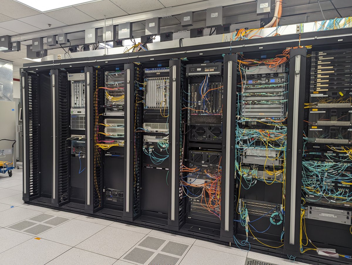
🌐SIG's @dsaah and Teal Richards-Dimitrie visited the WIFIRE lab at @SDSC_UCSD to connect with Ilkay Altintas’ team and map out pathways for large open-source community platforms focused on wildfire and landscape resilience and tour SDSC's cutting-edge data center. #GeoAI#GIS
Big news! PyreCast, our fire forecasting model, was featured on @kcranews, where they demonstrated how our tool can model fire spread over a period of 2 weeks. Thank you to Zeke Lunder (@wildland_zko) for getting the word to KCRA 3. Watch the video here: https://t.co/xiETcxA0DI
The 9th Annual @FirstStreetFdn Report is here! The report is based on wildfire modeling conducted by @pyregence and details how insurance premiums surge across the U.S. due to climate risks. Read more here: https://t.co/dwEZAU7k2S 🔥🌍
Experts at @forestservice note a shift: fire season's no longer seasonal; it's year-round. Winter's here, but Planscape is focused on reducing fire risk, boosting ecological benefits, and helping California's landscapes in adapting to #climatechange. 🌲🔥https://t.co/ZX2c1qjl1Y
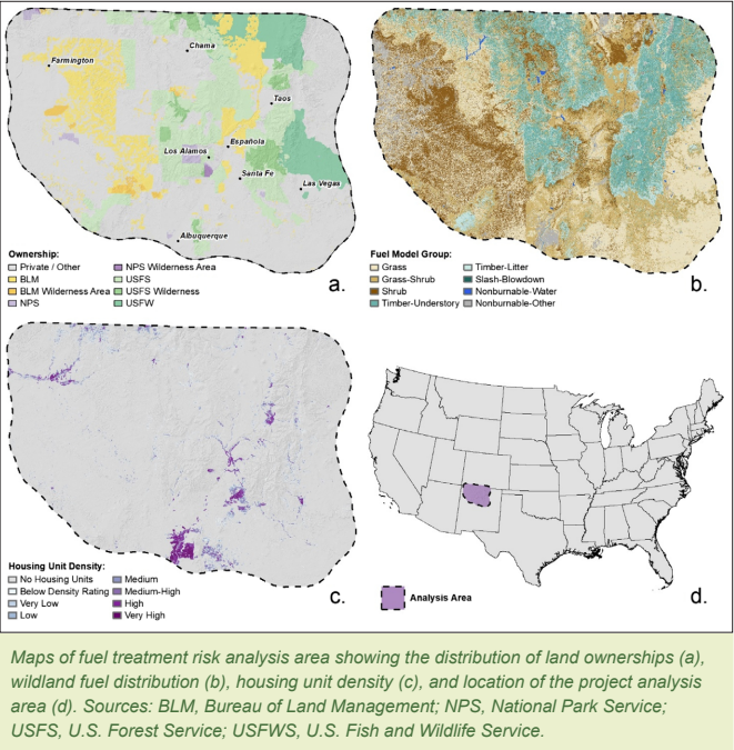
New report alert! @USDA & @forestservice's Rocky Mountain Research Station just released an in-depth study on #Wildfires, revealing their threats & restoration opportunities. Fuel management is crucial for this balance. Read more: https://t.co/kCLaZJ9Dlq🌲🔥#FireEcology#FireRisk
📢SIG is #hiring a #Clojure Developer for our Microservices Product team. Work alongside our amazing team of developers, designers, and environmental scientists to streamline analyses through online systems. Read more here: https://t.co/egY9Xii663 #TechJobs#RemoteWork#lisp
The 2023 wildfire season broke records for air #pollution in the U.S 🌫️#WildfireSmoke carries serious health risks. Planscape integrates potential smoke emissions metrics under the Air Quality pillar in California, aiding planning decisions. https://t.co/nDZQAtVC5V #ClimateChange
.@Pyregence team member Dr. Charles Maxwell and other scientists analyzed 6 forest management scenarios in CA's Central Sierra & found that moderate prescribed burning can mitigate wildfire-related smoke exposures & improve #publichealth. https://t.co/T7cj56xTfl 📚 #Wildfire
🔥 With the recent #TexasFires, our PyreCast #fireforecasting tool provides up to 14-day situational awareness information about active fire spread, fire risk & fire weather. With higher-resolution inputs & computational efficiency, check out https://t.co/WWql8Z84V3 now #Wildfire
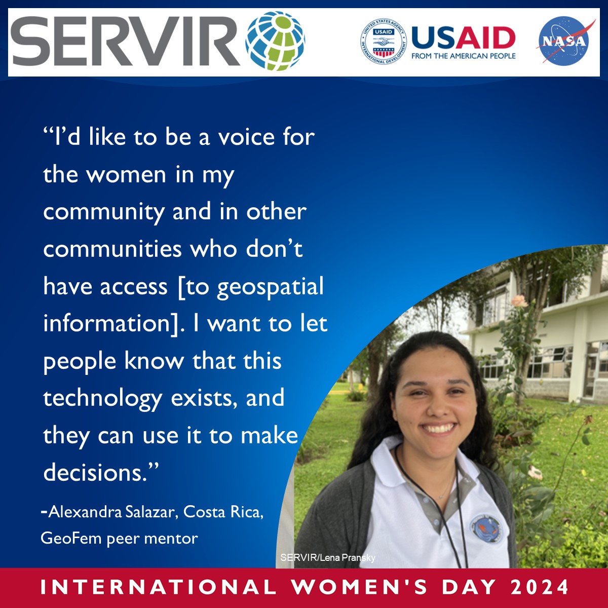
From the GeoFem event with @IICAnews in Costa Rica, peer mentor, Alexandra, shared her desire to be a voice for women and increase access to geospatial information. #IWD2024#InvestInWomen Learn more about GeoFem here: https://t.co/1c6lyRTuNf
Planscape will be at FSI today and tomorrow! Join us for live demos showcasing large-scale landscape planning in the Sierras, designed to further #forestmanagement and #wildfireprotection efforts. We hope to see you there! 🔥🌲 #FSI2024
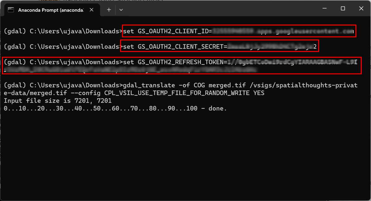
New Post: GDAL and Google Cloud Storage (GCS). GDAL can directly read or write data to a cloud-storage bucket. The tricky part is setting up authentication. I document and explore best practices for using #GoogleCloud Storage with #GDAL Tools. https://t.co/NWM9ITBZnG
Ready to start treatment planning with Planscape?🌿 Our latest video provides a step-by-step walkthrough on using Planscape for treatment planning across the diverse landscapes of #California! Watch the full video at https://t.co/OzY3tXidLN
#LandManagement#TreatmentPlanning📽️🌲
SIG worked with Clere Inc. & Blue Tree Analytics to map burn piles across CA. Funded by the California Joint Institute for Wood Products Innovation, this project examined where piles are located & trends in the burning of piles across air districts.🌲🔥 #CaliforniaWildfires🌐