#HudsonValley: I am increasing forecast snowfall amounts to one to two feet.
This is based on an expectation for heavy snow bands on Sunday, especially in the afternoon and evening, that could reach 2 to 4 inches per hour for a time. Such extreme snow rates are very unusual and will make travel impossible for a time.
➡️ Timing
Snow is expected to start between 5 a.m. and 8 a.m. Sunday from south to north. Snow won’t end until Monday afternoon, although the bulk of the accumulation will occur from Sunday through the first half of Sunday night.
The worst of the storm is expected on Sunday afternoon and evening when snow rates may exceed two inches per hour.
Do not attempt to travel on Sunday afternoon and evening, as you may become stranded.
➡️ Amounts
Because of frigid temperatures in the lower portion of the atmosphere and lots of rising air, this storm is primed to produce big, fluffy snow flakes that pile up with ease.
I’m expecting one to two feet across the region. There will be a ton of snow, but it will be light and relatively easy to move around — but it won’t be possible to make a snowman!
An interesting facet of this storm will be an advancing sleet line, which could reach portions of the lower Hudson Valley, including Rockland and Westchester Counties, on Sunday evening. Some forecast models even show this line moving into the southern reaches of Orange County, though I’m more skeptical about that. Any sleet would keep snow totals toward the lower end of the forecast range and make snow harder to shovel, but I don’t expect it to be widespread.
➡️ Impacts
Deep snow cover from Sunday afternoon through the night may make roads impassable and lead to closures. Blowing and drifting snow — with wind gusts of 15 to 25 mph — will create disorienting conditions late Sunday and overnight.
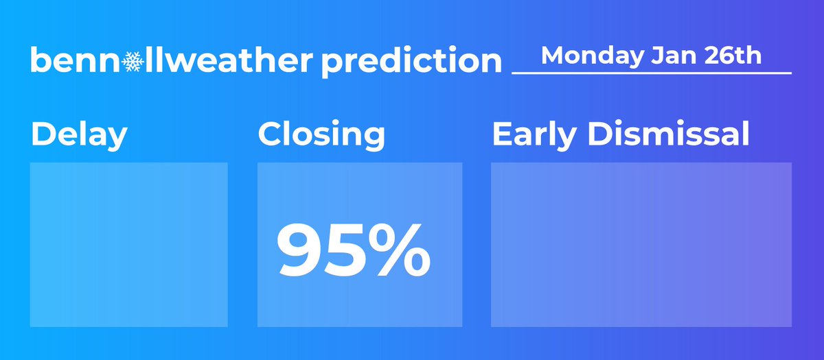
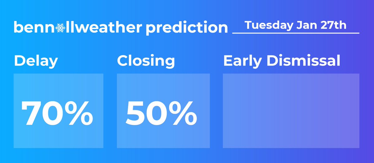
School closings are very likely on Monday as snow gradually ends and the cleanup begins. Because of the extensive nature of the cleanup process and the likelihood for subzero temperatures on Tuesday morning, I think there are chances for delays and potentially more closings in the hardest hit areas.
Stay safe! You’ve got this!
📧 Subscribe for important updates: https://t.co/tfQbL0SmcF
not to corn plate about this again but the choice of going into all the moments that everyone swore weren’t even romantic in this montage was so crazy and validating 😭 i won so bad with them
🚨#BREAKING: Watch as a time-lapse captures the dramatic retreat of water at Hanalei Bay in Hawaii, receding over 100 feet from its usual shoreline. This marks the confirmed arrival of the tsunami in Hawaii, with the first wave now detected at Hanalei, following a powerful 8.8 magnitude earthquake.
** VERY RARE G4 SOLAR STORM WATCH **
This is a map I made based on G4 storm history. If the storm does not achieve G4 levels, the viewing levels will be farther north and vice versa. More information about viewing the Northern Lights will be posted over the next 24 hours. Stay tuned!
The Space Weather Prediction Center is monitoring the risk for a potential geomagnetic storm after the release of a strong CME (coronal mass ejection) from the Sun yesterday afternoon. The current projection is for this storm to reach G4 (severe) strength, which would allow for the Northern Lights to be visible across the Commonwealth on the horizon and away from heavily light-polluted regions. The last two recent times a G4 Solar Storm Watch was issued were in May of 2024 and October of 2024, which both brought prolific shows across Pennsylvania. Nothing is a guarantee, but a LARGE aurora show tomorrow night is a growing possibility.
EARLY VIEWING FORECAST: Other than the expected cold conditions, the sky conditions look pretty good. The highest smoke concentrations look to remain west of PA Sunday night and most regions look to be cloud-free, with a few clouds possible across northeastern PA.
PRELIMINARY BEST VIEWING TIME: 10 pm (Sun) - 6am (Mon). Substorms throughout the period may increase aurora visibility.
➡️DISCLAIMER MUST READ: Solar weather is difficult to predict so be prepared to set up for disappointment. It is possible the CME arrives earlier than projected or later than projected or never arrives at all! The best place to view the Northern Lights is away from any light pollution and the long-exposure cameras and night mode will best pick up the colors. During stronger substorms, you will be able to see all of the colors, but best away from cities and light pollution!⬅️
Here is hoping for the Northern Lights tomorrow night. Clear skies are expected with low moonlight. Stay tuned for updates!
If you still can’t understand why “Snow White” BOMBED:
She called the original movie “dated.”
She called the Prince a “guy who just literally stalks her.”
She told potential customers that she was “scared of the original cartoon.”
She metaphorically told the Jewish people, “I WANT YOU ERADICATED.”
She told little girls “LOVE isn’t important, POWER is.”
She told 77,000,000 potential customers to go fck themselves if they voted for Trump.
Disney themselves told 3000-4200 DWARF parents that, “your kind ain’t welcome here.”
And Disney told 20,000,000 WHITE MOMS and 19,000,000 WHITE DADS that “your identity sucks, so we’re changing the character to Latina.”
Now do you get it?