It's such a fundamental misunderstanding that mathematicians are trying to 'solve' mathematics. The closest that comes to 'solving' it is finding interesting tools to explore further with.
That tech bros don't get this is a huge indictment.
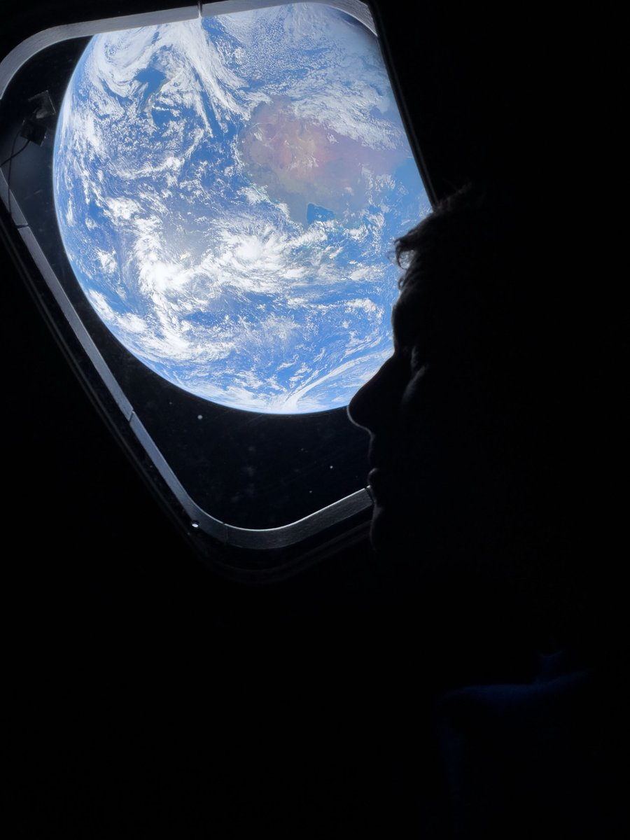
That's us! 🌍
The Artemis II crew captured beautiful, high-resolution images of our home planet during their journey to the Moon. As @Astro_Christina put it: "You guys look great."
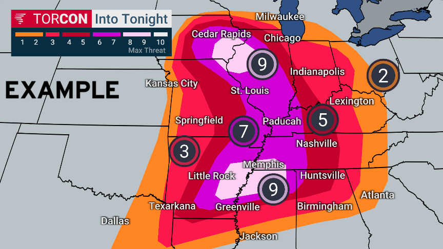
For the public, I think the best way to display forecasts of tornado risk is TORCON from Dr. Greg Forbes.
Add a plus sign (+) where the risk of strong tornadoes is high enough to warrant particular concern.
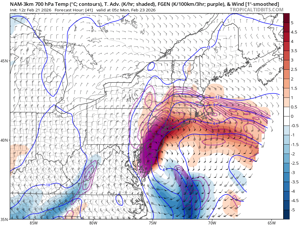
This is just a classic textbook example of a laterally translating warm air advection driven snow band transitioning to a pivoting intense snow band associated with rapid cyclogenesis
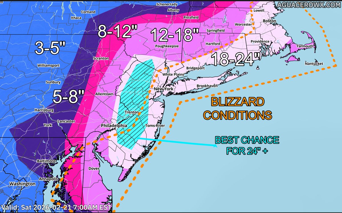
❄️ FINAL FORECAST: BLIZZARD OF 2026 ❄️
Now that the snowstorm is underway, I went into a high level of detail trying to narrow down the snow band placement and evolution.
Forecast reasoning follows in the thread below:
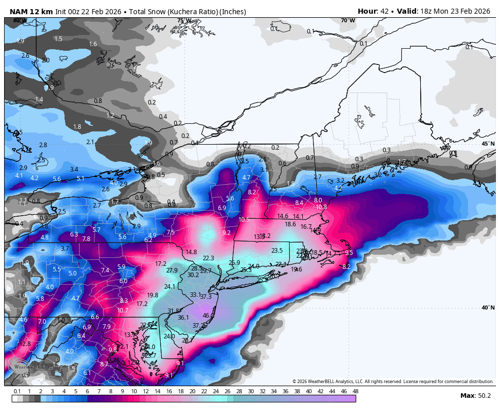
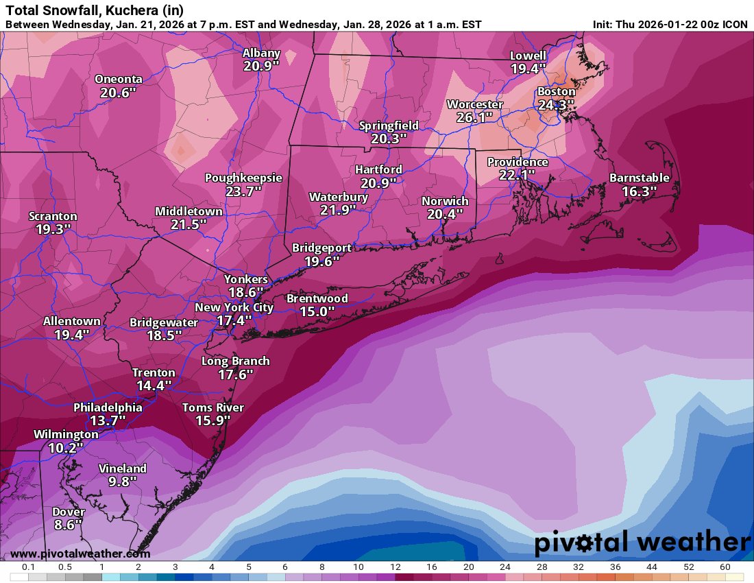
Here is my first snowfall forecast for this major #blizzard.
Made with @aguacerowx at https://t.co/VxYZ2sG3AC
Expecting widespread 1-2 feet of snow from DE to Maine. Best chance for 2-3 feet+ is in central NJ.
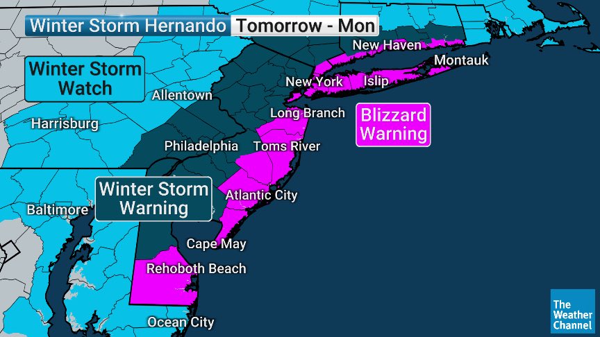
Extreme blizzard conditions at the coast with gusts easily 50-60mph
Will post a second update to my snow map later this afternoon — if current trends hold, I’m inclined to add a 24-36” contour in NJ and/or eastern PA.
Extremely impressive forcing for a slow-moving snow band with snow rates over 2-4”/hour.
This is going to be straight puking snow on Sunday night… a conservative estimate would be 2”, possibly up to 4”/hr with ratios in these bands. This is insane frontogenic forcing into deep Arctic air.
I think that there is an extent to just how far north this storm can go, and I’m confident that the 00z Euro/UKMET solutions were the northern extent of the track (with mixing into NYC/LI).
I think that if models do not waffle too far back south today, you can start becoming confident in a major snowstorm for the area