To Ndugu Vega and the entire Hakiza Clan, birth and death are inevitable in our lives. As humanity, we appreciate the legacy of William characterised his role as Ambassador of Uganda to different countries, as a states man and above all as a family man.
Mr. Toko Godfrey, a cartographer, presented the “Procurement of Orthorectified High Resolution Satellite Imagery Mosaic for Uganda (OReSIM)” project at the National Stakeholder Seminar on Digital Imagery. This initiative aims to modernize Uganda’s land administration systems by providing advanced geospatial data and builds on the successes of the Base Mapping Project (BMP), which ran from 2015 to 2018. The BMP had transformed land management processes by introducing accurate orthophotos for quality control, improving data sharing, resolving overlapping surveys, and supporting conservation efforts. However, the geoinformation data produced under BMP has since become outdated, necessitating the OReSIM project to meet current demands and standards.
The presentation identified key challenges, including the high demand for updated aerial datasets in critical regions such as the Albertine Graben, Karamoja, and wildlife restoration areas, as well as the need to address land disputes and boundary conflicts. The outdated data hampers socio-economic transformation, affecting community development and national projects reliant on accurate geospatial information.
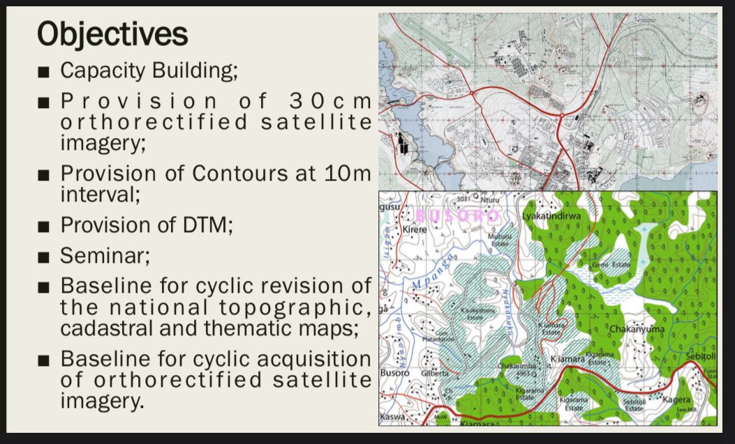
To address these gaps, OReSIM’s objectives include providing 30 cm orthorectified satellite imagery, contour data at 10-meter intervals, and a Digital Terrain Model (DTM). The project also aims to establish a baseline for the regular updating of topographic, cadastral, and thematic maps, alongside capacity-building initiatives for stakeholders.
The economic and social benefits of the project are significant. It will support;
✅public investment consolidation,
✅promote modern agriculture,
✅facilitate sustainable resource management, and
✅enable better planning for infrastructure and services.
It also addresses land conflicts, strengthens border security through geospatial information, and supports tourism and wildlife management. Satellite imagery is essential for these outcomes, reducing administrative conflicts and enabling mechanized farming and irrigation while improving access to investment services through enhanced visualization.
Toko emphasized that the OReSIM project, funded under the @cedp_uganda project, is a vital step in aligning Uganda’s land administration systems with global standards. By providing updated geospatial data, the initiative seeks to foster sustainable development, improve resource management, and enhance livelihoods, contributing to the country’s broader socio-economic goals.